Block
From the record
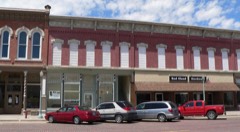
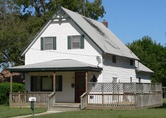
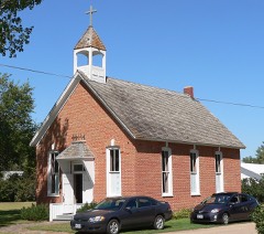
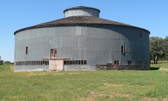
36 National Register listings published here, 1 of them a National Historic Landmark.
Sources: the National Register database, National Park Service
25 topographic sheets cover 10 settlements here, and 36 properties are on the National Register of Historic Places.
36 National Register listings published here, 1 of them a National Historic Landmark.
Sources: the National Register database, National Park Service
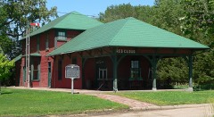
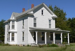
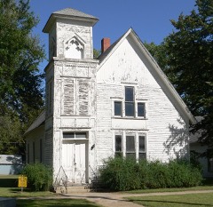
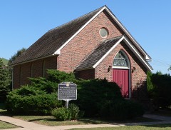
Every property in this county listed on the National Register of Historic Places, with the year it was listed and the federal nomination document.
Every wildfire the federal occurrence database records inside this county: 76 of them, burning about 791 acres. 3 started naturally and none was recorded as arson. Each settlement page carries the fires within five miles of it.
| Reported cause | Fires |
|---|---|
| Debris and open burning | 32 |
| Equipment and vehicle use | 22 |
| Missing data/not specified/undetermined | 13 |
| Natural | 3 |
| Power generation/transmission/distribution | 3 |
| Smoking | 2 |
| Recreation and ceremony | 1 |
The five largest, by the area the report gives. None of them was recorded as arson.
| Date | Cause | Size | Reported by | Name on the report |
|---|---|---|---|---|
| 13 April 2011 | Debris and open burning | 150 acres | Nebraska Forest Service | not named |
| 26 May 2009 | Natural | 100 acres | Nebraska Forest Service | not named |
| 22 September 2017 | Equipment and vehicle use | 80 acres | Nebraska Forest Service | not named |
| 2 March 2018 | Debris and open burning | 70 acres | Nebraska Forest Service | not named |
| 1 March 2018 | Missing data/not specified/undetermined | 50 acres | Nebraska Forest Service | not named |
| 9 March 2016 | Debris and open burning | 50 acres | Nebraska Forest Service | not named |
| 31 January 2009 | Debris and open burning | 40 acres | Nebraska Forest Service | not named |
| 19 March 2017 | Debris and open burning | 30 acres | Nebraska Forest Service | not named |
Every settlement page carries the fires within five miles of it - see the settlement index below.
The NOAA Storm Events Database holds 354 reports for this county, causing 1 death, no injuries and about $58,377,340 in recorded property damage. Each settlement page carries the reports that name it.
| Kind of event | Reports |
|---|---|
| Hail | 175 |
| Thunderstorm Wind | 102 |
| Tornado | 37 |
| Heavy Rain | 24 |
| Flash Flood | 7 |
| Flood | 5 |
| Lightning | 2 |
| Funnel Cloud | 2 |
The most serious of them, by death, then injury, then recorded damage. The accounts are quoted exactly as the forecast office filed them.
| When | Event | Place named | Harm | What the report says |
|---|---|---|---|---|
| July 1998 | Lightning | Blue Hill | 1 killed | no account filed |
| March 1990 | Tornado (F4) | not stated | $25,000,000 | no account filed |
| September 2023 | Hail | Red Cloud | $15,000,000 | Hail up to the size of baseballs fell across Red Cloud for approximately 25 minutes. There were numerous reports of car damage, and there was likely roof and siding damage as well. Trees in the area also suffered damage from the hail. |
| May 1993 | Tornado (F1) | Red Cloud | $5,000,000 | Tornado touched down five miles south of Red Cloud and moved northwest. A home was damaged just south of Inavale. |
| May 1985 | Tornado (F4) | not stated | $2,500,000 | no account filed |
| June 2014 | Thunderstorm Wind | Inavale | $2,000,000 | A line of thunderstorms with damaging wind gusts up to 80 MPH moved across the county. Numerous power poles were downed in the Inavale, Red Cloud and Guide Rock areas. Power outages were also reported. Several trees, including ones large in diameter, were damage or uprooted. In Guide Rock, a garage was blown off its foundation partially onto a roadway. |
| July 2014 | Hail | Bladen | $1,000,000 | Hail ranging in size from quarters to golf balls was reported. |
| July 2014 | Thunderstorm Wind | Blue Hill | $1,000,000 | Wind gusts were estimated to be between 60 and 70 MPH. Irrigation pivots were reported downed just west of Blue Hill and bean fields were damaged due to the combination of the wind and hail of unknown size. |
| May 2012 | Hail | Blue Hill | $500,000 | Golf ball size hail fell for nearly 20 minutes, causing severe crop damage and building damage in the area. |
| June 2004 | Tornado (F1) | Inavale | $500,000 | A tornado cut across Webster County shortly after sunset. The tornado caused damage at about half-dozen locations during its journey. |
| May 1998 | Thunderstorm Wind | Bladen | $500,000 | no account filed |
| December 2021 | Tornado (EF0) | Bladen | $400,000 | This tornado touched down just inside Franklin County south of Campbell, moved through northwestern Webster County and into southern Adams County. As this tornado tracked northeast, some power poles, and irrigation pivot, and an outbuilding were damaged east of Campbell. Once it crossed into Adams County, a few more pivots were tipped and a home sustained minor damage. The maximum wind gust was estimated to be 85 MPH. |
| May 2004 | Tornado (F0) | Bladen | $250,000 | A tornado occurred in northwest Webster county. A machine shed was damaged. There was extensive tree damage near the tornado's path. |
| July 2003 | Thunderstorm Wind | Blue Hill | $250,000 | no account filed |
| April 1991 | Tornado (F2) | not stated | $250,000 | no account filed |
| September 1986 | Tornado (F2) | not stated | $250,000 | no account filed |
| May 2024 | Thunderstorm Wind | Red Cloud | $150,000 | Wind gusts estimated to be near 70 MPH resulted in downed tree limbs across town, some falling onto power lines and causing power outages. A resident just southeast of town reported pivot and grain bin damage near their location in addition to tree damage. |
| September 2023 | Hail | Cowles | $150,000 | Hail up to two inches in diameter was reported in Cowles. |
| November 2016 | Tornado (EF1) | Amboy | $150,000 | This tornado uprooted trees, destroyed an outbuilding, upset 2 irrigation pivots and caused other minor damage along its path. The maximum wind speed was estimated to be 95 MPH. |
| May 2018 | Hail | Bladen | $150,000 | no account filed |
| May 2025 | Flash Flood | Red Cloud | $100,000 | Strong thunderstorms dropped as much as 4 to 6 inches of heavy rain across the area. Rural roads in the area were affected by running water, as were a portion of Highway 78/128 near the border of Webster County, NE and Jewell County, KS and a portion of Highway 281 in Smith County, KS. Some of the highest measured rain totals included: 5.62 inches from nine miles north-northwest of Burr Oak, KS; 5.61 inches from three miles east of Guide Rock, NE; 5.60 inches from six miles north of Esbon; 4.84 inches from four miles north-northwest of Bostwick. |
| May 2019 | Flood | Inavale | $100,000 | Heavy rainfall caused the flooding of area creeks and the Republican River. Numerous rural roads and bridges were under water. The Republican River gauge near Guide Rock crested at 15.12 feet the afternoon of the 28th, and that was the 2nd highest crest on record. |
| December 2016 | Thunderstorm Wind | Bladen | $100,000 | Multiple outbuildings were damaged with major loss of roof panels, and a pivot was overturned. |
| June 2024 | Hail | Bladen | $100,000 | no account filed |
| July 2023 | Hail | Bladen | $100,000 | no account filed |
| July 2006 | Thunderstorm Wind | Red Cloud | $100,000 | no account filed |
| June 2005 | Thunderstorm Wind | Red Cloud | $100,000 | no account filed |
| August 2002 | Hail | Blue Hill | $100,000 | no account filed |
| June 1999 | Lightning | Blue Hill | $80,000 | no account filed |
| May 2024 | Tornado (EF0) | Guide Rock | $75,000 | This tornado danced its way along an approximately six mile path in rural eastern Webster County and ended in far western Nuckolls County. It started just west of Highway 78 between 5-6 miles north of Guide Rock. The worst damage along its path occurred at a nearby farmstead, where there was widespread tree damage and minor damage to the home. The tornado crossed the highway and sporadically damaged some trees for the next couple of miles. The tornado eventually grazed another farmstead and damaged a couple areas of cedar trees. A local resident noted fence damage and debris in a fence north of the farmstead. The tornado likely ended at or near a farmstead in far western Nuckolls County where some tree damage and outbuilding damage occurred. The estimated peak wind was 85 MPH. |
| June 2017 | Hail | Inavale | $75,000 | Hail ranged in size from quarter to ping pong balls. |
| June 2012 | Thunderstorm Wind | Guide Rock | $75,000 | Thunderstorm wind gusts estmated at 60 mph occurred along with golf ball size hail. Very heavy rain was also occurring. |
| June 2017 | Hail | Red Cloud | $75,000 | no account filed |
| June 2014 | Hail | Red Cloud | $75,000 | no account filed |
| July 1996 | Thunderstorm Wind | Red Cloud | $70,000 | no account filed |
| July 2024 | Thunderstorm Wind | Bladen | $50,000 | Wind gusts estimated to be near 70 MPH resulted in tree damage in Bladen, with damage also reported to a roof and flagpole. A wind gust of 67 MPH was measured by a mesonet station located one mile southwest of Bladen. |
| December 2021 | Tornado (EF1) | Blue Hill | $50,000 | This tornado touched down in Webster County and lifted north into Adams County. This intermittent tornado path started west of Blue Hill, with damage including some irrigation pipe strewn into a tree line, and some tree damage a few miles west of town. As the tornado moved northeast, more pivots were overturned. The maximum wind gust was estimated to be 100 MPH, based upon the snapping of power poles southeast of Ayr. Spotters saw the tornado west of Glenvil, where it upset another pivot before lifting. |
| July 2019 | Thunderstorm Wind | Inavale | $50,000 | Wind gusts were estimated to be at least 70 MPH. West of Red Cloud, hay bales were pushed onto a nearby county road. Several large trees were damaged or uprooted in Red Cloud. A tin roof was also damaged, and a few power poles on the north side of town were damaged, resulting in a loss of power. |
| May 2008 | Flash Flood | Inavale | $50,000 | Numerous areas in Webster County picked up 3 to 4 inches of rain. This caused many rural roads to flood. |
| June 2014 | Hail | Red Cloud | $50,000 | no account filed |
| August 2007 | Thunderstorm Wind | Red Cloud | $50,000 | no account filed |
| April 2003 | Hail | Blue Hill | $50,000 | no account filed |
| May 2002 | Hail | Red Cloud | $50,000 | no account filed |
| June 2002 | Hail | Blue Hill | $50,000 | no account filed |
| June 2002 | Hail | Guide Rock | $50,000 | no account filed |
| May 1999 | Thunderstorm Wind | Red Cloud | $50,000 | no account filed |
| June 1998 | Hail | Red Cloud | $50,000 | no account filed |
| July 1995 | Thunderstorm Wind | Blue Hill | $50,000 | no account filed |
| May 2012 | Hail | Bladen | $45,000 | Damage to area crops, roofs and siding was reported. |
| August 2016 | Flood | Bladen | $40,000 | Generally 3-6 inches of rain fell across mainly the northern third of Webster County, resulting in extensive flooding. The rain began around 930 pm CDT on August 28th and ended at about 430 am CDT on August 29th, although the bulk of the heaviest rain occurred between 10 pm CDT on August 28th to 2 am CDT on August 29th. |
| August 2016 | Flash Flood | Bladen | $40,000 | Generally 3-6 inches of rain fell across mainly the northern third of Webster County, resulting in extensive flooding. The rain began around 930 pm CDT on August 28th and ended at about 430 am CDT on August 29th, although the bulk of the heaviest rain occurred between 10 pm CDT on August 28th to 2 am CDT on August 29th. |
| April 2012 | Thunderstorm Wind | Bladen | $40,000 | Wind gusts estimated at 70 mph resulted in a center irrigation pivot being overturned. |
| July 2006 | Hail | Red Cloud | $40,000 | no account filed |
| June 2016 | Hail | Red Cloud | $35,000 | Hail was accompanied by 75 MPH wind gusts. |
| June 2016 | Thunderstorm Wind | Red Cloud | $35,000 | Wind (measured by a personal weather station) was accompanied by nickel size hail. |
| July 1997 | Hail | Guide Rock | $35,000 | no account filed |
| July 1997 | Hail | Inavale | $35,000 | no account filed |
| May 2008 | Flash Flood | Inavale | $30,000 | Thunderstorms moved northeast out of northern Kansas and into southern Nebraska and dumped several inches of rain in southern Webster County during the evening and nighttime hours. This caused several roads and small creeks to become flooded. |
| May 2001 | Hail | Red Cloud | $30,000 | no account filed |
| June 2021 | Thunderstorm Wind | Cowles | $25,000 | Roof was ripped off of a motor home. Tree branches were blown down as well. |
The Survey's mineral resources record lists 1 working inside this county. It still produces. Each settlement page carries the workings within five miles of it.
| Commodity | Workings |
|---|---|
| Sand and Gravel, Construction | 1 |
The least common of them first, because a county's hundredth gravel pit says nothing its first ten did not.
| Where | Site | Commodity | Status | Recorded |
|---|---|---|---|---|
| Bladen Sand & Gravel Co Plant & Pit | Sand and Gravel, Construction | Producer |
Named settlements recorded in the Geographic Names Information System, each with the topographic sheets covering it. Villages, hamlets and abandoned places alike. Each is shown with the nearest named watercourse or landform and the survey quadrangle it falls on.