 Block
Giltner, Nebraska
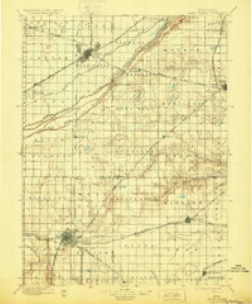
12 topographic sheets cover this place, the earliest surveyed in 1898 and the latest in 1985. It stands in Precinct 2. It lies in ZIP code area 68841. The Survey maps it on the Giltner quadrangle. 406 people lived here at the 2020 count. It stands 1,834 feet above sea level.
Population over time
2 figuresGiltner grew from 352 to 406 between 2010 and 2020. These are the recorded population figures Wikidata holds for this place, reached through the Geographic Names Information System number this page is keyed on rather than by name, so they belong to this place and not to another of the same name. Most are census counts, but not all are: an early figure may be a founding or settlement estimate, and an estimate published within five years of a census is left out. The change column is computed, and is left blank where more than 20 years separate a figure from the one before it, because a gap that long is not a change between two counts.
| Year | People | Change |
|---|---|---|
| 2010 | 352 | |
| 2020 | 406 | +54 (+15%) |
Topographic sheets covering this place
6 surveys from 12 printed sheetsMatched by testing this settlement's coordinate against the published boundary of every sheet in the United States Geological Survey's historical collection. Each opens the scanned sheet at the Survey.
- 1898 USGS Grand Island quadrangle1:125000, 4 printings
- 1955 USGS Grand Island quadrangle1:250000, 3 printings
- 1957 USGS Grand Island quadrangle1:250000
- 1958 USGS Grand Island quadrangle1:250000
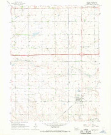
- 1967 USGS Giltner quadrangle1:24000
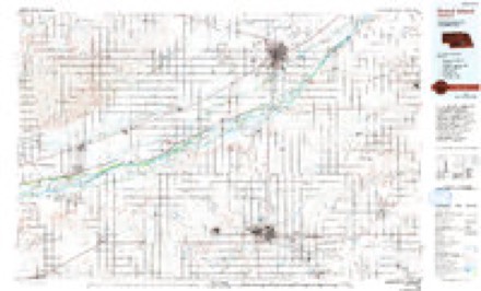
- 1985 USGS Grand Island quadrangle1:100000, 2 printings
Fires near this place
39 since 2008Regional context, not property-specific evidence. The federal wildfire occurrence database lists 39 fires within 5 miles of Giltner between 2008 and 2020, burning about 103 acres in total. None started naturally. None was recorded as arson. Distance is straight-line from the map coordinates, so a fire counted here may appear on a neighbouring settlement's page as well.
| Reported cause | Fires |
|---|---|
| Debris and open burning | 14 |
| Equipment and vehicle use | 14 |
| Missing data/not specified/undetermined | 10 |
| Power generation/transmission/distribution | 1 |
The most recent of them, most recent first, with the day each was reported and the service that recorded it.
| Date | Cause | Size | Reported by | Name on the report |
|---|---|---|---|---|
| 4 September 2008 | Missing data/not specified/undetermined | under an acre | Nebraska Forest Service | not named |
| 27 September 2018 | Equipment and vehicle use | 1.0 acres | Nebraska Forest Service | not named |
| 26 September 2013 | Debris and open burning | under an acre | Nebraska Forest Service | not named |
| 22 September 2020 | Debris and open burning | 1.0 acres | Nebraska Forest Service | not named |
| 30 August 2020 | Missing data/not specified/undetermined | 1.0 acres | Nebraska Forest Service | not named |
| 7 June 2016 | Debris and open burning | 1.0 acres | Nebraska Forest Service | not named |
| 29 June 2013 | Debris and open burning | under an acre | Nebraska Forest Service | not named |
| 25 June 2019 | Missing data/not specified/undetermined | 1.0 acres | Nebraska Forest Service | not named |
Settlements close enough to share some of these fires:
Storms near this place
60 of 77 shownRegional context, not property-specific evidence. The National Weather Service names Giltner in 77 storm reports between 1994 and 2024: 45 hail, 18 thunderstorm wind, 7 tornado, 2 funnel cloud. The reports record 5 injuries. Each account below is quoted exactly as the forecast office filed it, from the NOAA Storm Events Database, and each date opens the federal record of that event.
| When | Event | Place named | Harm | What the report says |
|---|---|---|---|---|
| May 2008 | Thunderstorm Wind | Giltner | 5 hurt, $250,000 | A supercell that spawned a couple of tornadoes produced a rear flank downdraft (RFD) that traveled along Interstate 80. The event was recorded by a storm chaser that was located south of Aurora at the I-80 and Highway 14 junction. The strong wind blew over several semi-trailers, pushed a couple of campers and a few cars off of I-80. Five people sustained minor injuries. A farmstead near the Interstate sustained considerable damage to the home and outbuildings. Numerous power poles and center pivot irrigation system down damaged. The canopies at the 3 gas stations at the I-80/Highway 14 interchange were damaged. |
| July 2021 | Thunderstorm Wind | Giltner | $5,000,000 | Wind gusts through this area were estimated to be near 90 MPH. The peak measured wind gust was 80 MPH, recorded at 11:00 PM CDT by a mesonet station located four miles northwest of Stockham. Article from the Aurora News-Register reported that a farmer from the Giltner area had crop damage, at least nine irrigation pivots damaged, and nine grain bins either damaged or destroyed. An irrigation pivot just west of Giltner was also flipped. An NWS Hastings employee noted pivot and grain bin damage straight south of Giltner. Time and speed estimated from surrounding reports and observations. |
| May 2016 | Hail | Giltner | $1,000,000 | Hail ranging from quarter to tennis ball size was reported, with the largest located northwest of town. Car windows were broken. |
| May 2022 | Thunderstorm Wind | Giltner | $500,000 | Wind gusts estimated to be near 70 MPH resulted in multiple semi-trucks being blown over on Interstate 80 between mile marker 326, which is two miles east of the Giltner interchange, and the Aurora/Highway 14 interchange. At least three irrigation pivots were tipped along both sides of the interstate in the area. |
| December 2021 | Tornado (EF1) | Giltner | $500,000 | This Hamilton County tornado touched down four miles southeast of Giltner and traveled northeast into Aurora. The estimated maximum wind gust of 100 MPH was based mainly upon snapped power poles. There were numerous irrigation pivots damaged along and near this path. The tornado crossed Interstate 80 approximately two miles west of the Aurora interchange. The tornado entered the southwest side of Aurora near the fairgrounds. Metal cladding was peeled from storage facilities nearby and there were several spots of tree damage. The tornado lifted around 12th and E Streets just south of the railroad tracks. |
| July 2023 | Hail | Giltner | $350,000 | Hail ranging in size from quarters to two inches in diameter was reported in this area. |
| July 2022 | Hail | Giltner | $250,000 | Hail as large as golf balls to 2 inches in diameter was reported along this path. |
| June 2015 | Flood | Giltner | $250,000 | Multiple rounds of heavy rainfall totaled generally 4-7 across primarily southern Hamilton County between the 3rd-6th, with the majority of this rain falling on the 4th-5th. Localized road flooding was initially reported across parts of the county on the evening of the 4th. Over the next few days, the main story turned to the West Fork Big Blue River and its smaller stream tributaries in the southern part of the county, as the cumulative effects of multiple rounds of heavy rain resulted in significant flooding, mainly on the 5th-6th. Reports indicated that this may have been some of the worst flooding observed along the river in 50-80 years. A few days of warm and dry weather settled in from June 7-9, allowing flood waters to largely recede. |
| December 2021 | Tornado (EF0) | Giltner | $150,000 | This tornado touched down in extreme northeast Adams County south of Trumbull, crossed through far northwest Clay County before heading into southwest Hamilton County. This intermittent tornado damaged a horse barn south of Trumbull as it began its roughly seven-mile path. As it moved northeast, most of the observable damage was to a couple of irrigation pivots along with a snapped tree. The estimated maximum wind gust was 75 MPH. |
| August 2021 | Hail | Giltner | $100,000 | Hail ranging in size from quarters to golf balls was reported. |
| August 2013 | Thunderstorm Wind | Giltner | $100,000 | A combination of hail and strong wind created a swath of crop damage, which occurred from 2-3 miles west of Giltner to 2 miles south of Giltner. Leaves were stripped from crops. The time was estimated from radar data. |
| May 2011 | Thunderstorm Wind | Giltner | $100,000 | Damage reports included 2 pivots overturned 6 miles south of Giltner and 4 to 6 inch tree limbs knocked down in Aurora. |
| September 2015 | Hail | Giltner | $100,000 | no account filed |
| May 2022 | Thunderstorm Wind | Giltner | $75,000 | A wind gust of 73 MPH was measured by a mesonet station located one mile northwest of Henderson. Emergency management estimated wind gusts near 70 MPH five miles south-southwest of Giltner. A trained spotter reported a destroyed grain bin approximately four miles northwest of Stockham, which was blown onto a rural road near Highway 14. |
| March 2006 | Thunderstorm Wind | Giltner | $75,000 | no account filed |
| July 2008 | Flash Flood | Giltner | $60,000 | As many as 40 roads were under water across southern Hamilton County. |
| June 2002 | Hail | Giltner | $50,000 | no account filed |
| September 2015 | Thunderstorm Wind | Giltner | $40,000 | Wind gusts estimated to be near 60 MPH resulted in roof damage to a few grain bins west of Giltner. |
| September 2015 | Hail | Giltner | $35,000 | no account filed |
| September 2015 | Hail | Giltner | $35,000 | no account filed |
| March 2009 | Thunderstorm Wind | Giltner | $30,000 | Accompanied by nickel size hail. Damage to siding and windows on the south side of numerous homes was reported, as well as damage to approximately 15 pivots. Two semi trucks were blown over on Highway 34, with no injuries. |
| April 1998 | Thunderstorm Wind | Giltner | $30,000 | no account filed |
| September 2015 | Hail | Giltner | $25,000 | no account filed |
| September 2015 | Hail | Giltner | $25,000 | no account filed |
| April 2013 | Hail | Giltner | $25,000 | no account filed |
| July 2011 | Hail | Giltner | $25,000 | no account filed |
| September 2006 | Hail | Giltner | $25,000 | no account filed |
| July 2003 | Hail | Giltner | $25,000 | no account filed |
| May 1998 | Hail | Giltner | $25,000 | no account filed |
| December 2021 | Thunderstorm Wind | Giltner | $20,000 | Emergency management estimated wind gusts to be near 85 MPH. A photo from social media shows significant roof and siding damage to a building located downtown. |
| May 1998 | Hail | Giltner | $20,000 | no account filed |
| July 2018 | Thunderstorm Wind | Giltner | $15,000 | Some minor tree damage was reported in town. |
| September 2015 | Hail | Giltner | $15,000 | no account filed |
| August 2009 | Flood | Giltner | $10,000 | no account filed |
| June 2008 | Hail | Giltner | $10,000 | no account filed |
| May 1999 | Hail | Giltner | $10,000 | no account filed |
| May 1998 | Hail | Giltner | $10,000 | no account filed |
| July 1995 | Hail | Giltner | $10,000 | no account filed |
| July 2008 | Hail | Giltner | $5,000 | Rainfall total of 3.49 inches also reported. |
| July 2008 | Hail | Giltner | $5,000 | no account filed |
| August 2006 | Hail | Giltner | $5,000 | no account filed |
| October 2023 | Thunderstorm Wind | Giltner | - | A wind gust of 63 MPH was measured by a mesonet station located five miles northwest of Stockham. Wind gusts were estimated to be near 60 to 65 MPH by the Giltner Fire Chief located one mile south of Giltner. |
| April 2022 | Thunderstorm Wind | Giltner | - | Wind gusts were estimated to be near 65 MPH by fire department spotters located four miles northeast of Trumbull. |
| July 2020 | Thunderstorm Wind | Giltner | - | Wind gusts were estimated be between 60 and 70 MPH. |
| August 2017 | Heavy Rain | Giltner | - | A 24-hour precipitation amount of 5.36 inches was recorded 1 mile northwest of Giltner. |
| June 2014 | Tornado (EF0) | Giltner | - | This brief tornado touchdown occurred approximately 5 miles south-southwest of Giltner. No damage was reported. |
| June 2014 | Tornado (EF0) | Giltner | - | This brief tornado touchdown occurred approximately 3 miles west-southwest of Giltner. No damage was reported. |
| August 2013 | Heavy Rain | Giltner | - | A 12 hour total of 3.72 inches fell through 7 am CDT. This report was from the Nebraska Rainfall Assessment and Information Network (NERAIN). |
| May 2011 | Tornado (EF0) | Giltner | - | No damage was caused by this brief tornado touchdown. |
| June 2010 | Thunderstorm Wind | Giltner | - | Wind gusts estimated at 60 mph. Large tree was blown down in city park. |
| June 2010 | Thunderstorm Wind | Giltner | - | Wind gusts estimated at 70 mph. |
| June 2009 | Hail | Giltner | - | Penny to nickel size hail was reported. |
| June 2007 | Funnel Cloud | Giltner | - | Funnel cloud was visible from NWS WFO Hastings. |
| July 2024 | Hail | Giltner | - | no account filed |
| October 2023 | Hail | Giltner | - | no account filed |
| June 2022 | Hail | Giltner | - | no account filed |
| June 2020 | Hail | Giltner | - | no account filed |
| May 2019 | Hail | Giltner | - | no account filed |
| July 2018 | Hail | Giltner | - | no account filed |
| June 2017 | Hail | Giltner | - | no account filed |
Nearest settlements
The eight closest, with where each one stands in the county. Distances are straight-line, computed from the Geographic Names Information System coordinates.
Elsewhere
Matched on this settlement's Geographic Names Information System number rather than its name, so it cannot be a different place of the same name in another state.
| Wikipedia article on Giltner | An encyclopaedic summary. Its text is share-alike, so it is linked here rather than copied. |
| Wikidata item Q2179936 | The structured record the population and elevation above come from. Public domain (CC0). |
Provenance
This settlement is recorded in the Geographic Names Information System as feature 829526. The sheet list is computed by point-in-boundary test against the United States Geological Survey's historical topographic inventory. Both are works of the United States government and carry no copyright under 17 U.S.C. 105.
Wildfire. Short, Karen C. 2022. Spatial wildfire occurrence data for the United States, 1992-2020 [FPA_FOD_20221014]. 6th Edition. Fort Collins, CO: Forest Service Research Data Archive. https://doi.org/10.2737/RDS-2013-0009.6 Collected with United States Government funding and usable without additional permissions or fees.
Storms. NOAA National Centers for Environmental Information, Storm Events Database https://www.ncei.noaa.gov/stormevents/ A work of the United States government, no copyright under 17 U.S.C. 105. Narratives are quoted verbatim from the National Weather Service report and are not edited or summarised.