 Block
Havelock, Nebraska
16 topographic sheets cover this place, the earliest surveyed in 1897 and the latest in 1986. It stands in Lincoln City. It lies in ZIP code area 68507. The Survey maps it on the Lincoln quadrangle.
On record in Havelock
Buildings and businesses the archive holds for this place. Each opens its own page, with the source record it came from.
On the National Register within a mile 1 record
The National Register names another town for these. They stand within one mile of this settlement's coordinate.
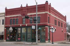 Lancaster Blocklisted 1989 · 0.5 miles away
Topographic sheets covering this place
6 surveys from 16 printed sheetsMatched by testing this settlement's coordinate against the published boundary of every sheet in the United States Geological Survey's historical collection. Each opens the scanned sheet at the Survey.
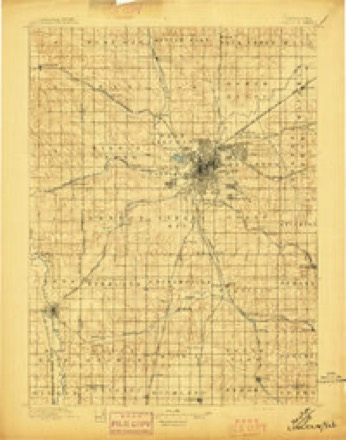
- 1897 USGS Lincoln quadrangle1:125000, 4 printings
- 1955 USGS Lincoln quadrangle1:250000, 5 printings
- 1957 USGS Lincoln quadrangle1:250000
- 1958 USGS Lincoln quadrangle1:250000
- 1964 USGS Lincoln quadrangle1:24000, 3 printings
- 1986 USGS Lincoln quadrangle1:100000, 2 printings
What happened here
An account from the chapter on Lincoln city. The inset identifies its exact source book and publication year.
Crimin.Al Cases
Lincoln and Lancaster County have been remarkably free from brutal murders or complicated crimes, and resultant criminal trials, but there have been a few cases of this type which have attracted a great amount of attention. Perhaps the most notable of the murder cases in thecounty was known as the Sheedy case.
Fires near this place
11 since 2007Regional context, not property-specific evidence. The federal wildfire occurrence database lists 11 fires within 5 miles of Havelock between 2007 and 2018, burning about 14 acres in total. None started naturally. None was recorded as arson. Distance is straight-line from the map coordinates, so a fire counted here may appear on a neighbouring settlement's page as well.
| Reported cause | Fires |
|---|---|
| Debris and open burning | 4 |
| Recreation and ceremony | 2 |
| Missing data/not specified/undetermined | 2 |
| Smoking | 1 |
| Fireworks | 1 |
| Equipment and vehicle use | 1 |
The most recent of them, most recent first, with the day each was reported and the service that recorded it.
| Date | Cause | Size | Reported by | Name on the report |
|---|---|---|---|---|
| 12 August 2018 | Smoking | under an acre | Nebraska Forest Service | not named |
| 4 July 2018 | Debris and open burning | under an acre | Nebraska Forest Service | not named |
| 4 July 2012 | Fireworks | 2.0 acres | Nebraska Forest Service | not named |
| 24 July 2007 | Missing data/not specified/undetermined | 1.0 acres | Nebraska Forest Service | not named |
| 18 July 2012 | Debris and open burning | 2.0 acres | Nebraska Forest Service | not named |
| 17 July 2007 | Equipment and vehicle use | 2.0 acres | Nebraska Forest Service | not named |
| 4 June 2012 | Debris and open burning | under an acre | Nebraska Forest Service | not named |
| 9 May 2018 | Recreation and ceremony | under an acre | Nebraska Forest Service | not named |
Settlements close enough to share some of these fires:
Storms near this place
5 since 1994Regional context, not property-specific evidence. The National Weather Service names Havelock in 5 storm reports between 1994 and 2024: 2 hail, 2 tornado, 1 thunderstorm wind. The reports record 3 injuries. Each account below is quoted exactly as the forecast office filed it, from the NOAA Storm Events Database, and each date opens the federal record of that event.
| When | Event | Place named | Harm | What the report says |
|---|---|---|---|---|
| April 2024 | Tornado (EF3) | Havelock | 3 hurt | This tornado touched down on the northeast side of Lincoln near the intersection of Havelock Ave and 84th Street causing damage to a business and a large transmission line south of Havelock Ave. The tornado moved northeast through agricultural fields, snapping power poles and large trees while increasing in strength. The tornado hit a manufacturing plant at 98th Street and Highway 6 where 70 employees were sheltered. The plant received EF-3 damage. There was a complete failure of the roof and 3 walls of the plant. Employee cars sustained varying damage, with the worst being thrown at least 75-100 yards. Tree trunks were snapped northeast of this location at a nearby business which sustained roof and siding damage.||The tornado quickly crossed 98th Street and Highway 6 where a BNSF train locomotive took a direct hit, derailing numerous cars. The tornado continued northeast across open fields, crossing I-80 and eventually Salt Creek. There was substantial tree damage along the path and along Salt Creek as well as deposited roof debris from the manufacturing plant.||Satellite and video analysis indicate that this tornado ended almost due west of Waverly, with another separate tornado developing less than a mile to the west-northwest. |
| July 2018 | Thunderstorm Wind | Havelock | - | Thunderstorm winds caused damage to a sports complex in east Lincoln. A tree was blown down, the metal roof was peeled back on the main storm complex and an inflatable dome over practice fields was destroyed. Time was taken from the complex security camera. |
| June 2008 | Tornado (EF0) | Havelock | - | A brief tornado touchdown was caught on tape near 84th and Bluff Road. The tornado did little or no apparent damage. |
| April 2012 | Hail | Havelock | - | no account filed |
| October 1994 | Hail | Havelock | - | no account filed |
Nearest settlements
The eight closest, with where each one stands in the county. Distances are straight-line, computed from the Geographic Names Information System coordinates.
| Map | Place | Distance | Sheets |
|---|---|---|---|
| Bethany | 1.2 miles | 16 | |
| University Place | 1.3 miles | 16 | |
| Mark IV Estates | 3.1 miles | 16 | |
| Belmont | 3.7 miles | 16 | |
| Arbor | 3.7 miles | 15 | |
| Lincoln | 3.9 miles | 16 | |
| Marian Center | 4.1 miles | 15 | |
| Countryside Estates | 4.6 miles | 16 |
Provenance
This settlement is recorded in the Geographic Names Information System as feature 829858. The sheet list is computed by point-in-boundary test against the United States Geological Survey's historical topographic inventory. Both are works of the United States government and carry no copyright under 17 U.S.C. 105.
Wildfire. Short, Karen C. 2022. Spatial wildfire occurrence data for the United States, 1992-2020 [FPA_FOD_20221014]. 6th Edition. Fort Collins, CO: Forest Service Research Data Archive. https://doi.org/10.2737/RDS-2013-0009.6 Collected with United States Government funding and usable without additional permissions or fees.
Storms. NOAA National Centers for Environmental Information, Storm Events Database https://www.ncei.noaa.gov/stormevents/ A work of the United States government, no copyright under 17 U.S.C. 105. Narratives are quoted verbatim from the National Weather Service report and are not edited or summarised.