 Block
From the record
One of 20 National Register listings published here for Fillmore County · listed in 2006 · category: Building.
Sources: the case file at the National Archives · the National Register database, National Park Service
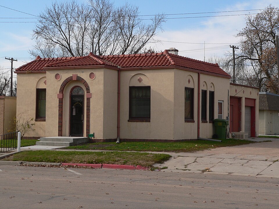
Listed on the National Register of Historic Places in 2006.
One of 20 National Register listings published here for Fillmore County · listed in 2006 · category: Building.
Sources: the case file at the National Archives · the National Register database, National Park Service
Regional context, not property-specific evidence. The federal wildfire occurrence database lists 9 fires within 5 miles of Lincoln Telephone & Telegraph Exchange Building in Fairmount between 2000 and 2017, burning about 304 acres in total. None started naturally. 1 was recorded as arson. Distance is straight-line from the map coordinates, so a fire counted here may appear on a neighbouring settlement's page as well.
| Reported cause | Fires |
|---|---|
| Debris and open burning | 5 |
| Smoking | 1 |
| Arson/incendiarism | 1 |
| Missing data/not specified/undetermined | 1 |
| Equipment and vehicle use | 1 |
The most recent of them, most recent first, with the day each was reported and the service that recorded it.
| Date | Cause | Size | Reported by | Name on the report |
|---|---|---|---|---|
| 21 April 2009 | Debris and open burning | 55 acres | Nebraska Forest Service | not named |
| 28 March 2005 | Debris and open burning | 119 acres | Rainwater Basin Wetland Management District | REAL |
| 18 February 2017 | Debris and open burning | 15 acres | Nebraska Forest Service | not named |
| 7 December 2010 | Debris and open burning | 6.0 acres | Nebraska Forest Service | not named |
| 14 December 2010 | Missing data/not specified/undetermined | under an acre | Rainwater Basin Wetland Management District | COUNTYLINE |
| 16 November 2010 | Debris and open burning | 5.0 acres | Nebraska Forest Service | not named |
| 7 October 2010 | Equipment and vehicle use | 8.0 acres | Nebraska Forest Service | not named |
| 23 January 2005 | Arson/incendiarism | 1.0 acres | Nebraska Forest Service | not named |
Regional context, not property-specific evidence. The National Weather Service names Fairmont, the town this property stands in, in 56 storm reports between 1994 and 2024: 24 thunderstorm wind, 21 hail, 7 tornado, 3 heavy rain. The reports record 3 injuries. Each account below is quoted exactly as the forecast office filed it, from the NOAA Storm Events Database, and each date opens the federal record of that event.
| When | Event | Place named | Harm | What the report says |
|---|---|---|---|---|
| March 2006 | Thunderstorm Wind | Fairmont | 3 hurt, $30,000 | no account filed |
| May 1998 | Tornado (F2) | Fairmont | $750,000 | no account filed |
| August 2007 | Thunderstorm Wind | Fairmont | $250,000 | Widespread damage to trees and some structures throughout town. |
| May 2014 | Tornado (EF1) | Fairmont | $150,000 | This tornado traveled rural areas and was witnessed by several storm chasers and experienced meteorologists. Video evidence, eyewitness accounts, radar imagey and even some of the damage confirm this tornado rotated anti-cyclonically. Damage along the path of the tornado included a grain bin and an old outbuilding being pushed off of their foundations, along with a roof partially blown off of another outbuilding. Numerous irrigation pivots were overturned, and there was plenty of tree damage. There was a home with minor roof damage. The peak wind with this tornado was estimated to be 90 MPH. |
| June 1997 | Thunderstorm Wind | Fairmont | $30,000 | no account filed |
| July 2015 | Thunderstorm Wind | Fairmont | $25,000 | Wind gusts estimated to be near 60 MPH resulted in some tree limbs approximately 3 inches in diameter being downed. |
| March 2009 | Thunderstorm Wind | Fairmont | $25,000 | Reports received included snapped power poles, overturned pivot, as well as an accident involving an overturned semi truck. |
| May 2011 | Hail | Fairmont | $25,000 | no account filed |
| July 2011 | Hail | Fairmont | $25,000 | no account filed |
| June 1997 | Hail | Fairmont | $25,000 | no account filed |
| September 2006 | Hail | Fairmont | $20,000 | no account filed |
| June 2017 | Thunderstorm Wind | Fairmont | $15,000 | Tree limbs up to 6 inches in diameter were downed. |
| May 2000 | Thunderstorm Wind | Fairmont | $15,000 | no account filed |
| May 2006 | Thunderstorm Wind | Fairmont | $10,000 | no account filed |
| July 2006 | Thunderstorm Wind | Fairmont | $10,000 | no account filed |
| June 2001 | Hail | Fairmont | $10,000 | no account filed |
| June 2001 | Hail | Fairmont | $10,000 | no account filed |
| July 2008 | Hail | Fairmont | $5,000 | no account filed |
| August 2006 | Thunderstorm Wind | Fairmont | $5,000 | no account filed |
| September 2007 | Heavy Rain | Fairmont | $2,000 | One to three inches of rain fell. |
| May 2024 | Thunderstorm Wind | Fairmont | - | A wind gust of 66 MPH was measured by a mesonet station located three miles west-southwest of Fairmont. |
| June 2022 | Thunderstorm Wind | Fairmont | - | A wind gust of 71 MPH was measured by a mesonet station located two miles east-southeast of Fairmont. |
| December 2021 | Thunderstorm Wind | Fairmont | - | A wind gust of 58 MPH was measured by a mesonet station located three miles northwest of Fairmont. |
| December 2021 | Thunderstorm Wind | Fairmont | - | A wind gust of 59 MPH was measured by a mesonet station located two miles east-southeast of Fairmont. |
| October 2020 | Thunderstorm Wind | Fairmont | - | A wind gust of 67 MPH was measured by a mesonet station located 2 miles east-northeast of Fairmont. |
| October 2020 | Thunderstorm Wind | Fairmont | - | Wind gusts were estimated to be near 60 MPH. |
| June 2018 | Tornado (EF0) | Fairmont | - | A weak tornado occurred with a maximum wind speed of 65 mph. The tornado was a landspout in nature, and was one of four to occur within a few miles of Fairmont. |
| June 2018 | Tornado (EF0) | Fairmont | - | A weak tornado with a maximum wind speed of 65 mph occurred. The tornado was a landspout in nature, and was one of four to occur within a few miles of Fairmont. |
| June 2018 | Tornado (EF0) | Fairmont | - | A weak tornado with a maximum wind speed of 60 mph occurred. The tornado was a landspout in nature, and was one of four to occur within a few miles of Fairmont. |
| June 2018 | Tornado (EF0) | Fairmont | - | A weak tornado with a maximum wind speed of 60 mph occurred. The tornado was a landspout in nature, and was one of four to occur within a few miles of Fairmont. |
| June 2018 | Thunderstorm Wind | Fairmont | - | A 58 mph thunderstorm wind gust was recorded three miles northwest of Fairmont. |
| June 2018 | Thunderstorm Wind | Fairmont | - | A 62 mph thunderstorm wind gust was recorded one mile east southeast of Fairmont. |
| June 2014 | Thunderstorm Wind | Fairmont | - | This 63 MPH wind gust was measured on a mobile wind instrument. |
| June 2014 | Thunderstorm Wind | Fairmont | - | This wind gust of 71 MPH was measured by a mobile wind instrument. Power flashes were also observed. |
| April 2013 | Hail | Fairmont | - | Hail covered the ground about an inch deep. |
| May 2012 | Heavy Rain | Fairmont | - | A rainfall total of 3.45 inches was reported over a 24 hour period. |
| May 2012 | Heavy Rain | Fairmont | - | A rainfall total of 3.21 inches was reported over a 24 hour period by a Nebraska Rainfall Assessment and Information Network Observer. |
| June 2001 | Tornado (F0) | Fairmont | - | Very brief tornado in Fillmore county |
| July 2024 | Hail | Fairmont | - | no account filed |
| July 2024 | Hail | Fairmont | - | no account filed |
| April 2012 | Hail | Fairmont | - | no account filed |
| May 2011 | Hail | Fairmont | - | no account filed |
| May 2008 | Thunderstorm Wind | Fairmont | - | no account filed |
| July 2006 | Hail | Fairmont | - | no account filed |
| April 2005 | Hail | Fairmont | - | no account filed |
| September 2005 | Hail | Fairmont | - | no account filed |
| April 2004 | Hail | Fairmont | - | no account filed |
| May 2004 | Hail | Fairmont | - | no account filed |
| June 2002 | Funnel Cloud | Fairmont | - | no account filed |
| June 2001 | Hail | Fairmont | - | no account filed |
| September 2001 | Hail | Fairmont | - | no account filed |
| June 2001 | Hail | Fairmont | - | no account filed |
| May 1998 | Thunderstorm Wind | Fairmont | - | no account filed |
| May 1996 | Hail | Fairmont | - | no account filed |
| July 1994 | Thunderstorm Wind | Fairmont | - | no account filed |
| August 1994 | Thunderstorm Wind | Fairmont | - | no account filed |
No historic map-sheet match is published for this property yet. That does not mean no map exists. This record needs a coordinate-quality review before it can be joined to a sheet boundary. Browse the county's mapped places while that work is pending.
Other National Register properties close enough to walk or drive between, ordered by distance from this one. Both positions come from the same geocoding pass that matched these properties to their map sheets.
| Photograph | Property | Distance | Listed |
|---|---|---|---|
 | Fairmont Creamery Company Building | under 500 feet | 1983 |
 | Fairmont Army Airfield | 3.1 miles | 2003 |
| Grafton High School | 6.7 miles | 2025 | |
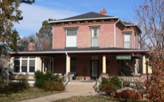 | Dempster-Sloan House | 7.0 miles | 2005 |
 | J. M. Burk House | 7.3 miles | 2001 |
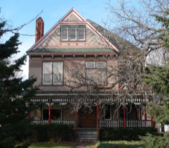 | George W. Smith House | 7.3 miles | 1986 |
| National Archives record | The nomination case file for reference 06000099 in Record Group 79. |
| Fillmore County | All 20 listed properties in this county. |