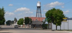
| June 2023 | Lightning | Oshkosh | 1 killed | An individual was struck by lightning resulting in death. Reported by the Garden County Sheriff's Department. |
| May 2018 | Thunderstorm Wind | Oshkosh | $3,500,000 | Flat roof was rolled back halfway on a commercial building. |
| April 2025 | Tornado (EF2) | Oshkosh | $750,000 | Tornado touched down approximately 3 miles southwest of Bingham in far northern Garden County. This tornado quickly increased in size as it moved northeast, impacting utility poles and trees along Highway 2. Just to the east, the tornado impacted a farmstead and overturned a freight train, producing EF2 damage. The tornado continued to move slowly northeast for the next hour, primarily impacting open country in rural southwest Cherry County. The tornado ended shortly after 6 PM MST, 11 miles north-northeast of Ashby Nebraska. |
| July 2006 | Thunderstorm Wind | Oshkosh | $150,000 | A violent downburst broke off large trees...one which fell on the roof of a small motel. The downburst also caused a pole barn to be destroyed, removed a roof from a machine shed, overturned two pivot irrigation systems, and stripped numerous corn fields on the northeast side of Oshkosh. |
| August 2005 | Thunderstorm Wind | Oshkosh | $150,000 | Thunderstorm outflow winds of 50 MPH caused the derailment of 40 empty coal train cars. |
| June 1998 | Hail | Oshkosh | $100,000 | Extensive damage to vehicles. Windows broken in homes. |
| June 1999 | Hail | Oshkosh | $60,000 | no account filed |
| June 1998 | Hail | Oshkosh | $50,000 | Damage to vehicles and buildings in Oshkosh. |
| July 1997 | Flash Flood | Oshkosh | $50,000 | Thunderstorms moving along the same path produced in excess of 4 inches of rainfall. This resulted in water flowing over roads and causing areas of road damage. |
| October 2025 | Thunderstorm Wind | Oshkosh | $30,000 | Power lines were reported downed in portions of Oshkosh. |
| August 2001 | Hail | Oshkosh | $20,000 | Estimated wind gusts to 53 knots accompanied the thunderstorm as it moved through the residence. |
| July 2004 | Thunderstorm Wind | Oshkosh | $15,000 | Trees and power poles were snapped off and a metal shed was tossed by the strong outflow winds. |
| August 2002 | Flash Flood | Oshkosh | $12,000 | The River Road south of Oshkosh washed out in numerous locations due to fast flowing water rushing over the road. |
| August 1998 | Hail | Oshkosh | $10,000 | Golfball size hail accompanied by strong winds damaged buildings, vehicles, and crops. |
| July 1998 | Thunderstorm Wind | Oshkosh | $10,000 | Thunderstorm winds caused extensive tree damage. |
| June 2003 | Hail | Oshkosh | $10,000 | no account filed |
| June 2012 | Hail | Oshkosh | $8,000 | A cooperative observer reported golf ball to tennis size hail that broke out windows and skylights southeast of his location. |
| August 2002 | Hail | Oshkosh | $8,000 | no account filed |
| June 1999 | Hail | Oshkosh | $8,000 | no account filed |
| August 2007 | Hail | Oshkosh | $7,000 | no account filed |
| May 2008 | Thunderstorm Wind | Oshkosh | $6,000 | Thunderstorm outflow winds tore a roof off a hay shed, destroyed and damaged grain bins, broke off four power poles, uprooted trees, and tore rain gutters off a house. |
| August 2007 | Hail | Oshkosh | $6,000 | no account filed |
| July 2001 | Hail | Oshkosh | $6,000 | no account filed |
| July 2001 | Hail | Oshkosh | $6,000 | no account filed |
| March 2007 | Hail | Oshkosh | $5,000 | Law enforcement reported golf ball size hail 5 miles southeast of Oshkosh in Garden County. |
| July 1998 | Thunderstorm Wind | Oshkosh | $5,000 | Several large trees blown down. |
| June 1998 | Hail | Oshkosh | $5,000 | Large tree limbs blown down |
| July 2007 | Hail | Oshkosh | $5,000 | no account filed |
| June 2007 | Hail | Oshkosh | $5,000 | no account filed |
| May 2004 | Hail | Oshkosh | $4,000 | no account filed |
| July 1999 | Hail | Oshkosh | $4,000 | no account filed |
| October 2025 | Thunderstorm Wind | Oshkosh | $2,000 | A large pine tree was uprooted at the high school. |
| April 2000 | Thunderstorm Wind | Oshkosh | $2,000 | TWO POWER POLES SNAPPED OFF |
| May 2004 | Hail | Oshkosh | $2,000 | no account filed |
| September 2004 | Hail | Oshkosh | $2,000 | no account filed |
| May 1998 | Hail | Oshkosh | $2,000 | no account filed |
| March 2015 | Thunderstorm Wind | Oshkosh | $1,000 | A dry thunderstorm produced down burstwinds estimated at 60 MPH. Tree limbs of 4 to 5 inches in diameter were downed. Pieces of tin blew off of a calving shed and a wooden fence was destroyed. |
| May 1998 | Thunderstorm Wind | Oshkosh | $1,000 | Thunderstorm winds blew down a large tree. |
| September 1997 | Hail | Oshkosh | $1,000 | Thunderstorm winds blew down large tree branches. |
| April 2005 | Hail | Oshkosh | $1,000 | no account filed |
| May 2004 | Hail | Oshkosh | $1,000 | no account filed |
| May 2004 | Hail | Oshkosh | $1,000 | no account filed |
| September 2004 | Hail | Oshkosh | $1,000 | no account filed |
| May 1998 | Hail | Oshkosh | $1,000 | no account filed |
| May 2000 | Thunderstorm Wind | Oshkosh | $500 | Large tree down |
| May 2025 | Thunderstorm Wind | Oshkosh | - | A thunderstorm wind gust of 63 MPH was measured at this location. |
| May 2025 | Thunderstorm Wind | Oshkosh | - | Thunderstorm wind gust of 59 MPH measured at this location. |
| April 2025 | Tornado (EFU) | Oshkosh | - | Track of tornado one. Tornado moved over open range. |
| April 2025 | Tornado (EFU) | Oshkosh | - | Brief touchdown of an anticyclonic tornado with location estimated by radar, video and photographic evidence. No damage was reported. |
| October 2025 | Thunderstorm Wind | Oshkosh | - | Trained spotter reports thunderstorm wind gusts of 60 MPH at this location. |
| June 2024 | Thunderstorm Wind | Oshkosh | - | Thunderstorm wind gusts estimated at 60 to 70 MPH at this location. |
| May 2024 | Tornado (EFU) | Oshkosh | - | Brief touchdown in open rangeland. No damage reported. |
| July 2023 | Hail | Oshkosh | - | Fire chief reported tennis ball size hail near Crescent Lake NWR. |
| July 2023 | Thunderstorm Wind | Oshkosh | - | Fire chief reports damage from wind driven hail, including broken windows, damaged vehicles, and destroyed garden. |
| July 2023 | Thunderstorm Wind | Oshkosh | - | A cooperative observer northeast of Oshkosh reported 11 power poles downed with winds estimated between 70 and 80 mph. |
| July 2023 | Thunderstorm Wind | Oshkosh | - | A trained spotter south of Oshkosh estimated wind gusts around 60 mph. |
| August 2023 | Thunderstorm Wind | Oshkosh | - | Observer says 60 mph winds blew potted plants off the porch. |
| July 2022 | Flash Flood | Oshkosh | - | Emergency management reported a washout near the intersection of roads 189 and 82 due to flooding. |
| May 2021 | Hail | Oshkosh | - | Pea to quarter sized hail reported in Oshkosh. |
| May 2021 | Hail | Oshkosh | - | Golf ball, goose egg and baseball sized hail reported at this location. |
 Block