
BlockBefore
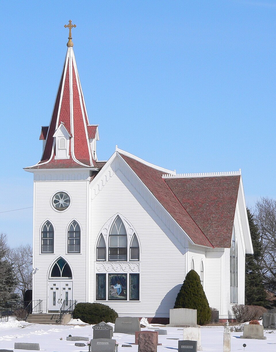
Photograph of St. Johannes Danske Lutherske Kirke
Photograph by Ammodramus, Public domain. Via Wikimedia Commons.

St. Johannes Danske Lutherske Kirke

Listed on the National Register of Historic Places in 1992.

From the record

One of 6 National Register listings published here for Hamilton County · listed in 1992 · category: District.

Sources: the case file at the National Archives · the National Register database, National Park Service · the Wikipedia article

The listing

  • What is counted as historic. The nomination lists 3 buildingss, 1 site, 1 structure as contributing to the listing.
  • Address. 2170 N. T Rd., Marquette, 68854
  • When was it listed? November 1992
  • Category. district
  • Precinct. Precinct 8
  • National Register reference number. 92001570 - the number the National Park Service assigned this property when it was listed, and the key its nomination file is catalogued under at the National Archives.

Fires near this property

10 since 2000

Regional context, not property-specific evidence. The federal wildfire occurrence database lists 10 fires within 5 miles of St. Johannes Danske Lutherske Kirke between 2000 and 2017, burning about 57 acres in total. None started naturally. None was recorded as arson. Distance is straight-line from the map coordinates, so a fire counted here may appear on a neighbouring settlement's page as well.

Reported cause Fires
Debris and open burning4
Missing data/not specified/undetermined4
Equipment and vehicle use2

The most recent of them, most recent first, with the day each was reported and the service that recorded it.

DateCause SizeReported by Name on the report
4 April 2007Debris and open burning5.0 acresNebraska Forest Servicenot named
2 April 2007Missing data/not specified/undetermined7.0 acresNebraska Forest Servicenot named
17 April 2007Debris and open burning1.0 acresNebraska Forest Servicenot named
4 March 2014Missing data/not specified/undetermined30 acresNebraska Forest Servicenot named
23 February 2015Equipment and vehicle use1.0 acresNebraska Forest Servicenot named
23 February 2015Missing data/not specified/undetermined10 acresNebraska Forest Servicenot named
28 November 2014Debris and open burning2.0 acresNebraska Forest Servicenot named
28 November 2000Equipment and vehicle useunder an acreNebraska Forest Servicenot named

Every fire recorded in Hamilton County

Storms near this property

51 since 1994

Regional context, not property-specific evidence. The National Weather Service names Marquette, the town this property stands in, in 51 storm reports between 1994 and 2024: 25 hail, 15 thunderstorm wind, 5 tornado, 4 heavy rain. No death or injury is recorded in these reports. Each account below is quoted exactly as the forecast office filed it, from the NOAA Storm Events Database, and each date opens the federal record of that event.

WhenEvent Place namedHarm What the report says
June 2014Thunderstorm WindMarquette$1,000,000Wind gusts estimated near 70 MPH resulted in damage to area grain bins, outbuildings and irrigation pivots.
June 2014HailMarquette$500,000Trees were stripped of leaves due to the combination of strong wind and quarter size hail. This was the second storm to come through this area. This report was from an NERAIN observer.
October 2001Tornado (F1)Marquette$400,000Tornado crossed from Hamilton County into Polk County.
May 2016Thunderstorm WindMarquette$250,000Wind gusts estimated to be near 70 MPH resulted in some pivot damage in the area.
May 2018HailMarquette$150,000Quarter to golf ball size hail was reported.
December 2021HailMarquette$100,000Wind-driven hail up to the size of golf balls caused significant siding damage to an area home.
October 2023Thunderstorm WindMarquette$80,000An estimated 70 mph wind gust loosened the base of an empty grain bin, destroyed a wood frame outbuilding and caused some tree damage.
June 2022HailMarquette$50,000Hail up to golf ball size was reported in and near Marquette.
June 2022HailMarquette$50,000Quarter to golf ball size hail was reported in Marquette. This was the second hail storm of the evening.
May 2005Thunderstorm WindMarquette$50,000no account filed
May 2003HailMarquette$50,000no account filed
July 2001Thunderstorm WindMarquette$40,000no account filed
August 2020HailMarquette$25,000Hail ranging in size from half dollars to 2 inches in diameter was reported along this path.
September 2018Thunderstorm WindMarquette$25,000Tree limbs were downed in the area.
May 2016Flash FloodMarquette$25,000Training, slow moving thunderstorms with torrential rainfall resulted in flash flooding across northern Hamilton, far southwestern Polk and far north-northwestern York Counties. Hamilton County was the hardest hit, with radar estimates of 5 to 8 inches of rain. Numerous county roads were covered with water and were closed. One home near Marquette in Hamilton County had about 2 feet of water inside and around the house. Animals at the farmstead had to be moved, and witnesses claimed the horses were nearly belly-deep in water at one point. This water moved downstream into Polk and York Counties, causing flooding along the Big Blue River.
August 2011HailMarquette$25,000Hail up to 2 inches in diameter continued for 10 minutes.
October 2001Tornado (F1)Marquette$25,000Tornado crossed from Hamilton County into Merrick County.
August 2020HailMarquette$25,000no account filed
October 2001Tornado (F0)Marquette$15,000Small weak tornado crossed over Marquette but caused little damage in town.
May 2016HailMarquette$15,000no account filed
July 1995Thunderstorm WindMarquette$10,000Thunderstorms remained nearly stationarrowy over northeast Hamilton County for three hours. Winds occasionally gusted to nearly 60 mph. The winds damaged three hog shelters south of Hordville and two more at Marquette. A tree and two power poles were snapped. The wind, in combination with small hail and extremely heavy rain, caused damage to the corn and soybean crops. Rainfall totaled seven inches, resulting in lowland flooding.
September 2006HailMarquette$10,000no account filed
September 2000HailMarquette$10,000no account filed
July 2023Thunderstorm WindMarquette$5,000Wind gusts estimated to be near 65 MPH resulted in some minor tree damage in the area. A street light was damaged in Marquette and a power pole was damaged near the Aurora Airport.
July 2016Thunderstorm WindMarquette$5,000Wind gusts estimated to be near 60 MPH resulted in tree damage in Marquette.
April 2024Thunderstorm WindMarquette-Wind gusts were estimated to be near 60 MPH. The combination of wind and heavy rain resulted in near-zero visibility.
May 2024Thunderstorm WindMarquette-Wind gusts were estimated to be near 60 MPH in Marquette.
May 2022Thunderstorm WindMarquette-A wind gust of 59 MPH was measured by a mesonet station located four miles south of Marquette.
March 2017Thunderstorm WindMarquette-Wind gusts were estimated to be near 60 MPH.
August 2017Heavy RainMarquette-A 24-hour precipitation amount of 5.05 inches was recorded 4 miles south of Marquette.
August 2017Heavy RainMarquette-A 24-hour precipitation amount of 4.52 inches was recorded 1 mile southeast of Marquette.
May 2016Heavy RainMarquette-Storm total rainfall report was 6.50 inches.
May 2016Heavy RainMarquette-Storm total rainfall report was 6.77 inches.
June 2014HailMarquette-Nickel to quarter size hail was reported from an NeRAIN observer.
June 2003Tornado (F0)Marquette-A brief tornado reported by storm chasers.
May 1994Tornado (F0)Marquette-A small tornado briefly touched down west of Marquette.
May 2024HailMarquette-no account filed
June 2020HailMarquette-no account filed
August 2018HailMarquette-no account filed
May 2016HailMarquette-no account filed
September 2015HailMarquette-no account filed
July 2014HailMarquette-no account filed
April 2013HailMarquette-no account filed
January 2011FloodMarquette-no account filed
August 2011HailMarquette-no account filed
June 2009HailMarquette-no account filed
August 2005Thunderstorm WindMarquette-no account filed
August 2005HailMarquette-no account filed
October 2001HailMarquette-no account filed
June 1999Thunderstorm WindMarquette-no account filed

Every storm recorded in Hamilton County

Map coverage status

No historic map-sheet match is published for this property yet. That does not mean no map exists. This record needs a coordinate-quality review before it can be joined to a sheet boundary. Browse the county's mapped places while that work is pending.

Sources for this property

National Archives recordThe nomination case file for reference 92001570 in Record Group 79.
Wikipedia articleCommunity-written account of this property, licensed CC BY-SA.
Hamilton CountyAll 6 listed properties in this county.

Provenance

  • Listing record. National Park Service National Register of Historic Places, listed-properties dataset, current to 2026-05-22.
  • Map join. Address geocoded through the United States Census geocoder, then tested against the published boundary of every sheet in the USGS Historical Topographic Map Collection.
  • How this page is made. Listing fields come from federal records; map-sheet coverage is a labelled coordinate-to-boundary calculation, not a source-field claim.
  • Wildfire. Short, Karen C. 2022. Spatial wildfire occurrence data for the United States, 1992-2020 [FPA_FOD_20221014]. 6th Edition. Fort Collins, CO: Forest Service Research Data Archive. https://doi.org/10.2737/RDS-2013-0009.6 Collected with United States Government funding and usable without additional permissions or fees.
  • Storms. NOAA National Centers for Environmental Information, Storm Events Database https://www.ncei.noaa.gov/stormevents/ A work of the United States government, no copyright under 17 U.S.C. 105. Narratives are quoted verbatim from the National Weather Service report and are not edited or summarised.