 Block
From the record
One of 110 National Register listings published here for Lancaster County · listed in 1993 · category: District.
Sources: the case file at the National Archives · the National Register database, National Park Service
Listed on the National Register of Historic Places in 1993.
One of 110 National Register listings published here for Lancaster County · listed in 1993 · category: District.
Sources: the case file at the National Archives · the National Register database, National Park Service
Regional context, not property-specific evidence. The federal wildfire occurrence database lists 12 fires within 5 miles of Pioneers Park between 2008 and 2020, burning about 29 acres in total. None started naturally. None was recorded as arson. Distance is straight-line from the map coordinates, so a fire counted here may appear on a neighbouring settlement's page as well.
| Reported cause | Fires |
|---|---|
| Debris and open burning | 7 |
| Recreation and ceremony | 3 |
| Equipment and vehicle use | 1 |
| Missing data/not specified/undetermined | 1 |
The most recent of them, most recent first, with the day each was reported and the service that recorded it.
| Date | Cause | Size | Reported by | Name on the report |
|---|---|---|---|---|
| 20 September 2018 | Missing data/not specified/undetermined | under an acre | Nebraska Forest Service | not named |
| 21 April 2020 | Debris and open burning | 10 acres | Nebraska Forest Service | not named |
| 2 April 2015 | Recreation and ceremony | under an acre | Nebraska Forest Service | not named |
| 8 March 2015 | Recreation and ceremony | under an acre | Nebraska Forest Service | not named |
| 30 March 2015 | Equipment and vehicle use | under an acre | Nebraska Forest Service | not named |
| 22 March 2015 | Recreation and ceremony | under an acre | Nebraska Forest Service | not named |
| 12 March 2016 | Debris and open burning | under an acre | Nebraska Forest Service | not named |
| 12 March 2015 | Debris and open burning | under an acre | Nebraska Forest Service | not named |
Regional context, not property-specific evidence. The National Weather Service names Lincoln, the town this property stands in, in 170 storm reports between 1994 and 2026: 99 hail, 56 thunderstorm wind, 8 lightning, 5 flash flood. The reports record 1 injury. Each account below is quoted exactly as the forecast office filed it, from the NOAA Storm Events Database, and each date opens the federal record of that event.
| When | Event | Place named | Harm | What the report says |
|---|---|---|---|---|
| May 1996 | Lightning | Lincoln | 1 hurt | no account filed |
| August 2006 | Lightning | Lincoln | $225,000 | A lightning strike caused a fire and over $200,000 damage to a laundry facility near 20th and J Streets in Lincoln. The lightning struck the roof next to the east wall and smoldered for several hours before being noticed. Most of the damage was confined to the east side of the roof of the building. |
| August 2003 | Lightning | Lincoln | $90,000 | Lightning caused around 90,000 dollars in smoke, fire and electrical damage to 3 businesses southwest of Lincoln. |
| August 1996 | Flash Flood | Lincoln | $60,000 | no account filed |
| July 1997 | Lightning | Lincoln | $25,000 | Lightning struck a house causing the roof to catch on fire. |
| August 1996 | Thunderstorm Wind | Lincoln | $20,000 | no account filed |
| September 1995 | Hail | Lincoln | $20,000 | no account filed |
| May 1996 | Lightning | Lincoln | $12,000 | no account filed |
| May 1996 | Lightning | Lincoln | $9,000 | no account filed |
| May 2004 | Lightning | Lincoln | $6,000 | A lightning strike caused fire in an attic and top floor of a house in Lincoln. |
| April 1999 | Thunderstorm Wind | Lincoln | $5,000 | Roof blown off a building |
| June 1997 | Thunderstorm Wind | Lincoln | $5,000 | Large tree branch fell on a home. |
| May 1996 | Lightning | Lincoln | $400 | no account filed |
| April 2026 | Hail | Lincoln | - | Public report of hail estimated up to 1 inch in diameter near Lincoln, NE. |
| May 2025 | Hail | Lincoln | - | Public report received via social media of hail estimated up to 1 in diameter. |
| September 2025 | Hail | West Lincoln | - | Emergency manager report of hail estimated at nickel to quarter-sized in diameter. |
| April 2024 | Hail | Lincoln | - | As a supercell moved northeast through Lancaster county, the office received multiple public reports on the northwest side of Lincoln of hail ranging from quarter to golf ball sized. |
| April 2024 | Funnel Cloud | Lincoln | - | A trained spotter called into the office to report a funnel cloud over downtown Lincoln. |
| May 2024 | Thunderstorm Wind | Lincoln | - | The office received a public report of large tree branches down in Lincoln. |
| May 2024 | Thunderstorm Wind | Lincoln | - | A large tree was reported down on Normal Boulevard, just north of South Street. |
| July 2024 | Thunderstorm Wind | Lincoln | - | The office received a report of a gas station awning blown down. |
| July 2024 | Thunderstorm Wind | Lincoln | - | The office received a public report of numerous large trees split and limbs down. |
| July 2023 | Hail | West Lincoln | - | Public reported 1-inch hail. |
| July 2023 | Hail | West Lincoln | - | Public reported 1-inch hail. |
| June 2022 | Hail | West Lincoln | - | Report received for 1.25 inch hail. |
| December 2021 | Thunderstorm Wind | Lincoln | - | Personal weather station measured a peak wind gust of 67 mph. |
| June 2020 | Thunderstorm Wind | Lincoln | - | Report from mping reported 3 inch tree limbs broken. |
| June 2020 | Thunderstorm Wind | West Lincoln | - | ASOS station at Lincoln Airport reported 69 mph wind. |
| June 2020 | Thunderstorm Wind | Lincoln | - | Emergency manager reported that there were nearly 100 calls to Lincoln Forestry for tree damage. |
| October 2020 | Thunderstorm Wind | Lincoln | - | Public sent pictures via social media of 8-12 inch diameter branches down near 70th St and Lincolnshire Rd in Lincoln. |
| July 2020 | Thunderstorm Wind | West Lincoln | - | ASOS at Lincoln Airport measured wind at 67 mph. |
| July 2020 | Thunderstorm Wind | West Lincoln | - | Emergency management reported significant number of power outages in Lincoln due to downed power lines. |
| April 2020 | Hail | Lincoln | - | Public, via an image, reported 2 inch hailsouth of Yankee Hill Road on 70th Street in Lincoln. |
| May 2019 | Flash Flood | West Lincoln | - | Several intersections are flooded. At least one with water up to the headlights of vehicles. |
| June 2018 | Thunderstorm Wind | Lincoln | - | Large tree branches broken by damaging winds near 35th and Vine Streets in Lincoln. |
| September 2018 | Thunderstorm Wind | West Lincoln | - | A power outage was reported at 31St and Merrill. |
| September 2018 | Thunderstorm Wind | Lincoln | - | Numerous trees and power lines were reported down across the city. |
| June 2018 | Thunderstorm Wind | West Lincoln | - | Large tree limbs down east of downtown Lincoln. |
| May 2017 | Hail | West Lincoln | - | Quarter size hail reported at 40th and Old Cheney Road. |
| August 2017 | Thunderstorm Wind | Lincoln | - | A possible microburst occurred in central part of Lincoln. There were numerous large trees and power lines downed by the wind event. About 15,000 customers lost power from the storm. |
| August 2017 | Thunderstorm Wind | West Lincoln | - | A 59 MPH wind gust was reported at Lincoln Airport. |
| June 2017 | Hail | West Lincoln | - | Also 60 mph wind was reported at the same location. |
| June 2017 | Hail | West Lincoln | - | One inch hail at AT 48th St. AND Highway 2. Sixty mph winds were also reported at the same location. |
| June 2017 | Thunderstorm Wind | West Lincoln | - | There were numerous reports of trees and power lines blown down in Lincoln. |
| April 2016 | Hail | West Lincoln | - | Several reports of large hail and gusty winds were received from Lincoln. The hail size ranged from nickel size to ping pong ball. |
| May 2015 | Hail | West Lincoln | - | Hail was falling near Memorial Stadium. |
| September 2015 | Hail | Lincoln | - | The public reported the hail at 56th and O Streets in Lincoln. |
| September 2015 | Hail | Lincoln | - | Numerous reports of large hail, some as big a tennis balls were received, mainly from social media, but also from spotters within the city of Lincoln. The largest hail fell on the southeast side of the city. |
| May 2014 | Thunderstorm Wind | West Lincoln | - | Thunderstorm winds estimated at around 60 mph downed some trees or caused tree damage in the Lincoln area knocking the power out for some LES customers. |
| May 2014 | Thunderstorm Wind | West Lincoln | - | A spotter measured a thunderstorm wind gust at 75 mph about 1.5 miles east of the Lincoln airport. The strong winds downed trees in the area. |
| May 2014 | Hail | West Lincoln | - | Reported about 1.5 miles east of the airport. |
| June 2014 | Thunderstorm Wind | West Lincoln | - | A trained spotter estimated winds of 60 to 65 mph. |
| October 2013 | Hail | Lincoln | - | Hail up to half dollar-size fell over parts of Lincoln. In some cases the hail covered the ground. |
| May 2013 | Hail | Lincoln | - | Hail up to 1.5 inches in diameter fell across parts of Lincoln from the first supercell thunderstorm that tracked across the city this evening. Among areas that received the large hail from this first storm included the North Bottoms neighborhood near 9th and Charleston, near Coddington and South Streets and at least one location in southwest Lincoln. |
| May 2012 | Hail | West Lincoln | - | Reported at the Lincoln Airpark. |
| June 2012 | Thunderstorm Wind | West Lincoln | - | A thunderstorm gust of 60 mph was recorded at the Lincoln airport. The strong winds downed some tree limbs which in turned brought down a few power lines in the Lincoln area. More than 450 LES customers lost power. |
| April 2012 | Flash Flood | West Lincoln | - | Rainfall of 2 to 3 inches caused flash flooding across several streets in Lincoln and also along Antelope Creek. Damage was apparently minimal. |
| September 2012 | Hail | West Lincoln | - | Hail up to 1.50 inches was reported at 70th and A Street in Lincoln. |
| August 2011 | Hail | West Lincoln | - | Near 58th and R Streets. |
| April 2011 | Hail | West Lincoln | - | Hail up to quarter-size almost covered the ground completely across mainly northern Lincoln. This report was near 27th and Superior Streets. |
No historic map-sheet match is published for this property yet. That does not mean no map exists. This record needs a coordinate-quality review before it can be joined to a sheet boundary. Browse the county's mapped places while that work is pending.
Other National Register properties close enough to walk or drive between, ordered by distance from this one. Both positions come from the same geocoding pass that matched these properties to their map sheets.
| Photograph | Property | Distance | Listed |
|---|---|---|---|
| Beal Slough Bridge | 2.8 miles | 1992 | |
 | Chicago, Burlington & Quincy Steam Locomotive No. 710 | 2.9 miles | 1997 |
| Robbers' Cave | 3.1 miles | 2020 | |
 | South Bottoms Historic District | 3.2 miles | 1986 |
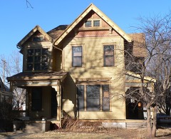 | Albert Watkins House | 3.3 miles | 1989 |
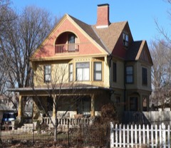 | James D. Calhoun House | 3.4 miles | 2002 |
| National Archives record | The nomination case file for reference 93000538 in Record Group 79. |
| Lancaster County | All 110 listed properties in this county. |