 Block
From the record
One of 28 National Register listings published here for Hall County · listed in 1998 · category: Site.
Sources: the case file at the National Archives · the National Register database, National Park Service
Listed on the National Register of Historic Places in 1998.
One of 28 National Register listings published here for Hall County · listed in 1998 · category: Site.
Sources: the case file at the National Archives · the National Register database, National Park Service
The chapter on Alda Township in History of Hall County, Nebraska; a Narrative of the Past with Special Emphasis Upon the Pioneer Period of the County's History, and Chronological Presentation of Its Social, Commercial, Educational, Religious, and Civic Development from the Early Days to the Present Time, and Special Analysis of Its Military and Civil Participation in the Late World War, published 1920 names Alda. This is what it says, exactly as the scans read.
W. G. Eldridge located in Hall County on May 20, 1859, on the northeast quarter of section 14, town 10, lange 11. The country was then decidedly sparsely settled. The nearest neighbors on the west were eight miles away. Buffalo, deer, antelope, wolves, and Indians roamed over the vast treeless plains with wild freedom, undaunted by the approach of any white neighbors. A few hundred Indians camping near Mr. Eldridge's humble habitation was not an unusual occurrence. He erected the first dwelling in the fall of 1859. Mr. Eldridge, the father of the Alda community, was a native of Lafayette, Indiana, born on December 23, 1882. He moved to Middleport, Illinois, at the age of twenty-one and carried on a harness shop until 1856. He went to Kansas then and without any permanent place of settlement traded ponies and horse with Indians and whites alike. Returning to Indiana in the winter of 1858, he stayed only long enough to get started for Nebraska in March, 1859. He was married in Hall County, in the fall of 1860 to Miss S. S. Shinton, a native of England. They had five children, Annie E. who became the wife of Warren Winslow, Jessie N., Mary I., Jasper J., and Fannie A.
Squire Lamb came to this part of the country in 1858. The Reese family came in 1860. In the meantime John Thomssen, one of the thirty-five members of the colony which settled near Grand Island in 1857, was married in 1860 to the one single lady who had ac- companied the original colony to Hall County. During the year 1860 this bridal couple setteled down and became pioneers of the present Alda township. Mr. and Mrs. N. V. Hansen settled on a place adjoining the Thomssen's. Other very early settlers were John Ring and two sons, John House and family, the Hann family, Henry Gam, and Charles and Arthur Lamberson. Francis Corkins came from Illinois to this part of Hall County in the fall of 1867. He worked through that neighborhood until 1875, then was married to Miss Harriet E. Smith and took a soldier's homestead.
Machine-read from a century-old scan, so expect the errors a machine makes: misspelled names, dropped words, stray characters.
Read the whole chapter on Alda Township - 2,439 words on its settlement, mills, schools and churches.
Regional context, not property-specific evidence. The federal wildfire occurrence database lists 5 fires within 5 miles of Townsley-Murdock Immigrant Trail Site between 2006 and 2020, burning about 41 acres in total. None started naturally. None was recorded as arson. Distance is straight-line from the map coordinates, so a fire counted here may appear on a neighbouring settlement's page as well.
| Reported cause | Fires |
|---|---|
| Debris and open burning | 3 |
| Missing data/not specified/undetermined | 2 |
The most recent of them, most recent first, with the day each was reported and the service that recorded it.
| Date | Cause | Size | Reported by | Name on the report |
|---|---|---|---|---|
| 8 June 2007 | Missing data/not specified/undetermined | 1.0 acres | Nebraska Forest Service | not named |
| 17 May 2019 | Debris and open burning | 38 acres | Nebraska Forest Service | not named |
| 15 April 2020 | Debris and open burning | 1.2 acres | Nebraska Forest Service | not named |
| 8 March 2020 | Debris and open burning | under an acre | Nebraska Forest Service | not named |
| 5 March 2006 | Missing data/not specified/undetermined | under an acre | Nebraska Forest Service | not named |
Regional context, not property-specific evidence. The National Weather Service names Alda, the town this property stands in, in 33 storm reports between 1996 and 2025: 20 hail, 8 thunderstorm wind, 2 flash flood, 1 flood. No death or injury is recorded in these reports. Each account below is quoted exactly as the forecast office filed it, from the NOAA Storm Events Database, and each date opens the federal record of that event.
| When | Event | Place named | Harm | What the report says |
|---|---|---|---|---|
| April 2024 | Flash Flood | Alda | $250,000 | Strong thunderstorms with heavy rainfall rates dropped 3 to 5 inches of rain in the Grand Island area, with much of that falling within 2 hours. Law enforcement reported multiple flooded intersections and stalled vehicles, and water coming up through a few manhole covers. |
| August 2014 | Hail | Alda | $150,000 | Estimated wind gusts of 60 mph were also reported with the quarter size hail. This was reported by the general public driving on Interstate 80 and was relayed by law enforcement. |
| August 2014 | Thunderstorm Wind | Alda | $150,000 | Quarter size hail also occurred along with the estimated 60 mph wind gusts reported the public driving on Interstate 80. This report was relayed by law enforcement. |
| June 1997 | Hail | Alda | $150,000 | no account filed |
| April 2024 | Flash Flood | Alda | $100,000 | Strong thunderstorms with heavy rainfall rates dropped 3 to 6 inches of rain in the Wood River area, with 2 to 4 inches of that falling within 2 hours. Report from social media noted street flooding in Wood River, with some streets blocked off. |
| August 2018 | Hail | Alda | $100,000 | Hail up to 2 inches in diameter was reported. |
| August 2019 | Thunderstorm Wind | Alda | $25,000 | Wind gusts estimated to be near 75 MPH caused semi trucks to be blown over on Interstate 80 near mile marker 305. |
| May 2004 | Hail | Alda | $25,000 | no account filed |
| May 1998 | Hail | Alda | $15,000 | no account filed |
| April 2013 | Hail | Alda | $10,000 | Hail covered the ground and lasted for about 5 minutes. |
| June 2006 | Thunderstorm Wind | Alda | $10,000 | no account filed |
| June 2008 | Hail | Alda | $5,000 | no account filed |
| July 2016 | Thunderstorm Wind | Alda | $3,000 | A semi truck and trailer were blown over near the Alda interchange of Interstate 80. |
| July 1996 | Hail | Alda | $2,000 | no account filed |
| April 2025 | Hail | Alda | - | Hail up to the size of half dollars was reported along this path. |
| April 2024 | Thunderstorm Wind | Alda | - | A wind gust of 63 MPH was measured by a mesonet station located two miles west-northwest of Alda. |
| July 2022 | Hail | Alda | - | Hail ranging in size from quarters to half dollars was reported along this path. |
| July 2020 | Thunderstorm Wind | Alda | - | A wind gust of 64 MPH was recorded by a mesonet station located 3 miles west-northwest of Alda. |
| August 2019 | Thunderstorm Wind | Alda | - | An 80 MPH wind gust was measured by a mesonet station located 3 miles west-northwest of Alda at 2:42 AM CDT. A 71 MPH wind gust was measured by a mesonet station located 2 miles north of Alda at 2:44 AM CDT. A 66 MPH wind gust was measured by a mesonet station located 3 miles northeast of Alda at 2:46 AM CDT. Significant damage to a large metal building was reported 3 miles northwest of Alda. |
| August 2017 | Heavy Rain | Alda | - | A 24-hour precipitation amount of 4.18 inches was recorded 4 miles east of Alda. |
| May 2015 | Tornado (EF0) | Alda | - | This tornado briefly touched down and was reported by a trained spotter. No damage occurred. |
| August 2014 | Hail | Alda | - | Quarter size hail occurred near the intersection of Highway 30 and Engleman Road. This report was received via Facebook. |
| April 2014 | Hail | Alda | - | Quarter to walnut size hail occurred near the Interstate 80 exit for Alda. This report, along with a photo, was received via Twitter. |
| June 2013 | Hail | Alda | - | Hail was ongoing at the time of the report. |
| April 2013 | Thunderstorm Wind | Alda | - | The electrical power was out in town. |
| June 2008 | Hail | Alda | - | Pea to nickel size hail was reported. |
| May 2024 | Hail | Alda | - | no account filed |
| June 2020 | Hail | Alda | - | no account filed |
| May 2016 | Hail | Alda | - | no account filed |
| May 2013 | Hail | Alda | - | no account filed |
| June 2011 | Hail | Alda | - | no account filed |
| February 2007 | Flood | Alda | - | no account filed |
| May 1996 | Hail | Alda | - | no account filed |
No historic map-sheet match is published for this property yet. That does not mean no map exists. This record needs a coordinate-quality review before it can be joined to a sheet boundary. Browse the county's mapped places while that work is pending.
Other National Register properties close enough to walk or drive between, ordered by distance from this one. Both positions come from the same geocoding pass that matched these properties to their map sheets.
| Photograph | Property | Distance | Listed |
|---|---|---|---|
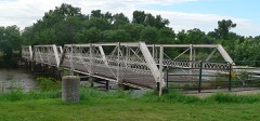 | Nine Bridges Bridge | 5.1 miles | 1992 |
 | Grand Island FCC Monitoring Station | 6.0 miles | 1973 |
 | Stuhr Museum of the Prairie Pioneer | 6.0 miles | 2015 |
 | Gloe Brothers Service Station | 6.4 miles | 2000 |
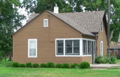 | Heinrich Giese House | 6.8 miles | 2006 |
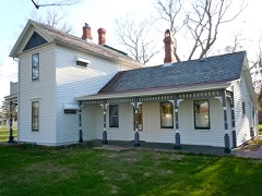 | William Stolley Homestead and Site of Fort Independence | 7.1 miles | 1972 |
| National Archives record | The nomination case file for reference 98000194 in Record Group 79. |
| Hall County | All 28 listed properties in this county. |