Major Bibliographical References - Federal agency -preliminary determination of individual listing _ Local government (36 CFR 67) has been requested _previously listed in the National Register Name of repository:Nancy H. Campbell designated a National Historic Landmark _recorded by Historic American Buildings _recorded by Historic American Engineering Record # Primary Location of Additional Data State Historic Preservation Office 1880-1885 University distinction. Bibliography history. ARCHITECTURE Criteria Considerations religious purposes. represents a significant and distinguishable Applicable National Register Criteria (Enter categories from instructions) Significant Dates persons significant in our past. Significant Person Period of Significance patterns of our history.
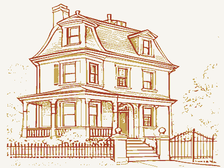
Property embodies the distinctive Other State agency County and State National Register listing) Architect/Builder Previous documentation on file (NPS) XOther Cultural Affiliation Survey # (Cite the books, articles, and other sources used in preparing this form on one or more continuation sheets.) _previously determined eligible by the National Register NPS Form 10-900-a OMB No. 1024-0018 United States Department of the Interior National Park Service National Register of Historic Places Continuation Sheet Section number 8 Page 1 Truman and Sylvia Bull Coe House, Franklin County, Ohio 8. STATEMENT OF SIGNIFICANCE example of the Queen Anne-Eastlake style of architecture in Columbus's Clintonville neighborhood.It is one of the few remaining residences of Clintonville's nineteenth-century the City of Columbus in 1910.
Clintonville is a neighborhood on the north side of Columbus, Ohio, that was built mostly in the North High Street and Indianola Avenue, two main streets that connect Columbus to Worthington. Clintonville extends north from Arcadia Avenue, which until 1910 was the northern boundary of century bungalow-style and Colonial-Revival-style houses give few clues that there was an active rural community in Clintonville in the nineteenth century. The historic context for the Coe House is the 687-acre tract of land in Clinton Township, Franklin County, Ohio, that Mrs. Coe's grandfather, Thomas Bull, purchased in 1814 from John Rathbone. Indianola Avenue, and from Weber Road north to Brevoort Road. This area was the core of the a separate entity in 1856 (Figure 4). The Bull family is mentioned in the first two histories of Clinton Township.
This five-square-mile In 1880, the History of Franklin and Pickaway Counties, Ohio, after descriptions of the topography, the remaining Indians, and the wildlife, profiled the first white settlers, including the publishedi, 1997, p. 9. Olentangy River east to Interstate 71. Summary Historic Context (8-86) the city of Columbus, to the city of Worthington, Ohio.²The numerous blocks of early-twentieth- 1920s and 1930s.Most of the streets form an east-west grid that bisects the north-south-running and George Stephenson each owned one quarter(Figure 1). The Truman and Sylvia Bull Coe House is significant under Criterion C as an excellent and rare rectangle was Township Number One, in Range 18 of the U. S. Military Lands.
In 1800 the area from the Glen Echo Ravine, which is just north of Arcadia Avenue, north to the city of Worthington, and from the township was divided into four quarters; Jonathan Dayton owned two quarters and John Rathbone 1 Nancy J. Pendleton, Early Clintonville (and Grove City) and the Bull and Smith Families. Columbus, Ohio: [self- NPS Form 10-900-a OMB No. 1024-0018 United States Department of the Interior National Park Service National Register of Historic Places Section number 8 Page 2 Truman and Sylvia Bull Coe House, Franklin County, Ohio Bull family and a dozen other families who came to Clinton Township in the earliest years of the Prominent among the pioneers of this township were Thomas Bull and family, who arrived in settled upon lot eight.....
[He and] his wife Sylvia (Benedict).....raised a family of four sons and two In 1930, Opha Moore's History of Franklin County included Thomas Bull in the list of thirteen early settlers of Clinton Township.*He was also included in the descriptions of Revolutionary War veterans who settled in Franklin County. In the first half of the nineteenth century, the landowners in the area of Clinton Township that sold part of Lot 9 to another newly arrived settler, John Smith. In 1821 Thomas Bull, with the help of his four sons, built a 1½-story brick New England-style house, on land that was next to the Columbus-Worthington Road. Today that location is the When Thomas Bull died in 1823, his will divided his land among his four sons and one of his daughters.The younger daughter, Edith, received 50 acres in Lot 9 of the Rathbone section.
The elder daughter, Chloe Comstock, received a bequest of two hundred dollars.® The eldest Surviving son Jason Bull (1793-1861), a farmer, Methodist preacher, and conductor on the Underground Railroad,° received 128 acres in the south half of Lot 10 (today's Lakeview to Weber Roads). One-half acre was held back from Jason's tract as a space reserved for a Methodist prominent men and pioneers. Cleveland, Ohio: Williams Brothers, 1880, p. 404. Publishing Company, 1930, p. 483. 5 Moore, p. 95 6 History of Franklin and Pickaway Counties, p. 404. Pendleton, p. 19 8 Will of Thomas Bull, item 9 in Abstract for house at75 East Lakeview Avenue. ° Pendleton, p. 31. daughters. (8-86) Continuation Sheet nineteenth century: Rathbone section, lots eight, nine, and ten, comprising something over six hundred acres. He became today's Clintonville were mostly farmers.
Geographically, they were well placed. The road from the "old" town of Worthington to the new state capital, Columbus, ran north and south southeast corner of North High Street and East Torrence Road. Clintonville historian Nancy J. Pendleton wrote, "This home stood until 1931, when it was razed. After Thomas died in 1823, [son] Alonson shared the home with his family and widowed mother [Sylvia Benedict Bull]." 3 History of Franklin and Pickaway Counties, Ohio, with illustrations and biographical sketches, of some of the Moore, Opha, History of Franklin County, Ohio, in three volumes, illustrated. Topeka, Indianapolis: Historical Worthington, in the fall of1812, removing from the State of New York. They remained the first NPS Form 10-900-a OMB No.
1024-0018 United States Department of the Interior National Park Service National Register of Historic Places Continuation Sheet Section number 8 Page 3 Truman and Sylvia Bull Coe House, Franklin County, Ohio The land that Thomas Bull owned in Lot 8 went to his younger sons Alonson and Hiram. The youngest son Hiram sold his share to his brother Alonson in 1826 and moved to Pleasant Township in Franklin County. The third son, Alonson Bull (1797-1858), was an abolitionist and civic leader who lived with his wife, children, and widowed mother in the brick family home that he built with his father and brothers. After his mother diedin 1846, Alonson Bull and his wife began selling nearby lots to In 1846 or'47 Alonson Bull laid out a few building lots on the Columbus and Worthington road, which were bought and improved by mechanics.
He did not design it for a village, and had no plat a little town, and took the name of Clintonville. A post office was established there in October, In addition to starting the commercial center of Clintonville at the crossroads of Oakland Avenue Alonson Bull was a director in the company that built the plank road from Columbus to Worthington. The road was completed in 1850.14 Through his wife's family, he was also a trustee son, James Bull, was twice elected mayor of Columbus, Ohio. He served from 1865 to 1868 and again from 1871 to 1874. History of Franklin and Pickaway Counties, p. 408. Matthew Westervelt, one of the founders of the town that was later called Westerville. Matthew Westervelt gave 25 Men's Seminary which later became Otterbein College. (8-86) 12 Pendleton, p. 57. 1847, with James Ferguson as postmaster.13 16 Pendleton, p. 46 and p. 54.
of the educational institution in Blendon Township that became Otterbein College.15Alonson's 10 Pendleton, p. 22. 11 Pendleton, pp. 37-38. Episcopal church building. As his father intended, Jason along with his brothers Alonson and The 128 acres in the north half of Lot 10 (today's Longview to Lakeview Avenues) were willed to this property, on the northeast corner of today's North High Street and East Como Avenue (Figure of the neighborhood. The few houses erected, however, formed the nucleus around which grew up Dr. Nathan Thompson Bull (1795-1880), a physician whose house was located in the middle of of his lots recorded.
His purpose was merely to afford homes for a few mechanics, for the benefit acres to the Methodist Episcopal Conference in 1839 that was used for the establishment of the Blendon Young Nathan built the Clinton Chapel in 1838 (Figure 18).10 people called "mechanics"-- tradespeople and craftsmen who served the local farmers. NPS Form 10-900-a OMB No. 1024-0018 United States Department of the Interior National Park Service National Register of Historic Places Continuation Sheet Section number 8 Page 4 Truman and Sylvia Bull Coe House, Franklin County, Ohio land owned by Alonson Bull (Figure 3).
The 1856 map of Clinton Township (Figure 4) shows Jason Bull's land as encompassing 128 acres (from the shore of Whetstone Creek, today's Olentangy River, to the north-south road the east side of the Columbus-Worthington Pike, and two other structures were on the west side structures, both on the east side of the road. One was his residence, which was built in 1846 (Figure 18). The other is no longer standing. Jason Bull and his first wife, Delia Matoon Bull, had five daughters and three sons. After Delia 1861, Sarah and her son Charles moved to Illinois, and the land in Clinton Township was divided Chloe Bull Wilson, the eldest daughter, who was married to Andrew Wilson, the owner of 170 acres south of Jason Bull's farm, received 23 acres on the riverfront. Sylvia Bull Coe, the second land was divided among the other sisters.
Cynthia Bull Spurgeon, who had moved to Illinois, received two lots, one each fronting on the west side of the Columbus-Worthington Road, and one The 1872 map of Clinton Township (Figure 5) showed the same three structures on the land that specifying its affiliation with the Methodist Episcopal Church. The two houses on the west side of 1 Pendleton, p. 33 19 J. A. Caldwell, Caldwell's Atlas of Franklin County and the City of Columbus, Clinton Township, p. 43. Also reproduced in Pendleton, p. 153 again on March 30, 1854, to Hiram Weaver (Item 16). (8-86) The 1842hand-drawn map of Clinton Township shows the land owned by Jason Bull and Dr. of the road. Dr. Nathan Thompson Bull's land also encompassed 128 acres, and showed two died in 1843," Jason married Sarah Sawyer, and they had one son, Charles.
When Jason died in daughter, received 29 acres, which fronted on the Columbus-Worthington Road. The rest of the apparently sold her 31 acres to J. M. Wilson. The youngest sisters, Lucy and Amelia, each had been Jason Bull's, as the 1856 map. The Clinton Chapel is now called the "M. E.Ch.," among the five daughters. The first three sons did not outlive their father.1 known today as Indianola Avenue),and including three structures.The Clinton Chapel was on Nathan Thompson Bull by including rectangles labeled "J. Bull" and "T. Bull",but does not show The house's abstract includes a list of marriages by the five daughters of Jason Bull(Items 12 to 17 on page 8 of the road were on land owned by"L. C.Weaver"(the former Lucy Bull)² and"A. [Amelia] K. Bull." NPS Form 10-900-a OMB No.
1024-0018 United States Department of the Interior National Park Service National Register of Historic Places Continuation Sheet Section number 8 Page 5 Truman and Sylvia Bull Coe House, Franklin County, Ohio The next township map, dated 1883 (Figure 6), showed names of owners and acreage, but not structures. Dr. Nathan Thompson Bull was still listed as owning his 128 acres, though he died in church belonged in 1883 to D. B. Walcutt. In 1903, the first topographic map of the area showed several streets in the Clintonville area, and West and East Como Avenues, Westand East Lakeview Avenues, and West Pacemont Road. In 1910, the Clinton Township map (Figure 8) shows numerous streets and subdivisions that correspond, to a great degree, to the current layout of Clintonville (Figure 10).
The first large subdivision in Clintonville was the Crestview Addition, a grid of five streets (Kelso, Crestview, formed from the landholdings around the Crestview Addition. Clintonville was a bustling rural community in the late nineteenth century after the dirt road from Columbus crept northward with the improvement of roads and the construction of trolley-car lines. Clintonville and drew thousands of visitors past the northern border of the city. The 1903 dense residential and commercial development, a few of the nineteenth-century structures can still be seen, although several of them have been altered. The architectural context for the Coe House is twofold. First, it is the emerging Eastlake and Queen Anne styles, whose popularity in Ohio began around 1880.2 Second, it is the nineteenth- 2 Pendleton, p. 37. p. 90-91.
Architectural Context streets and thirty-one structures south of the Clintonville center.Today these streets are called 1880,21 and four of the Bull daughters still owned their tracts.Cynthia's 32-acre tract next to the settlers' land holdings were subdivided for new generations and later settlers.The city of numerous structures (Figure 7). In addition to the cluster of commercial and residential buildings on North High Street near what is now Oakland Park Avenue, there was a community of three Tulane, Tibet, and Weber) between North High Street and Indianola Avenue. This was formed In 1897 an outdoor amusement center called Olentangy Park opened at the southern edge of topographic map shows numerous structures along the roads. While the area today is filled with century community of Clintonville, of which only a few representative structures remain. 2 Stephen C.
Gordon, How to Complete the Ohio Historic Inventory. Columbus, Ohio: Ohio Historical Society, 1992, from the eastern half of Andrew and Chloe Bull Wilson's farm. Numerous smaller "additions" were (8-86) NPS Form 10-900-a OMB No. 1024-0018 United States Department of the Interior National Park Service National Register of Historic Places Continuation Sheet Section number 8 Page 6 Truman and Sylvia Bull Coe House, Franklin County, Ohio The Eastlake style, which was used from about 1880 to 1890, exploited new woodworking machinery to create decorative three-dimensional ornament for frame houses. The use of the recently invented power lathes and spindle-shapers "resulted in distinctive, fanciful decorations and turned porch posts.
Also, beginning about 1880, the Queen Anne style achieved wide acceptance in the United States buildings for the Centennial Exposition of 1876 in Philadelphia and by the designs of English Victorian architect Richard Norman Shaw, whose early work was widely publicized in architectural journals. The biggest stylistic change in the Late Victorian period occurred after 1880, when the Queen Anne 1880, the predominant styles were still the one over one and two over two, but the introduction of The windows on the Coe House are one-over-one, and are made with the earliest type of check rail, a plain check rail. This is where the upper and lower sashes come together in their separate tracks at a vertical angle. Later windows were built with beveled or rabbeted check rails, so that the sashes met at an angle that was stronger and more resistant to wind and water.
The earliest pattern of lights (one over one) and the simplest pattern of sash alignment indicate that the Coe House was built early in the style's period of use. Within the house, the style of the woodwork and the hardware offer additional clues as to the date that the house was built. The woodwork in the house is elaborate, with wide baseboards, oak mantels in the living room and dining room, and carved floral decoration on the door and window used in the 1880s. The hinges, doorknobs, window locks, and pocket-doorplates in the Coe House use floral elements and curvilinear patterns that show the owners' preference for the style that was considered new and exotic in the 1880s. According to antique hardware expert H. Weber Wilson, 23 Gordon, p. 90.
and continued as the dominant style until 19oo."Its popularity was inspired by the British sash is ornate and divided into numerous patterns while the lower sash is plain and simple....ln (8-86) According to Brent Hull, an expert on historic construction methods: headblocks. The presence of the floral motifs shows the new taste in decoration that was widely nineteenth through the mid-twentieth centuries. Hoboken, N. J.: John Wiley & Sons, Inc., 2003, p. 61. style grew in popularity and the Queen Anne sash emerged. On a Queen Anne window, the upper NPS Form 10-900-a OMB No.
1024-0018 United States Department of the Interior National Park Service National Register of Historic Places Continuation Sheet Section number 8 Page 7 Truman and Sylvia Bull Coe House, Franklin County, Ohio decorative events: the emergence of eclectic or Queen Anne buildings and the Aesthetic or Americans at the Philadelphia Centennial of 1876."26 most of the 1880s. Design elements such as sunbursts, potted plants, diagonal and chevron stripes, daisies and sunflowers were borrowed from Japan. American manufacturers also found The house's wide front doorhas a stylish doorknob and double-keyhole backplate hardware that In the local architectural context, the Coe House is one of the few older houses that still exist in Clintonville and retain their nineteenth-century appearance.
The 1903 topographical map, which Many of the recorded buildings that remain are of the two-story gabled-ell type. Experts say that of these modest houses retain their original form and appearance, though they blend with the 27 Wilson, p. 90 * Wilson, p. 196 Numbers 116, 120, 126, 129, 132, 135, 146, and 162. The Auditor dates these houses from 1890 to 1915. These would have been built before 1900,but after 1880 because they do not appear on the 1872 Clinton Township map, and because their occupants were not listed in the 1880 Census in this area. (8-86) vicinity. 30 Gordon, p. 136. twenty gabled-ell type houses that are indicated on the 1903 topographic map(Figure 16). Many Anglo-Japanese style of interior design. Both of these building styles were introduced to inspiration from other exotic cultures, especially the Middle East, Egypt and even old Gothic.
American companies created a huge and delicious variety of Aesthetic hardware that is actively 33There are five gabled-ell houses on the north side of East Lakeview Avenue, across from the Coe House, at Numbers 54, 60, 66, 72, and 76. The Franklin County Auditor's records say that they were built between 1918 and the area, but not on the 1903 topo map, confirming their twentieth-century construction. was based on a survey done in 1901, shows the Coe House and numerous structures in its 26 H. Weber Wilson, Antique Hardware Price Guide. lola, Wisconsin: Krause Publications, 1999, p. 36. 32 The 1903 topo map shows a cluster of eight buildings on West Como Avenue that corresponds to the houses at correspond to Numbers 54 through 72; the turn-of-the-century buildings are spread out from near the corner of North sought by collectors today."27 NPS Form 10-900-a OMB No.
1024-0018 United States Department of the Interior National Park Service National Register of Historic Places Continuation Sheet Section number 8 Page 8 Truman and Sylvia Bull Coe House, Franklin County, Ohio Other examples with high degrees of integrity include: - the gabled-ell house at 71 East Como Avenue (Figure 17), and - the Jacob Weisheimer House at 286 West Weisheimer Road (Figure 21), built in 1897. - the Clinton Chapel, built in 1838 but enlarged and remodeled over the years (Figure 19); - the home of Dr. Nathan Thompson Bull, built in 1846, but moved up the street in the early moved from its original location; and - the Queen Anne-style farmhouse located at 3319 Calumet Street (Figure 15). The Coe House, probably built between 1880 and 1885, is distinguished by its location and its style.
It is situated on an uphill slope east of North High Street, and it is more elaborate than the has the same setback, orientation, and lot size, but it stands out as a late-nineteenth-century elaborate as some versions of Queen Anne in Columbus-it has no tower -the Coe House today Truman H. Coe (1819-1911) was described in the Centennial Biographical History of Columbus and Franklin County as a "well known retired business man of Clinton township [who] is an Development. Chicago: The Lewis Publishing Company, 1901, p. 383. (8-86) 34 Franklin County Auditor. Truman and Sylvia Bull Coe is different in style from most other Clintonville houses. them in the 1920s.
.the Queen Anne-style house at 489 East North Broadway (Figure 14),built in 189234 bungalows and Colonial Revival-style single-family and duplex residences that were built among Some examples of extant nineteenth-century buildings which have been altered include: nearby gabled-ell type houses. It blends with its twentieth-century neighbors, to the extent that is residence built with a modest interpretation of the Queen Anne-Eastlake style. While not as honored representative of the early pioneers of this county, and a true type of the energetic, hardy portraits of Many Well Known People of Franklin County, who Have Been and Are Prominent in Its History and twentieth century and enlarged in the late twentieth century (Figure 18); - the James Chestnut House at 3338-40 Wall Street (Figure 20), which may have been men who have actively assisted in developing and improving his locality.
NPS Form 10-900-a OMB No. 1024-0018 United States Department of the Interior National Park Service National Register of Historic Places Continuation Sheet Section number 8 Page 9 Truman and Sylvia Bull Coe House, Franklin County, Ohio Ohio from Vermont in 1807.3 Truman Coe's parents purchased farmland in neighboring Mifflin road from Columbus to Westerville (known before 1840 as Westervelt). The Centennial Biographical History described Mr. Coe's enterprising career as: After his marriage [in 1847] Mr. Coe made a purchase of two hundred and five acres of land in energies being devoted to the lumber and timber business. At the time that Mr.
Coe made this purchase of land in Blendon township a plank road was planned and stock taken at once to build the road from Columbus to Westervelt, he taking five hundred dollars worth of stock in the road The contractor of the plank road had a steam sawmill put on Mr. Coe's land and Mr. Coe furnished the timber in logs at the mill and the contractor sawed out for him one and a half million feet of plank, which he delivered on the line of the new road.After the road was finished the price of land After living in Blendon Township during the construction of the road, Mr. and Mrs. Coe bought a 200-acre property northeast of the town of Worthington and built a house for their family, which After the Civil War, Mr.
Coe, then aged forty-five, returned to Franklin County.* The Centennial Biographical History said that he then built "what is now the Coe residence on North High Street was given as 1802, p. 304. 2 Centennial Biographical History, p. 384. brother, Irwin Trimble Coe, attended the Academy in the 1871-1872 school year. (8-86) 39 http://www.wpl.lib.oh.us/library/overview/loc_hist/2wv_wh.html the new purchase and moved into it. He never engaged in agricultural pursuits to any extent, his along the route rose greatly in value and Mr. Coe soon sold his purchase of land at forty dollars per included a daughter and three sons. After five years they moved into Worthington for a few years and then moved to Delaware, Ohio, so that the children could attend college at Delaware occupation was in the lumber and timber industry. He had been one of the builders of the plank acre. Coe and his son S.
M.Coe operated a spoke factory in Hardin County, Ohio.42 NPS Form 10-900-a OMB No. 1024-0018 United States Department of the Interior National Park Service National Register of Historic Places Continuation Sheet Section number 8 Page 10 Truman and Sylvia Bull Coe House, Franklin County, Ohio the construction of the Coe house. There are no records that specify the date that the Coe House was built, nor even that the Coes and soit can reasonably be assumed that they were the original owners. By extrapolating information from census records, the 1880agricultural census, mortgage records, city and county directories, maps, and the construction and stylistic evidence, we can infer that the house appears to have been built between 1880 and 1885.
The 1860 Census listed Truman and Sylvia Coe as residents of Orange Township in Delaware Delaware, Ohio, so their children could attend "the Delaware University." The 1870 Census listed them as residents of Hale Township in Hardin County, Ohio, which correlates to the statement In 1870, the Coes mortgaged the 29 acres in Clinton Township, that is, they used it as security on purpose for which the money was used, the Coes may have used it to build the house at 75 East Lakeview Avenue. The 1878 directory of Clinton Township listed five men named Coe (Almon, George, Alvin, Irwin, Long Street. By 1880, however, Mr. and Mrs. Coe had moved back to the Clintonville area. household with their son John, and son and daughter-in-law, Erwin (Irwin/Irvin) and Aggie Coe. In the next household, the Census listed the Coes' daughter and son-in-law, Lucy and E. L.
Hendrix (Hendrickson) with their daughters, Bertha, age six, and Anna, age one. Truman and John listed 44 Centennial Biographical History, p. 385 includes a directory of Franklin County Townships. store. (8-86) was not paid off until after Mrs. Coe's death in 1891.45 While there is no documentation as to the County.This correlates to the Centennial Biographical History statement that the Coesmoved to that Mr.Coe and his son Safford operated a spoke factory in Hardin County during the Civil War. built it. It was built, however, on land that they owned during the lifetimes of Mr. and Mrs. Coe, When the mortgagee died in 1879, they renewed the mortgage with his widow.
The mortgage Irwin was listed in the Columbus city directory as working as a clerk, and boarding at 560 East In the 1880 Census, they were listed in Clinton Township, Franklin County, living in the same and Jonathan),4 but none of them are from the family of Truman and Sylvia Coe. The Coes' son their occupations as farmer. Irwin was a bookkeeper and E. L. Hendrickson worked for a liquor NPS Form 10-900-a OMB No. 1024-0018 United States Department of the Interior National Park Service National Register of Historic Places Continuation Sheet Section number 8 Page 11 Truman and Sylvia Bull Coe House, Franklin County, Ohio In the 1880 Agricultural Census, which was based on farm production in 1879, Sylvia Coe's 29 acres were listed as being 15 acres of tilled land and 14 acres of woodland and forest.
The value of the "farm including land, fences, and buildings" was 4,000 dollars, plus the value of the "farming prosperity of the farm (value of all farm production in 1879) totaled 200 dollars. The livestock included two cows, two calves, three horses, two head of cattle (one was sold), fifteen swine, and butter, fifty dozen eggs, fifty bushels of potatoes, twenty-five bushels of apples, and fifty cords of to Columbus and lower further from the capital city. Joseph Guitner, for example, who farmed 59 acres directly north of the city border, valued his farm at $40,000 or $678 per acre. The Columbus Sewer Pipe Company, which formed and fired ceramic sewer pipes on the land facing seven tillable acres, which the company valued at $2,400 or $343 per acre. Andrew Wilson, owner of the farm south of Jason Bull's land, owned 224 acres which he valued at $34,000 or $152 per acre.
Sylvia Coe's land, at $138 per acre is in line with her sisters' farms, which were valued at $112 and $152 per acre. North of the Bull sisters' farms, the twelve farms were valued at an average of $98 per acre. The 1872 Clinton Township map (Figure 5) showed that Sylvia's sister's farms both had structures that might have been farmhouses, while hers had no structures. The value of her 29 acres was higher than theirs, $4,000 versus $3,000 and $2,460. Her production was higher in every production, which was 20 bushels. Sylvia's livestock was significantly higher than the other sisters', offsetting the value of the structures on their land. This suggests that in 1879 the Coe House had not yet been built. Five years later, Truman Coe was included for the first time in a Columbus city directory.
His listing said that he was employed as a laborer and resided on the west side of North High Street. North High Street.It is not clear whether there was a move from a residence on the west side of the road to the east side, or whether the "w" abbreviation listed in the first entry was a directory listed the Coes as living "at the east side of the Columbus and Worthington Turnpike wood. (8-86) fifteen poultry. Three acres were planted with apple trees. Production included 100 pounds of A comparison of twenty Clintonville farms in the 1880 Agricultural Census, including twelve farms Mock Road(today's Arcadia Avenue, on land where today's North High School is located), had typographical error that was corrected with an "e" the following year. In either case, the 1885-86 implements and machinery" (200 dollars) and the value of the livestock (300 dollars).
The category, except her sister Lucy's Indian corn production, which was 320 bushels, and wheat In the next edition of the city directory, Mr. Coe was listed as a farmer living on the east side of NPS Form 10-900-a OMB No. 1024-0018 United States Department of the Interior National Park Service National Register of Historic Places Section number 8 Page 12 Truman and Sylvia Bull Coe House, Franklin County, Ohio known today as North High Street.) Since Sylvia Coe's land had no structures on the 1872 map and since Truman Coe was absent from the 1878 township directory, the Coe House was probably not built before 1880. Since the Coes appeared in the Clintonville area for the 1880 Census and were listed in the 1885-86 city directory as living on the east side of High Street, they were probably installed in the Coe House by 1885.
The house was designed in the Queen Anne style, that was becoming popular in the early 1880s, and the house's hardware is typical of the floral "Aesthetic" style that was also set, which was manufactured in the mid-1880s. While, again, there is no documentary evidence as to when the Coe House was built, it was probably built between 1880 and 1885. The family's interests in lumber may have influenced Mr. and Mrs. Coe's selection of a house design of the wood-featuring Queen Anne-Eastlake style and their embellishment of the house's interior with elaborate woodwork. Mr. and Mrs. Coe's son, Irvin T. Coe, was active in several he was superintendent of the company's lumberyard onthe northeast corner of Spring and Front Streets.
Two years later, the 1887-88 directory listed him as manager of the Door Sash and After Sylvia Coe died in 1891, the Coe house and land were jointly owned by her husband and acre tract among three of the children. Truman sold for one dollar his share of the property to the Irwin, and Lucy. In three transactions on October 5 and 6, 1891, Safford, Irwin, and Lucy each bought portions of the 29-acre tract. Safford M. Coe owned the 12.066-acre northern strip of the farm. Lucy Hendrickson owned the 6.148-acre center portion. Irvin T. Coe owned the 12.40-acre The Hendrickson family was the primary occupant of the house at 75 East Lakeview Avenue in the 1890s. In the late 1880s, they had been living with Irvin Coe's family at 65 Smith Place Northwood Avenue, a residential street north of the Ohio State University campus, and Truman 47 Williams Columbus Directory, 1886, p., 213-4. 50 R. L.
Polk & Co.'s Columbus Directory, 1889/90, p. 266. (8-86) Continuation Sheet southern strip. popular in the 1880s.The house's impressively wide front door also had a decorative doorhandle north of the corporate line of North Columbus.* (The Columbus and Worthington Turnpike is lumber businesses in Columbus. City directories show that Irvin T. Coe was clerk at the Door, children. The house's real estate abstract lists several transactions that year that divided the 29- Avenue.5°The 1893 Columbus city directory listed Irvin Coe as owning the house at 60 West Lumber Company's branch yard, and showed that he resided at 65 Smith Place (Figure 11).49 49 Wiggins Columbus City Directory, 1887-88, p. 188 Sash, & Lumber Company in 1883-1884, and that he resided at 25 Say Avenue.48 In 1885-1886, OMB No.
1024-0018 United States Department of the Interior National Park Service National Register of Historic Places Continuation Sheet Truman and Sylvia Bull Coe House, Franklin County, Ohio Coe as boarding there. Safford Coe was listed as a partner in the lumber firm, Coe & Zinn, and both living and working at the firm's address of 2552 North High Street. E. L. Hendrickson is listed as selling cigars, and owning the "house on the east side of High one mile north of the corporation In the 1898-99 Columbus city directory, Irvin Coeis listed as residing at 65Smith Place Avenue, In the 1900 Census, Truman Coe is listed as living in the north precinct of Clinton Township in the household of his son-in-law and daughter, E. L. and Lucy Hendrickson. Other members of the side of Lakeview Avenue. In the 1906-07 city directory, Lucy P. Hendrickson, now a widow, was listed at the same address.
Her father, Truman, now 86 years old, was listed as a boarder who sells bees. In 1907, Lucy sold to Vinton Pace the 6.148 acres of land south of the Coe House that had been hers after the she and her brothers divided the 29-acre tract."S In 1905, Safford Coe still owned his 12-acre share of the tract, which included the Coe House, $2,814.57 to pay off the debt to Mr. Stillwagen. Safford forfeited the Lot 12 property (the Coe line," p. 384. 52 1898-99 Columbus City Directory, p. 226 53 1898-99 Columbus City Directory, p. 437. 54 1901 Columbus City Directory, p. 455. and south sides of East Pacemont Avenue, from North High Street to Calumet Street. listings. (8-86) and tried to subdivide 5.50 acres of it into residential lots.He and Lucy met opposition from H. H. Section number 8 Page 13 NPS Form 10-900-a 51 which corresponds to the location of the Coe House.
household included Hendrickson daughters Ethel, age seventeen, and Marie Hatton, age nineteen, and her husband Robert Hatton, Truman Coe, age eighty, and two African-American The 1901 Columbus City Directory listed the Hendrickson family as "Hendrickson, L. P., h e s High 1 s Lake View av."4 The key indicates that this means that they were living in a house that House on Lakeview Avenue. they owned (not boarding or renting) on the east side of High Street, the first house on the south NPS Form 10-900-a OMB No. 1024-0018 United States Department of the Interior National Park Service National Register of Historic Places Section number 8 Page 14 Truman and Sylvia Bull Coe House, Franklin County, Ohio Lucy Hendrickson, for $1,500. and son-in-law, Bertha and Ernest Hassenzahl, their daughter Sylvia, and Lucy's widowed daughter Marie.
Truman Coe appeared in the 1910 Census as a boarder in the home of a widow 49 West Duncan Avenue, a mile south of Lakeview Avenue. Lucy continued to own the Coe House, but rented it to tenants from 1910 to 1920, when she sold or transferred it to her daughters Lot 12 in E. J. Swerer's North High Street Subdivision. This plat included thirty-six lots on the In just over a century, the Ohio land that early settlers purchased, tamed, farmed, and divided among their descendents, became the burgeoning neighborhoods of the capital city. Thomas Bull's 1814 purchase of 687 acres became the nucleus of Clintonville. His granddaughter's 1880s home, the Coe House, standing now amid twentieth-century neighbors, retains its original appearance, location, and association with the early settlers. 51 State of Ohio Certificate of Death, filed July 10, 1911. year-old Bertha.
In 1900, 17-year-old Ethel lived with them. Continuation Sheet Bertha Hassenzahl and Ethel Phillips, who owned it until 1936.59 The property was included as (8-86) Lucy Hendrickson was listed in the 1910 Census as living in Detroit, Michigan, with her daughter and her four children in Jerome Township, Union County, Ohio. Truman died at the age of 91 on Hendrickson re-appeared in the 1911-12 city directory, living on the east side of a double house at southside of East Lakeview Avenue between North High Street and Calumet Street. In the 1910-11 city directory, no members of the Truman Coe family were listed. Lucy 58 R. L. Polk & Co.'s Columbus Directory, 1911-12, p. 837. NPS Form 10-900-a OMB No.
1024-0018 United States Department of the Interior National Park Service National Register of Historic Places Section number 8 Page 15 Truman and Sylvia Bull Coe House, Franklin County, Ohio The Rathbone Subdivision 1842 Clinton Township map Figure 4: Figure 5: 1903 Topographic Map - Clintonville detail of 1903 Dublin Quadrangle 1910 Map of Clintonville and environs 1922 Sanborn Fire Insurance Map, showing the neighborhood of 75 East Lakeview The Columbus home of Irvin Coe, Mr. and Mrs. Coe's second son: Figure 11: 65 Smith Place Avenue, Columbus, Ohio Other nineteenth-century buildings in Clintonville: Avenue. Maps: (8-86) Funeral Chapel. Continuation Sheet Figure 8: List of figures: Figure 1: Figure 6: Figure 7: Figure 3: Figure 9: Figure 2: Outline Map of Township No. 1, Range No. 18, U.S. Military Lands.
Queen Anne-style house at 489 East North Broadway in Clintonville Queen Anne-style house at 3319 Calumet Street in Clintonville Gabled-ell houses on West Como Avenue Howard B. Westervelt's home at 71 East Como Avenue. Dr. Nathan Thompson Bull's home, now located at 83 East Como Avenue. The Clinton Chapel at 3100North High Street, now the Southwick-Good & Fortkamp Figure 10: Contemporary street map of Clintonville neighborhood in Columbus, Ohio. Figure 12: 1903 Topographic Map - Detail of 1903 Dublin Quadrangle - with key Figure 21:The Jacob Weisheimer House, at 286 West Weisheimer Road. OMB No. 1024-0018 United States Department of the Interior National Park Service Section number 8 Page 16 Truman and Sylvia Bull Coe House, Franklin County, Ohio Quarter Sections Number 1 and Number 3. John Rathbone owned Quarter Section Number 2. Township No. 1, Range No. 18, U. S. M. Lands.
Quarter Section No. 2 Area - 4000 200 Chains OUTLINE MAP Continuation Sheet George Stephenson owned Quarter Section Number 4.61 National Register of Historic Places NPS Form 10-900-a Figure 1: Outline Map of Township No. 1, Range No. 18, U.S. Military Lands.6 Jonathan Dayton owned 60 Item Number [3] in the abstract for 75 East Lakeview Avenue. 61 History of Franklin and Pickaway Counties, Ohio, p. 401. (8-86) OMB No. 1024-0018 United States Department of the Interior National Park Service National Register of Historic Places Continuation Sheet Section number 8 Page 17 Truman and Sylvia Bull Coe House, Franklin County, Ohio Figure 2: Thomas Bull purchased Lot Numbers 8, 9, and 10 of the Rathbone Subdivision in 1814. - 0- 05 Plat of R. 18, T. 1, S. 2 809, for John Rathbone, of New York, by James Kilbourne, D. S., Danie Benjamin and Lewis Gay, Chainmen, and Thomas Cooper, Marker.
Recorder's Office, Franklin County, Ohio. 231-0-12 NPS Form 10-900-a Made on a scale of 80 p.to an inch, surveyed and concluded Oct.30 RATHBANE OUBDIVIOIEN. 459 P 24L: 449 P 1½ L. No 7 62 Item number [5] in the abstract for 75 East Lakeview Avenue. (8-86) Filed for record Jan.15, 1836,and recorded in D.B.15,page 257 OMB No. 1024-0018 United States Department of the Interior National Park Service National Register of Historic Places Continuation Sheet Section number 8 Page 18 Truman and Sylvia Bull Coe House, Franklin County, Ohio Map hand-drawn in 1842: B.H. Skeel H. Ennis W Neil R. Stevenson J. Stevenson (8-86) Stanley C.Cook J.Buck Peck A.Han derson NPS Form 10-900-a Figure 3: D.Adams Casey JField Hess -nson Beer Shattuck E Sharplas Cottage Hill Form J. Loy J. Smith Bull J. Noble I. Noble R.Cook A.N.B. Phipps Perry A.zinn E.Raot OMB No.
1024-0018 United States Department of the Interior National Park Service National Register of Historic Places Continuation Sheet Section number 8 Page 19 Truman and Sylvia Bull Coe House, Franklin County, Ohio Clinton Township map from 1856: (8-86) NPS Form 10-900-a Figure 4: 126.d NPS Form 10-900-a OMB No. 1024-0018 United States Department of the Interior National Park Service National Register of Historic Places Continuation Sheet Section number 8 Page 20 Truman and Sylvia Bull Coe House, Franklin County, Ohio 1872 Clinton Township map: (8-86) Figure 5: 1. E Coe 100 Jacob Slrh 150 Fieta NPS Form 10-900-a OMB No.
1024-0018 United States Department of the Interior National Park Service National Register of Historic Places Continuation Sheet Section number 8 Page 21 Truman and Sylvia Bull Coe House, Franklin County, Ohio 1883 Map of Clinton Township: ARInnis ess (8-86) Figure 6: W.H.Innis 22 e 1443 Clas b D&EHuy 263 Jos 221 8 ull 128 NPS Form 10-900-a OMB No. 1024-0018 United States Department of the Interior National Park Service National Register of Historic Places Continuation Sheet Section number 8 Page 22 Truman and Sylvia Bull Coe House, Franklin County, Ohio 1903 Topographic Map - Detail of 1903 Dublin Quadrangle E. Morth Broadway W. Como Ave Weber Rd N. High St. Olentangy S (8-86) Park Indianola Ave. The Coe House Oakland Park Ave. Calumet St. Figure 7: W.Pacemont Rd Lakeview Ave 782 Olentangy River OMB No.
1024-0018 United States Department of the Interior National Park Service National Register of Historic Places Section number 8 Page 23 Truman and Sylvia Bull Coe House, Franklin County, Ohio Figure 8: 1910 Map of Clintonville and environs: Jos. A Veffrey Elias K. Peg Henry c Charles 5, Webster Mary L Elmer E Pegg (8-86) Continuation Sheet 47A NPS Form 10-900-a Melis. Slyh R.T Warner 18A Eunice A Bacon Wood 35A 75A Coe SIMS Joseph SIA Whetmore Almon ohn 23A Cook NPS Form 10-900-a OMB No. 1024-0018 United States Department of the Interior National Park Service National Register of Historic Places Section number 8 Page 24 Truman and Sylvia Bull Coe House, Franklin County, Ohio 1922 Sanborn Fire Insurance Map, showing the neighborhood of 75 East Lakeview Avenue. 306 309 311 (8-86) Continuation Sheet Figure 9: 307° E COMO BELMONT 308. NPS Form 10-900-a OMB No.
1024-0018 United States Department of the Interior National Park Service National Register of Historic Places Continuation Sheet Section number 8 Page 25 Truman and Sylvia Bull Coe House, Franklin County, Ohio Contemporary street map of Clintonville neighborhood in Columbus, Ohio. (8-86) Figure 10: - 3 DIST CENTER Freeviay Dr N Cooke Rd 63 Rand McNally, Columbus & Vicinity Streetfinder. [Chicago?]: Rand McNally, 2002, p. 37. 4000 43202 CEMETERY INDIAN SPRINGS 5000 NPS Form 10-900-a OMB No. 1024-0018 United States Department of the Interior National Park Service National Register of Historic Places Section number 8 Page 26 Truman and Sylvia Bull Coe House, Franklin County, Ohio Irvin T.
Coe's house at 65 Smith Place Avenue, Columbus, Ohio The house at 65 Smith Place Avenue, Columbus, Ohio, is located one block west of North High Street, between Fifth Avenue and McMillan Street, in the area of Columbus that is known today as the "Short North." The two-story brick Italianate- style house was built in the mid-1880s. Between 1885 and 1900, the Columbus city directories listed it as the residence of various Coe family members. It was primarily the home of Irwin T. Coe (1886 directory). In the 1886-87 directory, Lucy Coe Hendrickson and her husband were also listed as living there. The two families apparently continued to live there through 1891. In March 1891, Sylvia Bull Coe died and a private funeral was held at "the residence of her daughter, Mrs. E.L. Hendrickson, No. 65 Smith Place. 6 Columbus Dispatch, March 14, 1891, p. 7.
Continuation Sheet (8-86) Figure 11: NPS Form 10-900-a OMB No. 1024-0018 United States Department of the Interior National Park Service National Register of Historic Places Section number 8 Page 27 Truman and Sylvia Bull Coe House, Franklin County, Ohio The following map is a detail of the 1903topographical map with present-day street names noted. The circles and numbers refer to some of the nineteenth-century structures that are still standing and correspond to the photographs and captions in Figures 13 to 21. (8-86) Continuation Sheet North High St Figure 12: Le Oakland Park Ave. Weber Rd Olentangy River NPS Form 10-900-a OMB No.
1024-0018 United States Department of the Interior National Park Service National Register of Historic Places Continuation Sheet Section number 8 Page 28 Truman and Sylvia Bull Coe House, Franklin County, Ohio Figure 13: The buildings referred to in this area on the 1903 map are sketched in Nancy Pendleton's history of Clintonville,based on the memories of turn-of-the-twentieth-century resident Mamie White. The one-story, one-and-one-half-story, and two-story buildings may be some of the structures that the "mechanics" began building there around 1850. Ms. Pendleton wrote, "Mamie said that all the buildings depicted on both sides of the street were built 66 Pendleton, p. [159] (8-86) before1900 and most were torn down by 1910.66 Turn-of-the-century buildings at Clintonville commercial center.®s NPS Form 10-900-a OMB No.
1024-0018 United States Department of the Interior National Park Service National Register of Historic Places Continuation Sheet Section number 8 Page 29 Truman and Sylvia Bull Coe House, Franklin County, Ohio The large frame residence at 489 East North Broadway was built in 1892, according to the Franklin County Auditor. Like the Coe House, it used the Queen Anne- The frame residence at 3319 Calumet Street was built in 1903, according to the Franklin County Auditor. It used modest elements of the Queen Anne style. Eastlake style. (8-86) Figure 15: Figure 14: NPS Form 10-900-a OMB No.
1024-0018 United States Department of the Interior National Park Service National Register of Historic Places Section number 8 Page 30 Truman and Sylvia Bull Coe House, Franklin County, Ohio Gabled-ell houses on West Como Avenue 116 West Como Avenue (right) was built in 1895, according to the Franklin County Auditor. 120 West Como Avenue, which is "Old" 129 and 135 West Como Avenue - According according to the Auditor, has had some to the Franklin County Auditor, the house on alterations, including new siding and an enclosed the left was built in 1890, and the house on the porch. It retains its original front window. Continuation Sheet (8-86) right is "Old." Figure 16: NPS Form 10-900-a OMB No.
1024-0018 United States Department of the Interior National Park Service National Register of Historic Places Continuation Sheet Section number 8 Page 31 Truman and Sylvia Bull Coe House, Franklin County, Ohio The house at 71 East Como Avenue is listed in the Franklin County Auditor's records as topo map and its similarity to the two-story gabled-ell houses on West Como Avenue, however, vintage. This house differs in hip roof lines and the multi-light This was the residence of Howard B. Westervelt, a minister, farmer, and descendent of Dr. Nathan Thompson Bull. He was listed in the 1898-99 Columbus city directory as owning the first house on the south side of Como Avenue east of High Street. The 1903 topo map shows two buildings directly north of the Coe House. This house corresponds to the location of one of them.
The structure between this house and the Coe House may have been the home of Frank Westervelt, who was listed in the 1898-99 Columbus city directory as owning the second house onthe north side of Lakeview Avenue east of North address. The three houses were apparently residences of Jason and Nathan Bull's confirm its nineteenth-century 67 R. L. Polk & Co.'s Columbus Directory, 1898-99, p. 960. (8-86) descendents.The house in the center appears to have been razed in the twentieth century. the first-floor front window. Queen Anne-style upper sash in "Old." Its presence on the 1903 embellishments like its gabled- Figure 17: High Street.* Marcia Westervelt, a daughter of Dr. Nathan Thompson Bull boarded at this OMB No.
1024-0018 United States Department of the Interior National Park Service National Register of Historic Places Continuation Sheet Section number 8 Page 32 Truman and Sylvia Bull Coe House, Franklin County, Ohio Dr. Nathan Thompson Bull's house was built in 1846 and located on land that became the northeast corner of North High Street and East Como Avenue. The house was built of walnut 1897. In the 1930s, as more and more of Clintonville was developed, this house was moved about 700 feet east to a lot at 83 East Como Avenue. It has been enlarged and modernized and, except for the irregular fenestration pattern in which the two windows on the left side of the façade are closer to each other than the two windows on the right side, is unrecognizable as a nineteenth-century house. 6 Pendleton, p. 38. The top photograph was taken in (8-86) Figure 18: NPS Form 10-900-a OMB No.
1024-0018 United States Department of the Interior National Park Service National Register of Historic Places Continuation Sheet Section number 8 Page 33 Truman and Sylvia Bull Coe House, Franklin County, Ohio The Clinton Chapel building that Jason, Nathan, and Alonson Bull built in 1838 was used as a currently the Southwick-Good & Fortkamp Funeral Chapel building, and it is a designated Historic Underground Railroad Site. Forkamp Funeral Chapel web site (www.southwick-good.com). (8-86) Figure 19: NPS Form 10-900-a NPS Form 10-900-a OMB No.
1024-0018 United States Department of the Interior National Park Service National Register of Historic Places Continuation Sheet Section number 8 Page 34 Truman and Sylvia Bull Coe House, Franklin County, Ohio James Chestnut's brick house, located at 3338-3340 Wall Street, faces west on the alley Avenue and Brighton Road.It has a brick foundation, and was built in 1890, according to the Franklin County Auditor. property on the 1872 map, although the Chestnut family is included in this area in the 1880 Census. While the house's Italianate style with its hipped roof, round-arched windows and square massing indicates a construction date between 1840 and 1885, this house does not built between 1872 and 1903, but later moved to its west-facing location. the left appears in Pendleton, p. 98.
James Chesnut/Chestnut appeared as a landowner in this section of Clintonville beginning Figure 20: (8-86) behind the commercial buildings that face east on North High Street between West Longview NPS Form 10-900-a OMB No. 1024-0018 United States Department of the Interior National Park Service National Register of Historic Places Section number 8 Page 35 Truman and Sylvia Bull Coe House, Franklin County, Ohio The Jacob Weisheimer House, located at 286 West Weisheimer Road, is about two miles north of the Coe House.
It is an imposing brick residence that used elements of the Richardsonian Romanesque style, including the hipped roof, round arches over the windows, and a broad tower.It was built in 1897,according to the Franklin County Auditor and to Columbus historian Bill Arter.It is an individually listed property on the Columbus Register of Historic Properties, but is not listed on the National Register of Historic Places. Continuation Sheet (8-86) Figure 21: NPS Form 10-900-a OMB No. 1024-0018 United States Department of the Interior National Park Service National Register of Historic Places Continuation Sheet Section number 9 Page 1 Truman and Sylvia Bull Coe House, Franklin County, Ohio SECTION 9. MAJOR BIBLIOGRAPHICAL REFERENCES Arter, Bill, Columbus Vignettes IV. Columbus, Ohio: Nida-Eckstein Printing, Inc., 1971.
A Centennial Biographical History of the City of Columbus and Franklin County, Ohio, Illustrated, Embellished with Portraits of Many Well Known People of Franklin County, who Have Been and Gordon, Stephen C., How to Complete the Ohio Historic Inventory. Columbus, Ohio: Ohio Historical Society, 1992. History of Franklin and Pickaway Counties, Ohio, with illustrations and biographical sketches, of some of the prominent men and pioneers. Cleveland, Ohio: Williams Brothers, 1880. Hull, Brent, Historic Millwork, a guide to restoring and re-creating doors, windows, and moldings of the late nineteenth through the mid-twentieth centuries. Hoboken, N. J.: John Wiley & Sons, Inc., McAlester, Virginia and Lee McAlester, A Field Guide to American Houses.New York: Alfred A. Knopf, 2002. Company, 1930. Pendleton, Nancy J., Early Clintonville(and Grove City) and the Bull and Smith Families.
Columbus, Ohio: [self-published], 1997. Wilson, H. Weber, Antique Hardware Price Guide. Iola, Wisconsin: Krause Publications, 1999. 1842 Map of Clinton Township, engraved and published by H. F. Wheeler, Columbus Map of Clinton Township, by John Graham, Esq., surveyor and civil engineer. Columbus, Ohio: R. C. Foote, Jr., publisher, 1856. 2003. Maps: Books: (8-86) Are Prominent in Its History and Development. Chicago: The Lewis Publishing Company, 1901. Moore, Opha, History of Franklin County, Ohio. Topeka & Indianapolis: Historical Publishing NPS Form 10-900-a OMB No. 1024-0018 United States Department of the Interior National Register of Historic Places Section number 9 Page 2 Truman and Sylvia Bull Coe House, Franklin County, Ohio Caldwell, J.A., Caldwell's Atlas of Franklin County and of the City of Columbus, Ohio, from actual surveys, by and under the direction of J. A.
Caldwell and H. T. Gould, assisted by Henry Cring, Map of Clinton Township, Franklin County, Ohio. Columbus: G. J. Brand & Company, 1883. United States Geological Survey, Dublin Quadrangle, 1903 Topographic Map, 15-minute series, Map of Clinton Township, from notes and surveys furnished by Jennings & Lindsey, civil engineers and surveyors. Columbus, Ohio: Modie and Kilmer, compilers and publishers, 1910. (8-86) Continuation Sheet (surveyed 1901). Col.J.N.Headington &Josiah Kinnear.Columbus,Ohio:J.A.Caldwell &H.T.Gould,1872. National Park Service Coe, Truman and Sylvia Bull, House Franklin County, OH Name of Property 10. Geographical Data Acreage of Property _0.16 acres Zone Easting Verbal Boundary Description (Describe the boundaries of the property on a continuation sheet.) 11. Form Prepared By name/title_Nancy H.
Campbell .date_April 14, 2005 street & number_123 East Longview Avenue _telephone_614-447-8047 city or town_Columbus _ state_OH_ zip code _43202 Submit the following items with the completed form: Representative black and white photographs of the property. Additional items (Check with the SHPO or FPO for any additional items) (Complete this item at the request of the SHPO or FPO.) name_Brad and Coleen Schwartz street & number 75 East Lakeview Ave. _telephone_614-267-1383 Paperwork Reduction Act Statement:This information is being collected for applicationsto the National Register of Historic Places to nominate properties for Estimated Burden Statement: Public reporting burden for this form is estimated to average 18.1 hours per response including the time for reviewing instructions, gathering and maintaining data, and completing and reviewing the form.
Direct comments regarding this burden estimate or any aspect of this form to the Chief, Reductions Project (1024-0018), Washington, DC 20503. 328308 4432485 Northing Zone Photographs Maps Continuation Sheets organization_N/A See continuation sheet. Additional Documentation Property Owner UTM References(Place additional UTM references ona continuation sheet) Boundary Justification(Explain why the boundaries were selected ona continuation sheet.) County and State the National Historic Preservation Act, as amended (16 U.S.C. 470 et seq.). A USGS map (7.5 or 15 minute series) indicating the property's location. listing or determine eligibility for listing, to list properties, and to amend existing listings. Response to this request is required to obtain a benefit in accordance with Administrative Services Division, National Park Service, P.0.
Box 37127, Washington, DC 20013-7127; and the Office of Management and Budget, Paperwork NPS Form 10-900-a OMB No. 1024-0018 United States Department of the Interior National Park Service Continuation Sheet Section number 10 Page 1 Truman and Sylvia Bull Coe House, Franklin County, Ohio 10. GEOGRAPHICAL DATA Verbal Boundary Description 118 teet on the east and west sides. The parcel encompasses approximately one-sixth of an acre, and is identified as parcel number 010-021126-00 in Franklin County. It was Lot 12 in E.J. Swerer's North High Street Subdivision. Boundary Justification The boundary relates to the tract purchased by Brad A. Schwartz and his wife Coleen K. Schwartz (8-86) National Register of Historic Places The nominated property forms a rectangle measuring 60 feet on the north and south ends and on October 1,1990, and defined as Conveyance Number 199000016978.
NPS Form 10-900-a OMB No. 1024-0018 United States Department of the Interior National Park Service Continuation Sheet Section number Photographs Page 1 Truman and Sylvia Bull Coe House, Franklin County, Ohio This information applies to Photographs 1 through 14: Photographer: Brad Schwartz; Digital image on CD Photograph 1 - Front elevation, looking south. (Date: April 10, 2005) Photograph 3- Entry hall, looking southwest from front doorway, with stairway to second floor. (Date: April 10, 2005) overhead to the southeast. (Date: April 10, 2005) Photograph 5 - Dining Room, looking southwest. (Date: April 10, 2005) recently added over-mantel. (Date: April 10, 2005) Photograph 8 - Living Room, looking north. (Date: April 10, 2005) April 19, 2005) Photograph 13-West elevation, looking southeast, shows side entrance.
(Date: April 19, 2005) This information applies to Photographs 15 and 16: Photographer: Nancy H. Campbell; Digital image on CD Photograph 15 - Street view, looking east-southeast. (Date: November 17, 2005) 2004) (8-86) Photograph 9 - Original mantel in Living Room, looking east. (Date: April 10, 2005) Photograph 4 -Entry hall, drop newel beneath top landing newel at top of stairway.
Looking Photograph 2-West elevation, sunburst motif in gable.(Date:April 12,2005) Photograph 10 -View of typical first-floor door and window headblocks.(Date:April 10,2005) Photograph 12-West elevation, looking northeast, shows added section of front Photograph 14 -Rear elevation, looking north.(Date: September 1,2005) National Register of Historic Places Photograph 6-Dining Room, looking east-southeast, shows original fireplace mantel with Photograph 16 -Street view, including garage/carriage house, looking south. (Date: March 6, Photograph 7 - Living Room, looking north from Dining Room. (Date: April 10, 2005) Photograph 11-View of typical first-floor baseboards with leaf motif. (Date: April 10, 2005) OMB No.
1024-0018 United States Department of the Interior National Park Service Truman and Sylvia Bull Coe House, Franklin County, Ohio ENTRY PANTRY PORCH REAR KITCHEN PARLOR ROOM Continuation Sheet National Register of Historic Places CLOSET Section number Photographs Page 2 NPS Form 10-900-a Photo Key STORAGE BEWIND HOME TAKEN FROM (8-86) FRONT N PDIL: N PERIOD: PROGRAM UNAPPROVED: N COMMENT WAIVER: N ACCEPT ABSTRACT/SUMMARY COMMENTS: If a nomination is returned to the nominating authority, the TELEPHONE DATE DISCIPLINE RETURN 5/13/06 5/02/06 3/30/06 MULTIPLE REJECT REVIEWER RECOM./CRITERIA OTHER: EVALUATION/RETURN SHEET NAME: DATE RECEIVED: REASONS FOR REVIEW: NATIONAL PARK SERVICE UNITED STATES DEPARTMENT OF THE INTERIOR NATIONAL REGISTER OF HISTORIC PLACES DATE OF WEEKLY LIST: DATE OF 16TH DAY: DOCUMENTATION see attached comments Y/N see attached SLR Y/N N SLR DRAFT: N STATE & COUNTY: OHIO, Franklin NATIONAL: nomination is no longer under consideration by the Nps.
LESS THAN 5O YEARS: Entered tn tho Coe, Truman and Sylria Bull, House. Franklin County, Okio Franklin County, Ohio Coe, Truman and Sylvia Bull, House. Franklin County,Ohio Coe, Truman and Sylvia Bull, House Coe, Truman and Sylvia Bull, House. Franklin County, Onio Coe, Truman and Sylvia Bull, House. Coe, Truman and Sylvia Bull, 8e House. Franklin County, Ohio Coe, Truman and Sylvia Bull, House Bull, House Franklin County, Ohio Coe, Truman and Syluia Coe, Truman and Sylvia Bull, Franklin County, Ohio House. Coe, Truman and Sylvia Bull, House. Franklin County, Ohio Coe. Truman and Syluia Franklin County, Onis Bull, House. Franklin County, Ohio Coe, Truman and Sylvia Bull. House Franklin Couaty, Ohio Bull, House. Franklin County, Ohio Franklin County, Ohio Coe, Truman and Sylvia Bull, House. NORTHWEST COLUMBUS, OH U.S.
GEOLOGICAL SURVEY 1995 NORTHWEST COLUMBUS QUADRANGLE 7.5-MINUTE SERIES (TOPOGRAPHIC) COLUMBUS March 28, 2006 RECEIVED : 2280 Ms. Jan Matthews, Associate Director and Keeper of the MAR 3 O 2006 National Park Service 2280 National Register of Historic Places 1201 I (Eye) Street, NW Washington DC 20005 Dear Ms. Matthews: Enclosed please find one (1) new National Register nomination. All appropriate notification procedures have been followed for this new submission. NEW SUBMISSION Coe, Truman and Sylvia Bull, House If you have questions or comments about these documents, please contact the National Register staff in the Ohio Historic Preservation Office at (614) 298-2000.
State Historic Preservation Officer Ohio Historic Preservation Office 567 East Hudson Street, Columbus, Ohio 43211-1030 ph: 614.298.2000 fx: 614.298.2037 COUNTY www.ohiohistory.org HISTORY Franklin Sincerely, Enclosures National Register OHIO HISTORICAL SOCIETY Rachel Tooker OHIO
 Block
Block