BlockBefore
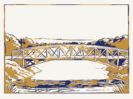
Decorative drawing: a timber truss bridge spanning a river on stone piers, side elevation. Not a photograph of this place.

Nomination for Bergstresser Covered Bridge

The case file that argued this property on to the National Register: 1,464 words across 12 pages, filed in 1974. Read by 4 independent recognisers, of which at least 3 had to agree before a line was published.

Source document Held by the National Archives in Record Group 79 as reference 74001484, where it exists only as a scan with no text layer. The words below were read off that scan by 4 independent recognisers at two resolutions. Only lines that at least 3 of them returned identically appear below; where they disagreed, the line is withheld rather than guessed, so some of the form's furniture is missing. Spelling is never corrected, so a stray character that all the readers agreed on is the recogniser's and the typewriter's.. Nothing is summarised, corrected or written by this site. See the catalogue record, or return to the property.

From the form

The catalogue entry the section above was filed under.

Form 10-300 UNITED STATES DEPARTMENT OF THE INTERIOR (Rev.

6-72) NATIONAL PARK SERVICE INVENTORY - NOMINATION FORM FOR NPS USE ONLY (Type all entries - complete applicable sections) AND/OR HISTORIC: * Structure - In Process - Preservation work 2 Transportation - Comments Commercial - Other (Specify) OWNER OF PROPERTY OWNER'S NAME: LOCATION OF LEGAL DESCRIPTION COURTHOUSE, REGISTRY OF DEEDS, ETC: REPRESENTATION IN EXIST ING SURVEYS - Federal DEC 191973 049 1974 039 LOCATION MAY REGISTER ACCESSIBLE CLASSIFICATION STATE NATIONAL District Military Religious Both Government Columbus NAME Franklin County Site CATEGORY Private STATUS Educational Restricted Agricultural Ohio Unoccupied Park Entertainment OWNERSHIP Private Residence Franklin CODE Museum Building Public COUNTY: 380 South High Street Scientific COMMON: CONGRESSIONAL DISTRICT: Franklin County Court House Bergstresser Covered Bridge Object ENTRY DATE Being Considered Public Acquisition: NATIONAL REGISTER OF HISTORIC PLACES RECEIVED STREET AND NUMBER: Local DEPOSITORY FOR SURVEY RECORDS: Industrial TITLE OF SURVEY: (Check One) CITY OR TOWN: TO THE PUBLIC DATE OF SURVEY: County Road 224 Just west of SR 674 Ohio 43215 DATE Yes: ENTRY NUMBER 1 mile south of Canal Winchester DESCRIPTION - Deteriorated - Unexposed EX Unaltered DESCRIBE THE PRESENT AND ORIGINAL (if known) PHYSICAL APPEARANCE

Description of the property

briefly as follows: upper and lower chords in 2 sections, the ties or new his angling of the braces and posts, the chords in two sections and Bridge) - DEC 1 9 1973 CONDITION Ruins battens. The structure under consideration is a one span covered wooden truss their ends rest against the posts and chords.Mr.Partridge claimed as may be omitted and the ends of the braces sprung together and bolted so bridge over Lt.Walnut Creek.The bridge measures 134 feet from posts are securely bolted to the chords and stand at an angle of 6o with 1971. and are bolted in the middle to the middle of the posts..The ends of (Check One) - Moved tals are projected with a 9 foot overhang and are finished with 2g inch 9", 5}" by 8", 5}" by 7" and 5%" by 6". The lower chords are 32" by 11" on the portals, its appearance has changed little over the years.

The Excellent Good cedar shingles and the siding is vertical white pine boards.The por- Original Site The Bergstresser Bridge is on its original site and except for red paint The abutments are of cut stone laid with mortar.The roof is l6 inch has been replaced when necessary.The entire roof was reshingled in are parallel with each other and pass upon opposite sides of the posts an angle of 45with the horizontal plane.The two braces of each pair is l6 feet with a 13 foot roadway and a 13 foot overhead clearance. and the top chords are 6by 8and 7by 8#.The Partridge truss as

From the form

The catalogue entry the section above was filed under.

SIGNIFICANCE PERIOD (Check One or More as Appropriate) SPECIFIC DATE(S) (If Applicable and Known) AREAS OF SIGNIFICANCE (Check One or More as Appropriate) - Prehistoric X:Engineering - Architecture Transportation STATEMENT OF SIGNIFICANCE

Statement of significance

Reuban Partridge (U. S. Patent #127,791, June 11, 1872) of Marysville, The Bergstresser Bridge is a well-built, sturdy structure, an out- DEC 1 9 1973 1887 REGISTER Conservation Aboriginal NATIONAL Commerce Science Communications Literature Theater Political Landscape Agriculture itarian Music The name Bergstresser comes from one Daniel Bergstresser who owned Pre-Columbian Retigion/Phi- Military the last original covered bridge in Franklin County and one of only Sculpture RECEIVED serves one home and the Canal Winchester sewage plant.

Social/Human- Ford although the mill has been gone for many years.The Partridge The road carried across Lt.Walnut Creek by the Bergstresser Bridge 6 examples of the Partridge truss in existance today.The Franklin truss was undoubtedly chosen ror this bridge because its inventor, The Bergstresser Bridge was built in l887 by the Columbus Bridge Industry Ohio, was an officer in the Columbus Bridge Company at that time. Urban Planning and has placed historical signs over each portal. 17th Century Invention Company at a cost of 2,690.The abutments were laid by M.Corbett.

became SR 674 in the late 1930's and the state assumed ownership of Education Other(Specify) Art County Engineering Department keeps this bridge in excellent condition This is the original bridge on this site.Louis Kramer built a grist 79 acres to the east of the bridge site in section 3l of Madison Twp the bridge.In 1956,the state relocated route 674 and the covered standing example of late 19th century engineering skills.I and saw mill here in l8o8 and the ford was always known as Kramer's

The rest of the file

Bibliography, boundary description, and the people who prepared and reviewed the nomination.

MAJOR BIBLIOGRAPHICAL REFERENCES 10. GEOGRAPHICAL DATA DEFINING THE CENTER POINT OF A PHOPERTY DEFINING A RECTANGLE LOCATING THE PROPERTY DEC 1 9 1973 FORM PREPARED BY September 20, 1973 12.

STATE LIAISON OFFICER CERTIFICATION I hereby certify that this property is included in the tional Historic Preservation Act of 1966 (Public Law National Register 89-665), I hereby nominate this property for inclusion in the National Register and certify that it has been Director, Office of Archeology and Historic Preservation GP 0 931-894 039 Seconds LONGITUDE Degrees DATE COUNTY Minutes STATE ATTEST: ORGANIZATION LATITUDE CORNER REGISTER NATIONAL Degrees Minutes Seconds CODE NATIONAL REGISTER VERIFICATION Ohio Covered Bridge Committee LATITUDE AND LONGITUDE COORDINATES Columbus evaluated according to the c-iteria and procedures set level of significance of this nomination is: NAME AND TITLE: less than 1 As the designated State Liaison Officer for the Na- STREET AND NUMBER: CITY OR TOWN: 3155 Whitehead Road OF LESS THAN TEN ACRES Moore, Opha History of Franklin County- Topeka-Indianapolis: Historical Publishing Company, 1930.

Vol. 1, pp. 499-504. N 390 49 APPROXIMA TE ACREAGE OF NOMINATED PROPERTY: Wood, Miriam F. forth by the National Park Service. The recommended Bareis, George F. Local Name Title CONTROL REVIEW HISTOR IAN ARCHITECTURAL HISTORIAN MAY 3 PROPERTY KEEPER Entered Re-submit Send-back MAPS INT:1538-73 BRANCH CHIEF Federal Register entry WORKING NUMBER REVIEW UNIT CHIEF TECH REVIEW 12.26 1219.73.4123 PHOTOS 2/27/74 Cole the write up, please indicate them below. SHEET DESCRIPTION: COMMENTS: PROPERTY: WRITE-UP COMMENT LOCATION: (leave attached to nomination) SURVEY RECORDS form correct?): If there are comments(negative or positive) which will affect STYLE OR CULTURE: PROPERTY OF THE NATIONAL REGISTER Form No.

10-301a UNITED STATES DEPARTMENT OF THE INTERIOR NATIONAL PARK SERVICE FOR NPS USE ONLY (Type all entries - attach to or enclose with photograph) ENTRY NUMBER AND/OR HISTORIC: LOCA TION STREET AND NUMBER: CITY OR TOWN: PHOTO CREDIT: Miriam Wood DATE OF PHOTO: Columbus, Ohio 43204 DESCRIBE VIEW, DIRECTION, ETC. DEC 1 9 1973 INT: 154-72 039 049 IDENTIFICATION Franklin DATE MAY NATIONAL COUNTY NAME STATE Ohio REGISTER One mile south of Canal Winchester PHOTO REFERENCE CODE June 1973 NATIONAL REGISTER OF HISTORIC PLACES North Portal of bridge looking south PROPERTY PHOTOGRAPH FORM (7/72) County Road 224 just west of SR 674 COMMON: Bergstresser Bridge PROPERTY OF THE NATIONAL REGISTER Form No.

10-301a UNITED STATES DEPARTMENT OF THE INTERIOR NATIONAL PARK SERVICE NATIONAL REGISTER OF HISTORIC PLACES CODE COUNTY: FOR NPS USE ONLY MAY AND/OR HISTORIC: STREET AND NUMBER: County Road 224 just west of SR 674 CITY OR TOWN: NEGATIVE FILED AT: Columbus, Ohio 43204 DESCRIBE VIEW, DIRECTION, ETC. DEC I9 1973 INT: 154-72 049 039 IDENTIFICATION Franklin NATIONAL LOCATION STATE DATE Ohio NAME Miriam Wood REGISTER PHOTO REFERENCE CODE Southhportal of bridge looking northeast 1974 PHOTO CREDIT: PROPERTY PHOTOGRAPH FORM (Type all entries -attach to or enclose with photograph) ENTRY NUMBER (7/72) RECEIVED 3155 Whitehead Road DATE OF PHOTO: June 1973 COMMON: Bergstresser Covered Bridge One mile south of Canal Winchester UNITED STATES DEPARTMENT OF THE INTERIOR 1. NAME NUMERIC CODE (Aesigned by NPS) 2. LOCATION 1 mile s. Canal Winchester 3.

MAP REFERENCE DEC 1 9 1973 GPO 932-010 1966 MAY 1:24000 TOWN STATE Franklin REGISTER COUNTY DATE SOURCE COMMON NATIONAL U.S.G.S. SCALE Bergstresser Covered Bridge Ohio RECEIVED NATIONAL REGISTER OF HISTORIC PLACES (Type all entries -attach to or enclose with map) AND/OR HISTORIC PROPERTY MAP FORM Form 10-301 NATIONAL PARK SERVICE (July 1968) County road 224 just west of SR 674 Canal Winchester, Ohio Quad. REQUIREMENTS: PROPERTY BOUNDARIES, WHERE REQUIRED, AND NORTH ARROW: STREET AND NUMBER UNITED STATES CANAL WINCHESTER, OHIO CANAL WINCHESTER QUADRANGLE GEOLOGICAL SURVEY DEPARTMENT OF THE INTERIOR 75 MINUTE SERIES (TOPOGRAPHIC) 49- 01" OU.S. Route Bergstresser Covered Revised in cooperation with State of Ohio agencies Bergstreaser Covered Bridge Port Clinton Hon. Howard M. Metzenbaum Hon. Robert Taft. Jt. Me. Daniel R. Porter, Director Mr.

Steven Ruttenbaun, GSA Location Name STATE MMott Huron County Paulding Regional Twinsburg Paulding County Franklin County Also Notified Ottawa County ENTRIES IN THE NATIONAL REGISTER Monroeville Seioto County Cuyahoga County Cleveland Paulding County Courthouse Otway Covered Bridge Twinsburg Congregational Church Otway vicinity Ottawa County Courthouse Hon. Jameg V. Stanton Sumait County Old Federal Building (and Post Office) 5/7/74 Schug, Mary, House Interstate #7l at j7th Avenue Hon. Sawuel L. Devine Hon. Delbert L Latta 1974 MAY Director, Midwest Region Date Entered Canal Hinchanter vicinity