Geographical Data Verbal Boundary Description O'Shaughnessy Dam is contained on the east and west by the Scioto River. The structure is 1,750 feet long and 21.5 feet wide at the roadway level. 11. Form Prepared By organization - _ zip code 43212 University Local government Zone Boundary Justification Easting Ohio Acreage of property The boundary includes the dam, and bridge which crosses the Scioto River at County Northing Road 126. UTM References has been requested Federal agency previousty listed in the National Register Other State agency state Previous documentation on file (NPS): N/ A street & number 1439 Ashland Avenue CIy or town November 9, * 614-487-0940/466-2645 date telephone Other United States Department of the Interlor National Park Service Columbus Dispatch 5/11/26 p. 1; 5/12/26 p. 3; 5/13/26 p. 3; Citizen, 5/14/26 p. 1, 2; 5/15/26 p. 1, 20; 5/17/26 p.2.
See "The O'Shaughnessy Dam," Ohio State Journal p. 4 5/15/26. Ohio State Journal, 5/16/26 p. 1. "The O'Shaughnessy Dam and Reservoir," paper no. 1715, Engineers, 10/12/27, Transactions of the American Society of Simmons, 5/5/89. O'Shaughnessy Dam and Bridge, Shawnee Hills, Ohio, Delaware County National Register of Historlc Places Telephone conversation with historian and bridge expert David Continuation Sheet 35-38. Washington: Preservation Press. Sectlon number9Page "200o See O'shaughnessy Dam Dedicated to Service of City," of Feature and News Events of Columbus. Donald C.Jackson,(1988) Great American Bridges and Civil Engineers, vol. 93 p. 1495 (1929). - Page _ Journal 5/15/26 p. 1; 5/16/26 p. 1, 2, 3, 6, 9. Columbus Mayor Thomas' address in Sunday Dispatch 5/16/26, front page presented to the fall meeting of the American Society of Civil Shawnee Hills, Delaware, Ohio 1.
Name of property: 2. City and state where property is located: 3. Name of photographer: 4. Date of photograph: November 09, 1989 5. Location of original negative: 7. Photograph number: Photo no. 1 On Dam looking East (Pavilion) . Photo no. 2 Photo no. 3 1ooking North (Pavilion). Photo no. 4 Photo no. 5 Photo no. 7 PHOTOGRAPHS Items numbered one through five are identical.Items six 6. Description of view indicating direction of camera: Northwest side of Dam looking Southeast Inside of Pavilion looking North North-Northwest (Pavilion interior). Jerry O'shaughnessy and seven are as follows: Southeast side of Dam looking North (closeup of Outlet Gatehouse). (Pavilion interior). Shawnee Hills, OH O'Shaughnessy Dam O'Shaughnessy Dam and Bridge Southeast (Pavilion & Outlet Gatehouse). & observation deck). Photo no. 6 Photo no.
8 Inside of Paviliion looking On East side Observation deck Northwest side of Dam (upstream) looking Photo no. 9 Bridge) - (Piers & Arches). (Outlet Gatehouse, Arches, Piers, & Outlet Gatehouses, Arches, & general overview) . Photos 16-23 taken June 21, 1989 Southwest of Dam looking Northeast South of Dam looking Northeast. west. North-Northwest. roadway). PHOTOGRAPHS South side (downstream side) of Dam looking Southeast (downstream) of Dam looking north- On East side Observation deck looking East (Balustrade). East (closeup of Balustrade). Southwest side of Dam looking North Southeast of Dam looking West. Southwest side of Dam (Power Gatehouse & observation deck).
looking Northeast (Outlet Gatehouse & North of Dam (upstream) looking South North of Dam looking South & O'Shaughnessy Dam and Bridge Shawnee Hills, Delaware, Ohio EVALUATION/RETURN SHEET DATE OF 16TH DAY: NOMINATOR: STATE PROGRAM UNAPPROVED: ABSTRACT/SUMMARY COMMENTS : 4/08/90 2/22/90 3/22/90 REJECT DISCIPLINE MULTIPLE REVIEWER DATE RETURN PERIOD: OTHER: NAME: PDIL: NATIONAL REGISTER OF HISTORIC PLACES NATIONAL PARK SERVICE COMMENT WAIVER: DATE RECEIVED: DATE OF WEEKLY LIST: REASONS FOR REVIEW: UNITED STATES DEPARTMENT OF THE INTERIOR REQUESTED ACTION: O'Shaughnessy Dam and Bridge RECOM.
/CRITERIA DOCUMENTATION see attached comments Y/N see attached SLR Y/N PROPERTY NOMINATION ACCEPT _count resource type STATE/FEDERAL AGENCY CERTIFICATION _architectural classification _descriptive text _summary paragraph _clarity _applicable criteria _context justification of exception GEOGRAPHICAL DATA _acreage verbal boundary description ACCOMPANYING DOCUMENTATION/PRESENTATION -presentation _ Phone FUNCTION materials DESCRIPTION _current Period Builder/Architect historic photographs completeness SIGNIFICANCE Date CLASSIFICATION BIBLIOGRAPHY Specific dates boundary justification OTHER COMMENTS justification of areas checked Questions concerning this nomination may be directed to Statement of Significance (in one paragraph) relationship of integrity to significance Areas of Significance--Check and justify below Signed _other UTMS relating significance to the resource United States Department of the Interlor FEB 2 2 1990 NATIONAL REGISTER PROGRAMS for Completing National Register Forms (National Register Bulletin 16).
Complete each item by marking "x" in the appropriate box or by entering and areas of significance, enter only the categories and subcategories listed in the instructions. For additional space use continuation sheets (Form 10-900a). Type all entries. 1. Name of Property 2. Location Street & number County Road 126 btwn. S.R. 257 & S.R. 745 city, town Shawnee Hills X vicinity state Ohio code OH zip code 43065 Ownership of Property Category of Property I structure listed in the National Register - State/Federal Agency Certification As the designated authority under the National Historic Preservation Act of 1966, as amended, I hereby certify that this National Park Service Certification Ventered in the National Register.
determined eligible for the National other, (explain:) Noncontributing site public-local private Registration Form public-Federal Total public-State district Date ECEIVE National Register of Historic Places National Register. historic name See continuation sheet. removed from the National Register. Number of contributing resources previously Signature of the Keeper DIVISION OF National Park Service Date of Action Number of Resources within Property Name of related multiple property listing: other names/site number N/A determined not eligible for the State or Federal agency and bureau Jobject NA not for publication This form is for use in nominating orrequesting detorminations of eligibility for individual properties or districts.See Instructions in Gukdelines Signature ol centitying official Signature of commenting or other official building(s) 1.hereby, certify that this property is: 3.
Classification National Register of Historic Places and meets the procedural and professional requirements set forth in 36 CFR Part 60 In my opinion, the property county Delaware In my opinion, the property meets does not meet the National Register criteria. see continuation sheet. O'SHAUGHNESSY DAM G BRIDGE FEB 2 2 1990 6. Functlon or Use Historic Functions (enter categories from instructions) 7. Description foundation Concrete Description of 0'Shaughnessy Dam portion of the dam is 879 ft. long, measured face to face of copings on the abutments. The two approaches have a total length of 871 ft., but they are not of equal length, Crossing the Dam, above the overflow or spillway section, is a reinforced con- net length of the spillway, under the bridge, after deducting the length of the bridge piers and the outlet gatehouse, is 765.7 ft. The crest of the spillway is 64 ft.
above low water in the river on the down- stream side of the Dam and 84 ft. above the rock foundation. The roadway on the bridge is 21.3 ft. above the crest of the spillway making, therefore, a total height of dam from rock foundation to roadway level of 105.3 ft. [3] in the rock, the benches being curved in plan and sloping down stream from the toe of not only do they provide for guiding flood-water down to the river, but they also furnished most of the rock for the construction of the dam. at the same time, spills over from one bench to the next lower one until it reaches the benches. With any considerable volume of flow over the dam, it is a beautiful sight next. [4] on a 2-span, steel, truss bridge, 240 ft. in length.
With the filling of the reservoir of the reservoir or river at or near this point, the choice then lay between raising the existing bridge about 51 ft., adding new trusses at each end, and building long Industry/waterworks Transportation/pedestrian-related Transportation/road-related Neo-Classical Architectural Classification Describe present and historic physical appearance. (enter categories from instructions) to a-maximum of 20 ft.
In excavating these spillway channels a double purpose was served; Spillway Channels Current Functions (enter categories from instructions) Materials (enter categories from instructions) crete arch bridge of twelve spans,each span measuring 64 ft.6 in.in the clear.The Ceramic tile Description of o'shaughnessy Dam Bridge With water passing over the spillway of the dam it flows along these benches and, the apron until the river bank is reached.These benches vary in width from a minimum Second Renaissance Revival With the width of spillway adopted it was necessary to provide spillway channels the east approach being slightly longer than the west one. of32 ft.11 in.toa maximumof 103ft.3.in.,and inheight from a minimum of 5 ft. to see the water rush along the spillway benches and tumble over from one bench to the The below the Dam on each side of the river.
This was accomplished by excavating benches walls Concrete, Brick straight in plan, and 1,750 ft. in length, including the approaches. The masonry At Powell Road, about 2,000 ft. above the Dam, a county highway crossed the river See continuation sheet this bridge would have been submerged.As it was not feasible to abandon a crossing The o'shaughnessy Dam is a concrete masonry dam, of the gravity overflow type, roof .Nº& Form 10-000 United States Department of the Interlor FEB 22 1990 National Park Service National Register of Historlc Places O'Shaughnessy Dam and Bridge, Shawnee Hills, Ohio, Delaware County expensive approaches, and the construction of a new bridge. Comparative estimates showed that it would be considerably cheaper to build a bridge across the Dam and t which the Dam and reservoir are located.
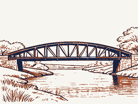
The bridge consists of twelve reinforced concrete arches and has a total length of 79 ft., measured face to face of copings on the abutments at each end of the spillway The arches are segmental, the intrados being struck on a radius of 52 ft. 9.5/16 in. bridge, measured along the intrados the arches have a length of 19 ft. 4 in. The roadway over the arches has a clear width of 17 ft. 6. in., and is carried by reinforced concrete slabs supported by spandrel and curtain-walls extending down to the roadway surface is a vitrified brick pavement, 4 in. thick, laid on a 1 in. sand cushion. The roadway is drained by cast-iron inlets spaced at frequent intervals along each through the arches, or through the piers, depending on the arrangement of the details. On each side of the roadway is a 4-ft.
sidewalk, consisting of a reinforced concrete slab carried on cantilever brackets anchored to the arch ring at the center of the arch sidewalk, together with the pylons, is constructed of blue Indiana limestone, sawed, surface. [5] At each end of the spillway section the approach consists of a rolled earth embank- side slopes of 1 on 2, except that the stone paving below the berm, on the up-stream side of the dike, has a slope of 1 on 3. The top of the dike is at Elevation 866.25, that is, 21 ft. 3 in. above the crest of the spillway and 8 ft. 9 in. above a high-water level, 1 on 2 Slope terminates at a bern 10 ft. in width and located 1 ft. 6 in. above high water. The slope paving begins at the outer edge of the berm, and, at the lower end, is either keyed into the rock or abuts against a concrete to-wall. It is from 12 to 18 in. in thickness and is bedded on 12 in.
of free-draining broken stone. The concrete core wall is 3 ft. wide at the top, has a batter of ½ in. in 1 ft. on each The roadway on each approach is of bituminous macadam, the width, 17 ft. 6 in., being the same as the clear width, between curbs, of the roadway on the bridge over the the masonry abutments at each end of the spillway, concrete steps on each side of the roadwy provide access to the natural surface of the ground. [6] high-water. Approaches Continuation Sheet finished by sand rubbing toa Section number 7 Page 1 abandon the crossing at Powell Road. This solution of the problem was adopted after it had been submitted to and approved by the County Commissioners of Delaware County, in Each arch has a clear span of 64 ft. 6. in. and a rise of 11 ft. The thickness at the crown is 18 in., and at the springing line, 3 ft.
At right angles to the axis of the arch rings, except that, for a length of 21 ft. 6. in. at the center of each arch, the concrete slab: are supported on a cinder fill made directly over the arch rings. The joints in the brick were grouted with an asphalt filler. mont or dike with concrete core wall. The approaches are 25 ft. 6 in. wide on top and have side, and is keyed 12 in. into solid rock. The top is at Elevation 858.5 or 1 ft. above United States Department of the Interlor Natlonal Park Service FEB 22 1990 National Register of Historlc Places O'Shaughnessy Dam and Bridge, Shawnee Hills, Ohio, Delaware County The outlet gate-house gate-chamber are two sets of chambers or wells, each set consisting of two separate thus providing duplicate means of drawing water from the reservoir. In case of repair to any sluice-gate one set of wells can be shut off.
[7] The gate-house superstructure is built of cut and dressed blue Indiana limestone, matching that in the balustrade on the bridge, and is lined inside with a light-colored, ball-bearing sluice-gate stands and also a 2-ton, hand-operated crane for raising and lowering the screens, stop-planks, etc. [8] with reservoir full and water overflowing the spillway, or when water is drawn from structing a hydro-electric power plant below the Dam, on the west side of the river. [9] The power gate-house is slightly smaller in size than, but of the same construction an, the outlet gate-house.
[10] In the three sides other than that next to the roadway, balustrades, similar to those on Pavilion Continuation Sheet Power Gate-House salt-glazed face brick.The roof is constructed of steel trusses carrying concrete slabs 3 in.in thickness.The covering is of bright red mission tile laid on a bedding OMB Approval No. 1084-0018 Section number _7 The outlet gate-house is 32 ft. square, inside dimensions, and is located at the storage, say, from the upper 10 or 15-ft. depth in the reservoir, it could do so by con- To balance the structure as a whole, a pavilion has been built at the east end of except that the wall panels between the pilasters have been omitted on all four sides. pavilion a commanding view is obtained, especially up stream across the reservoir.
[11] At the west end of the spillway is a power gate-house.This was built so that, Page 2 Unlted States Department of the Interlor FEB 22 1990 National Park Service O'Shaughnessy Dam and Bridge, Shawnee Hills, Ohio, Delaware County Section number - and Reservoir the dam and reservoir may be summarized, as follows: Length of earth approaches, including concrete abutments, in feet... Height of spillway above low water in Height of dam from rock foundation to roadway level, in feet.... Net length of spillway, in teet... Maximum flood capacity of spillway, in Depth of water over spillway with maximum flood, in feet..... reservoir full, in gallons... 871 105.25 110 21.25 879 1922-1925 Page 765.7.
1,750 Continuation Sheet Natlonal Register of Historlc Places 5,341,000,000 For convenience of reference the principal data relating to Summary of Principal Data Relating to the O'Shaughnessy Dam feet. crest of spillway, in feet... Width of paved roadway, in feet... cubic feet per second.. Total iength of dam, in feet / Maximum width of dam at base, in Width of sidewalks, in feet..... Total available storage capacity, Date of construction. Length of masonry part of dam, in feet. FED 22 1990 Unlted States Department of the Interlor National Park Service Civil Engineers, vol. 93 pp. 1461-1463 (1929). 5. "THE O'SHAUGHNESSY DAM AND RESEVOIR," paper no. 1715, presented References Continuation Sheet National Register of Historlc Places presented to the fall meeting of the American Society of Civil "THE O'SHAUGHNESSY DAM AND RESERVOIR," paper no. 1715, Engineers, 10/12/27.
Transactions of the American Society of Civil Engineers, vol. 93 p. 1429 (1929). O'Shaughnessy Dam and Bridge, Shawnee Hills, Ohio, Delaware County Engineers, vol. 93 pp.1452-1457 (1929). United States Department of the Interlor National Park Service FEB 22 1990 National Register of Historlc Places O'Shaughnessy Dam and Bridge, Shawnee Hills, Ohio, Delaware County Continuation Sheet Engineers, 10/l2/27. Transactions of the American Society of 9."THE O'SHAUGHNESSY DAM AND RESERVOIR," Paper no. 1715, Civil Engineers, vol. 93 p. 1461 (1929). presented to the fall meeting of the American Society of Civil FEB 22 1990 8.
Statement of Significance Certifying official has considered the significance of this property in relation to other properties: Applicable National Register Criteria Areas of Significance (enter categories from instructions) Period of Significance Significant Dates Community Planning and Development Architect/Builder Frank L. Packard, Architect Thompson-Starrett Company, Builder setting, design, materials, workmanship, and historical association to the present day. Architectural features of the structure remain intact including spillway channels, twelve The bridge and dam were designed in the Neo-Classical style, but also evidence Second structures were designed in this style. Common stylistic elements evidenced by the bridge historic structure of its kind on the Scioto River in the Columbus metropolitan area.
Other Neo-Classical bridges on the Scioto River are located in downtown Columbus at Town, Main, and Broad Streets and were bullt between 1915 and 1917. A later masonry bridge south of 0'Shaughnessy Dam at SR 161 was built in 1935 and substantially altered in 1985. The Broad Street Bridge Is to be replaced in 1990. completed a five year program of important water works improvements which included the the river, about two miles from the city center. In the fall of 1925 the city completed a X See continuation sheet 1922-1925 Architecture central pavilion. Renaissance Revival influence.The Neo-Classical style was first popularized by the 1893 Significant Person Improvements completed in the 1920's.
Cultural Affiliation Criteria Considerations (Exceptions) The O'Shaughnessy Dam and Bridge is eligible for listing on the National Register of leading central Ohio architect as the centerpiece of a five year program of water works reinforced concrete arches, two gate houses topped by red tile roofing material, and a and dam include the symmetrical arrangement of the gate houses and observation pavilion, The 0'Shaughnessy Dam and Bridge Is the only documented bridge designed by Frank L. Packard, a Columbus architect known more for his courthouses, city halls, jalls, public construction of a water purification and softening works and pumping station adjacent to State significance of property,and justify criteria, criteria considerations, and areas and periods of significance noted above. OMB Approval No.
1024-0018 FEB 22 1990 National Park Service O'Shaughnessy Dam and Bridge, Shawnee Hills, Delaware County, Ohio When the second five year program was begun in 1920 Jerry O'Shaughnessy was the officials, wishing to recognize 0'Shaughnessy's contributions, named the new bridge and A bronze tablet was placed on the new structure with the following inscription: "By So Faithfully and Well Served The City as Superintendent of Its Water Works for Many The 0'Shaughnessy Dam was a popular central Ohio attraction by its completion on August 1, At least two verses were written in local newspapers celebrating its beauty. over the Dam's spillway, which was added to the structure to accommodate the loss of the nearly Powell Road Bridge, was built as a twelve span reinforced concrete closed spandrel that Columbus had one of the best and cheapest pieces of construction in the country.
(1) day in its history." (2) The bridge over the dam is currently the subject of plans for replacement to accommodate bridge will not be compromised to facilitate further development. (2) Ohio State Journal, 5/15/1926, page 4. River. Years." National Register of Historic Places Continuation Sheet United States Department of the Interior Named and Designated the 'o'Shaughnessy Dam' in Honor of the Late Jerry O'Shaughnessy, Who was carried over the radio and documented by newsreel.Speakers at the ceremony included Columbus Sunday Dispatch,5/26/1926,front page of news and features section. During the week before its dedication on May 15,1926,news of the event monopolized front dam after him.
(8-86) NPS Form 10-900-a Section number _8 Resolution of the Council of the City of Columbus, Adopted, February 7, 1921, This Dam Was Postcards and souvenirs with the image of the Dam were available in the area. The bridge arched bridge, a type selected not only because the construction benefitted the local project that will yleld rich fruit to the Columbus of the future, and it again honors the increased traffic between Columbus and southern Delaware County. The area around the of the historic preservation community that the architectural character of the dam and Mayor Thomas, former Mayor George Karb, and John J.
Lentz, president of the American Columbus takes pride in its water supply and the dedication of the new dam is a red letter O'Shaughnessy Dam has been the scene of rapid residential development.The Columbus Zoo, programs.o'Shaughnessy did not live to see the completion of these projects but city memory of the man who for somanyyearsserved the city so faithfully and so well.. Page 2 FEB 22 1990 -preliminary determination of individual listing (36 CFR 67) Primary location of additional data: L* State historic preservation office previousty listed in the National Register previousty determined eligible by the National Register designated a National Historic Landmark Local government recorded by Historic American Buildings Survey # Jrecorded by Historic American Engineering Specify repository: Record # Ohio Historic Preservation Office 10.
Geographical Data Verbal Boundary Description area is confined to the bridge and dam combined structure. Road 126. 11. Form Prepared By organization - city or town - . state _ zip code 43212 University See continuation sheet telephone Northing Federal agency Ohio Boundary Justification The boundary includes the dam, and bridge which crosses the Scioto River at County has been requested UTM References Zone Easting Other State agency Previous documentation on file (NPS): Other November 9, - 614-487-09407/466-2645 Acreage of property - 5 acres Zone date street & number 1439 Ashland Avenue O'Shaughnessy Dam is contained on the east and west by the Scioto River.The United States Department of the Interlor National Park Service FEB 22 1990 5/14/26 pp. 1, 3; 5/15/26 p. 1; 5/15/26 pp. 17-18. Ohio State Ohio State Journal, 5/16/26 p. 1. "The O'Shaughnessy Dam and Reservoir," paper no.
1715, Simmons, 5/5/89. "The 0'Shaughnessy Dam," ohio State Journal p. 4 5/15/26. Continuation Sheet O'Shaughnessy Dam and Bridge, Shawnee Hills, Ohio, Delaware County Columbus Dispatch 5/11/26 p. 1; 5/12/26 p. 3; 5/13/26 p. 3; 35-38. Washington: Preservation Press. Telephone conversation with historian and bridge expert David "2000 See O'Shaughnessy Dam Dedicated to Service of City," of Feature and News Events of Columbus. Sectlon number 9Page Engineers, 10/12/27. Transactions of the American Society of National Register of Hlstorlc Places Donald c. Jackson,(1988) Great American Bridges and Dams, PP Page l Journal 5/15/26 p. 1; 5/16/26 p. 1, 2, 3, 6, 9. Columbus presented to the fall meeting of the American Society of Civil Civil Engineers, vol. 93 p. 1495 (1929). Citizen, 5/14/26 p.1,2; 5/15/26 p. 1, 20; 5/17/26 p.2. See Shawnee Hills, Delaware, Ohio 1.
Name of property: Shawnee Hills, 3. Name of photographer: 4. Date of photograph: November 09, 1989 5. Location of original negative: 6. Description of view indicating direction of camera: 7. Photograph number: Photo no. 1 Photo no. 2 1ooking North (Pavilion). Photo no. 7 Southeast (Pavilion & Outlet Gatehouse). PHOTOGRAPHS Items numbered one through five are identical.Items six Northwest side of Dam looking Southeast Inside of Pavilion looking North North-Northwest (Pavilion interior). O'Shaughnessy Dam Southeast side of Dam looking North (Pavilion interior). and seven are as follows: Jerry O'shaughnessy On Dam looking East O'Shaughnessy Dam and Bridge (closeup of Outlet Gatehouse). Northwest side of Dam looking On East side Observation deck 2. City and state where property is located: Photo no. 3 Photo no. 4 Photo no. 5 Photo no. 6 Photo no.
8 Inside of Paviliion looking (Pavilion & observation deck). FED 22 1990 Shawnee Hills, Delaware, Ohio Photo no. 9 1ooking Northeast (Outlet Gatehouse & Bridge) . (Piers & Arches). (Outlet Gatehouse, Arches, Piers, & Outlet Gatehouses, Arches, & general South side (downstream side) of Dam looking June 21, 1989 Southwest of Dam looking Northeast South of Dam looking Northeast. Southeast (downstream) of Dam looking north- Southeast of Dam looking West. roadway). overview). North-Northwest. PHOTOGRAPHS west. Southwest side of Dam looking North On East side Observation deck looking Southwest side of Dam (downstream) East (Balustrade). Photos 16-23 taken O'Shaughnessy Dam and Bridge North of Dam looking South & East (closeup of Balustrade). (Power Gatehouse & observation deck).
North of Dam looking South UNITED STATES DEPARTMENT OF THE INTERIOR NATIONAL PARK SERVICE NATIONAL REGISTER OF HISTORIC PLACES EVALUATION/RETURN SHEET DATE OF PENDING LIST: DATE OF WEEKLY LIST: NOMINATOR: STATE DETAILED EVALUATION: Y ABSTRACT/SUMMARY COMMENTS : DOCUMENTATION see attached comments Y/N see attached SIR YN 7/07/90 DATE 5/23/90 MULTIPLE RETURN NAME: VACCEPT DATE RECEIVED: DATE OF 16TH DAY: O'Shaughnessy Dam and Bridge dam and bridge PROPERTY RECOM./CRITERIA _resource type STATE/FEDERAL AGENCY CERTIFICATION _historic _descriptive text _summary paragraph _completeness _clarity _applicable criteria _justification of areas checked _relating significance to the resource _context _relationship of integrity to significance _justification of exception GEOGRAPHICAL DATA _acreage _verbal boundary description boundary justification ACCOMPANYING DOCUMENTATION/PRESENTATION Questions concerning this nomination may be directed to current count FUNCTION materials Builder/Architect Period DESCRIPTION BIBLIOGRAPHY SIGNIFICANCE CLASSIFICATION Signed Date Phone Specific dates _presentation _architectural classification Areas of Significance--Check and justify below OTHER COMMENTS _sketchmaps -photographs Statement of Significance one paragraph) _other _USGS maps UTMs DelAWARe, O H.
Photo #1 TOTAl PhoTos = 23 FEB 22 1990 OSHAUGHNESSY DAM DelAWARe, OH. TOTA/ PhoTo s =23 FEB 22 1990 O'SHAUGHNESSY DAM DelAWARe, OH. Photo #3 TOTA/ Photos = 23 FEB 22 O'SHAUGHNESSY DAM O'SHAUGHNESSY DAM DelAWARE, OH. Photo # 4 FEB 22 1990 O'SHAUGHNESSY DAM DelAWARE, CH. ToTA/ Photos = 23 FEB 22 1990 O'SHAUGHNESSY DAM DelAWARe, OH. TOTAl PhoTos = 23 FEB 22 1990 DelAWARe, OZ TOTAl Photos =23 FEB 22 GSHAUGHNESSY DAM O'SHAUGHNESSY DAM DelAWARe, O4. TOTAl Photos =23 FEB 22 1990 O'SHAUGHNESSY DAM DelAWARe, OH TOTAl Photos = 23 FEB 22 1990 O'SHAUGHNESSY DAM DelAWARe, OH. PhoTo #10 TOTAl Photos =23 FEB 22 1990 DelAWARe, OH PhoTo #11 TOTz/ PhoTos = 23 OSHAUGANESSY DAM FEB 22 1990 DelAWARe, OH. TOTAl Photos =23 FEB 22 OSHAUGHNESSY DelAWARe, OH.
PhoTo #13 FEB 22 1990 O'SHAUGHNESSY DAM FEB 22 DelAWARe, OH FEB 22 190n O'SHAUGHNESSY DAM Photo #15 DAM O'SHAUGHNESSY DAM DELAWARE, OH PhoTo No.16 TOTAL Photo's 23 FEB 22 100n DeLAWARe, OH. PhoTo No. 27 TOTAL PhoTo's 23 O'SHHUGHNESSY DAM FEB 22 1990 O'SHAUGHNESSY DAM DELAWARe, OH. FEB 22 PhoTo No.18 O'SHAUGHNESSY DAM PhoTo No. 19 TOTA L PhoTó's 23 DeLAWARe, OH. FEB221990 O'SHAUGHNESSY DAM VELAWARE, OH. PhoTo No. 520 TOTAL Photo's 823 FEB 22 1990 O'SHAUGHNESSY DAM DeLAWARe, CH. Photo No. 20 FEB: 22 1990 DAM DeLAWARe, OH. PhoTo No.22 TOTAL Photo's 23 FEB 22 1990 DeLAWARe, OH. PhoTo No.
23 TOTAL Photo's 23 O'SHAUGHNESSY DAM POWELL QUADRANGLE 7.5 MINUTE SERIES (TOPOGRAPHIC) POWELL, OHIO N4007.5W8300/7.5 ROAD CLASSIFICATION GEOLOGICAL SURVEY UNITED STATES DEPARTMENT OF THE INTERIOR Sate FOUte 7.5 MINUTE SERIES (TOPOGRAPHIC) SHAWNEE HILLS QUADRANGLE SHAWNEE HILLS, OHIO GEOLOGICAL SURVEY DEZAWARE COUNTY UNITED STATES EAT1NL:317910 S DEPARTMENT OF THE INTERIOR 1985 Velma Avenue Columbus, Ohio 43211 February 15, 1990 SINCE 1885 Ms. Carol Shull, Chief DIVISION OF P.O. Box 37127 NATIONAL REGISTEH PROGRAMS of the appropriate notification procedures have been followed for this O'Shaughnessy Dam & Bridge Please contact me if you have any questions. W.
Ray Luce WRL/JW: dh SOCIETY Enclosure 614/297-2300 County Sincerely, HISTORICAL Delaware Dear Carol: New Submission State Historic Preservation Officer National Register of Historic Places Department of the Interior NATIONAL PARK SERVICE Enclosed please find one new National Register nomination.All FEB 2 2 1990 ECEIVE Washington D.C. 20013-7127 Ohio Historic Preservation Office MAY 2 3 1990 1982 Velma Avenue Columbus, Ohio 43211 SINCE 1885 Ms. Carol Shull, Chief Natlonal Park Service Department of the Interior P.O. Box 37127 Washington, D.C. 20013-7127 All of the appropriate notification procedures have been followed for these In regard to the 0'Shaughnessy Dam and Bridge re-submission, the amended New Submission Perrysburg Historic District (Boundary Increase) W.
Ray Luce State Historic Preservation Officer WRL/JW: dh SOCIETY REGISTER 614/297-2470 HISTORICAL County Enclosures nrohp/trans.rev Please contact me if you have any questions. submissions. Delaware O'Shaughnessy Bridge and Dam Dear Carol: Sheet for the initial submission. National Register of Historic Places Enclosed is one (1) new National Register nomination and one re-submission. Sincerely
 Block
Block