Major Bibliographical References Previous documentation on file (NPS): N/A Primary location of additional data: - preliminary determination of individual listing (36 * State Historic Preservation Office CFR 67) has been requested L Other State agency - Federal agency - Local government W University - Other -recorded by Historic American Buildings Survey - recorded by Historic American Engineering Record # Bibilography Register Property is: Criteria Considerations individual distinction. religious purposes. Period of Significance Significant Person Applicable National Register Criteria Narrative Statement of Significance our history.
Social History Significant Dates County and State previously listed in the National Register designated a National Historic Landmark Name of repository: previously determined eligible by the National Areas of Significance (Enter categories from instructions) Arehitecture for National Register listing.) (Cite the books.articles,and other sources used in preparing this form on one or more continuation sheets.) Cultural Affiliation significant in our past. (Mark "x" in one or more boxes for the criteria qualifying the property (Explain the significance of the property on one or more continuation sheets.) May, David and Mary, House County and State 10. Geographical Data Acreage of Property - See continuation sheet (Describe the boundaries of the property on a continuation sheet.) 11. Form Prepared By name/title - Mary Ann Olding Old World Research, Inc.
November 15, 1995 2453 Fairview Avenue street & number - telephone City or town. - state , zip code Submit the following items with the completed form: A USGS map (7.5 or 15 minute series) indicating the property's location. A Sketch map for historic districts and properties having large acreage or numerous resources. Mr. and Mrs. O. Lavelle Bond 3723 Washington Avenue Paperwork Reduction Act Statement: This informationis being collected for applications to the National Register of Historic Places to nominate a benefit in accordance with the National Historic Preservation Act, as amended (16 U.S.C. 470 et seq.). Estimated Burden Statement: Publicreporting burden for this form is estimated to average18.1 hours per response including time for reviewing Management and . Project: (1024-0018).!
45219 513-721-7727 date name Easting Cincinnati Continuation Sheets Maps Zone organization Photographs Hamilton County, Ohio Additional items UTM References Additional Documentation Boundary Justification Verbal Boundary Description Property Owner 1.75 acres (Place additional UTM references on a continuation sheet.) Northing Representative black and white photographs of the property. (Check with the SHPO or FPO for any additional items) (Complete this item at the request of SHPO or FPO.) ,Administrative Servi Name of Property . telephone 513-961-7821 Division, National Park wice, P.O. Box 37127, shington, DC 20013-712 (Explain why the boundaries were selected on a continuation sheet.) - zip code 45229 NPS Form 10-900-a OMB Approval No.
1024-0018 United States Department of the Interior National Park Service National Register of Historic Places May, David and Mary, House Hamilton County, Ohio Section number - The David and Mary May House is eligible for listing in the National Register of Historic Places under Criteria A and C. Eligible under Criterion A, the house is one of the elegant residences which represent the establishment of Avondale as Cincinnati's most elegant Jewish neighborhood for a half- century from 1900 to the 1950s. The 1910 May House is also eligible under Criterion C because it is an excellent example of the Italian Renaissance Revival style. Found in early 20th century architect- World War I until its decline in popularity during the Depression era of the 1930s.
Historical Significance- Criterion A The rolling land that became Avondale is about four miles northeast of Fountain Square in downtown Cincinnati. In the 1830s, a few Cincinnati businessmen built homes near Reading Road, an early road to Lebanon, and began commuting to their establishments in the city. Ironworks' owners, such as Miles Greenwood and Stephen Burton, either used their land for farming or held it as investments. By 1846, properties were subdivided, and wealthy merchants and manufacturers built homes on large spacious lots, just as others of their class were doing in Clifton, Mt. Auburn, and Walnut Hills. In 1853, it is said that Mrs. Stephen Burton gave the district the name of Avondale because she saw a resemblance between the stream behind her house and the Avon River in England. Two large parcels of land were identified the new combined subdivision as Avondale.
The village was given the name when it was incorporated in 1864. For the next thirty years, the Village of Avondale struggled to control crime that plagued its wealthy citizens, but was more successful with improving roads and laying sewer lines. Continuous annexation attempts were made by the City of Cincinnati in an effort to regain the population and tax income migrating to the suburbs. For most of the nineteenth century, Avondale was populated mainly by Protestants of the merchant class of English and German ancestry. Established during this period were the pre-Civil War farmhouses of Stephen Burton and Miles Greenwood, owners of the Eagle Iron Works, and the 1870 Parish of Grace Episcopal church on Reading Road. Andrew Erkenbrecher spearheaded the founding of the Zoological Society of Cincinnati at 3400 Vine Street in 1873.
Also remaining is an early Catholic congregation, organized by Irish domestics soon after the Civil War. The Irish were part of the small number of middle or lower-income residents that included the 8 to 10% who were black. In the 1890s, well-to-do German Jewish families which were not welcomed by the select social circles that dominated suburbs like Clifton, began moving into Avondale, primarily to its northern part. Page purchased by the Cincinnati and Chicago Railroad in 1854, and H. C. Freeman, the company surveyor, Continuation Sheet designed houses throughout the country, the style was built primarily in major metropolitan areas prior to Brief History of Avondale (8-86) NPS Form 10-900-a OMB Approval No.
1024-0018 United States Department of the Interior : National Park Service Hamilton County, Ohio Section number 8 The Reform Jews moved from the downtown basin into northern Avondale where they erected large, tastefully styled homes on rolling, landscaped lawns. In 1910 David and Mary May joined the successful Jewish families in Avondale where they built a three-story limestone mansion on Washington Avenue. They owned the house and lived in North Avondale until their deaths. After Avondale was annexed by the City of Cincinnati in 1896, streetcar lines were laid in 1903. This allowed less affluent Cincinnatians access to Avondale. Many Greek Americans and Eastern declining and congested West End to new, less expensive subdivisions of southern Avondale. These new immigrants profoundly changed the social character of Avondale.
As the migration accelerated, most of the Avondale suburb became a Jewish colony. The Orthodox Jews infiltrated the southern part of the suburb and gradually established a shopping district Avondale that is today a highly attractive residential district of massive homes and apartment hotels, imposing temples and synagogues, and old trees and gardens along Rose Hill Avenue. Robert Mitchell provided the community's first planned residential subdivision, offering 112 lots on Lenox Place, Reading Road, Paddock Road, and Rose Hill, Beechwood, and Mitchell Avenues. His son, Richard Mitchell, had the architectural firm, Samuel Hannaford & Sons, design a home in 1892 at 3 Burton Woods Lane in northern Avondale. (Listed in the National Register of Historic Places) Housing construction began about 1900 on winding streets with large lots and wide front lawns.
Prosperous Cincinnati families, some non-Jews, built substantial homes in fine examples of English Medieval, Tudor Renaissance, Classical Revival, English Cottage Revival, and Italian Renaissance styles. The divergence between the northern and southern parts of Avondale began and eventually splintered the once unified Avondale community. From the 1920s until the end of World War II, 60 per cent of the suburb's population was Jewish. Known as "the gilded ghetto," Avondale was the home of a variety of Jewish institutions and businesses built along Reading Road, Washington Avenue, and Rockdale Avenue between 1902-1926. After World War II, the character of Avondale changed again. Reasonable mortgage rates allowed younger Jewish residents to buy more modern homes in the newer suburbs, and older people began to move away as the large homes became too difficult for them to maintain.
In the late 1940s, Jewish families, many from Avondale, moved to middle-income homes in communities on the northern Page 6 Continuation Sheet that had originated in the old Jewish neighborhoods of the West End. Seven synagogues or temples were edge of Cincinnati. along Reading Road near Rockdale Avenue.The older Jewish familiesmoved still farther out into upper May, David and Mary, House European Jews, who were generally Orthodox, joined the exodus of Reform Jewish families leaving the National Register of Historic Places NPS Form 10-900-a OMB Approval No. 1024-0018 United States Department of the Interior National Park Service Hamilton County, Ohio As Avondale residents re-established communities farther north, middle-income black families often replaced them because Avondale was one of the few desirable neighborhoods open to them.
Under urban renewal and displacement from the West End so that by 1959, the southern portion of Avondale had was the dividing line between the northern more affluent section and the southern section that was victimized by "white flight." Dramatic racial turnover and declining property values were not universal in Avondale. North of Gholson Avenue, the expensive houses on large lots were less likely to be sub-divided into low-rent 1956, city planners identified southern Avondale as blighted and in need of rehabilitation. The City's Renewal Project I only caused more problems because the work completed between 1965 and 1975 benefited the university and hospitals, not the residents.
The frustration caused by the city's failure to fulfill its promises and by the massive displacement of 40,000 people from the West End, many into South Avondale, fueled anger and resentment among its black residents. In the late 1960s, a time of urban rioting throughout America, these feelings were expressed between 1967-70 in a series of riots and firebombings that damaged many of South Avondale's commercial and institutional buildings and drove out most of the remaining white businesses. The city responded in 1971 with a second renewal plan, Avondale II, which emphasized the creation of a "town center" business area with a shopping mall at Reading Road and Rockdale Avenue where the riots had occurred.
Rejuvenation has been extremely show and uneven, and much of the Brief History of Judaism in Cincinnati The neighborhood of Avondale most completely exemplifies Jewish settlement in Cincinnati from 1900-1950, even though there are now essentially two separate neighborhoods, North and South Avondale. As was typical of Jewish ethnic communities in other cities in the country, Jews settled in concentrated neighborhoods during the nineteenth century and until the end of World War II. The cohesiveness of Jewish communities dissolved after the 1960s, and now Jewish families have moved to all parts of Greater Cincinnati. The history of Judaism in Cincinnati began in 1817 upon the arrival of English Jews, the Jonas Page Continuation Sheet apartments.North and South Avondale became increasingly distinct and separate neighborhoods.In and Moses families.
Prior to 1830 no more than 150 Jews, mostly of English ancestry, lived in the city. Section number become predominantly black. Gholson Avenue, several blocks south of the David and Mary May House, May, David and Mary, House the Cincinnati Department of Relocation, more than 220 black families were settled in Avondale through responsibility for further improvement passed largely into the hands of community groups. (8-86) National Register of Historic Places NPS Form 10-900-a OMB Approval No. 1024-0018 United States Department of the Interior National Park Service May, David and Mary, House Hamilton County, Ohio They first settled downtown east of Main Street between Third and Fifth Streets. In 1836, they built the first synagogue west of the Alleghenies near the corner of Sixth and Broadway in Cincinnati.
In 1840, a German Jewish peddler, Philip Heidelbach, opened a clothing store at Front and Sycamore Streets. Many Jews remained peddlers for only a short time but became successful in well-defined sectors of the economy, notably the garment industry. They developed an informal credit system of their own to stimulate investment in business. By 1860, the manufacture, distribution, and sales of men's ready-made clothing and other apparel supplied at least a portion of the livelihood for well over one-half of Cincinnati's Jews. Sixty-five to seventy wholesale clothing firms in the city were Jewish owned, and Cincinnati was proclaimed "the ready-made clothing capital of the West" by Stephen G. Mostov. In his 1983 manuscript entitled, "A Jerusalem on the Ohio," he reviewed Jewish economic history in Cincinnati from 1840-1875.
Not all Cincinnati Jews were involved in the clothing trades, but they also worked, among other things, as peddlers, clerks, salesmen, bookkeepers, doctors, and even cigar manufacturers. Jews were drawn from downtown to the West End as early as 1821 when Nicholas Longworth sold a small plot of land near Chestnut Street and Western Row (now Central Avenue) for use as a Jewish cemetery. The West End, now bounded by Central Avenue on the east, the Mill Creek on the west, Bank Street on the north, and the Ohio River to the south, was first subdivided in 1816.It became home to wealthy men of English backgrounds, such as William Barr, James Gamble, and William Betts. In addition to the homes of the wealthy, the West End also had a large unimproved subdivision, some factories, and worker housing.
By 1845, no more than 2,500 Jews were living in the city, but the figure increased to 10,000 by 1860. Many Jews began moving from downtown into the West End as the first residents, non-Jews, moved away to hilltop suburbs. During the period of national expansion after the Civil War as Cincinnati became the fifth largest city in the country, commercial construction in the downtown exploded. Cincinnati's Jews left their homes in the downtown and moved, in large numbers, to the then-prestigious West End. In 1866, the first Reformed Jewish congregation west of the Alleghenies dedicated the Issac M. Wise Temple on Plum Street between Seventh and Eighth Streets, one block from Central Avenue. Two years later, Bene Israel, the oldest and largest Jewish congregation in Cincinnati, sold their Sixth and Broadway Street house of worship and consecrated a synagogue at Eighth and Mound Streets.
The first Jewish Hospital was on Central Avenue, the Hebrew Union College, begun in the vestry rooms of the Plum Street and Mound Street Temples, moved in 1881 to Sixth and Cutter Streets. Wealthy Jewish families built fashionable townhouses from the 1870s to the 1890s on both sides of Central Avenue at Eighth and Ninth Streets, which is only one block from the Issac M. Wise Temple. By 1900, nine of the eleven Jewish congregations were in the West End. Page (8-86) Continuation Sheet Section number National Register of Historic Places NPS Form 10-900-a OMB Approval No. 1024-0078 United States Department of the Interior National Park Service May, David and Mary, House Hamilton County, Ohio Section number & As the first residents, primarily Reformed Jews, began moving to hilltop suburbs, growing numbers of immigrant Jews replaced them.
Many were impoverished and from backgrounds that left them poorly prepared for life in a crowded urban setting. After the turn of the century, German Reform Jews tended to settle in northern Avondale, while Walnut Hills and southern Avondale became home for many Eastern European Orthodox Jewish families. The only exception to the Jewish migration to northern parts of Cincinnati took place about 1906 when a small Jewish settlement was started in Price Hill. United Jewish Charities moved a number of families to this neighborhood on the western side of Cincinnati so that members with tuberculosis could receive treatment at the sanitarium. By the 1920s, although the area was predominantly Catholic, many Sephadic Jews from the West End had settled near Glenway Avenue.
This Spanish sect traces its roots to Jews who were expelled from Catholic Spain during the Inquisition, and have their own rituals and customs. They bought their own cemetery on Sunset Avenue, and in 1934, they dedicated the Synagogue of Sephardic Beth Shalom. The Spanish Jews in Price Hill were joined after World War II by Jewish Holocaust survivors. However, because the location was inconvenient, in 1987, they sold their synagogue, which was the only one of its kind in Ohio. They assimilated into the Ashkenazic Jewish mainstream, and joined other families which moved into Avondale, Bond Hill and Roselawn. After the second World War in the late 1940s, Jewish families, many from Avondale, moved to middle-income homes in Paddock Hills, Bond Hill, Golf Manor, and Roselawn. In the 1960s, upper- income Jews moved to Amberley Village.
Today, these five communities contain twelve of Cincinnati's seventeen Jewish congregations. (See maps on Continuation sheets #13,14.) History of David and Mary May's migration in Cincinnati The story of David and Mary May fits into Cincinnati's history of Jewish migration. In Cincinnati, Jewish communities were concentrated in four major areas: (See map, page 14) downtown at Sycamore and Broadway, primarily between Third and Fifth Streets 2 the West End 3 North and South Avondale David May was born December 20, 1857, in the downtown Jewish community where his father, Issac May, owned a large livery business. David lived with his family on Walnut Street, attended the public schools, and began his career as an employee of Jacob Sachs & Co., clothing merchants.
At the Page (8-86) Continuation Sheet National Register of Historic Places the automobile suburbs of Paddock Hills, Bond Hill, Golf Manor, Roselawn, and Amberley Village NPS Form 10-900-a OMB Approval No. 1024-0018 United States Department of the Interior National Park Service Hamilton County, Ohio Section number 8 age of 26, he moved to the West End and started his own business. The furniture company, with partners Harry Stern and Aaron Waldheim, was located in 1885 in the West End at the corner of Sixth Street and Western Row (now Central Avenue). In 1903, the firm built a ten-story brick building 100 x 100 feet, one block from Central Avenue at Fifth and Elm Street. At that time, the May-Stern Company became the other stores in various parts of the country, and a large mail order house in Chicago.
The members of the company had commenced as small business men, and had developed into extremely wealthy men. The principal holding was the Irwin Building at Fifth and Race Streets. During the 1890s and early 1900s, David and Mary May lived in the Grand Hotel, an elegant residential hotel built in 1874 at Central Avenue and Fourth Street. Once again, David May followed the Jewish migration path in Cincinnati when in 1908 he and his wife left the West End to move to Avondale, the third Jewish community in Cincinnati. At first, they lived just off Reading Road in an 1895 Queen Anne house at 709 Glenwood Avenue. When their Italian Renaissance mansion was completed in 1910, they moved to 3723 Washington Avenue. From 1910 until their deaths, David and Mary Gilroy May lived in the stone mansion at 3732 time, Mr.
May was president of the nationally known chain of furniture stores in Pittsburgh, Pennsylvania, and Dayton, Ohio. At his death in 1932, during the Depression, stores in New York, Cleveland, and Chicago had been closed, and the store in St. Louis was being closed. Mr. May was a member of the Cincinnati Club, Chamber of Commerce, Plum Street Temple, and Knights of Pythias. His will provided for the creation of a $500,000 trust fund and for the erection of a $25,000 mausoleum for his body. Bequests were made to Mr. May's brother and niece, and various charitable organizations, including four in Denver, Colorado; and the United Jewish Social Agencies. Since the couple was childless, the residue of the estate, with over $500,000 in personal property, went to the widow, Mrs. Mary Gilroy May. She lived alone in the house until 1945, and died on June 6, 1946.
The house was listed as vacant in the because they had no children, and their fortune was dispersed among charities and siblings. From 1950 until 1967, another Jewish family, Samuel B. Zussman, President of H. Zussman & Sons Co., lived in the house. He owned one of the largest clothing stores in Cincinnati. His father, Hirsch Zussman, was listed as a second-hand clothing shop owner in 1910. By 1918, he established the H. Zussman & Sons Co. and constructed a seven-story building at 309-311 Elm Street. The firm (8-86) Page 10 Continuation Sheet Washington Avenue.At age 74,Mr.May died at his home where the funeral service was held.At this largest establishment of its kind in Cincinnati.They also had two warehouses in Cincinnati, twenty-eight firm also operated a real estate business in Cincinnati, under the name of Waldheim Realty Company.
A Jewish ones: Jewish Hospital; Hebrew Union College; the National Jewish Hospital for Consumptives Williams Directory from1945-50.The story of this family's migration stopped after World War II NPS Form10-900-a OMB Approval No. 1024-0018 United States Department of the Interior National Park Service Hamilton County, Ohio Section number 8 listed both on the National Register of Historic Places and as part of the Cincinnati Local Historic District. In the early 1990s, the building was converted into downtown offices. The third owners from 1968 to 1983 were Irma C. and Edward T. Buford, Jr., He was the physician in charge of the Scientific Blood Center. For four years from 1983-1987, the Brothers of Showcase, in May, 1988. The present owners, Mr. and Mrs. O. Lovelle Bond bought the house and moved there in November, 1989. Mr. Bond is an executive at the Procter and Gamble Company and Mrs.
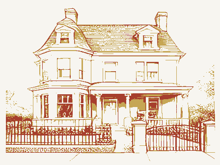
Bond owns a catering business. Architectural Significance- Criterion C The three-story mansion is eligible for listing under Criterion C because it is an excellent example of the Italian Renaissance style with some Beaux Arts details. Their house is typical of the elegant mansions built in Avondale and across the country during the Eclectic movement. This was an era of excellence that drew on the full spectrum of architectural tradition -- English Medieval, Chateauesque, Tudor Renaissance, Classical Revival, English Cottage Revival, and Italian Renaissance. Eclecticism began quietly in the last decade of the 19th century as fashionable, European-trained architects designed landmark period houses for wealthy clients who made great fortunes and paid no income taxes.
Classically inspired designs, based upon formal, academic philosophy and Beaux-Arts based training of architects occurred simultaneously with Prairie Style and the Arts and Crafts Movement at the turn-of-the-century until roughly WWI. One focused on academic, classical traditions, such as The Breakers (1892) in Newport, RI; the Columbus Foundation (1904) at E. Broad Street in Columbus, Ohio; the George King House (1908) in Marion, Ohio; and Kingwood (1926) in Mansfield, Ohio. The other broad approach to American architecture at the turn of the century and the early 20th century focused on (1889) in Oak Park, Illinois; the Gamble House (1908) in Pasadena, California; and the Robie House (1909) in Chicago Illinois. The classically styled house at 3723 Washington Avenue was placed in an attractive formal setting of eleven acres with a sunken garden on the north side.
A private park and flower beds also formed part Continuation Sheet of the grounds. The house was on a quiet thoroughfare lined with many thick old trees and impressive (8-86) Page 11 more regional, vernacular organic expressions, including the Frank Lloyd Wright Home and Studio remained in the building until 1988. It was included in the West Fourth Street Historic District, which is National Park Service Hamilton County, Ohio Section number & homes.
At its northern end, the avenue dipped and turned suddenly into a wooded, sparsely settled ravine elegant homes in the neighborhood of North Avondale are those in the Rose Hill Park Subdivision, a planned residential subdivision dominated by fine examples of English Medieval, Tudor Renaissance, Classical Revival, English Cottage Revival, and Italian Renaissance styles, built by jeweler Frank Herschede, distiller Charles Fleischmann, and Barney Kroger, a non-Jew. Additional Avondale homes listed in the National Register of Historic Places are the A. E. Burdkhardt House (1887) and the Richard Mitchell House (1892), both built by non-Jews. Continuation Sheet Page 12 (8-86) United States Department of the Interior NPS Förm 10-900-a OMB Approval No. 1024-0018 May, David and Mary, House through which it led up into the torturous streets and lanes of elegant Rose Hill.
Typical of the huge National Register of Historic Places David and Mary May House 3723 Washington Avenue Cincinnati, Ohio 45229 Hamilton County, Ohio LEGEND 1943 Page National Register of Historic Places Continuation Sheet National Park Service United States Department of the Interior OMB Approval No. 1024-0018 CINCINNATI: A GUIDE TO THE" QUEEN CLTY TOUR Section number AVONDALE David and Mary May House Cincinnati, Ohio Hamilton County, Ohio EXIT 7 ST. BERNARD HAMILTON COUNTY ENGINEERS MANOR GOLF Hills VILLAGE NORWOOD Winton AST SEYMOUR AMBERLEY Oakley Hyde Park North Continuation Sheet Natlonal Register of Historic Places HILL National Park Service CIRCLES ADDED Clifton Hts. Place United Statoe Department of tho Interlor Bond Hill !
EXIT 5 HOWARD -BELLEVUE RUN River ** MAP HAMIRTON CO 1990 BY MARY ANN 127 DAYTON Page Avondale BECK AVE Section number Cumminsville LOSANTIVILLE PADDDCK Coriyville Ridge 1996 PLACI: Hts OLDIN6 562m United States Department of the Interior National Park Service May. David and Mary, House Hamilton County, Ohio Section number . Page for Every Home 7 Full Floors to Select From FIFTH and ELM FURNITURE APPLIANCES Continuation Sheet 1951 "Serving HOMES for 64 Years" National Register of Historic Places Cosh, Chorge or Convenient Terms RADIOS and PArkway 3250 NPS Form 10-900~a OMB Approvai No. 1024-0018 Store Is Alcays Open to Visitors. So Come In and Look Around MAY-STERN S CITY DIRECTORY National Park Service Continuation Sheet May, David and Mary, House Hamilton County, Ohio 9.
Major Bibliographical References Cincinnati: A Guide to the Queen City and Its Neighbors, City of Cincinnati, 1943. November 12, 1962 20:2; March 14, 1946 16:2 Cincinnati Post. March 26, 1932 1:1 Giglierano, Geoffrey and Overmeyer, Deborah. The Bicentennial Guide to Greater Cincinnati. The Cincinnati Historical Society, Cincinnati, Ohio 1988. Historic Inventory of Cincinnati, City of Cincinnati, 1976. Hurley, Dan. Cincinnati: The Queen City, The Cincinnati Historical Society, 1982. Memoirs of the Miami Valley. Robert O. Law Company, Chicago, 1920. North Avondale Community Master Plan, 1967. Owens, D. Ohio Historic Inventory Form, Ham-7657, 11/76. Sanborn Insurance Map, 1922 Serna, Jonas. Jews of Cincinnati. Center for the Study of the American Jewish Experience., 1989.
Williams City Directories, 1901-1990 The property is 1 3/4 acres, or all of Lot 5 in Avon Acres Subdivision in the on the west by Lot 4, and on the north by a line drawn when the north portions of the original lot were subdivided. (See Plat map, Continuation sheet 17) Natlonal Register of Historic Places Verbal Description Section number _ 10. Geographical Data neighborhood of North Avondale, a neighborhood in the City of Cincinnati.The land parcel is bounded on the east by Washington Avenue, on the south by Norway Avenue, Cincinnati Enquirer.March26,193215:1;May6,1932 17:4;October 18,1932-2:2; United Statoe Departmont of the Interior 9 &10 Page 16 Continuation Sheet May, David and Mary, House The rest of the land in the original 11 acres has been sold off and subdivided.
CINCINNATI 1943 .ARK North Hamilton County, Ohio CAMDEN The nomination includes all of Lot 5 where the house, garage, and sunken garden are. WASHINGTON Boundary Justification Parcel #0078. The courthouse reference is found in Deed Book 114,Plat #0001, Natlonal Register of Historic Places lational Park Service 9 &10 Page 17 lection number - NORWAY National Park Service David and Mary May House 3723 Washington Avenue Section number - Cincinnati, Ohio 45229 Photographer: Mary Ann Olding, 10/95 Location of negatives: Mr. and Mrs. O.
Lovelle Bond, owner Gates and entrance off Washington Avenue, facing west Gates and long distance view of house, facing west Long distance view of house across knoll and circular brick driveway East facade of main entrance to house, facing west Close-up of main entrance to house, facing west View of side portico, photographer facing south View of sunken garden and side portico, photographer facing south Rear of house, photographer facing east Front facade of garage, looking from north side of side portico and sunken garden South side of garage looking toward the rear of house, photographer facing east South facade of house, photographer facing north Interior foyer on first floor, looking toward staircase Interior-Great room with Rookwood Fountain Interior-Great room-close-up of Rookwood Fountain Interior-Great room-looking toward entrance, photographer facing east Interior-dining room looking toward foyer Interior-upstairs bathroom Number Photograph Southeast corner of house, photographer facing northwest Continuation Sheet National Register of Historic Places View of curving stairway toward side portico, photographer facing south Front facade of stone garage, photographer facing west Close-up of steps and central pavilion of house United States Department of the Interior Page - OMB Approval No.
1024-0018 National Register of Historic Places Continuation Sheet May, David and Mary, House Hamilton County, Ohio Section number - Page Drawn from AVE Sanborn Insurance Map Cincinnati 1937 north National Park Service Not to scale GREENWOOD GARDEN BRICK Untod Statee Department of the Interior UNITED STATES DEPARTMENT OF THE INTERIOR NATIONAL REGISTER OF HISTORIC PLACES NAME : DATE OF 16TH DAY: DATE OF 45TH DAY: DATE OF WEEKLY LIST: NOMINATOR: STATE N PDIL: N PERIOD: N PROGRAM UNAPPROVED: COMMENT WAIVER: N ABSTRACT/SUMMARY COMMENTS: TELEPHONE DATE 9/07/96 7/24/96 MULTIPLE RETURN REJECT 8/22/96 REVIEWER DISCIPLINE ACCEPT RECOM./CRITERIA OTHER: National Register EVALUATION/RETURN SHEET Entered in the NATIONAL PARK SERVICE DATE RECEIVED: DOCUMENTATION see attached comments Y/N see attached SLR Y/N STATE & COUNTY: OHIO, Hamilton APPEAL: N 8 - 22.46 DATE REASONS FOR REVIEW: 10/95 THE MAY HOUSE FRENCH RENAISSANCE (DAVID AND MARY MAY) 1910 ARCHITECTS: MCMILLAN AND TAFT 19/95 10/95 10/95 1095 16/95 10/95 10/95 NOR NOR 7.5 MINUTE SERIES (TOPOGRAPHIC UNITED STATES CINCINNATI EAST, OHIO GEOLOGICAL SURVEY CINCINNATI EAST QUADRANGLE DAVID MAY HOUSE 39084-B4-TF-024 16714510,4336430
 Block
Block