
BlockBefore
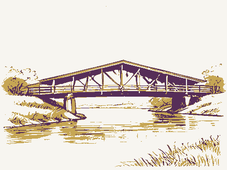
Decorative drawing: a timber truss bridge spanning a river on stone piers, side elevation. Not a photograph of this place.

Nomination for Barkhurst Mill Covered Bridge

The case file that argued this property on to the National Register: 2,739 words across 20 pages, filed in 1999. Read by 4 independent recognisers, of which at least 3 had to agree before a line was published.

Source document Held by the National Archives in Record Group 79 as reference 99000097, where it exists only as a scan with no text layer. The words below were read off that scan by 4 independent recognisers at two resolutions. Only lines that at least 3 of them returned identically appear below; where they disagreed, the line is withheld rather than guessed, so some of the form's furniture is missing. Spelling is never corrected, so a stray character that all the readers agreed on is the recogniser's and the typewriter's.. Nothing is summarised, corrected or written by this site. See the catalogue record, or return to the property.

From the form

The catalogue entry the section above was filed under.

OMB No. 1024-0018 (Rev. 10-90) United States Department of the Interior National Park Service NATIONAL REGISTER OF HISTORIC PLACES JAN - 8 1999 REGISTRATION FORM information requested. If any item does not apply to the property being documented, enter "N/A" for "not applicable." For functions, architectural :lassification, materials, and areas of significance, enter only categories and subcategories from the instructions. Place additional entries and narrative 1. Name of Property Historic name Barkhurst Mill Covered Bridge 2. Location Street & number Township Rd. 21 Nta not for publication City or town_Chesterhill Ea vicinity State Ohio _ county Morgan Code 115 3.

State/Federal Agency Certification As the designated authority under the National Historic Preservation Act of 1986, as amended, I hereby certify that this W Signature of certifying official Ohio Historic Preservation Office -- OH SHPO State or Federal agency and bureau additional comments.) Signature of commenting or other official 4. National Park Service Certification 1, hereby certify that this property is: entered in the National Register - See continuation sheet. - determined not eligible for the - removed from the National other (explain): Register Date RECEIVED NPS Form 10-900 code OH National Register zip code 43728 60.In my opinion, the property meets does not meet the National Register Criteria.I recommend that this property Register of Historic Places Registration Form (National Register Bulletin 16A).

Complete each item by marking "X" in the appropriate box or by entering the items on continuation sheets (NPS Form 10-900a). Use a typewriter, word processor, or computer, to complete all items Other names/site numberWilliams Covered Bridge nomination L request for determination of eligibility meets the documentation standards for registering properties in the National Register of Historic Places and meets the procedural and professional requirements set forth in 36 CFR Part Morgan, Ohio 5. Classification Ownership of Property Category of Property Number of Resources within Property (Check only one box) (Do not include previously listed resources in the - building(s) - private - district - public-local - site -public-State X structure - public-Federal - object Name of related multiple property listing Number of contributing resources previously listed in the National Register 6.

Function or Use Historic Functions Current Functions (Enter categories from instructions) Transportation/road related (vehicular) Transportation /Road Related 7. Description Other: Covered Bridge Narrative Description (Describe the historic and current condition of the property on one or more continuation sheets.) Wood Total Tin Noncontributing Foundation other roof count) apply) Stone Materials Architectural Classification Name of Property Barkhurst Mill Covered Bridge walls (Check as many boxes as County and State United States Department of the Interior National Park Service NATIONAL REGISTER OF HISTORIC PLACES CONTINUATION SHEET Barkhurst Mill Covered Bridge Morgan County, Ohio which crosses over Wolf Creek in Marion Township, Section 4, two miles carries about 10 vehicles per day across scenic Wolf Creek. remind visitors of what was once a busy milling center.

The Buckeye Trail crosses the bridge and heads east along the creek (Photo #1). This bridge is known as the Barkhurst Mill or Williams Covered Bridge and was The overall length of the bridge is 92'6" with a truss length of 80'2". The quarters of the way up and that later more boards were added to take the siding up to the eaves of the bridge (Photo #5). This modification was probably made extending from blocks of wood on the lower chords, running down and connected planks laid at right angles to the trusses. Steel rods run down the face of each abutment (2 rods each) and fasten into an eye-bolt in the abutment stones. These rods are bolted to blocks of wood which rest on the lower chords (Photo road crews moved the bridge back to proper position. A concrete wingwall was added to the southwest corner of the south abutment probably also in 1950. The and has weathered to a soft gray color.

In 1996, extensive maintenance work was done to the bridge Description built in 1872. It is a 10 panel, single span, multiple kingpost truss with added 3 #5).This is obviously to keep the bridge in place in times of high water. A flash abutments, and a corrugated metal roof (Photos #2, #3, #4). Section number 7 Page 1 The structure under consideration is a single span wooden truss covered bridge The site is extremely beautiful and peaceful and is near the remains of a mill to of random width boards and it appears that this siding once extended only three to the floor beams beneath the bridge. The bridge floor is in one layer, with the flood in June of 1950 moved the bridge some14 inches off center and the county metal roof of the bridge was repaired by road crews after a heavy snowstorm northeast of Chesterhill on Township Road 21.

The bridge is open to traffic and ply wooden arches, projecting portals, vertical board siding, cut sandstone roadway width is 12'3" and the overall width of the structure is 14'4". The siding is when the arches were added which may have been around 1913 (Photo #6; See line drawing). The floor system of horizontal planking is carried by iron rods flattened it in the winter of 1966. The siding of the bridge has never been painted United States Department of the Interior National Park Service NATIONAL REGISTER OF HISTORIC PLACES CONTINUATION SHEET Section number_7 Barkhurst Mill Covered Bridge Morgan County, Ohio Steel supports were installed and creosoted end sills were placed under the rafters and lath remained intact. Page Description (continued) Morgan, Ohio 8. Statement of Significance

Statement of significance

Applicable National Register Criteria Areas of Significance the property for National Register listing) - A Property is associated with events that have made a significant contribution to the broad patterns of - B Property is associated with the lives of persons significant in our past. - C Property embodies the distinctive characteristics of a type, period, or method of construction or represents the work of a master, or possesses high artistic values, or represents a significant 1872 to 1948 and distinguishable entity whose components lack individual distinction. - D Property has yielded, or is likely to yield Significant Dates information important in prehistory or history. (Mark "X" in all the boxes that apply.) Significant Person -A owned by a religious institution or used for - B removed from its original location. - C a birthplace or a grave. - D a cemetery.

- E a reconstructed building, object,or structure. - F a commemorative property. John Shrake - Builder OG less than 50 years of age or achieved significance E.W. Kirby - Stonemason within the past 50 years. Narrative Statement of Significance (Explain the significance of the property on one or more continuation sheets.) 9.

The rest of the file

Bibliography, boundary description, and the people who prepared and reviewed the nomination.

Major Bibliographical References (Cite the books, articles, and other sources used in preparing this form on one or more continuation sheets.) Primary location of additional data - preliminary determination of individual listing (36 CFR - State Historic Preservation Office 67) has been requested. - Other State agency - previously listed in the National Register - previously determined eligible by the National & Local government - University - designated a National Historic Landmark - Other - recorded by Historic American Buildings Survey Morgan County Commissioners Journal - recorded by Historic American Engineering Record Court House Archives 1872 Register our history. Bibliography (Enter categories from instructions) Engineering Property is: Criteria Considerations religious purposes.

Previous documentation on file (NPS) N/ A Architect/Builder Federal agency Cultural Affiliation Period of Significance Barkhurst Mill Covered Bridge Name of Property (Complete if Criterion B is marked above) County and State Name of repository: (Mark "x' in one or more boxes for the criteria qualifying United States Department of the Interior National Park Service NATIONAL REGISTER OF HISTORIC PLACES CONTINUATION SHEET Barkhurst Mill Covered Bridge Morgan County, OH Of the 3,850 identified timber truss highway, canal and railroad bridges built in Ohio, exemplifies the multiple kingpost truss design covered bridge in Ohio. Barkhurst Mill Shrake, one of Ohio's foremost bridge builders during the period from 1850-1875.

Of the many covered bridges built by Shrake, only three are still standing, and only one of his Until the late 1940s, Morgan County had 15 covered bridges, but construction of Burr Three of these spans, the Barkhurst Mill Covered Bridge, Helmick Mill Covered Bridge, from Rosseau to the Morgan County Fairgrounds in 1953. Another covered bridge was bridges are not being nominated to the National Register. During the first half of the 1gth century, several truss designs were employed on Ohio's of the outer shell and the weight of the travelers. By far the most common of all wooden truss designs in Ohio, the multiple kingpost, became known across the state as the Buckingham truss, so named after Catherinus Buckingham, bridge builder and Adjutant and was developed for longer spans. Buckingham's Y Bridge at Zanesville (1832) was John Shrake, the builder of the Barkhurst Mill Covered Bridge.

Shrake, the founder of a family of bridge builders, is often cited in the bridge building records of eastern and covered bridges are still standing. The Helmick Covered Bridge in Coshocton County (1863; NROHP 1975), a two span Buckingham truss, and the Waterloo/Shade Bridge in Fairfield County (1871, moved), also a multiple kingpost truss, are in good condition. builder. Significance The Barkhurst Mill Covered Bridge, one of five covered bridges remaining in Morgan the National Register. One other span, the Wolf Creek Covered Bridge was moved General of Ohio. The multiple kingpost consisted of a series of vertical posts and braces southeastern Ohio. Although it is known he built bridges as far west as Madison County and Adams Covered Bridge remain on their original sites and are being nominated to timber truss bridges.

A truss is the arrangement of timber beams and braces, usually Section number 8 Page 1 United States Department of the Interior National Park Service NATIONAL REGISTER OF HISTORIC PLACES CONTINUATION SHEET Barkhurst Mill Covered Bridge Morgan County, OH Significance (continued) The old Barkhurst Mill or Williams Covered Bridge as it is known today, was built in 1872 by John Shrake at a cost of $8.69 per linear foot. The abutments were built by builder of covered bridges in central and southeastern Ohio. Elisha Kirby was a resident of Morgan County. The bridge takes its name from the Barkhurst Mill, the remains of which are about 75 feet from the covered bridge on the north side of Wolf Creek. The mill is on the present property of Russell Williams, and the covered bridge is on a little- used township road. According to the 1875 Morgan County Atlas, J.

Barkhurst owned the mill and a Mclnturf lived to the northwest of the mill and bridge. A Morgan County Barkhurst's Mill was a gristmill and there also was a sawmill located on the south bank of Wolf Creek southwest of the covered bridge. disuse and some roads in the area were closed, leaving what had once been a busy milling center to be a rarely-visited place where few, outside of local residents, know of its existence. The Barkhurst Mill Covered Bridge is one of Ohio's most remote covered bridges, located in a picturesque setting on lovely Wolf Creek. The trail crosses the bridge and heads east along Wolf Creek. The fine old Barkhurst Bridge is a reminder of what life was like over 100 years ago in Morgan County, Ohio. history written in 1886 described J. Barkhurst as a very highly respected businessman.

With the advent of modern transportation and new roads, the old Barkhurst Mill fell into Barkhurst Mill Covered Bridge Morgan, Ohio County and state 10. Geographical Data Acreage of Property less than one acre UTM References (Place additional UTM references on a continuation sheet) 1 17 428270 4372700 - See continuation sheet. Verbal Boundary Description (Describe the boundaries of the property on a continuation sheet.) Boundary Justification (Explain why the boundaries were selected on a continuation sheet.) 11. Form Prepared By street & number 19 East Main Street _ telephone (740) 962-3181 city or town McConnelsville Additional Documentation Submit the following items with the completed form: Continuation Sheets A USGS map (7.5 or 15 minute series) indicating the property's location. Representative black and white photographs of the property.

Property Owner (Complete this item at the request of the SHPO or FPO.) name Morgan County Commissioners _ State Oh zip code 43/56 as amended (16 U.S.C. 470 et seq.). Direct comments regarding this burden estimate or any aspect of this form to the Chief, Administrative Services Division, Paperwork Reductions Project (1024-0018), Washington, DC 20503. NPS Form 10-900 OMB No. 1024-0018 Maps Photographs (Rev. 10-90) Name of Property zip code 43756 Additional items (Check with the SHPO or FPO for any additional items) Zone Easting Northing A Sketch map for historic districts and properties having large acreage or numerous resources. Estimated Burden Statement: Public reporting burden for this form is estimated to average 18.1 hours per response listings.

Response to this request is required to obtain a benefit in accordance with the National Historic Preservation Act, National Park Service, P.O. Box 37127, Washington, DC 20013-7127; and the Office of Management and Budget, state OH United States Department of the Interior National Park Service NATIONAL REGISTER OF HISTORIC PLACES CONTINUATION SHEET Barkhurst Mill Covered Bridge Allen, Richard Sanders. Covered Bridges of the Middle West 1970 Krekeler, Brenda. Covered Bridges Today 1989 Morgan County Commissioner's Journals Ohio Historic Bridge Association. Ohio Historic Bridge Guide 1997 Robertson, Charles D. History of Morgan County 1886 Titus Simmons and Titus. Atlas of Morgan County, Ohio 1875. Wood, Miriam.

The Covered Bridges of Ohio 1993 Verbal Boundary Description: The geographical boundary of the Barkhurst Mill bridge would be one foot beyond the perimeter of the bridge structure including the abutments. The structure is located on Marion Township Road 21, 2400 feet south and 2100 feet east of the north west corner of Section 4, Marion Township, Township 9 North, Range 12 West. Said location also has UTM Reference of 17 428275 4372708 and is shown on the attached Stockport, Ohio Boundary Justification The justification for the boundary of the Barkhurst Mill Covered Bridge is to include the timber structural elements of the bridge as well as the cut stone abutments. Bibliography USGS Quadrangle map.

Morgan County, Ohio Geographical Data Section number9,10 Page _1 United States Department of the Interior National Park Service Section number // Page 1 View looking westerly at the side of the bridge View of the inside of the east wall of the bridge, looking southerly Continuation Sheet National Register of Historic Places View looking north into and thru the bridge View of the bridge site, looking north Barkhurst Mill Covered Bridge Photograph #1 Morgan County, Ohio Engineer, on February 2, 1998 and all negatives are on file in the Note:All photographs were taken by Calvin V. Parmiter, Morgan County Morgan County Engineer's Office. END VIEW SCALE /"= 1O nches to the Mile SM Dunn TODD P.O A Calvert FEst of N. G.Choquill Jas. Smith 1:3 72 John. Beck N. Morris BsL of Thos! S G. Fawcett J.

W.Myers 35.90 BRIDGE Bundy Range 12 51.56 218..53 155 1003 Talbott BARKHURST (775/ 105 1 Creri Ress dfe G.Green J.C.M.Baniust G Hopkins 2483 Den? Worrell Murydnn Jesse Wor tungion L.J. Snutto Tr!!" T White 50.60 Jinett 38.55 100.40 Larkins HESTERFIELD 61.88 COVERED R.Peebles 144.02 RION Jas.Bowers 163.97 7.56 Thas 9-1.78 80.63. 784 Melmick Mill Cov. BRiDGE DEPARTMENT OF TRANSPORTATION MORGAN COUNTY MUSKINGUM WASHINGTON COUNTY ATHENS Adams MORGAN OHIO Barkhurst SCALE OF MILES Mill Cov. BR. PERRY UNITED STATES DEPARTMENT OF THE INTERIOR NATIONAL PARK SERVICE IATIONAL REGISTER OF HISTORIC PLACE VALUATION/RETURN SHEE!

REFERENCE NUMBER: N PERIOD: PROGRAM UNAPPROVED: COMMENT WAIVER: N ABSTRACT/SUMMARY COMMENTS : 99000097 DATE REJECT MULTIPLE RETURN TELEPHONE DISCIPLINE REVIEWER PROPERTY 2/22/99 1/08/99 2/05/99 RECOM./CRITERIA Barkhurst Mill Covered Bridge VACCEPT OTHER: DATE RECEIVED: DATE OF WEEKLY LIST: REASONS FOR REVIEW: DATE OF 45TH DAY: DATE OF 16TH DAY: NAME : STATE & COUNTY: APPEAL: N DATA PROBLEM: N REQUEST: N N SLR DRAFT: N NATIONAL: PDIL: OHIO, Morgan BARKHURST MILe COVERCOBRIDGE MORGAN COUNTY, OHIO PHOTOGRAPH #/ MORGAN COUNTY, OHIO PHOTOGRAPH #Z BARKHURST MILL COVEREDBRIDGE BARKHURST MILL COVERED BRIDGE MORGAN COUNTY, OHIO PHOTOGRAPH #3 TONS MORGAN COUNTY, OHIO PHOTOGRAPH # 4 BARKHURST MILL COVERED BRIDLE MORGAN COUNTY, OHIO PHOTOGRAPH PS PHOTOGRAPH # 6 O DEPARTMENT OF THE INTERIOR BARKHURST MILL UTM REFERENCE: GEOLOGICAL SURVEY STOCKPORT QUADRANGLE UNITED STATES 17/4282704372700 STATE OF OHIO DEPARTMENT OF NATURAL RESOURCES 7.5 MINUTE SERIES (TOPOGRAPHIC)