 Block
From the record
One of 53 National Register listings published here for Nye County · listed in 1982 · category: Building.
Sources: the case file at the National Archives · the National Register database, National Park Service · the Wikipedia article
Listed on the National Register of Historic Places in 1982.
One of 53 National Register listings published here for Nye County · listed in 1982 · category: Building.
Sources: the case file at the National Archives · the National Register database, National Park Service · the Wikipedia article
Regional context, not property-specific evidence. The federal wildfire occurrence database lists 1 fire within 5 miles of Samuel C. Dunham House in 2007, burning under an acre in total. None started naturally. None was recorded as arson. Distance is straight-line from the map coordinates, so a fire counted here may appear on a neighbouring settlement's page as well.
| Reported cause | Fires |
|---|---|
| Missing data/not specified/undetermined | 1 |
The most recent of them, most recent first, with the day each was reported and the service that recorded it.
| Date | Cause | Size | Reported by | Name on the report |
|---|---|---|---|---|
| 29 May 2007 | Missing data/not specified/undetermined | under an acre | Battle Mountain District Office | TONOPAH |
Regional context, not property-specific evidence. The federal mineral resources record lists 103 workings within 5 miles of Samuel C. Dunham House: 50 past producers, 29 occurrences, 14 unknowns, 7 producers. 8 still produce. What was taken out: Silver, Gold, Uranium, Gold, Silver. Distance is straight-line from the map coordinates, so a quarry counted here may appear on a neighbouring settlement's page as well.
| Where | Site | Commodity | Status | Recorded |
|---|---|---|---|---|
| Amalgamated Placers | Tin, Gold, Tungsten | Unknown | ||
| B.C.H. Minerals Co. Property | Gold, Silver, Platinum | Occurrence | Gold | |
| Brougher Divide Mine | Mercury, Gold, Copper, Silver, Molybdenum | Past Producer | ||
| Connolly | Stone, Dimension | Unknown | ||
| Desert Queen Shaft | Tungsten, Silver, Lead, Gold | Past Producer | ||
| Divide Extension Shaft & Lode | Silver, Molybdenum, Mercury, Manganese, Gold, Barium-Barite | Unknown | ||
| Esmeralda 04-4 | Sand and Gravel, Construction | Past Producer | ||
| G & H Claims | Silver, Zinc, Lead, Arsenic, Molybdenum, Gold | Unknown | ||
| Garibaldi Claims | Uranium, Molybdenum | Occurrence | Unknown | |
| Jewess | Silver, Zinc, Molybdenum, Lead, Gold, Arsenic, Barium-Barite | Unknown |
Regional context, not property-specific evidence. The National Weather Service names Tonopah, the town this property stands in, in 9 storm reports between 2006 and 2021: 7 flash flood, 1 lightning, 1 flood. The reports record 1 death and 1 injury. Each account below is quoted exactly as the forecast office filed it, from the NOAA Storm Events Database, and each date opens the federal record of that event.
| When | Event | Place named | Harm | What the report says |
|---|---|---|---|---|
| July 2006 | Lightning | Tonopah | 1 killed, 1 hurt | A 16 year old boy was struck and killed by lightning when he and his dad got out of their pickup truck to check the tires. His father was thrown to the ground when the lightning struck. The father was taken to the hospital for treatment and released. The boy's mother and sister stayed in the truck and were unharmed. |
| August 2017 | Flash Flood | Tonopah | $5,000 | Flash flooding occurred in the town of Tonopah damaging some road shoulders. Damages are estimated. |
| July 2014 | Flash Flood | Tonopah | $3,000 | Heavy rain from a thunderstorm caused flash flooding in the town of Tonopah. Water 1 to 1.5 feet deep flowed down main street. Water seeped into one business in downtown. Some asphalt was lifted at a Shell gas station. Damages are estimated. |
| July 2018 | Flash Flood | Tonopah | $1,500 | Water to 18 deep was reported flowing across U.S. 95 southeast of of Tonopah. Minor road damage occurred. |
| July 2018 | Flash Flood | Tonopah | $1,500 | Public reports via social media videos and pictures of street flooding in Tonopah. |
| August 2015 | Flash Flood | Tonopah | $1,000 | Multiple reports were received of flooding on Route 89 near the Crescent Dunes solar energy plant. Damages are estimated. |
| August 2014 | Flash Flood | Tonopah | $1,000 | Six inches of water were reported flowing down the shoulders and side roads in Tonopah. Estimated three feet of flowing water in dry washes. Damages estimated. |
| September 2014 | Flash Flood | Tonopah | $1,000 | Heavy rain from thunderstorms sent water and debris across State Highway 376 from mile post 8 to 14. Damages estimated. |
| July 2021 | Flood | Tonopah | - | Law enforcement reported minor flooding at the corner of Main street and Cutting. An estimated 2-3 inches was flowing over the roadway per social media photo. Deputy estimated the flooding lasted 30 minutes, and no damage was reported. A nearby station (CMP23) recorded 0.79 inches of rain that fell in 40 minutes to 1 hours time. |
No historic map-sheet match is published for this property yet. That does not mean no map exists. This record needs a coordinate-quality review before it can be joined to a sheet boundary. Browse the county's mapped places while that work is pending.
Other National Register properties close enough to walk or drive between, ordered by distance from this one. Both positions come from the same geocoding pass that matched these properties to their map sheets.
| Photograph | Property | Distance | Listed |
|---|---|---|---|
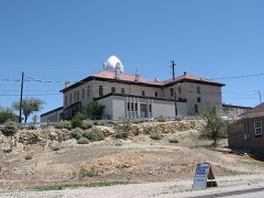 | Nye County Courthouse | 0.1 miles | 1982 |
| Tonapah Mining Company Cottage | 0.2 miles | 1982 | |
| Tonapah Mining Company House | 0.2 miles | 1982 | |
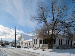 | E. R. Shields House | 0.2 miles | 1982 |
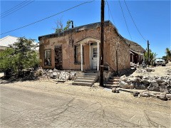 | Combellack Adobe Row House | 0.3 miles | 1982 |
| Cal Shaw Stone Row House | 0.3 miles | 1982 |
| National Archives record | The nomination case file for reference 82003229 in Record Group 79. |
| Wikipedia article | Community-written account of this property, licensed CC BY-SA. |
| Nye County | All 53 listed properties in this county. |