 Block
BlockBinghamton, New York
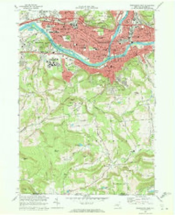
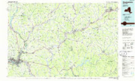
23 topographic sheets cover this place, the earliest surveyed in 1904 and the latest in 1985. It stands in Binghamton City. It lies in ZIP code area 13905. It lies near Chenango Valley. The Survey maps it on the Binghamton West quadrangle. 47,969 people lived here at the 2020 count. It stands 866 feet above sea level.
Then and now
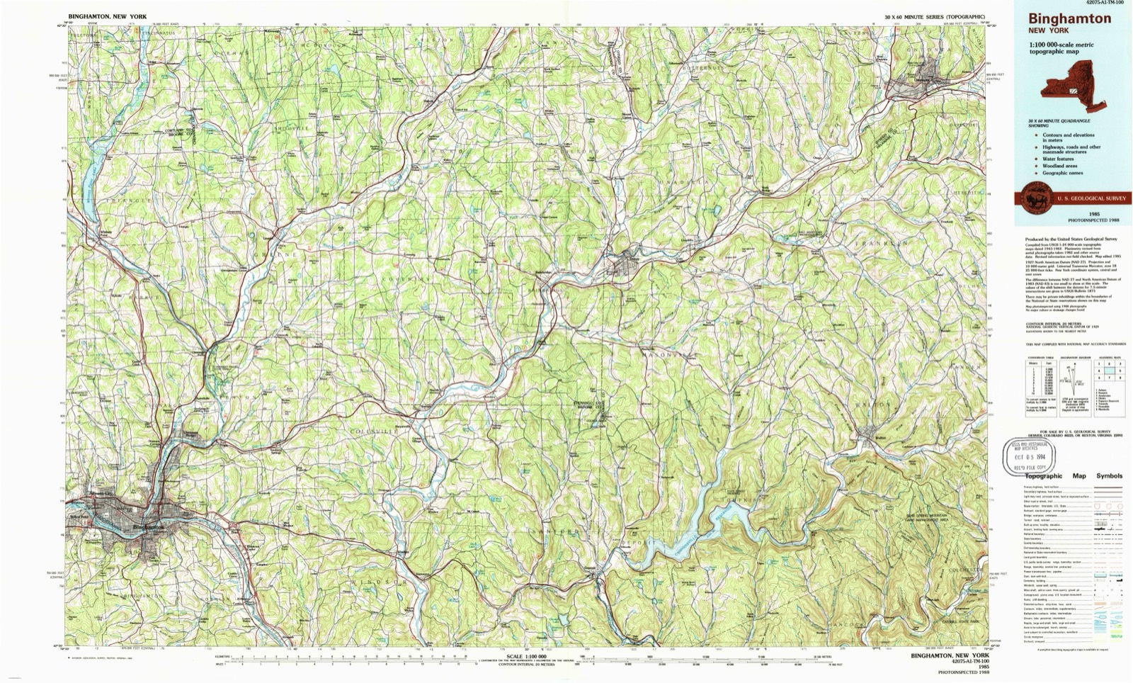
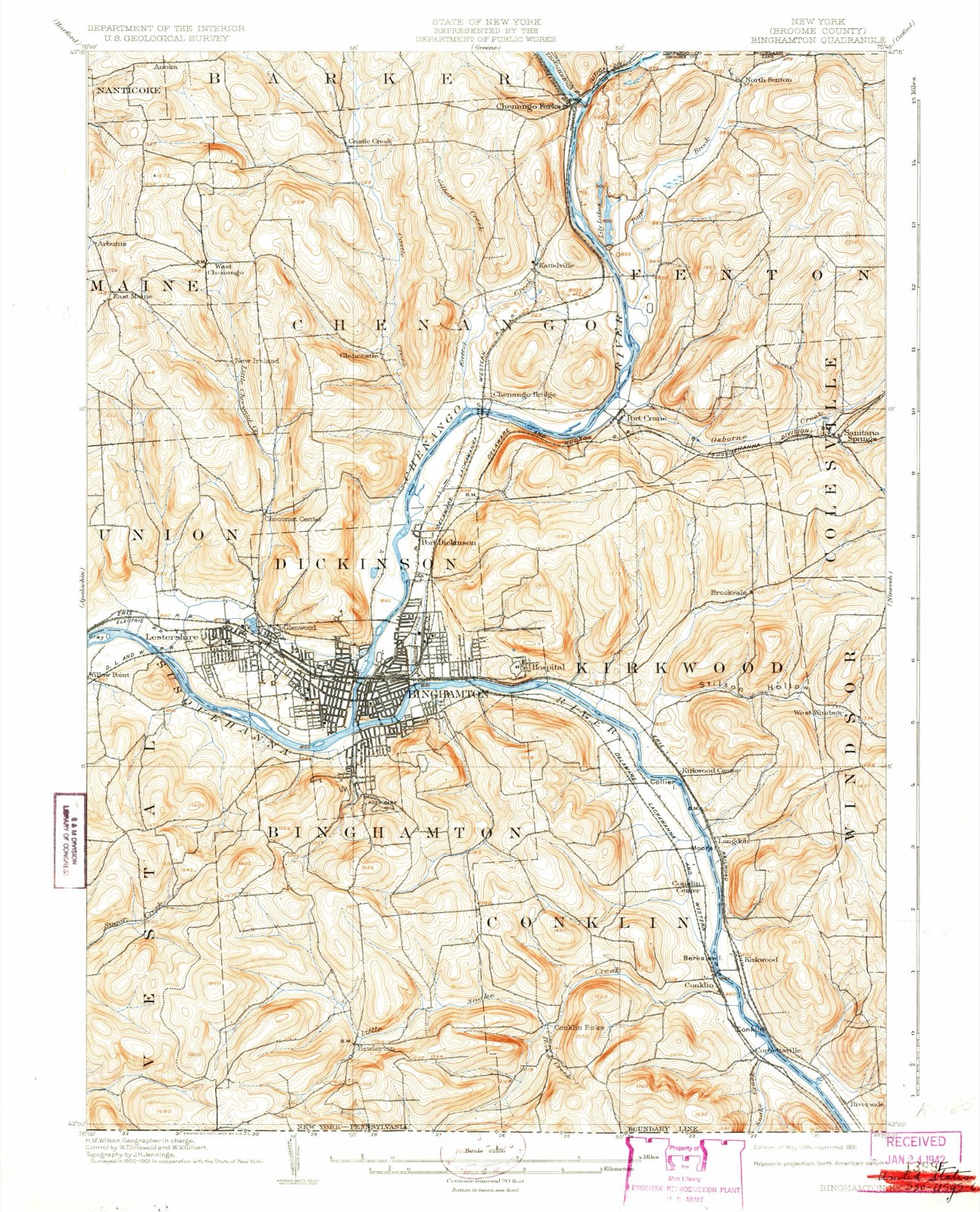
1904 to 1985The same ground, surveyed 81 years apart. Drag the handle to wipe between them. Both sheets are United States Geological Survey originals; neither has been altered.
On record in Binghamton
Buildings and businesses the archive holds for this place. Each opens its own page, with the source record it came from.
On the National Register 12 of 35 shown
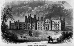 New York State Inebriate AsylumNational Historic Landmark · listed 1996
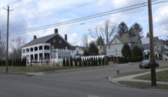 Abel Bennett Tract Historic Districtlisted 2008
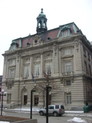 Binghamton City Halllisted 1971
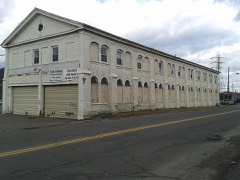 Binghamton Railway Company Complexlisted 2006
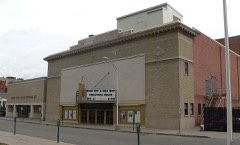 Binghamton Theatrelisted 2008
 Broome County Courthouselisted 1973
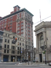 Broome County YWCAlisted 1984
 Building at 171-177 Clinton Streetlisted 2002
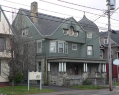 Harlow E. Bundy Houselisted 2011
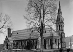 Christ Churchlisted 1974
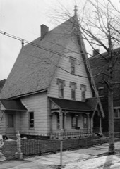 Alfred Dunk Houselisted 1985
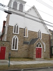 Emmanuel Church of the Evangelical Association of Binghamtonlisted 2009
Population over time
2 figuresBinghamton grew from 47,376 to 47,969 between 2010 and 2020. These are the recorded population figures Wikidata holds for this place, reached through the Geographic Names Information System number this page is keyed on rather than by name, so they belong to this place and not to another of the same name. Most are census counts, but not all are: an early figure may be a founding or settlement estimate, and an estimate published within five years of a census is left out. The change column is computed, and is left blank where more than 20 years separate a figure from the one before it, because a gap that long is not a change between two counts.
| Year | People | Change |
|---|---|---|
| 2010 | 47,376 | |
| 2020 | 47,969 | +593 (+1%) |
Topographic sheets covering this place
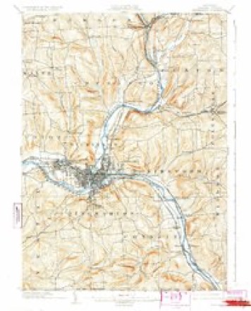
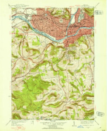
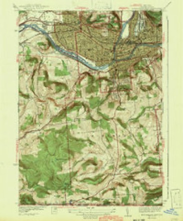
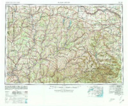
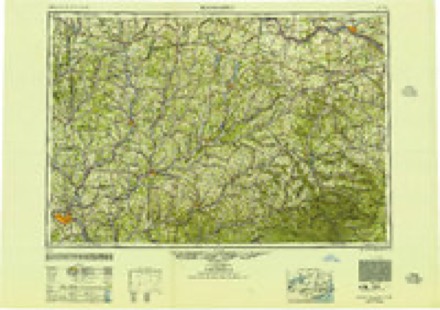
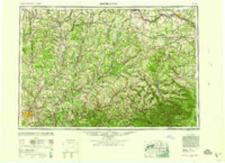
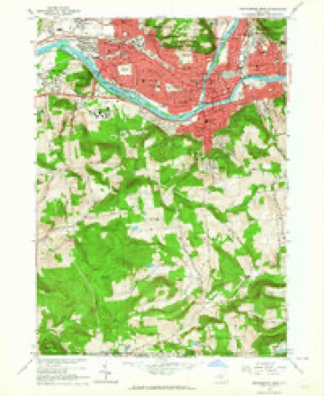
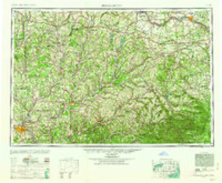
10 surveys from 23 printed sheetsMatched by testing this settlement's coordinate against the published boundary of every sheet in the United States Geological Survey's historical collection. Each opens the scanned sheet at the Survey.
- 1904 USGS Binghamton quadrangle1:62500, 9 printings
- 1935 USGS Binghamton West quadrangle1:24000
- 1942 USGS Binghamton West quadrangle1:31680, 2 printings
- 1948 USGS Binghamton quadrangle1:250000
- 1950 USGS Binghamton quadrangle1:250000, 2 printings
- 1958 USGS Binghamton quadrangle1:250000
- 1961 USGS Binghamton West quadrangle1:24000
- 1963 USGS Binghamton quadrangle1:250000
- 1968 USGS Binghamton West quadrangle1:24000, 3 printings
- 1985 USGS Binghamton quadrangle1:100000, 2 printings
Fires near this place
580 since 2001Regional context, not property-specific evidence. The federal wildfire occurrence database lists 580 fires within 5 miles of Binghamton between 2001 and 2020, burning about 375 acres in total. 25 started naturally. 52 were recorded as arson. Distance is straight-line from the map coordinates, so a fire counted here may appear on a neighbouring settlement's page as well.
| Reported cause | Fires |
|---|---|
| Missing data/not specified/undetermined | 286 |
| Smoking | 73 |
| Recreation and ceremony | 58 |
| Arson/incendiarism | 52 |
| Equipment and vehicle use | 30 |
| Debris and open burning | 27 |
| Natural | 25 |
| Misuse of fire by a minor | 16 |
| Power generation/transmission/distribution | 6 |
| Railroad operations and maintenance | 4 |
| Other causes | 3 |
The most recent of them, most recent first, with the day each was reported and the service that recorded it.
| Date | Cause | Size | Reported by | Name on the report |
|---|---|---|---|---|
| 9 September 2017 | Missing data/not specified/undetermined | under an acre | Fire Department of New York | N/A |
| 9 September 2015 | Missing data/not specified/undetermined | under an acre | Fire Department of New York | NA |
| 9 September 2010 | Missing data/not specified/undetermined | under an acre | Fire Department of New York | not named |
| 8 September 2008 | Missing data/not specified/undetermined | under an acre | Fire Department of New York | not named |
| 7 September 2017 | Smoking | under an acre | Fire Department of New York | N/A |
| 7 September 2016 | Recreation and ceremony | 1.3 acres | Fire Department of New York | N/A |
| 7 September 2015 | Missing data/not specified/undetermined | under an acre | Fire Department of New York | N/A |
| 7 September 2010 | Smoking | 1.0 acres | Fire Department of New York | not named |
Settlements close enough to share some of these fires:
Mines and quarries near this place
5 within 5 milesRegional context, not property-specific evidence. The federal mineral resources record lists 5 workings within 5 miles of Binghamton: 2 past producers, 1 prospect, 1 producer, 1 plant. 2 still produce. What was taken out: Sand and Gravel, Construction, Clay, Salt. Distance is straight-line from the map coordinates, so a quarry counted here may appear on a neighbouring settlement's page as well.
| Where | Site | Commodity | Status | Recorded |
|---|---|---|---|---|
| Brown No.1 Well | Salt | Prospect | ||
| Binghampton Brick Co. Pit | Clay | Past Producer | Sedimentary | |
| Binghampton Brick Co. Pit | Clay | Plant | ||
| Boland Pit | Sand and Gravel, Construction | Producer | ||
| Weber Road Pit and Plant | Sand and Gravel, Construction | Past Producer | Sedimentary |
Storms near this place
60 of 83 shownRegional context, not property-specific evidence. The National Weather Service names Binghamton in 83 storm reports between 1993 and 2025: 43 thunderstorm wind, 25 hail, 8 flash flood, 4 lightning. No death or injury is recorded in these reports. Each account below is quoted exactly as the forecast office filed it, from the NOAA Storm Events Database, and each date opens the federal record of that event.
| When | Event | Place named | Harm | What the report says |
|---|---|---|---|---|
| July 2025 | Hail | Binghamton | $20,000,000 | There was an exceptional swath of hail damage, approximately 2.5 miles wide and 5 miles long. Many trees were completely stripped of their foliage, including an entire hillside, which bore the brunt of the storm and appeared entirely bare. Widespread hail damage was also reported to vehicles and homes within the affected area. Spotters reported golf ball sized hail. The hail accumulated in some areas making the ground white and roads slippery. |
| September 2011 | Flash Flood | Binghamton | $20,000,000 | Catastrophic flash flooding occurred in the Binghamton, Vestal, Endicott, Endwell and Chenango Valley areas. Numerous roads, bridges and homes were severely damaged. Deep ponding of water occurred below underpasses. |
| June 2006 | Flood | Binghamton | $5,000,000 | no account filed |
| July 2017 | Flash Flood | Binghamton | $165,000 | Heavy rainfall closed several roads in the Binghamton area due to high water collecting within several underpasses and other poor drainage areas. Interstate 81 was down to a single lane due to flooding. |
| June 2016 | Flood | Binghamton | $50,000 | One to two inches of thunderstorm rainfall caused typical urban flooding in several locations around the Triple Cities, including the railroad underpasses in the City of Binghamton, the Vestal Parkway, and downtown Endicott. |
| July 1994 | Thunderstorm Wind | Binghamton | $50,000 | no account filed |
| April 2010 | Lightning | Binghamton | $35,000 | Lightning hit a tree, and then a storage shed at the Binghamton Mobile Estates. The flames spread to two mobile homes, and both sustained serious damage. One home was deemed unsafe to live in. |
| June 2004 | Thunderstorm Wind | Binghamton | $20,000 | Thunderstorm winds downed trees in Binghamton, Hillcrest, Chenango Bridge, and Port Crane. |
| July 2025 | Thunderstorm Wind | Binghamton | $12,500 | Strong thunderstorm winds knocked down a tree onto a house. The second floor porch was destroyed. There were other downed trees and wires in the area. |
| August 2019 | Thunderstorm Wind | Binghamton | $10,000 | Strong thunderstorm winds brought down multiple trees and wires in the Binghamton metro area. |
| August 2019 | Thunderstorm Wind | Binghamton | $10,000 | Strong thunderstorm winds brought down trees and wires. |
| November 2006 | Flash Flood | Binghamton | $10,000 | Three feet of water on Vestal Avenue in Binghamton. |
| July 2012 | Thunderstorm Wind | Binghamton | $8,000 | Numerous trees and wires were blown in the Town and City of Binghamton. |
| July 2025 | Thunderstorm Wind | Binghamton | $5,000 | Strong thunderstorm winds knocked down trees onto a house and garage. Both structures were damaged. |
| March 2022 | Thunderstorm Wind | Binghamton | $5,000 | Strong thunderstorm winds knocked down numerous trees. |
| April 2020 | Thunderstorm Wind | Binghamton | $5,000 | Strong thunderstorm winds brought down a tree and wires on Eldredge Street and Emmett Street. |
| July 2020 | Thunderstorm Wind | Binghamton | $5,000 | Strong thunderstorm winds brought down trees on a road. |
| July 2020 | Thunderstorm Wind | Binghamton | $5,000 | Strong thunderstorm winds brought down a pole and wires on Clinton Street. |
| July 2020 | Thunderstorm Wind | Binghamton | $5,000 | Strong thunderstorm winds brought down a tree. |
| August 2020 | Thunderstorm Wind | Binghamton | $5,000 | Strong thunderstorm winds brought down trees. |
| August 2020 | Thunderstorm Wind | Binghamton | $5,000 | Strong thunderstorm winds brought down trees on Highland Avenue. |
| October 2020 | Thunderstorm Wind | Binghamton | $5,000 | Strong thunderstorm winds brought down wires on Sunset Drive. |
| June 2020 | Lightning | Binghamton | $5,000 | A lightning strike from a thunderstorm caused a tree to catch on fire. |
| August 2018 | Thunderstorm Wind | Binghamton | $5,000 | Thunderstorm winds blew down trees. |
| August 2017 | Thunderstorm Wind | Binghamton | $5,000 | A thunderstorm moved across the region and became severe. This thunderstorm produced severe winds and knocked over a tree which fell on a house on Clifton Blvd. |
| May 2015 | Flash Flood | Binghamton | $5,000 | There was extensive street, parking lot and underpass flooding in the City of Binghamton. |
| September 2014 | Thunderstorm Wind | Binghamton | $5,000 | Several trees were uprooted on Front Street. |
| June 2013 | Thunderstorm Wind | Binghamton | $5,000 | Poles and wires were blown down on Colfax Street. |
| September 2005 | Thunderstorm Wind | Binghamton | $5,000 | Scattered trees down in the Binghamton area. |
| May 2004 | Lightning | Binghamton | $5,000 | Lightning struck the roof of the Bates Troy Laundry and Cleaners on 151 Laurel Avenue. The lightning started a fire that was extinguished within 20 minutes. There was damage to the electrical and telephone systems, and minor water damage. |
| August 1994 | Thunderstorm Wind | Binghamton | $5,000 | no account filed |
| June 1994 | Thunderstorm Wind | Binghamton | $5,000 | no account filed |
| August 1993 | Thunderstorm Wind | Binghamton | $5,000 | no account filed |
| July 2025 | Thunderstorm Wind | Binghamton | $2,500 | Strong thunderstorm winds knocked down a tree on Glen Avenue. Damage to property was also reported. |
| July 2025 | Thunderstorm Wind | Binghamton | $2,500 | Strong thunderstorm winds knocked down trees. |
| July 2025 | Flash Flood | Binghamton | $2,000 | Flooding was reported in both directions on Route 7. All lanes were blocked. |
| August 2009 | Flash Flood | Binghamton | $2,000 | The underpass was flooded at Court Street and Alice Street. |
| August 2007 | Thunderstorm Wind | Binghamton | $2,000 | Trees were blown down in Binghamton and Vestal. |
| July 2004 | Thunderstorm Wind | Binghamton | $2,000 | Thunderstorm winds uprooted a large tree. |
| May 2004 | Lightning | Binghamton | $2,000 | Lightning hit a house at 3855 Brady Hill Road in the Town of Binghamton. The only damage that occurred was a short to the house's alarm system. |
| July 2021 | Thunderstorm Wind | Binghamton | $1,500 | Strong thunderstorm winds knocked down a tree onto a porch. |
| February 2023 | Thunderstorm Wind | Binghamton | $1,000 | Strong thunderstorm winds knocked down a tree on Edwards Road. |
| August 2017 | Thunderstorm Wind | Binghamton | $1,000 | A thunderstorm moved across the region and became severe. This thunderstorm produced severe winds and knocked over a tree near the intersection of Clinton Street and Front Street. |
| July 2016 | Thunderstorm Wind | Binghamton | $1,000 | A thunderstorm moved into the area Monday afternoon and quickly became severe. The thunderstorm knocked a tree over on Grand Boulevard in Vestal. |
| April 2010 | Thunderstorm Wind | Binghamton | $1,000 | Several trees were blown down in the city. |
| June 2008 | Thunderstorm Wind | Binghamton | $1,000 | Trees were blown down. |
| October 2007 | Thunderstorm Wind | Binghamton | $1,000 | Several trees were blown down. Trees were also down in Endicott and Port Crane. |
| July 2025 | Hail | Binghamton | - | Estimated half dollar hail via social media photo. |
| May 2011 | Flash Flood | Binghamton | - | Numerous roads were flooded in Binghamton, especially near underpasses, low spots and poor drainage areas. Route 11 was closed due to flooding in Kirkwood. |
| March 2008 | Flash Flood | Binghamton | - | Flooding occurred along Upper Court Street in the city of Binghamton. |
| July 2008 | Thunderstorm Wind | Binghamton | - | Trees were blown down. |
| July 2008 | Thunderstorm Wind | Binghamton | - | Several trees were blown down. |
| June 2007 | Thunderstorm Wind | Binghamton | - | Trees and wires were blown down county-wide. |
| June 2007 | Thunderstorm Wind | Binghamton | - | Several trees were blown down. |
| November 2006 | Flood | Binghamton | - | Heavy rainfall caused minor flooding on the Susquehanna River at Washington Street in Binghamton. The river reached its flood stage of 14 feet at 10:52 pm on the 17th and crested at 14.7 feet at 12:30 am on the 18th. |
| November 2001 | Thunderstorm Wind | Binghamton | - | Tree fell and snapped two utility poles on Howard Avenue on the east side of Binghamton. 15 electric customers were affected. Also 50 other customer in Whitney Point and Greene (in Chenango County) had power interruptions. |
| April 2000 | Thunderstorm Wind | Binghamton | - | Billboard blown down into a car. |
| May 2000 | Thunderstorm Wind | Binghamton | - | Thunderstorm winds knocked a concrete pineapple off of a building facade. |
| September 2000 | Thunderstorm Wind | Binghamton | - | Wires down. Also reported in Port Dickinson. |
| July 2025 | Hail | Binghamton | - | no account filed |
Nearest settlements
The eight closest, with where each one stands in the county. Distances are straight-line, computed from the Geographic Names Information System coordinates.
| Map | Place | Distance | Sheets |
|---|---|---|---|
| Sunrise Terrace | 1.8 miles | 23 | |
| Park Terrace | 2.0 miles | 23 | |
| Stella (historical) | 2.2 miles | 23 | |
| Johnson City | 2.5 miles | 23 | |
| Port Dickinson | 2.7 miles | 23 | |
| Summit Hill | 2.7 miles | 23 | |
| Popes Ravine | 2.9 miles | 24 | |
| Pine Manor | 3.0 miles | 24 |
Elsewhere
Matched on this settlement's Geographic Names Information System number rather than its name, so it cannot be a different place of the same name in another state.
| Wikipedia article on Binghamton | An encyclopaedic summary. Its text is share-alike, so it is linked here rather than copied. |
| Wikidata item Q213814 | The structured record the population and elevation above come from. Public domain (CC0). |
Provenance
This settlement is recorded in the Geographic Names Information System as feature 943985. The sheet list is computed by point-in-boundary test against the United States Geological Survey's historical topographic inventory. Both are works of the United States government and carry no copyright under 17 U.S.C. 105.
Wildfire. Short, Karen C. 2022. Spatial wildfire occurrence data for the United States, 1992-2020 [FPA_FOD_20221014]. 6th Edition. Fort Collins, CO: Forest Service Research Data Archive. https://doi.org/10.2737/RDS-2013-0009.6 Collected with United States Government funding and usable without additional permissions or fees.
Mines and quarries. USGS Mineral Resources Data System (MRDS) https://mrdata.usgs.gov/mrds/ A work of the United States government, no copyright under 17 U.S.C. 105.
Storms. NOAA National Centers for Environmental Information, Storm Events Database https://www.ncei.noaa.gov/stormevents/ A work of the United States government, no copyright under 17 U.S.C. 105. Narratives are quoted verbatim from the National Weather Service report and are not edited or summarised.