 Block
BlockCamden, New York
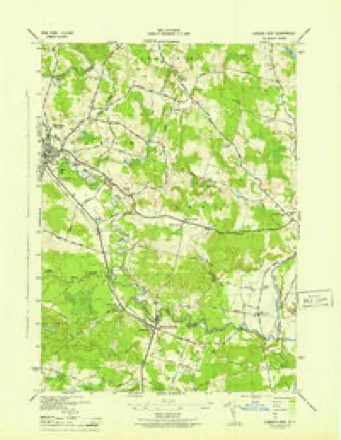
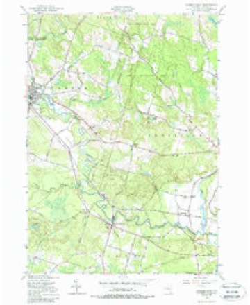
19 topographic sheets cover this place, the earliest surveyed in 1905 and the latest in 1985. It stands in Camden town. It lies in ZIP code area 13316. It stands on Mad River. The Survey maps it on the Camden East quadrangle.
Then and now
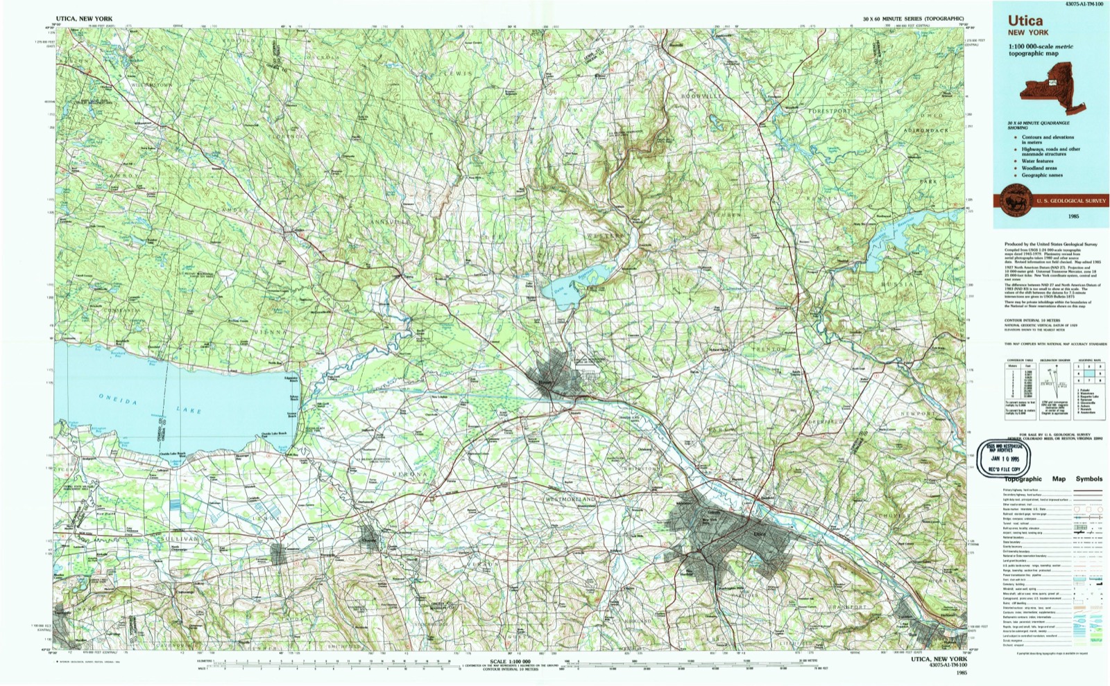
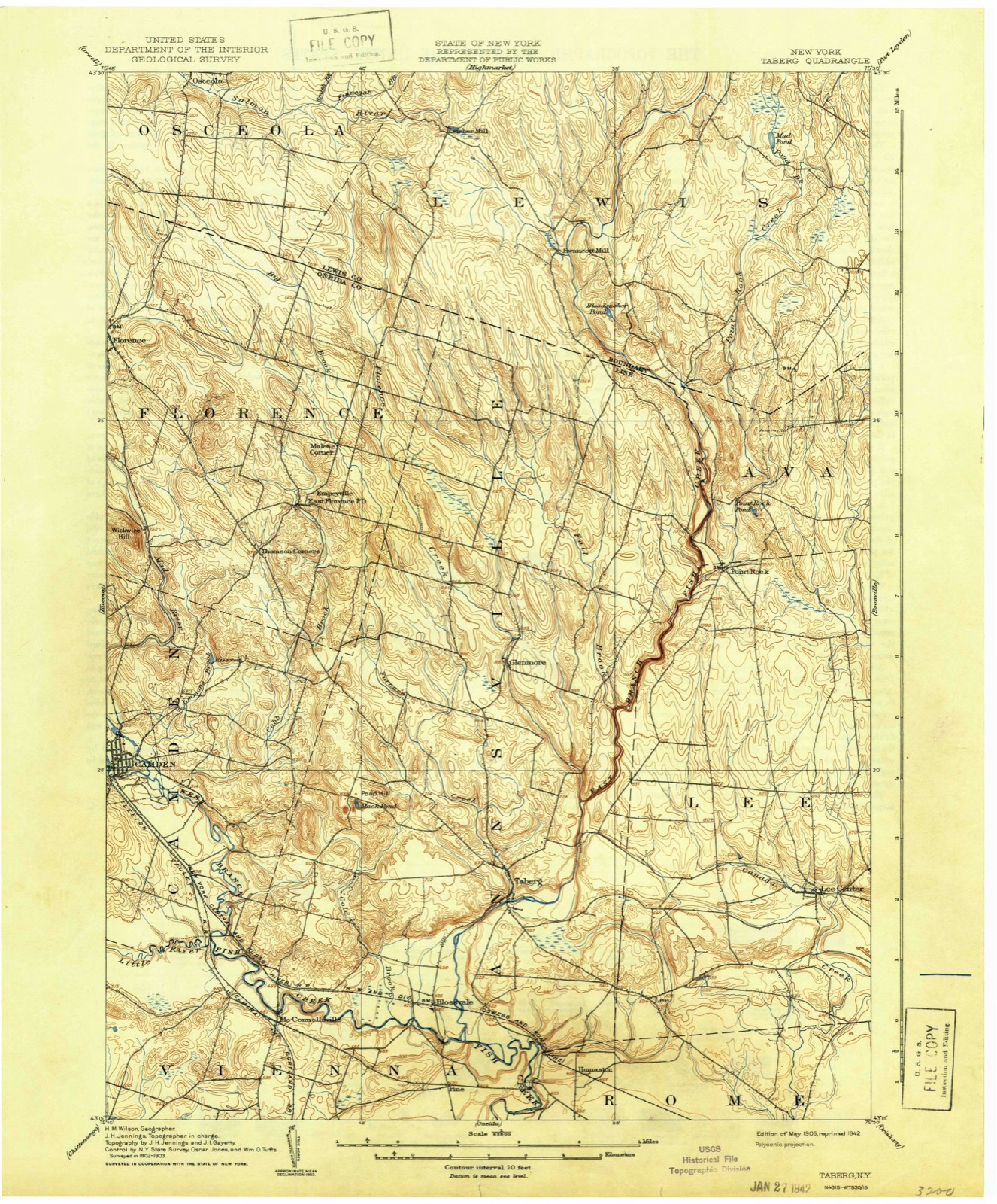
1905 to 1985The same ground, surveyed 80 years apart. Drag the handle to wipe between them. Both sheets are United States Geological Survey originals; neither has been altered.
On record in Camden
Buildings and businesses the archive holds for this place. Each opens its own page, with the source record it came from.
On the National Register 1 record
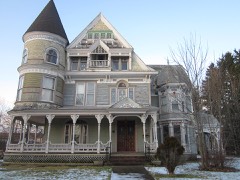 W.H. Dorrance Houselisted 1999
Topographic sheets covering this place
9 surveys from 19 printed sheetsMatched by testing this settlement's coordinate against the published boundary of every sheet in the United States Geological Survey's historical collection. Each opens the scanned sheet at the Survey.
- 1905 USGS Taberg quadrangle1:62500, 6 printings
- 1943 USGS Camden East quadrangle1:31680
- 1950 USGS Utica quadrangle1:250000
- 1955 USGS Camden East quadrangle1:24000, 3 printings
- 1957 USGS Utica quadrangle1:250000
- 1962 USGS Utica quadrangle1:250000, 3 printings
- 1964 USGS Utica quadrangle1:250000
- 1967 USGS Utica quadrangle1:250000
- 1985 USGS Utica quadrangle1:100000, 2 printings
Fires near this place
64 since 1997Regional context, not property-specific evidence. The federal wildfire occurrence database lists 64 fires within 5 miles of Camden between 1997 and 2018, burning about 84 acres in total. 4 started naturally. 4 were recorded as arson. Distance is straight-line from the map coordinates, so a fire counted here may appear on a neighbouring settlement's page as well.
| Reported cause | Fires |
|---|---|
| Missing data/not specified/undetermined | 35 |
| Smoking | 9 |
| Debris and open burning | 9 |
| Natural | 4 |
| Arson/incendiarism | 4 |
| Recreation and ceremony | 2 |
| Power generation/transmission/distribution | 1 |
The most recent of them, most recent first, with the day each was reported and the service that recorded it.
| Date | Cause | Size | Reported by | Name on the report |
|---|---|---|---|---|
| 25 September 2005 | Missing data/not specified/undetermined | under an acre | Fire Department of New York | not named |
| 2 September 2007 | Missing data/not specified/undetermined | under an acre | Fire Department of New York | not named |
| 13 September 2011 | Recreation and ceremony | under an acre | Fire Department of New York | not named |
| 11 September 2015 | Missing data/not specified/undetermined | under an acre | Fire Department of New York | N/A |
| 29 July 1997 | Smoking | 3.0 acres | New York Forest Rangers | not named |
| 17 July 2008 | Debris and open burning | under an acre | Fire Department of New York | not named |
| 16 July 2009 | Missing data/not specified/undetermined | 1.0 acres | Fire Department of New York | not named |
| 13 July 2002 | Missing data/not specified/undetermined | under an acre | Fire Department of New York | not named |
Settlements close enough to share some of these fires:
Mines and quarries near this place
3 within 5 milesRegional context, not property-specific evidence. The federal mineral resources record lists 3 workings within 5 miles of Camden: 2 past producers, 1 producer. 1 still produces. What was taken out: Sand and Gravel, Construction. Distance is straight-line from the map coordinates, so a quarry counted here may appear on a neighbouring settlement's page as well.
| Where | Site | Commodity | Status | Recorded |
|---|---|---|---|---|
| Mcconnellsville Pit | Sand and Gravel, Construction | Producer | ||
| Mcconnellsville Plant | Sand and Gravel, Construction | Past Producer | Sedimentary | |
| Morse Pit | Sand and Gravel, Construction | Past Producer |
Storms near this place
52 since 1993Regional context, not property-specific evidence. The National Weather Service names Camden in 52 storm reports between 1993 and 2025: 36 thunderstorm wind, 10 hail, 2 lightning, 2 flash flood. The reports record 1 injury. Each account below is quoted exactly as the forecast office filed it, from the NOAA Storm Events Database, and each date opens the federal record of that event.
| When | Event | Place named | Harm | What the report says |
|---|---|---|---|---|
| August 2001 | Lightning | Camden | 1 hurt | A man was injured when lightning struck a car he was leaning on. |
| May 1993 | Thunderstorm Wind | Camden | $500,000 | no account filed |
| May 1998 | Thunderstorm Wind | Camden | $65,000 | A fast moving line of severe thunderstorms inflicted widespread wind damage across much of the county, especially in northern and central portions. From roughly Camden eastward across the Rome area to Forestport, numerous trees and wires were downed. |
| September 1998 | Thunderstorm Wind | Camden | $25,000 | A line of severe thunderstorms plowed across northern sections of the county late in the evening. Several trees and power lines were downed in a corridor from Camden eastward to Ava around and just after 1000 pm EDT. |
| May 2013 | Thunderstorm Wind | Camden | $20,000 | Large oak tree fell on house, along with power lines down. |
| September 2002 | Thunderstorm Wind | Camden | $15,000 | Trees and wires downed by thunderstorm winds. The towns of Camden, Lee, Boonville, and Forestport had trees and wires down. |
| August 2002 | Thunderstorm Wind | Camden | $15,000 | Trees and wires down countywide. Towns affected included Camden, Verona, Blossvale, Lee, Taberg, Rome, Ava, Trenton, Vienna, Whitesboro, Whitesfield, and Deerfield. Lee was hit particularly hard. On Davidson Road in Lee, a tree took down wires before landing on a house. 10,000 customers were without power. Television station WKTV got knocked off the air for several minutes after lightning struck the transmitter located in Deerfield on Smith Hill Road. |
| March 2020 | Thunderstorm Wind | Camden | $10,000 | Strong thunderstorm winds brought down trees on wires. |
| April 2004 | Thunderstorm Wind | Camden | $10,000 | Thunderstorm winds brought down isolated trees and wires. Some of the affected towns were Camden, Verona, Westmoreland, Whitestown, and New Hartford. A farm wagon was flipped over in Camden. Between 500 and 1,000 customers lost power. |
| September 1997 | Thunderstorm Wind | Camden | $10,000 | A thunderstorm briefly intensified to severe levels while crossing northern portions of the county. This late evening event contained strong winds which toppled a few trees in the town of Camden. Also, several power lines were blown down and vivid cloud to ground lightning struck a major transformer. These factors combined to cause several major power outages in the area. |
| August 1995 | Thunderstorm Wind | Camden | $10,000 | no account filed |
| August 1995 | Thunderstorm Wind | Camden | $6,000 | no account filed |
| August 2023 | Thunderstorm Wind | Camden | $5,000 | Strong thunderstorm winds knocked down multiple trees on the road. |
| July 2017 | Thunderstorm Wind | Camden | $5,000 | A thunderstorm moved across the region and became severe. This thunderstorm produced severe winds and knocked over several trees. |
| July 2013 | Thunderstorm Wind | Camden | $5,000 | Fifteen trees were blown down in one location. |
| May 2013 | Thunderstorm Wind | Camden | $5,000 | Trees and wires were blown down by thunderstorm winds. |
| May 2008 | Tornado (EF0) | Camden | $5,000 | An EF0 tornado touched down near the west branch of Fish Creek. A barn collapsed, and siding was riped off a portion of the house. Several large branches over one foot in diameter were broken off trees, and a snowmobile trailer was blown approximately 20-25 feet. Debris from the yard was found 1/2 mile away. |
| July 2008 | Thunderstorm Wind | Camden | $5,000 | There were numerous reports of trees and wires blown down. |
| June 2006 | Thunderstorm Wind | Camden | $5,000 | Trees were blown down by strong thunderstorm winds. |
| July 2006 | Flash Flood | Camden | $5,000 | Heavy rain from thunderstorms flooded many roads across the Northwest part of Oneida county. |
| August 1995 | Thunderstorm Wind | Camden | $5,000 | An isolated severe thunderstorm downed trees and power lines in the Camden area in Onieda County. |
| August 1993 | Thunderstorm Wind | Camden | $5,000 | A squall line moved across eastern New York on the afternoon and evening of August 2nd resulting in severe thunderstorms across parts of the region. There were numerous reports of large tree limbs, trees and power lines downed by thunderstorm winds. The areas hardest hit were Herkimer, Montgomery, Oneida, Otsego and Washington Counties. In all over 15,000 customers were left without power. |
| May 2013 | Hail | Camden | $5,000 | no account filed |
| May 2013 | Hail | Camden | $5,000 | no account filed |
| July 1996 | Thunderstorm Wind | Camden | $5,000 | no account filed |
| September 1993 | Thunderstorm Wind | Camden | $5,000 | no account filed |
| June 2025 | Thunderstorm Wind | Camden | $3,000 | Strong thunderstorm winds knocked down trees and wires over Wolcott Hill Road. |
| December 2006 | Thunderstorm Wind | Camden | $3,000 | Several power poles were snapped. |
| August 2024 | Flash Flood | Camden | $2,000 | River Road was flooded between Quarry Road and Hart Road. |
| July 2005 | Thunderstorm Wind | Camden | $2,000 | Thunderstorm winds downed trees and wires. |
| May 2003 | Thunderstorm Wind | Camden | $2,000 | Trees and wires down. |
| May 2022 | Thunderstorm Wind | Camden | $1,000 | Strong thunderstorm winds uprooted a tree. |
| July 2022 | Thunderstorm Wind | Camden | $1,000 | Strong thunderstorm winds knocked down a tree in Camden. |
| June 2008 | Thunderstorm Wind | Camden | $1,000 | Wires were knocked down. |
| July 2007 | Thunderstorm Wind | Camden | $1,000 | A few trees were knocked down. |
| July 1995 | Thunderstorm Wind | Camden | $1,000 | no account filed |
| August 1993 | Thunderstorm Wind | Camden | $500 | no account filed |
| January 2018 | Flood | Camden | - | Flooding along the West Branch Fish Creek was crossing Route 69 and blocking traffic throughout downtown Camden. |
| May 2013 | Thunderstorm Wind | Camden | - | Trees were blown down on Railroad Street by thunderstorm winds. |
| May 2011 | Hail | Camden | - | Penny size hail covered the ground. Some lawn furniture was blown around, with estimated winds of 30 to 40 mph. |
| May 2008 | Thunderstorm Wind | Camden | - | Several trees were knocked down. |
| June 2007 | Thunderstorm Wind | Camden | - | Trees were blown down with power outages. |
| May 2001 | Thunderstorm Wind | Camden | - | Small hail was reported by a NWS cooperative weather observer. |
| May 2000 | Lightning | Camden | - | Lightning struck a trailer and started a fire on Dingle Street. |
| May 2013 | Hail | Camden | - | no account filed |
| July 2012 | Hail | Camden | - | no account filed |
| May 2011 | Hail | Camden | - | no account filed |
| May 2011 | Hail | Camden | - | no account filed |
| June 2010 | Hail | Camden | - | no account filed |
| December 2006 | Thunderstorm Wind | Camden | - | no account filed |
| May 2004 | Hail | Camden | - | no account filed |
| May 2000 | Hail | Camden | - | no account filed |
Nearest settlements
The eight closest, with where each one stands in the county. Distances are straight-line, computed from the Geographic Names Information System coordinates.
| Map | Place | Distance | Sheets |
|---|---|---|---|
| Preston Hill | 1.7 miles | 21 | |
| Thompsons Corner | 3.4 miles | 21 | |
| Blennes Corner | 3.9 miles | 19 | |
| Dibbletown | 4.2 miles | 19 | |
| Hillsboro | 4.3 miles | 21 | |
| McConnellsville | 5.1 miles | 19 | |
| Westdale | 5.1 miles | 21 | |
| Elpis | 5.3 miles | 21 |
Provenance
This settlement is recorded in the Geographic Names Information System as feature 945512. The sheet list is computed by point-in-boundary test against the United States Geological Survey's historical topographic inventory. Both are works of the United States government and carry no copyright under 17 U.S.C. 105.
Wildfire. Short, Karen C. 2022. Spatial wildfire occurrence data for the United States, 1992-2020 [FPA_FOD_20221014]. 6th Edition. Fort Collins, CO: Forest Service Research Data Archive. https://doi.org/10.2737/RDS-2013-0009.6 Collected with United States Government funding and usable without additional permissions or fees.
Mines and quarries. USGS Mineral Resources Data System (MRDS) https://mrdata.usgs.gov/mrds/ A work of the United States government, no copyright under 17 U.S.C. 105.
Storms. NOAA National Centers for Environmental Information, Storm Events Database https://www.ncei.noaa.gov/stormevents/ A work of the United States government, no copyright under 17 U.S.C. 105. Narratives are quoted verbatim from the National Weather Service report and are not edited or summarised.