 Block
BlockStuyvesant, New York
25 topographic sheets cover this place, the earliest surveyed in 1893 and the latest in 1986. It stands in Stuyvesant town. It lies in ZIP code area 12173. It stands on Stuyvesant Brook. The Survey maps it on the Ravena quadrangle.
Then and now
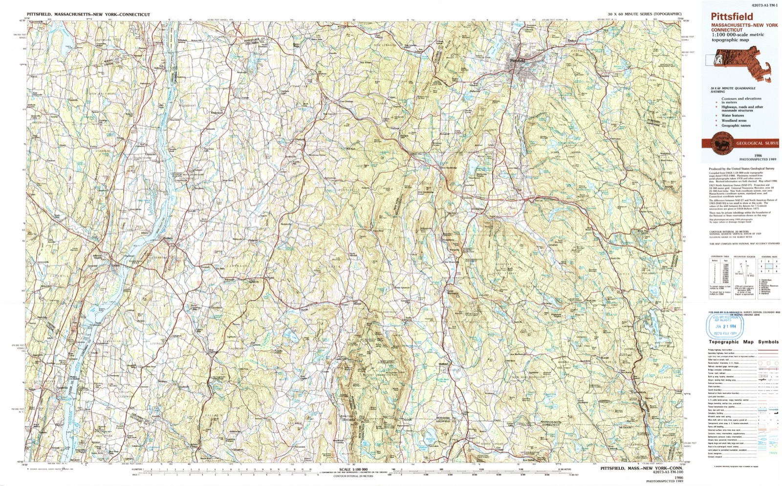
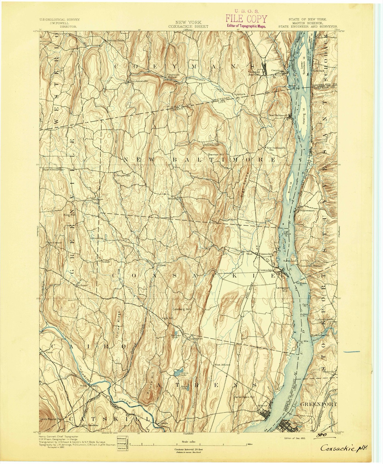
1893 to 1986The same ground, surveyed 93 years apart. Drag the handle to wipe between them. Both sheets are United States Geological Survey originals; neither has been altered.
On record in Stuyvesant
Buildings and businesses the archive holds for this place. Each opens its own page, with the source record it came from.
On the National Register 5 records
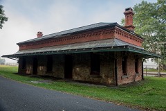 Stuyvesant Railroad Stationlisted 1999
- Requa Houselisted 2002
- R. and W. Scott Ice Company Powerhouse and Ice House Sitelisted 1985
- Johannis L. Van Alen Farmlisted 1973
- William A. Witbeck Houselisted 1994
Topographic sheets covering this place
11 surveys from 25 printed sheetsMatched by testing this settlement's coordinate against the published boundary of every sheet in the United States Geological Survey's historical collection. Each opens the scanned sheet at the Survey.
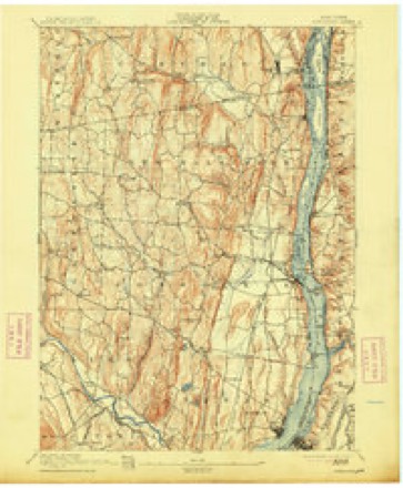
- 1893 USGS Coxsackie quadrangle1:62500
- 1894 USGS Coxsackie quadrangle1:62500, 8 printings
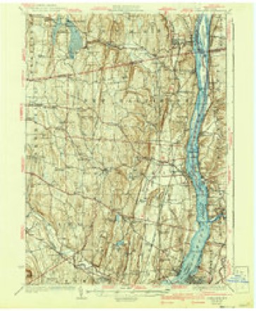
- 1929 USGS Coxsackie quadrangle1:62500, 4 printings
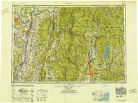
- 1948 USGS Albany quadrangle1:250000
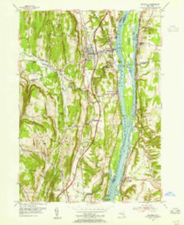
- 1953 USGS Ravena quadrangle1:24000, 3 printings
- 1956 USGS Albany quadrangle1:250000, 2 printings
- 1957 USGS Albany quadrangle1:250000
- 1959 USGS Albany quadrangle1:250000
- 1962 USGS Albany quadrangle1:250000
- 1978 USGS Wilmington quadrangle1:25000
- 1986 USGS Pittsfield quadrangle1:100000, 2 printings
Fires near this place
153 since 1992Regional context, not property-specific evidence. The federal wildfire occurrence database lists 153 fires within 5 miles of Stuyvesant between 1992 and 2020, burning about 131 acres in total. 12 started naturally. 17 were recorded as arson. Distance is straight-line from the map coordinates, so a fire counted here may appear on a neighbouring settlement's page as well.
| Reported cause | Fires |
|---|---|
| Missing data/not specified/undetermined | 67 |
| Debris and open burning | 23 |
| Arson/incendiarism | 17 |
| Natural | 12 |
| Equipment and vehicle use | 11 |
| Recreation and ceremony | 9 |
| Railroad operations and maintenance | 6 |
| Smoking | 5 |
| Power generation/transmission/distribution | 2 |
| Misuse of fire by a minor | 1 |
The most recent of them, most recent first, with the day each was reported and the service that recorded it.
| Date | Cause | Size | Reported by | Name on the report |
|---|---|---|---|---|
| 8 September 2010 | Natural | under an acre | Fire Department of New York | not named |
| 8 September 2007 | Missing data/not specified/undetermined | under an acre | Fire Department of New York | not named |
| 7 September 2012 | Missing data/not specified/undetermined | under an acre | Fire Department of New York | not named |
| 5 September 2012 | Arson/incendiarism | under an acre | Fire Department of New York | not named |
| 29 September 2012 | Natural | under an acre | Fire Department of New York | not named |
| 21 September 2010 | Missing data/not specified/undetermined | under an acre | Fire Department of New York | not named |
| 20 September 2010 | Missing data/not specified/undetermined | under an acre | Fire Department of New York | not named |
| 31 August 2016 | Recreation and ceremony | under an acre | Fire Department of New York | N/A |
Settlements close enough to share some of these fires:
Mines and quarries near this place
10 of 11 shownRegional context, not property-specific evidence. The federal mineral resources record lists 11 workings within 5 miles of Stuyvesant: 6 producers, 5 past producers. 6 still produce. What was taken out: Clay, Limestone, General, Stone, Crushed/Broken. Distance is straight-line from the map coordinates, so a quarry counted here may appear on a neighbouring settlement's page as well.
| Where | Site | Commodity | Status | Recorded |
|---|---|---|---|---|
| Climax West Limestone Quarry | Limestone, General | Producer | Limestone | |
| Climax West Limestone Quarry | Stone, Crushed/Broken | Past Producer | ||
| Cox Sackie Limestone Quarry | Limestone, General | Producer | Limestone | |
| Cox Sackie Limestone Quarry | Stone, Crushed/Broken | Past Producer | ||
| New Baltimore Limestone Quarry | Limestone, General | Producer | Limestone | |
| New Baltimore Limestone Quarry | Stone, Crushed/Broken | Past Producer | ||
| Cox Sackie Clay Pit | Clay | Producer | ||
| Cox Sackie Clay Pit | Clay | Past Producer | ||
| Route 81 Shale Pit | Clay | Producer | ||
| Stuyvesant Clay Pit | Clay | Producer |
Storms near this place
30 since 1994Regional context, not property-specific evidence. The National Weather Service names Stuyvesant in 30 storm reports between 1994 and 2023: 19 thunderstorm wind, 4 flash flood, 3 hail, 2 tornado. No death or injury is recorded in these reports. Each account below is quoted exactly as the forecast office filed it, from the NOAA Storm Events Database, and each date opens the federal record of that event.
| When | Event | Place named | Harm | What the report says |
|---|---|---|---|---|
| July 2009 | Flash Flood | Stuyvesant | $4,500,000 | Training thunderstorms produced excessive rainfall, and major flash flooding across northern and central portions of Columbia County during Wednesday afternoon and night. The heavy rainfall also led to Kinderhook Creek overflowing its banks.||Numerous roadways were closed due to flooding, which included, but were not limited to, Route 28, Route 13 near Albany Turnpike, Route 295 near Schillings Crossing Road, Hennett Road, McCagg Road, Gun Road, and Novak Road in Chatham, Route 9H near Fischer Road, East Shore Drive, and State Route 203 near Chapel Drive in Kinderhook, State Route 20 near the Speedway in New Lebanon, and Route 9J in Stuyvesant. Novak Road in Kinderhook and Reed Road in Ghent were reportedly washed out.||Numerous campers were stranded in water and mud within the parking area and adjacent camping area at Lebanon Valley Speedway in New Lebanon.||In addition, in Red Rock, County Route 5 at County Route 24 was closed due to a mudslide, and in Hollowville, County Route 16 was also closed due to a mudslide.||The severe flooding also led to the declaration of a state of emergency for the towns of Stuyvesant, Kinderhook, and New Lebanon.||Preliminary damage estimates in Columbia County from the flash flooding were in excess of $4 million. |
| July 2003 | Tornado (F0) | Stuyvesant | $10,000 | no account filed |
| May 1998 | Thunderstorm Wind | Stuyvesant | $6,000 | no account filed |
| July 2003 | Tornado (F0) | Stuyvesant | $5,000 | no account filed |
| July 1994 | Thunderstorm Wind | Stuyvesant | $5,000 | no account filed |
| May 1998 | Hail | Stuyvesant | $4,000 | no account filed |
| September 1998 | Thunderstorm Wind | Stuyvesant | $1,000 | no account filed |
| July 2023 | Thunderstorm Wind | Stuyvesant | - | A tree was downed along Route 9J in Stuyvesant. |
| September 2023 | Thunderstorm Wind | Stuyvesant | - | Trees and wires were down in multiple locations in the Town of Stuyvesant. |
| March 2022 | Thunderstorm Wind | Stuyvesant | - | A downed tree was reported on Sharptown Rd. |
| March 2022 | Thunderstorm Wind | Stuyvesant | - | Utility pole and power lines were reported down. |
| May 2022 | Thunderstorm Wind | Stuyvesant | - | A tree was reported down on the road. |
| September 2021 | Flood | Stuyvesant | - | Sheriff reported some minor flooding on State Route 9J. |
| July 2021 | Thunderstorm Wind | Stuyvesant | - | A road was closed due to a downed tree near Highway 9J and CR26A. |
| October 2020 | Thunderstorm Wind | Stuyvesant | - | A tree and wires were downed. |
| July 2019 | Thunderstorm Wind | Stuyvesant | - | Trees were downed in the Stuyvesant area, some onto roads. |
| August 2019 | Thunderstorm Wind | Stuyvesant | - | A tree was downed on Route 9J near Gibbons Road. |
| May 2015 | Thunderstorm Wind | Stuyvesant | - | A tree limb and power line were reported down on State Route 9J in Stuyvesant due to thunderstorm winds. |
| July 2014 | Thunderstorm Wind | Stuyvesant | - | A tree was reported down in Stuyvesant due to thunderstorm winds. |
| September 2013 | Flash Flood | Stuyvesant | - | Flash flooding and a mudslide occurred on Route 9J, just south of the intersection with Route 26A, in Stuyvesant, as a result of heavy rain. |
| October 2013 | Thunderstorm Wind | Stuyvesant | - | Trees and wires were reported down on Sharptown Road in Stuyvesant as a result of thunderstorm winds. |
| June 2011 | Thunderstorm Wind | Stuyvesant | - | Wires were reported down in Stuyvesant due to strong thunderstorm winds. |
| May 2011 | Flash Flood | Stuyvesant | - | One lane of Route 9J was reported closed due to flooding and debris in the road just south of Stuyvesant. The nearby railroad tracks were also reported flooded. |
| August 2011 | Hail | Stuyvesant | - | Quarter size hail was reported during a thunderstorm in Stuyvesant. |
| May 2010 | Thunderstorm Wind | Stuyvesant | - | Trees were reported down in Stuyvesant due to strong thunderstorm winds. |
| July 2009 | Flood | Stuyvesant | - | Flooding from previous heavy rainfall continued from Wednesday night into Friday morning. Numerous roadways remained closed, and many basements were pumped out during this time.||As a result of the flooding, Amtrak train service was suspended early Thursday morning on July 30th between the Rensselaer Rail Station and Penn Station, in order for track and signal systems to be examined for flood damage in Hudson. The rail service resumed by early Thursday afternoon. |
| July 2009 | Flash Flood | Stuyvesant | - | Training thunderstorms produced very heavy rainfall across northern Columbia County. A large section of Route 9J near Stuyvesant was closed due to flash flooding from this intense rainfall. |
| February 2006 | Thunderstorm Wind | Stuyvesant | - | A trained spotter estimated wind gusts to 65 miles an hour during a thunderstorm in Stuyvesant. |
| June 2006 | Thunderstorm Wind | Stuyvesant | - | Fire Department personnel in Stuyvesant report that 5 trees were blown down. |
| May 2001 | Hail | Stuyvesant | - | no account filed |
Nearest settlements
The eight closest, with where each one stands in the county. Distances are straight-line, computed from the Geographic Names Information System coordinates.
| Map | Place | Distance | Sheets |
|---|---|---|---|
| Newton Hook | 2.5 miles | 25 | |
| Sunnyside | 2.8 miles | 21 | |
| Poolsburg | 3.2 miles | 25 | |
| Stuyvesant Falls | 3.6 miles | 21 | |
| Kinderhook | 4.4 miles | 21 | |
| Rossman | 4.5 miles | 21 | |
| Columbiaville | 5.2 miles | 25 | |
| Dwarf Orchard Park | 5.2 miles | 21 |
Provenance
This settlement is recorded in the Geographic Names Information System as feature 966671. The sheet list is computed by point-in-boundary test against the United States Geological Survey's historical topographic inventory. Both are works of the United States government and carry no copyright under 17 U.S.C. 105.
Wildfire. Short, Karen C. 2022. Spatial wildfire occurrence data for the United States, 1992-2020 [FPA_FOD_20221014]. 6th Edition. Fort Collins, CO: Forest Service Research Data Archive. https://doi.org/10.2737/RDS-2013-0009.6 Collected with United States Government funding and usable without additional permissions or fees.
Mines and quarries. USGS Mineral Resources Data System (MRDS) https://mrdata.usgs.gov/mrds/ A work of the United States government, no copyright under 17 U.S.C. 105.
Storms. NOAA National Centers for Environmental Information, Storm Events Database https://www.ncei.noaa.gov/stormevents/ A work of the United States government, no copyright under 17 U.S.C. 105. Narratives are quoted verbatim from the National Weather Service report and are not edited or summarised.