 Block
BlockSyracuse, New York
29 topographic sheets cover this place, the earliest surveyed in 1895 and the latest in 1985. It stands in Syracuse City. It lies in ZIP code area 13202. It stands on Harbor Brook. The Survey maps it on the Syracuse West quadrangle. 148,620 people lived here at the 2020 count. It stands 381 feet above sea level.
Research this city
Then and now
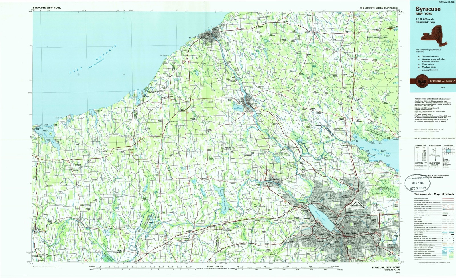
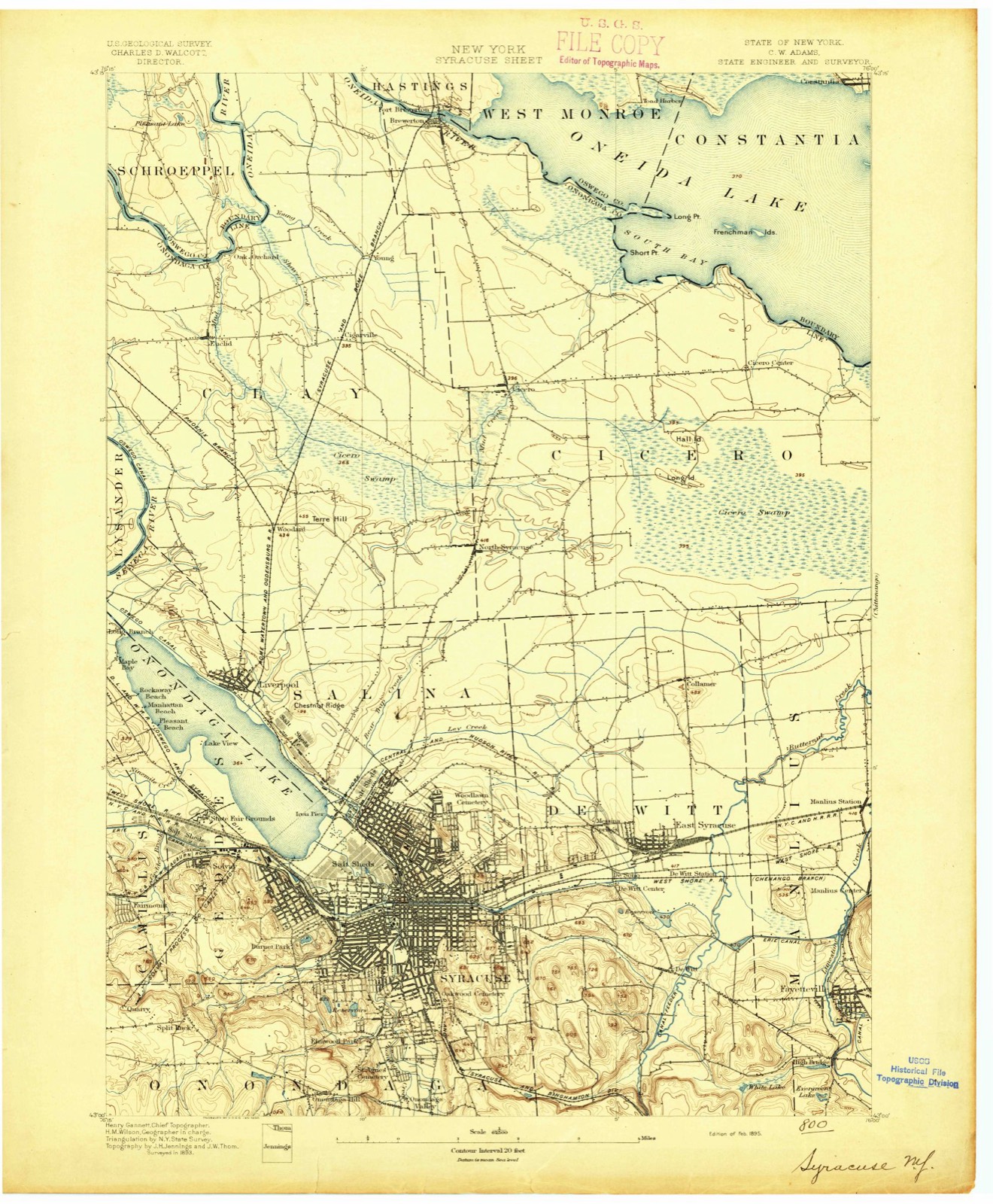
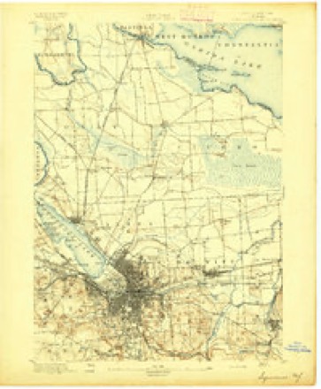
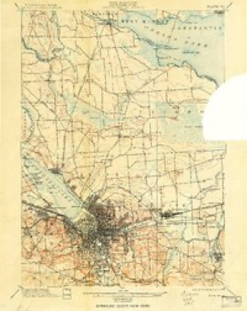
1895 to 1985The same ground, surveyed 90 years apart. Drag the handle to wipe between them. Both sheets are United States Geological Survey originals; neither has been altered.
On record in Syracuse
Buildings and businesses the archive holds for this place. Each opens its own page, with the source record it came from.
On the National Register 12 of 128 shown
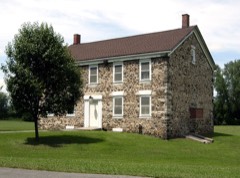 Alvord Houselisted 1976
 Amos Blocklisted 1978
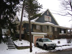 Ashton Houselisted 1997
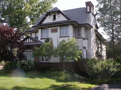 John G. Ayling Houselisted 2011
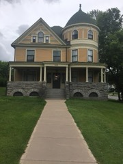 Babcock-Shattuck Houselisted 2004
 Barnes-Hiscock House, Thelisted 2010
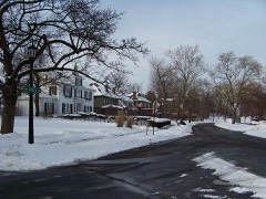 Berkeley Park Subdivision Historic Districtlisted 2002
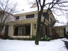 Blanchard Houselisted 1997
 Alexander Brown Houselisted 1988
 Buildings at 500 and 506 Erie Boulevard Eastlisted 2023
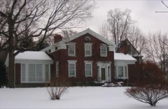 Harry N. Burhans Houselisted 2007
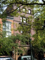 Central New York Telephone and Telegraph Buildinglisted 1973
Population over time
2 figuresSyracuse grew from 145,170 to 148,620 between 2010 and 2020. These are the recorded population figures Wikidata holds for this place, reached through the Geographic Names Information System number this page is keyed on rather than by name, so they belong to this place and not to another of the same name. Most are census counts, but not all are: an early figure may be a founding or settlement estimate, and an estimate published within five years of a census is left out. The change column is computed, and is left blank where more than 20 years separate a figure from the one before it, because a gap that long is not a change between two counts.
| Year | People | Change |
|---|---|---|
| 2010 | 145,170 | |
| 2020 | 148,620 | +3,450 (+2%) |
Topographic sheets covering this place
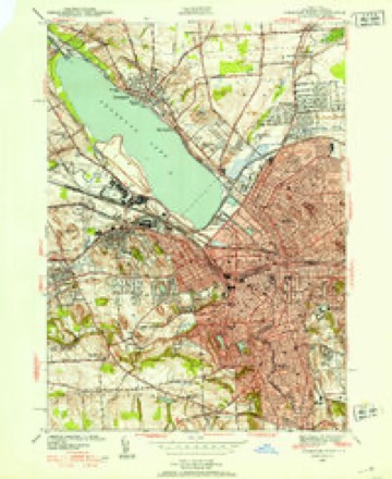
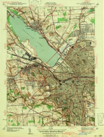
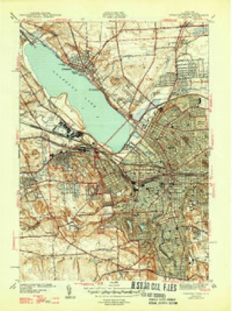
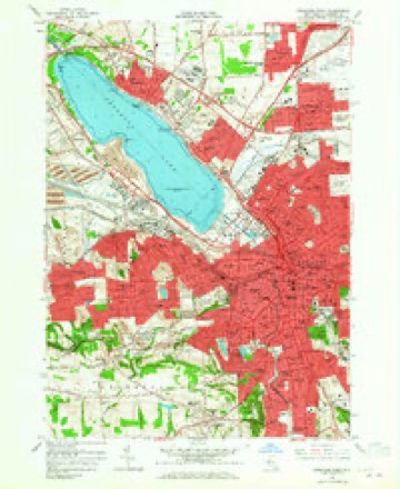
11 surveys from 29 printed sheetsMatched by testing this settlement's coordinate against the published boundary of every sheet in the United States Geological Survey's historical collection. Each opens the scanned sheet at the Survey.
- 1895 USGS Syracuse quadrangle1:62500
- 1898 USGS Syracuse quadrangle1:62500, 10 printings
- 1939 USGS Syracuse West quadrangle1:24000, 2 printings
- 1939 USGS Syracuse West quadrangle1:31680
- 1947 USGS Syracuse West quadrangle1:31680, 2 printings
- 1958 USGS Syracuse West quadrangle1:24000, 2 printings
- 1960 USGS Rochester quadrangle1:250000, 2 printings
- 1961 USGS Rochester quadrangle1:250000, 3 printings
- 1965 USGS Rochester quadrangle1:250000
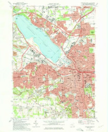
- 1973 USGS Syracuse West quadrangle1:24000, 2 printings
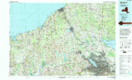
- 1985 USGS Syracuse quadrangle1:100000, 3 printings
Fires near this place
589 since 2000Regional context, not property-specific evidence. The federal wildfire occurrence database lists 589 fires within 5 miles of Syracuse between 2000 and 2020, burning about 337 acres in total. 40 started naturally. 94 were recorded as arson. Distance is straight-line from the map coordinates, so a fire counted here may appear on a neighbouring settlement's page as well.
| Reported cause | Fires |
|---|---|
| Missing data/not specified/undetermined | 304 |
| Arson/incendiarism | 94 |
| Smoking | 59 |
| Natural | 40 |
| Equipment and vehicle use | 27 |
| Debris and open burning | 27 |
| Misuse of fire by a minor | 17 |
| Recreation and ceremony | 11 |
| Power generation/transmission/distribution | 10 |
The most recent of them, most recent first, with the day each was reported and the service that recorded it.
| Date | Cause | Size | Reported by | Name on the report |
|---|---|---|---|---|
| 9 September 2015 | Missing data/not specified/undetermined | under an acre | Fire Department of New York | NA |
| 9 September 2011 | Recreation and ceremony | under an acre | Fire Department of New York | not named |
| 8 September 2020 | Equipment and vehicle use | under an acre | Fire Department of New York | NA |
| 8 September 2015 | Missing data/not specified/undetermined | under an acre | Fire Department of New York | NA |
| 8 September 2008 | Smoking | under an acre | Fire Department of New York | not named |
| 7 September 2008 | Missing data/not specified/undetermined | 1.0 acres | Fire Department of New York | not named |
| 6 September 2015 | Recreation and ceremony | under an acre | Fire Department of New York | N/A |
| 6 September 2007 | Missing data/not specified/undetermined | under an acre | Fire Department of New York | not named |
Settlements close enough to share some of these fires:
Mines and quarries near this place
10 of 12 shownRegional context, not property-specific evidence. The federal mineral resources record lists 12 workings within 5 miles of Syracuse: 10 past producers, 2 producers. 2 still produce. What was taken out: Gypsum-Anhydrite, Sand and Gravel, Construction, Stone, Crushed/Broken, Calcium. Distance is straight-line from the map coordinates, so a quarry counted here may appear on a neighbouring settlement's page as well.
| Where | Site | Commodity | Status | Recorded |
|---|---|---|---|---|
| Jamesville Quarry | Limestone, General | Past Producer | Sedimentary | |
| Jamesville Quarry | Calcium | Producer | ||
| Jamesville Quarry & Cement Plant | Stone, Crushed/Broken | Past Producer | ||
| Jamesville Quarry and Mill | Calcium | Past Producer | Calcite | |
| Rock Cut Quarry | Stone, Crushed/Broken | Producer | ||
| Van Slyke Pit | Sand and Gravel, Construction | Past Producer | Sedimentary | |
| Van Slyke Pit | Sand and Gravel, Construction | Past Producer | ||
| Unnamed Gypsum Quarry | Gypsum-Anhydrite | Past Producer | ||
| Unnamed Gypsum Quarry | Gypsum-Anhydrite | Past Producer | ||
| Unnamed Gypsum Quarry | Gypsum-Anhydrite | Past Producer |
Storms near this place
60 of 61 shownRegional context, not property-specific evidence. The National Weather Service names Syracuse in 61 storm reports between 1993 and 2024: 36 thunderstorm wind, 11 hail, 6 lightning, 4 flash flood. The reports record 1 death and 13 injuries. Each account below is quoted exactly as the forecast office filed it, from the NOAA Storm Events Database, and each date opens the federal record of that event.
| When | Event | Place named | Harm | What the report says |
|---|---|---|---|---|
| August 2004 | Lightning | Syracuse | 1 killed | A 12-year-old boy was killed by lightning. His mother and a neighbor took shelter from a thunderstorm under a tree in Assumption Cemetery. Both the boy and his mother had bicycles with them. The neighbor was in a wheelchair. The mother and neighbor felt the lightning but were not injured. Lightning also took out power to 1,000 customers in nearby DeWitt. |
| July 1999 | Thunderstorm Wind | Syracuse | 11 hurt, $500,000 | Numerous tents and booths were damaged or blown down at the county Fairgrounds during the "Taste of Syracuse" festival. |
| July 1994 | Thunderstorm Wind | Syracuse | 1 hurt, $5,000 | Thunderstorms produces damaging winds which downed trees and power lines. Some of the trees were up to one foot in diameter. One person was struck by lightning in Onondaga County. |
| July 1999 | Lightning | Syracuse | 1 hurt | Lightning struck a Rural/Metro driver in North Syracuse who was operating the passenger lift of a van and holding an umbrella. She did not suffer life-threatening injuries but was treated at a nearby hospital. |
| June 2015 | Flash Flood | East Syracuse | $500,000 | Numerous vehicles were stranded in deep, ponded water throughout the City of Syracuse. |
| July 2005 | Flash Flood | Syracuse | $500,000 | Nearly stationary thunderstorms with heavy rain caused a flash flood in Syracuse, DeWitt, and Mattydale. Rainfall was 2 to 4 inches in less than 2 hours. The Syracuse airport ASOS measured 2.38 inches of rain. The ground was moist from showers and thunderstorms the day before. Flooding closed numerous roads and train tracks including State Route 5. Dozens of cars were under water some up to hood. Dozens of homes and businesses had several feet of water in them. Roads were damaged. |
| August 1993 | Thunderstorm Wind | Syracuse | $500,000 | Severe thunderstorms produced golfball-size hail and winds which downed trees and power lines. The hardest hit area was East Syracuse. |
| August 1993 | Tornado (F1) | Syracuse | $500,000 | no account filed |
| August 1993 | Thunderstorm Wind | Syracuse | $50,000 | Severe thunderstorms produced golfball-size hail and winds which downed trees and power lines. The hardest hit area was East Syracuse. |
| May 1993 | Thunderstorm Wind | Syracuse | $50,000 | Thunderstorms developed in a moist, southerly flow ahead of a cold front. The thunderstorm winds downed trees and wires. Three-quarter inch hail fell at Silver Lake. |
| April 2005 | Flash Flood | East Syracuse | $50,000 | no account filed |
| June 1994 | Thunderstorm Wind | Syracuse | $50,000 | no account filed |
| August 1993 | Thunderstorm Wind | Syracuse | $50,000 | no account filed |
| July 2014 | Thunderstorm Wind | East Syracuse | $30,000 | Numerous trees were blown down on houses. |
| August 2021 | Flash Flood | East Syracuse | $20,000 | Serious urban flooding was reported from East Syracuse across the southern sections of the City of Syracuse and portions of Onondaga county. |
| July 2014 | Thunderstorm Wind | East Syracuse | $20,000 | A confirmed microburst produced winds of between 65 and 75 MPH in East Syracuse. Widespread tree damage and a few snapped power poles occurred. |
| May 2004 | Lightning | Syracuse | $20,000 | Lightning struck a vacant house at 201 Elliott Street in Syracuse. "The house, under repair from a previous fire, had extensive fire damage." |
| June 2002 | Flood | Syracuse | $20,000 | Heavy thunderstorm rains caused street and basement flooding. Some cars were under water. Sump pumps in the Hotel Syracuse were overwhelmed. The fire department came in and pumped out a foot of water in the basement and 6 feet of water in the elevator shaft. The rain fell on wet ground from earlier thunderstorms that day in addition to rain from earlier in the week. |
| June 2002 | Lightning | Syracuse | $20,000 | Lightning struck the roof and chimney of a three story apartment building. Bricks flew as far as 100 feet. These flying bricks broke building and car windows across the street at Hiawatha Used Cars, bore holes in the roof of another building, and dented the siding of Tucci Furniture across the street. The lightning knocked out a window and partially collapsed a ceiling on the third floor. The seven families in the building had to find somewhere else to stay until the building was repaired. |
| July 2017 | Thunderstorm Wind | East Syracuse | $15,000 | A thunderstorm moved across the region and became severe. This thunderstorm produced severe winds and tore the roof off Syracuse Diesel and Electric. |
| July 1999 | Thunderstorm Wind | North Syracuse | $15,000 | Several trees and powerlines blown down. |
| August 1995 | Thunderstorm Wind | Syracuse | $15,000 | no account filed |
| June 2013 | Thunderstorm Wind | North Syracuse | $10,000 | Large branch was blown down on car and garage. |
| May 2004 | Lightning | Syracuse | $10,000 | Lightning struck the police headquarters on 550 South State Street blowing out the department's computer system. The computer system was still down the next afternoon. Time was estimated. |
| August 2002 | Lightning | Syracuse | $10,000 | A Beech 1900 aircraft with 20 passengers had to make an emergency landing at Syracuse Hancock International Airport after lightning knocked out its right engine. The Air Midwest commuter plane, working for US Airways, was on its way from Watertown to Pittsburgh. |
| May 1996 | Thunderstorm Wind | Syracuse | $8,000 | no account filed |
| July 2020 | Thunderstorm Wind | East Syracuse | $5,000 | Strong thunderstorm winds brought down power lines at Smith Street and near Thompson Road. |
| July 2019 | Thunderstorm Wind | North Syracuse | $5,000 | Strong thunderstorm winds brought down trees. |
| August 2017 | Thunderstorm Wind | North Syracuse | $5,000 | A thunderstorm moved across the region and became severe. This thunderstorm produced severe winds and knocked over trees and wires. |
| August 2017 | Thunderstorm Wind | North Syracuse | $5,000 | A thunderstorm moved across the region and became severe. This thunderstorm produced severe winds and knocked over trees and wires. |
| August 2017 | Thunderstorm Wind | North Syracuse | $5,000 | A thunderstorm moved across the region and became severe. This thunderstorm produced severe winds and knocked over trees and wires. |
| June 1994 | Thunderstorm Wind | Syracuse | $5,000 | no account filed |
| June 1994 | Thunderstorm Wind | Syracuse | $5,000 | no account filed |
| June 1995 | Thunderstorm Wind | Syracuse | $3,000 | Severe thunderstorms moved across portions of the Genesee Valley and the Finger Lakes Region. There were numerous reports of downed trees and power lines. |
| August 2006 | Thunderstorm Wind | Syracuse | $2,000 | A dozen trees were blown down near Crawford Avenue. |
| August 2006 | Thunderstorm Wind | Syracuse | $2,000 | Numerous trees were knocked down on the Syracuse University campus. |
| July 2006 | Thunderstorm Wind | Syracuse | $2,000 | Numerous trees and wires down. 8000 customers were without power in the Syracuse area. |
| November 2006 | Thunderstorm Wind | Syracuse | $2,000 | A 74 mph wind gust was measured on the roof of the Carrier Dome in Syracuse. |
| July 2024 | Thunderstorm Wind | North Syracuse | $1,000 | Strong thunderstorm winds knocked down a tree on Bear Road near Harris Circle. |
| June 2021 | Thunderstorm Wind | East Syracuse | $1,000 | Strong thunderstorm winds knocked down tree onto wires. |
| September 2012 | Thunderstorm Wind | North Syracuse | $1,000 | A tree fell against a house at Hamilton Road and Kennedy Lane. |
| September 2012 | Thunderstorm Wind | North Syracuse | $1,000 | A tree and power lines were blown down near the intersection of Hopkins and Buckley Roads. |
| September 2012 | Thunderstorm Wind | East Syracuse | $1,000 | Power lines were blown down across Caleb Avenue. |
| June 2008 | Thunderstorm Wind | East Syracuse | $1,000 | Large tree limbs and power lines were blown down. |
| March 2007 | Flood | Syracuse | - | Minor flooding occurred on the Onondaga Creek at Syracuse from the evening hours of March 14th to the morning of the 15th. The creek at Syracuse crested at 5.1 feet which is .1 feet over the flood stage of 5 feet. Over an inch of rain combining with snowmelt caused the minor flooding. |
| November 2005 | Thunderstorm Wind | Syracuse | - | 69 mph measured wind gust by ASOS at Syracuse Hancock Field. |
| May 2004 | Hail | North Syracuse | - | 0.75 inch hail. |
| May 2001 | Thunderstorm Wind | East Syracuse | - | Pea-sized hail and wind gusts to 50 MPH were reported by a television meteorologist. |
| November 2001 | Thunderstorm Wind | Syracuse | - | Telephone pole with transformer fell on State Fair Boulevard next to the the Interstate 690 West on ramp. Utility pole also fell in Central Square. A total of 5,000 customers were without power. |
| June 2000 | Flood | Syracuse | - | Heavy thunderstorm rains caused significant ponding of water on Park Street, McBride Street, and Burt Street. Route 174 as well as the northbound lanes of Interstate 81 were closed for a short time. |
| June 2000 | Thunderstorm Wind | North Syracuse | - | Storm spotters reported a tree down on a house on Fly Road. Thunderstorm winds also ripped a roof top air conditioning unit off of a factory in DeWitt. 1 inch diameter hail was reported in Mattydale. Wires down across the region left 6000 people in the Syracuse area without power. A lightning strike at a Wal-Mart shopping center on the east side of Syracuse caused damage to merchandise outside of the store. |
| August 2011 | Hail | East Syracuse | - | no account filed |
| August 2011 | Hail | East Syracuse | - | no account filed |
| April 2011 | Hail | East Syracuse | - | no account filed |
| August 2011 | Hail | East Syracuse | - | no account filed |
| April 2011 | Hail | North Syracuse | - | no account filed |
| June 2008 | Hail | North Syracuse | - | no account filed |
| June 2008 | Hail | North Syracuse | - | no account filed |
| June 2008 | Hail | East Syracuse | - | no account filed |
| May 2000 | Hail | North Syracuse | - | no account filed |
Nearest settlements
The eight closest, with where each one stands in the county. Distances are straight-line, computed from the Geographic Names Information System coordinates.
Elsewhere
Matched on this settlement's Geographic Names Information System number rather than its name, so it cannot be a different place of the same name in another state.
| Wikipedia article on Syracuse | An encyclopaedic summary. Its text is share-alike, so it is linked here rather than copied. |
| Wikidata item Q128069 | The structured record the population and elevation above come from. Public domain (CC0). |
Provenance
This settlement is recorded in the Geographic Names Information System as feature 966966. The sheet list is computed by point-in-boundary test against the United States Geological Survey's historical topographic inventory. Both are works of the United States government and carry no copyright under 17 U.S.C. 105.
Wildfire. Short, Karen C. 2022. Spatial wildfire occurrence data for the United States, 1992-2020 [FPA_FOD_20221014]. 6th Edition. Fort Collins, CO: Forest Service Research Data Archive. https://doi.org/10.2737/RDS-2013-0009.6 Collected with United States Government funding and usable without additional permissions or fees.
Mines and quarries. USGS Mineral Resources Data System (MRDS) https://mrdata.usgs.gov/mrds/ A work of the United States government, no copyright under 17 U.S.C. 105.
Storms. NOAA National Centers for Environmental Information, Storm Events Database https://www.ncei.noaa.gov/stormevents/ A work of the United States government, no copyright under 17 U.S.C. 105. Narratives are quoted verbatim from the National Weather Service report and are not edited or summarised.