 Block
BlockWhitehall, New York
30 topographic sheets cover this place, the earliest surveyed in 1893 and the latest in 1989. It stands in Whitehall town. It lies in ZIP code area 12887. It lies near Skene Mountain. The Survey maps it on the Whitehall quadrangle. 2,465 people lived here at the 2020 count. It stands 153 feet above sea level.
Research this city
Then and now
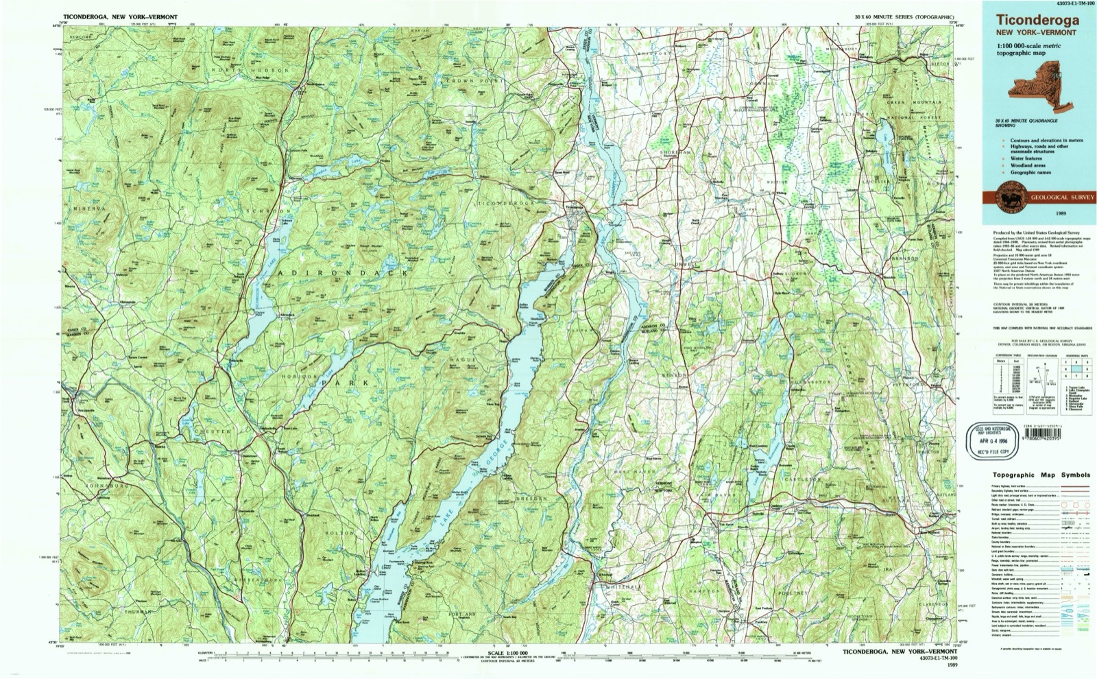
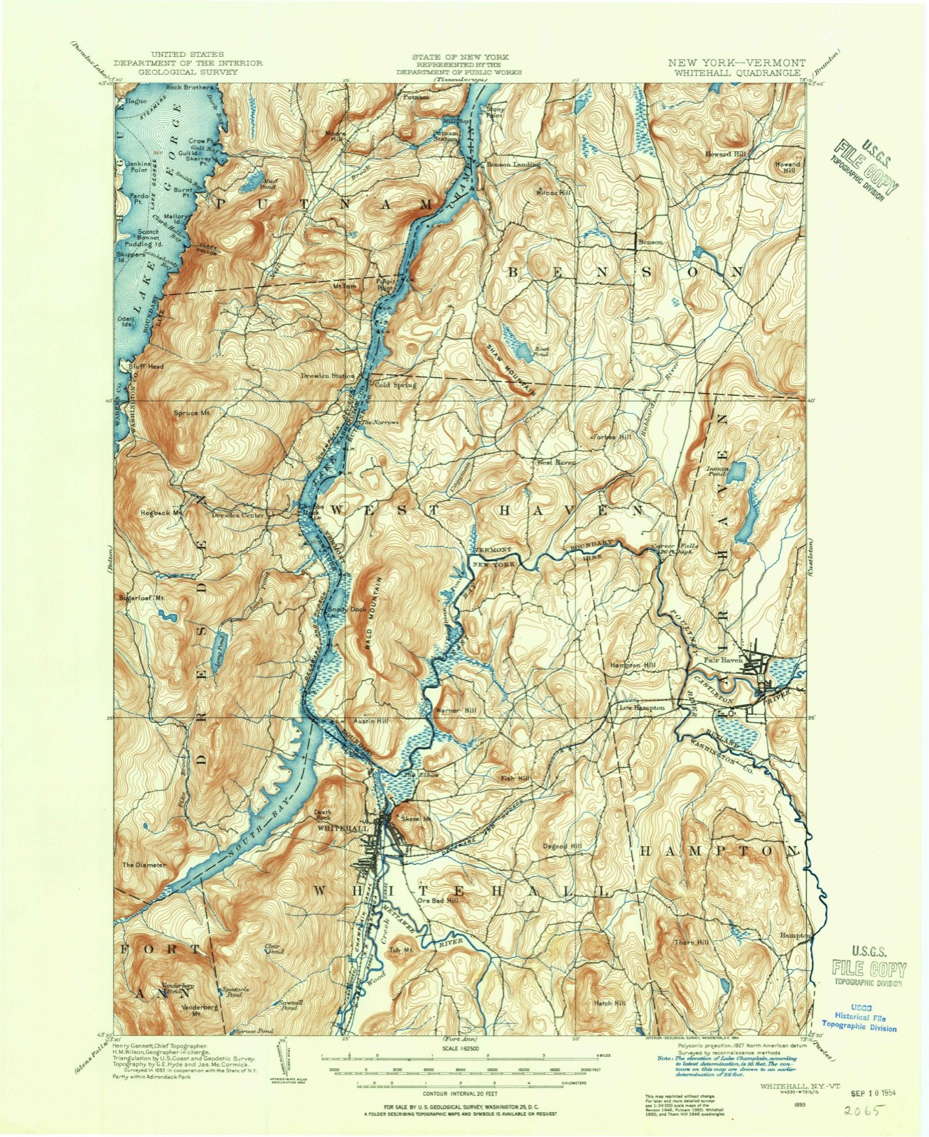
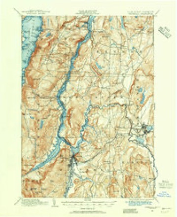
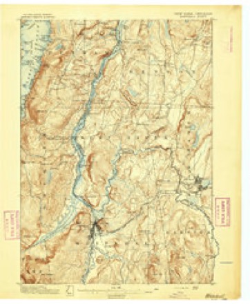
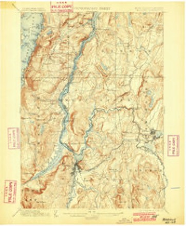
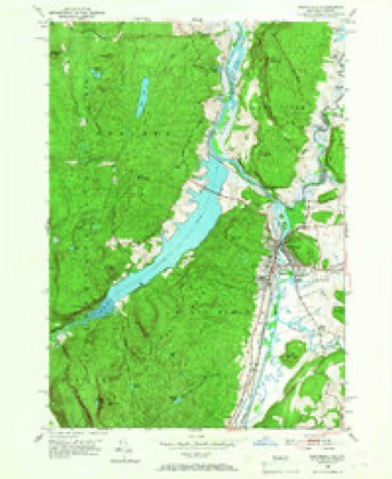
1893 to 1989The same ground, surveyed 96 years apart. Drag the handle to wipe between them. Both sheets are United States Geological Survey originals; neither has been altered.
On record in Whitehall
Buildings and businesses the archive holds for this place. Each opens its own page, with the source record it came from.
On the National Register 5 records
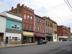 Main Street Historic Districtlisted 1975
 Judge Joseph Potter Houselisted 1974
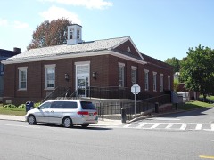 US Post Office-Whitehalllisted 1989
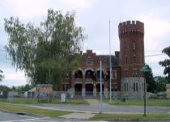 Whitehall Armorylisted 1995
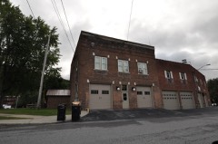 Whitehall Fire Stationlisted 2018
Population over time
3 figuresWhitehall fell from 2,616 to 2,465 between 2000 and 2020. These are the recorded population figures Wikidata holds for this place, reached through the Geographic Names Information System number this page is keyed on rather than by name, so they belong to this place and not to another of the same name. Most are census counts, but not all are: an early figure may be a founding or settlement estimate, and an estimate published within five years of a census is left out. The change column is computed, and is left blank where more than 20 years separate a figure from the one before it, because a gap that long is not a change between two counts.
| Year | People | Change |
|---|---|---|
| 2000 | 2,616 | |
| 2010 | 2,614 | -2 (-0%) |
| 2020 | 2,465 | -149 (-6%) |
Topographic sheets covering this place
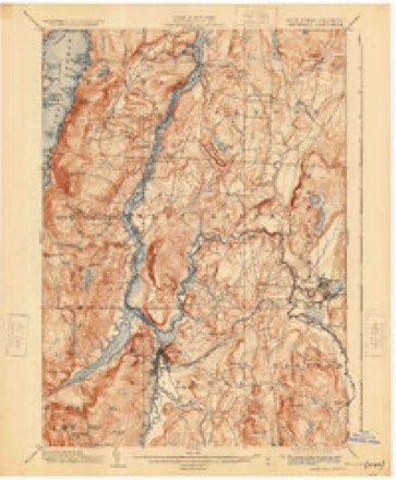
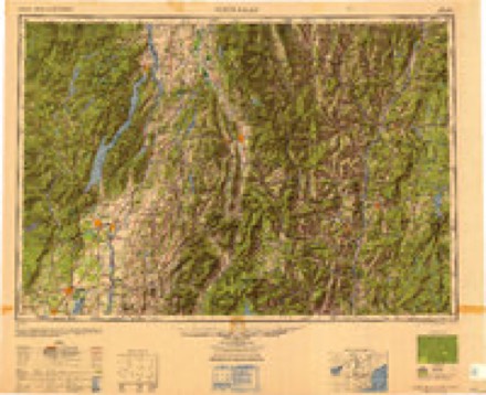
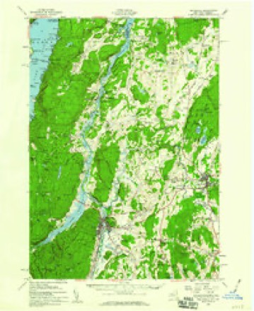
12 surveys from 30 printed sheetsMatched by testing this settlement's coordinate against the published boundary of every sheet in the United States Geological Survey's historical collection. Each opens the scanned sheet at the Survey.
- 1893 USGS Whitehall quadrangle1:62500
- 1895 USGS Whitehall quadrangle1:62500
- 1898 USGS Whitehall quadrangle1:62500, 2 printings
- 1902 USGS Whitehall quadrangle1:62500, 10 printings
- 1950 USGS Glens Falls quadrangle1:250000
- 1950 USGS Whitehall quadrangle1:24000, 4 printings
- 1950 USGS Whitehall quadrangle1:62500, 2 printings
- 1956 USGS Glens Falls quadrangle1:250000, 3 printings
- 1959 USGS Glens Falls quadrangle1:250000, 2 printings
- 1964 USGS Glens Falls quadrangle1:250000
- 1986 USGS Ticonderoga quadrangle1:100000
- 1989 USGS Ticonderoga quadrangle1:100000, 2 printings
Fires near this place
71 since 1995Regional context, not property-specific evidence. The federal wildfire occurrence database lists 71 fires within 5 miles of Whitehall between 1995 and 2020, burning about 155 acres in total. 5 started naturally. 15 were recorded as arson. Distance is straight-line from the map coordinates, so a fire counted here may appear on a neighbouring settlement's page as well.
| Reported cause | Fires |
|---|---|
| Missing data/not specified/undetermined | 31 |
| Arson/incendiarism | 15 |
| Debris and open burning | 10 |
| Natural | 5 |
| Recreation and ceremony | 4 |
| Other causes | 2 |
| Power generation/transmission/distribution | 2 |
| Railroad operations and maintenance | 2 |
The most recent of them, most recent first, with the day each was reported and the service that recorded it.
| Date | Cause | Size | Reported by | Name on the report |
|---|---|---|---|---|
| 27 September 2014 | Arson/incendiarism | under an acre | Fire Department of New York | N/A |
| 27 September 2014 | Missing data/not specified/undetermined | 62 acres | Vermont Division of Forestry | not named |
| 16 September 2008 | Arson/incendiarism | under an acre | Fire Department of New York | not named |
| 2 August 2014 | Missing data/not specified/undetermined | under an acre | Fire Department of New York | N/A |
| 18 August 2002 | Missing data/not specified/undetermined | 1.4 acres | Fire Department of New York | not named |
| 18 August 2002 | Other causes | 2.0 acres | New York Forest Rangers | CRUSHER HILL FIRE |
| 6 July 2016 | Natural | under an acre | Fire Department of New York | N/A |
| 4 July 2003 | Missing data/not specified/undetermined | under an acre | Fire Department of New York | not named |
Settlements close enough to share some of these fires:
Mines and quarries near this place
10 of 13 shownRegional context, not property-specific evidence. The federal mineral resources record lists 13 workings within 5 miles of Whitehall: 12 past producers, 1 occurrence. None of them still produces. What was taken out: Graphite, Sulfur-Pyrite, Feldspar, Quartz, Quartz, Feldspar, Mica. Distance is straight-line from the map coordinates, so a quarry counted here may appear on a neighbouring settlement's page as well.
| Where | Site | Commodity | Status | Recorded |
|---|---|---|---|---|
| Adirondack Mining and Milling Co Mine | Graphite, Quartz, Feldspar, Mica | Past Producer | 1904, 1907 | |
| Ainsworth Quarry | Slate, Dimension | Past Producer | 1874, 1892 | |
| Arana Marble Co. Mine | Limestone, General | Past Producer | 1897 | |
| Hooper Brothers Mine | Graphite, Quartz, Feldspar, Sulfur-Pyrite | Past Producer | 1916, 1921 | |
| Whitehall Quarry | Stone, Crushed/Broken | Past Producer | Sandstone | |
| Champlain Graphite Co. Mine | Graphite, Sulfur-Pyrite | Past Producer | Metamorphic | |
| Champlain Graphite Company Mine | Graphite, Feldspar, Quartz | Past Producer | 1904, 1908 | |
| Hooper Bros. Mine | Graphite, Sulfur-Pyrite | Past Producer | Graphite, Pyrite | |
| Silver Leaf Co. Prospect | Graphite, Feldspar, Quartz | Occurrence | 1904, 1907 | |
| Adirondack Mining & Milling Co.Mine | Graphite | Past Producer |
Storms near this place
52 since 1994Regional context, not property-specific evidence. The National Weather Service names Whitehall in 52 storm reports between 1994 and 2024: 31 thunderstorm wind, 9 flood, 8 flash flood, 4 hail. No death or injury is recorded in these reports. Each account below is quoted exactly as the forecast office filed it, from the NOAA Storm Events Database, and each date opens the federal record of that event.
| When | Event | Place named | Harm | What the report says |
|---|---|---|---|---|
| August 2020 | Flash Flood | East Whitehall | $16,000,000 | The Whitehall Central Schools' Superintendent reported that 100 percent of the Junior-Senior High School had flood waters inside, resulting in major damage. |
| August 2020 | Flood | Whitehall | $16,000,000 | no account filed |
| April 2011 | Flood | Whitehall | $53,000 | Widespread flooding occurred in and near the Village of Whitehall due to high water on Lake Champlain. The Lake Champlain river gauge north of Whitehall went over flood stage on April 13th and continued to rise through the end of the month. ||Areas where flooding were reported: Lower and North Main Street, North Williams Road|Doig Street (County Road 10), East Bay Road and South Bay including Route 22. |
| June 1998 | Flash Flood | Whitehall | $50,000 | Thunderstorms with torrential rain produced flash flooding at Whitehall in Washington County. A State of Emergency was declared in the village. Several roads were washed out and 15 to 20 basements were pumped out. |
| December 1996 | Flash Flood | Whitehall | $50,000 | no account filed |
| August 2020 | Flash Flood | Whitehall | $20,000 | Cars were submerged in flood waters near Intersection of Route 4 and Route 22 in the town of Whitehall. |
| June 1998 | Thunderstorm Wind | Whitehall | $18,000 | no account filed |
| August 2020 | Thunderstorm Wind | Whitehall | $10,000 | Numerous snapped and downed trees near Skenesborough Drive in Whitehall. A house nearby also had roof damage. |
| May 2002 | Thunderstorm Wind | Whitehall | $10,000 | no account filed |
| August 2020 | Flash Flood | Whitehall | $5,000 | Gilmore Street was flooded with a car partially submerged in flood waters. |
| June 1994 | Thunderstorm Wind | Whitehall | $5,000 | Severe thunderstorms moved across eastern New York during the afternoon and evening of June 12th downing trees and powerlines and dumping large hail across parts of the area. The hardest hit areas were Sprakers in Montgomery County and Queensbury in Warren County. In Sprakers straight-line winds uprooted trees, removed shingles from homes, and overturned hay wagons. One of the trees which fell completely crushed a car. Hail up to golf ball-size ruined crops in local gardens. In Queensbury thunderstorm winds downed trees and powerlines along several roads. |
| May 1995 | Thunderstorm Wind | Whitehall | $5,000 | no account filed |
| July 1994 | Thunderstorm Wind | Whitehall | $5,000 | no account filed |
| July 1994 | Thunderstorm Wind | Whitehall | $5,000 | no account filed |
| May 1998 | Thunderstorm Wind | Whitehall | $3,000 | no account filed |
| August 1996 | Thunderstorm Wind | Whitehall | $3,000 | no account filed |
| August 2020 | Flash Flood | Whitehall | $2,000 | Broadway Street in the town of Whitehall was flooded, with an estimated 4 to 5 feet of water. |
| May 2018 | Flood | Whitehall | $1,000 | Minor to moderate flooding occurred along the south end of Lake Champlain in the village of Whitehall. Yards were flooded along Lower Main Street and North William Street, and water partially surrounded a building at the Whitehall RV Campground. Water levels peaked during the morning of May 7th. |
| June 2024 | Thunderstorm Wind | Whitehall | - | Trees and wires were downed along County Route 7 near State Route 22. |
| August 2023 | Hail | Whitehall | - | Quarter size hail was reported along Saunders Street in Whitehall. |
| July 2023 | Thunderstorm Wind | Whitehall | - | Multiple trees and wires were reported down across the county. |
| July 2023 | Thunderstorm Wind | Whitehall | - | A tree was downed across State Route 4 near Whitehall. |
| July 2022 | Thunderstorm Wind | Whitehall | - | A tree and wires were reported down on US Route 4. |
| August 2022 | Thunderstorm Wind | Whitehall | - | Two trees were downed in the Village of Whitehall. |
| June 2021 | Thunderstorm Wind | Whitehall | - | A tree was downed across the roadway. |
| September 2021 | Thunderstorm Wind | East Whitehall | - | Wires were reported down on Park Avenue. |
| August 2020 | Thunderstorm Wind | Whitehall | - | Trees were downed onto wires on Gilmore Street and Potter Terrace. Time was estimated by radar. |
| August 2020 | Thunderstorm Wind | Whitehall | - | Trees were downed on North and South Williams Streets and County Route 12. A tree was downed onto a vehicle along South Williams Street. Time was estimated by radar. |
| August 2020 | Thunderstorm Wind | Whitehall | - | Trees were downed on Skenesborough Drive in the front of Skeneborough EMS Building. |
| August 2020 | Thunderstorm Wind | East Whitehall | - | Trees were downed on wires along Route 12/Upper Turnpike Road. Time was estimated by radar. |
| August 2020 | Thunderstorm Wind | Whitehall | - | Trees were downed on several roads, including Bellamy, North, West, Saunders and Kirtland Streets and on Railroad Avenue. Tree was downed onto a vehicle on Kirtland. Time was estimated by radar. |
| August 2020 | Thunderstorm Wind | Whitehall | - | Trees were downed onto wires along North Mountain Street as well as a tree downed on McCotter Street. Time was estimated by radar. |
| August 2020 | Thunderstorm Wind | Whitehall | - | A tree was downed onto wires along County Route 7 and Blue Goose Road. Time was estimated by radar. |
| January 2019 | Flood | East Whitehall | - | Gray Lane at Upper Turnpike Road was closed due to flooding along the Mettawee River. |
| June 2018 | Thunderstorm Wind | Whitehall | - | Several large tree limbs were downed. |
| August 2018 | Thunderstorm Wind | Whitehall | - | A tree was downed across Stalker Road. |
| July 2017 | Flood | East Whitehall | - | Heavy rainfall caused rapid rises on the Mettawee River near Granville. The river crested at 9.95 feet, just below major flood stage. At 3:30 am EST, the river began to flood low-lying fields adjacent to the river bank. At 4:30 am EST, Upper Turnpike Road was covered in water on both sides of the bridge over the Mettawee, and Grey Lane had washed out. The water receded later that morning. |
| July 2014 | Thunderstorm Wind | Whitehall | - | A thunderstorm wind gust measured at 68 MPH was reported by a member of the public and relayed via Facebook. |
| June 2014 | Thunderstorm Wind | Whitehall | - | Trees and wires were reported down on South William Street in Whitehall due to thunderstorm winds. |
| June 2011 | Flood | Whitehall | - | Widespread flooding continued in and near the Village of Whitehall due to high water on Lake Champlain. The village was flooded north of Williams Street. Dozens of homes and businesses north of Lock 12 on both sides of the Champlain Canal were under several feet of water. The worst flooding was reported to be along North Williams Street and at the new townhomes near the Whitehall Marina. |
| May 2011 | Flood | Whitehall | - | Widespread flooding continued in and near the Village of Whitehall due to high water on Lake Champlain. The village was flooded north of Williams Street. Dozens of homes and businesses north of Lock 12 on both sides of the Champlain Canal were under several feet of water. The worst flooding was reported to be along North Williams Street and at the new townhomes near the Whitehall Marina.||Amtrak halted service between Albany and Montreal on Wednesday, May 4th, due to flooding of tracks from heavy rainfall in the Adirondack Park's eastern boundary 2 miles north of the Village of Whitehall. Train service was restored Thursday morning, May 5th. |
| June 2009 | Thunderstorm Wind | Whitehall | - | Multiple trees were reported down in Whitehall due to strong thunderstorm winds. |
| July 2009 | Hail | Whitehall | - | Quarter size hail was reported in Whitehall during a thunderstorm. |
| July 2009 | Hail | Whitehall | - | Penny size hail was reported in Whitehall during a thunderstorm. |
| July 2009 | Flash Flood | East Whitehall | - | Upper Turnpike Road in Whitehall was closed due to flash flooding from very heavy rainfall. |
| April 2008 | Flood | Whitehall | - | The melting of a deep snowpack led to moderate or higher river flooding across portions of the upper Hudson River basin.||Snow water equivalents of nearly one foot began to melt during a warm period beginning around April 10th, and led to river flooding which persisted through the end of April.||Some summer campsites were flooded on the southern end of Lake Champlain due to the persistent high water levels. In addition, the New York State Canal Corporation was unable to open the Hudson-Champlain Canal in April due to high water levels. |
| June 2007 | Thunderstorm Wind | Whitehall | - | Numerous trees were reported down due to strong thunderstorm winds in Whitehall. |
| May 2006 | Flood | Whitehall | - | On May 8, the Champlain Canal in Whitehall had minor flooding due to the normal Spring-season high water level of Lake Champlain and a brisk northerly wind. The canal crested at a tenth of a foot above its 100-foot flood stage at 13:00 EST. |
| June 2006 | Thunderstorm Wind | Whitehall | - | Law enforcement personnel reported wires were blown down onto Route 12 in Whitehall. |
| June 2005 | Thunderstorm Wind | Whitehall | - | Trees were blown down, and power lines were knocked down. |
| August 2004 | Flash Flood | Whitehall | - | Broadway, West and Gilmore Streets closed due to flooding. Fern Street washed out. County Route 12 flooded over in several places. |
| June 1998 | Hail | Whitehall | - | no account filed |
Nearest settlements
The eight closest, with where each one stands in the county. Distances are straight-line, computed from the Geographic Names Information System coordinates.
| Map | Place | Distance | Sheets |
|---|---|---|---|
| Grays Corner | 2.0 miles | 30 | |
| East Whitehall | 4.3 miles | 29 | |
| Dresden Center | 5.8 miles | 31 | |
| Chubbs Dock | 5.8 miles | 31 | |
| Low Hampton | 6.0 miles | 29 | |
| South Bay | 6.0 miles | 31 | |
| Clemons | 6.0 miles | 31 | |
| Comstock | 7.1 miles | 28 |
Elsewhere
Matched on this settlement's Geographic Names Information System number rather than its name, so it cannot be a different place of the same name in another state.
| Wikipedia article on Whitehall | An encyclopaedic summary. Its text is share-alike, so it is linked here rather than copied. |
| Wikidata item Q3461864 | The structured record the population and elevation above come from. Public domain (CC0). |
Provenance
This settlement is recorded in the Geographic Names Information System as feature 971145. The sheet list is computed by point-in-boundary test against the United States Geological Survey's historical topographic inventory. Both are works of the United States government and carry no copyright under 17 U.S.C. 105.
Wildfire. Short, Karen C. 2022. Spatial wildfire occurrence data for the United States, 1992-2020 [FPA_FOD_20221014]. 6th Edition. Fort Collins, CO: Forest Service Research Data Archive. https://doi.org/10.2737/RDS-2013-0009.6 Collected with United States Government funding and usable without additional permissions or fees.
Mines and quarries. USGS Mineral Resources Data System (MRDS) https://mrdata.usgs.gov/mrds/ A work of the United States government, no copyright under 17 U.S.C. 105.
Storms. NOAA National Centers for Environmental Information, Storm Events Database https://www.ncei.noaa.gov/stormevents/ A work of the United States government, no copyright under 17 U.S.C. 105. Narratives are quoted verbatim from the National Weather Service report and are not edited or summarised.