BlockBefore
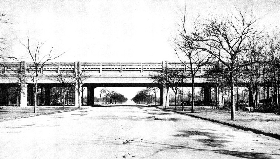
Photograph of Pelham Parkway station (IRT White Plains Road Line)
Photograph by James Blaine Walker, Public domain. Via Wikimedia Commons.

Pelham Parkway Station (Dual System IRT)

Listed on the National Register of Historic Places in 2005. 12 historic topographic surveys show this location, the earliest from 1898.

From the record

“The Pelham Parkway station is a local station on the IRT White Plains Road Line of the New York City Subway. Located at the intersection of Pelham Parkway and White Plains Road in the Pelham Parkway neighborhood of the Bronx, it is served by the 2 train at all times and by the 5 train during rush hours in the peak direction.”

Wikipedia article Pelham Parkway station (IRT White Plains Road Line), CC BY-SA 4.0.

One of 91 National Register listings published here for Bronx County · listed in 2005 · category: Structure.

Sources: the Wikipedia article · the case file at the National Archives · the National Register database, National Park Service
The listing

  • What is counted as historic. The nomination lists 1 structure as contributing to the listing.
  • Address. Jct. of White Plains Rd. and Pelham Pkwy, Bronx, 12569
  • When was it listed? March 2005
  • Category. structure
  • Also known as. New York City Subway System MPS
  • National Register reference number. 05000228 - the number the National Park Service assigned this property when it was listed, and the key its nomination file is catalogued under at the National Archives.

Storms near this property

31 since 1996

Regional context, not property-specific evidence. The National Weather Service names Bronx, the town this property stands in, in 31 storm reports between 1996 and 2025: 14 thunderstorm wind, 10 flash flood, 4 hail, 2 lightning. The reports record 1 death and 4 injuries. Each account below is quoted exactly as the forecast office filed it, from the NOAA Storm Events Database, and each date opens the federal record of that event.

WhenEvent Place namedHarm What the report says
September 1998Thunderstorm WindBronx1 killed, 2 hurtno account filed
June 2006LightningBronx1 hurtLightning stuck a person at Crotona Park pool. Extent of injuries unknown.
May 1997Thunderstorm WindBronx1 hurtno account filed
September 2012Thunderstorm WindBronx$12,500Numerous trees and limbs were reported down throughout the Bronx.
August 2020Thunderstorm WindBronx$1,000Large tree branch down on Hoe Avenue in the Longwood section of the Bronx.
July 2025Flash FloodBronx-Cross Bronx Expressway at Jerome Avenue closed in both directions due to flooding.
July 2022Flash FloodBronx-All lanes blocked on the I-87 Major Deegan Expressway Northbound approaching Exit 8 - West 179th Street.
July 2022HailBronx-MPING report of 1 inch hail.
July 2014Flash FloodBronx-All lanes were closed on the Cross Bronx Expressway at Jerome Ave. due to flooding. The northbound exit ramp to Jerome Ave. was also closed due to flooding.
July 2009Flash FloodBronx-In the neighborhood of Morrisania in the Bronx, 3rd Ave. in the vicinity of the Bronx-Lebanon Hospital was closed due to flooding.
June 2007Thunderstorm WindBronx-Large Tree and limbs down on West 231st Street between Palisade and Independence Avenues.
June 2007Flash FloodBronx-Flash Flooding of Major Deegan Expressway (I-87) Soutbound at 230th St (W).
October 2006Flash FloodBronx-Heavy rain produced flash flooding along portions of the Bronx River Parkway and Bruckner Expressway in East Tremont.
August 2004Thunderstorm WindBronx-A large tree was downed on Van Ness Street.
September 2004Flash FloodBronx-Flash flooding on the Bronx River Parkway.
May 2002Thunderstorm WindBronx-As a severe thunderstorm moved east, it produced high winds that downed trees at the intersection of the Henry Hudson Parkway and West 247th Street.
June 2002Thunderstorm WindBronx-Police reported that strong winds knocked down several trees and power lines.
June 2002Flash FloodBronx-Radio media reported widespread street flooding in the Bronx.
August 2002Thunderstorm WindBronx-New York City Office of Emergency Management reported a building collapse.
June 2002Thunderstorm WindBronx-Police reported that several trees were knocked down in the Bronx.
April 2007FloodBronx-no account filed
August 2004HailBronx-no account filed
May 2000Thunderstorm WindBronx-no account filed
August 2000Flash FloodBronx-no account filed
June 2000Thunderstorm WindBronx-no account filed
June 1998HailBronx-no account filed
July 1997Thunderstorm WindBronx-no account filed
May 1997Thunderstorm WindBronx-no account filed
November 1997HailBronx-no account filed
August 1996LightningBronx-no account filed
September 1996Flash FloodBronx-no account filed

Every storm recorded in Bronx County

Maps showing this location

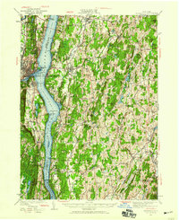
12 surveys

United States Geological Survey topographic sheets whose coverage includes this point. Matched by taking the coordinate the National Park Service records for this property, then testing that coordinate against the published boundary of every sheet.

Sources for this property

National Archives recordThe nomination case file for reference 05000228 in Record Group 79.
Wikipedia articleCommunity-written account of this property, licensed CC BY-SA.
Bronx CountyAll 91 listed properties in this county.

Provenance

  • Listing record. National Park Service National Register of Historic Places, listed-properties dataset, current to 2026-05-22.
  • Map join. Address geocoded through the United States Census geocoder, then tested against the published boundary of every sheet in the USGS Historical Topographic Map Collection.
  • How this page is made. Listing fields come from federal records; map-sheet coverage is a labelled coordinate-to-boundary calculation, not a source-field claim.
  • Storms. NOAA National Centers for Environmental Information, Storm Events Database https://www.ncei.noaa.gov/stormevents/ A work of the United States government, no copyright under 17 U.S.C. 105. Narratives are quoted verbatim from the National Weather Service report and are not edited or summarised.