Block
BlockFrom the record
One of 66 National Register listings published here for Broome County · listed in 2019 · category: Building.
Sources: the National Register database, National Park Service
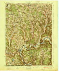
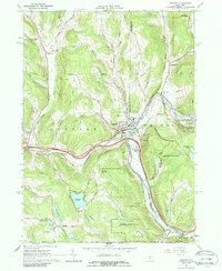
Listed on the National Register of Historic Places in 2019. 9 historic topographic surveys show this location, the earliest from 1924.
One of 66 National Register listings published here for Broome County · listed in 2019 · category: Building.
Sources: the National Register database, National Park Service
Regional context, not property-specific evidence. The federal wildfire occurrence database lists 47 fires within 5 miles of First Presbyterian Church of Deposit between 1995 and 2020, burning about 92 acres in total. None started naturally. 2 were recorded as arson. Distance is straight-line from the map coordinates, so a fire counted here may appear on a neighbouring settlement's page as well.
| Reported cause | Fires |
|---|---|
| Missing data/not specified/undetermined | 23 |
| Debris and open burning | 12 |
| Equipment and vehicle use | 8 |
| Arson/incendiarism | 2 |
| Power generation/transmission/distribution | 1 |
| Recreation and ceremony | 1 |
The most recent of them, most recent first, with the day each was reported and the service that recorded it.
| Date | Cause | Size | Reported by | Name on the report |
|---|---|---|---|---|
| 24 September 2008 | Missing data/not specified/undetermined | under an acre | Fire Department of New York | not named |
| 4 July 2020 | Equipment and vehicle use | 5.0 acres | Fire Department of New York | NA |
| 25 June 2010 | Missing data/not specified/undetermined | under an acre | Fire Department of New York | not named |
| 19 June 2020 | Equipment and vehicle use | under an acre | Fire Department of New York | NA |
| 5 May 2018 | Missing data/not specified/undetermined | under an acre | Fire Department of New York | N/A |
| 5 May 2007 | Debris and open burning | 1.1 acres | Fire Department of New York | not named |
| 5 May 2007 | Debris and open burning | 3.0 acres | Fire Department of New York | not named |
| 4 May 2006 | Equipment and vehicle use | under an acre | Fire Department of New York | not named |
Regional context, not property-specific evidence. The National Weather Service names Deposit, the town this property stands in, in 11 storm reports between 1995 and 2024: 7 thunderstorm wind, 2 flash flood, 1 tornado, 1 flood. No death or injury is recorded in these reports. Each account below is quoted exactly as the forecast office filed it, from the NOAA Storm Events Database, and each date opens the federal record of that event.
| When | Event | Place named | Harm | What the report says |
|---|---|---|---|---|
| July 2024 | Flash Flood | Deposit | $15,000 | A residence was flooded on Meadowlark Ln. |
| April 2019 | Thunderstorm Wind | Deposit | $15,000 | Cabins were damaged by strong thunderstorm winds. These winds also downed power poles and snapped trees. |
| May 2002 | Tornado (F0) | Deposit | $10,000 | The tornado initially touched down close to a campground off of H. Decker Road. The tornado then traveled northeast across a small lake. Minor tree damage was observed. An eyewitness reported seeing a swirling mass of debris which was mainly composed of leaves. He also saw a picnic table get lifted up and thrown about 50 yards into the lake. The tornado tracked to the northeast and lifted close to Blueberry Lake in Sanford township. There was no significant damage reported to structures from this tornado. Most of the damage from this tornado was to trees. |
| August 1995 | Thunderstorm Wind | Deposit | $8,000 | no account filed |
| August 2011 | Thunderstorm Wind | Deposit | $3,000 | Trees were blown down. |
| August 2011 | Thunderstorm Wind | Deposit | $3,000 | Trees were blown down. |
| August 2023 | Thunderstorm Wind | Deposit | $2,000 | Strong thunderstorm winds knocked down a tree on wires onto Nelson Frank Road. |
| August 2023 | Thunderstorm Wind | Deposit | $2,000 | Strong thunderstorm winds knocked down a tree onto wires on Old NY-17. |
| July 2016 | Thunderstorm Wind | Deposit | $1,000 | A thunderstorm moved into the area Monday afternoon and quickly became severe. The thunderstorm knocked a tree over which took down electric wires. |
| July 2024 | Flash Flood | Deposit | - | Several motorists reported significant flooding on State Route 17 westbound near Exit 83. Oquaga Creek parallels this highway and was out of its banks. |
| June 2006 | Flood | Deposit | - | no account filed |
United States Geological Survey topographic sheets whose coverage includes this point. Matched by taking the coordinate the National Park Service records for this property, then testing that coordinate against the published boundary of every sheet.
| National Archives record | The nomination case file for reference 100004734 in Record Group 79. |
| Broome County | All 66 listed properties in this county. |