Block
BlockFrom the record
One of 87 National Register listings published here for Schenectady County · listed in 2025 · category: Building.
Sources: the National Register database, National Park Service
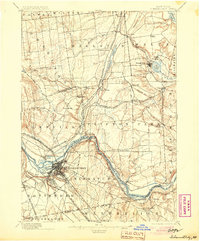
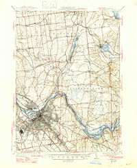
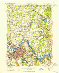
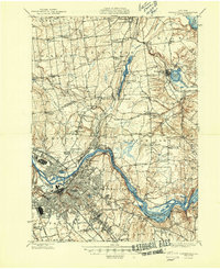
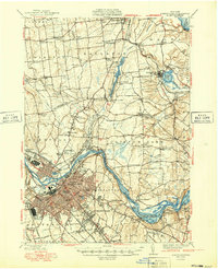
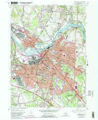
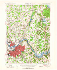
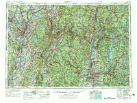
Listed on the National Register of Historic Places in 2025. 16 historic topographic surveys show this location, the earliest from 1893.
One of 87 National Register listings published here for Schenectady County · listed in 2025 · category: Building.
Sources: the National Register database, National Park Service
Regional context, not property-specific evidence. The federal wildfire occurrence database lists 690 fires within 5 miles of St. George's Lodge No. 6 Masonic Temple and Club between 1995 and 2020, burning about 456 acres in total. 37 started naturally. 149 were recorded as arson. Distance is straight-line from the map coordinates, so a fire counted here may appear on a neighbouring settlement's page as well.
| Reported cause | Fires |
|---|---|
| Missing data/not specified/undetermined | 345 |
| Arson/incendiarism | 149 |
| Smoking | 63 |
| Debris and open burning | 40 |
| Natural | 37 |
| Misuse of fire by a minor | 23 |
| Equipment and vehicle use | 20 |
| Power generation/transmission/distribution | 10 |
| Recreation and ceremony | 2 |
| Other causes | 1 |
The most recent of them, most recent first, with the day each was reported and the service that recorded it.
| Date | Cause | Size | Reported by | Name on the report |
|---|---|---|---|---|
| 9 September 2010 | Smoking | under an acre | Fire Department of New York | not named |
| 9 September 2003 | Missing data/not specified/undetermined | under an acre | Fire Department of New York | not named |
| 8 September 2012 | Missing data/not specified/undetermined | under an acre | Fire Department of New York | not named |
| 8 September 2003 | Arson/incendiarism | under an acre | Fire Department of New York | not named |
| 7 September 2015 | Missing data/not specified/undetermined | under an acre | Fire Department of New York | NA |
| 7 September 2010 | Missing data/not specified/undetermined | under an acre | Fire Department of New York | not named |
| 7 September 2010 | Debris and open burning | under an acre | Fire Department of New York | not named |
| 7 September 2003 | Arson/incendiarism | under an acre | Fire Department of New York | not named |
Regional context, not property-specific evidence. The federal mineral resources record lists 4 workings within 5 miles of St. George's Lodge No. 6 Masonic Temple and Club: 3 past producers, 1 producer. 1 still produces. What was taken out: Sand and Gravel, Construction. Distance is straight-line from the map coordinates, so a quarry counted here may appear on a neighbouring settlement's page as well.
| Where | Site | Commodity | Status | Recorded |
|---|---|---|---|---|
| Scotia Sand and Gravel Pit | Sand and Gravel, Construction | Past Producer | Sedimentary | |
| Scotia Sand and Gravel Pit | Sand and Gravel, Construction | Producer | ||
| Vley Pit | Sand and Gravel, Construction | Past Producer | ||
| Vley Plant | Sand and Gravel, Construction | Past Producer | Sedimentary |
Regional context, not property-specific evidence. The National Weather Service names Schenectady, the town this property stands in, in 89 storm reports between 1994 and 2022: 47 thunderstorm wind, 17 flash flood, 15 hail, 5 flood. The reports record 3 injuries. Each account below is quoted exactly as the forecast office filed it, from the NOAA Storm Events Database, and each date opens the federal record of that event.
| When | Event | Place named | Harm | What the report says |
|---|---|---|---|---|
| June 2007 | Lightning | Schenectady | 2 hurt | Two females, ages 18 and 16, were standing under a tree in Schenectady when lightning struck the tree, injuring both females. The 18 year old female was airlifted to Albany Medical Center for burns to her feet, ankles, legs, stomach, and chest, and may have also had internal injuries, while the 16 year old female suffered superficial wounds to her right arm. |
| July 2019 | Thunderstorm Wind | Schenectady | 1 hurt | A large tree was downed on Interstate 890 just west of Exit 7, hitting a moving SUV, trapping and injuring the driver who was taken to a hospital for treatment. |
| July 2008 | Flash Flood | Schenectady | $2,000,000 | Flash flooding resulted in numerous road closures across Schenectady County during the late afternoon and evening hours.||Several roads were also washed out, including, but not limited to, State Route 160 and culverts near the New York State Thruway overpass in Pattersonville, Crawford Road, North Kelly Road, and the bridge at Kelly Station Road and Route 7.||Additional damage occurred to a section of Route 5S near Rotterdam Junction.||In addition, Interstate 90, the New York State Thruway, was closed between exits 26 and 27 due to flooding, with several vehicles disabled in the flood waters.||Other roads that were closed included, but were not limited to, Guilderland Road at Cleveland Road, Route 147 between Charlton Road and West Glenville Road, Junction Road, Creek Road and Shun Pike Road near Esperance.||High water also scoured out a railroad embankment and the tracks that a train was on, stranding the train until the track could be repaired. |
| July 2016 | Thunderstorm Wind | Schenectady | $203,000 | A National Weather Service meteorologist surveyed thunderstorm wind damage in the Upper Union Street neighborhood of Schenectady and determined a microburst occurred during a thunderstorm. Numerous large silver maple trees and large tree limbs were downed along DeCamp Avenue, Wright Avenue, Hampton Avenue, Eastern Parkway and Union Street. These trees and tree limbs downed power lines and damaged some homes and cars as well. Trees were also downed near the Rose Garden in Central Park as well. |
| July 1999 | Thunderstorm Wind | Schenectady | $175,000 | no account filed |
| June 2000 | Thunderstorm Wind | Schenectady | $110,000 | no account filed |
| May 2015 | Lightning | Schenectady | $75,000 | A lightning strike caused a house to catch fire on Eastern Avenue in Schenectady. The home's attic was damaged by fire and smoke and water damage occurred throughout the house. |
| August 2001 | Thunderstorm Wind | Schenectady | $50,000 | no account filed |
| August 2002 | Thunderstorm Wind | Schenectady | $25,000 | no account filed |
| September 2000 | Thunderstorm Wind | Schenectady | $17,000 | no account filed |
| June 2002 | Thunderstorm Wind | Schenectady | $15,000 | no account filed |
| May 1998 | Thunderstorm Wind | Schenectady | $12,000 | no account filed |
| June 2000 | Hail | Schenectady | $10,000 | no account filed |
| January 1996 | Thunderstorm Wind | Schenectady | $10,000 | no account filed |
| July 2007 | Flash Flood | Schenectady | $5,000 | Heavy rain from repeated clusters of thunderstorms led to flash flooding in portions of Schenectady. This flooding led to several cars being stranded within rapid rises of water, along with ensuing water rescues. ||Weaver Street in Schenectady was particularly hard hit. |
| April 1996 | Thunderstorm Wind | Schenectady | $5,000 | no account filed |
| July 1994 | Thunderstorm Wind | Schenectady | $5,000 | no account filed |
| July 1994 | Thunderstorm Wind | Schenectady | $5,000 | no account filed |
| August 1995 | Thunderstorm Wind | Schenectady | $4,000 | no account filed |
| October 2020 | Thunderstorm Wind | Schenectady | $2,000 | Trees and power lines were downed onto a house in the town of Schenectady. |
| September 1998 | Thunderstorm Wind | Schenectady | $2,000 | no account filed |
| July 2003 | Thunderstorm Wind | Schenectady | $1,000 | no account filed |
| September 2022 | Flood | Schenectady | - | Numerous reports of urban and poor drainage flooding on Weaver Street, Edison Avenue, and Broadway. |
| September 2022 | Flood | Schenectady | - | Minor Street flooding reported in Schenectady on Broadway and Union Street. |
| May 2021 | Thunderstorm Wind | Schenectady | - | A tree was downed on wires due to wind from a gust front well ahead of thunderstorms. |
| August 2020 | Thunderstorm Wind | Schenectady | - | Trees and wires were downed in Schenectady. There was also minor street flooding. |
| October 2020 | Thunderstorm Wind | Schenectady | - | A large tree fell near GE Plot. |
| October 2020 | Thunderstorm Wind | Schenectady | - | Trees were downed on a house and power lines in the town of Schenectady. |
| August 2019 | Thunderstorm Wind | Schenectady | - | Multiple trees snapped, blocking Ardsley Road. |
| August 2019 | Flash Flood | Schenectady | - | Flash flooding was reported at the intersection of Parkwood Blvd and Rugby Rd. |
| August 2019 | Flash Flood | Schenectady | - | Street flooding was reported in the city of Schenectady. |
| August 2019 | Thunderstorm Wind | Schenectady | - | Several large tree limbs were down on West Alley in the city of Schenectady. |
| July 2019 | Thunderstorm Wind | Schenectady | - | A 72-year old sign atop a restaurant was destroyed by a fallen tree on Erie Boulevard in Schenectady. Erie Boulevard was also closed between Union Street and Nott Street due to a downed tree. |
| July 2019 | Thunderstorm Wind | Schenectady | - | Half of a large tree was downed on Van Dyke Avenue between Laura Street and Cleveland Avenue. |
| July 2019 | Thunderstorm Wind | Schenectady | - | Three large trees were downed at a residence on Oaklawn Avenue in Rotterdam. One brought down a front porch roof, one knocked the chimney off the roof and damaged the kitchen, and one brought down lines and dented a car. |
| July 2019 | Thunderstorm Wind | Schenectady | - | A tree was downed in front of a house, damaging an awning on Garner Road. |
| August 2018 | Heavy Rain | Schenectady | - | Heavy rainfall of 1.32 inches fell in a short period of time. |
| August 2017 | Thunderstorm Wind | Schenectady | - | Several trees were downed on McClellan Street and Brandywine Ave. A telephone pole was knocked down onto an unoccupied car. |
| August 2016 | Flash Flood | Schenectady | - | The intersection of Broadway and Edison Avenue in Schenectady was closed due to flash flooding. |
| April 2016 | Thunderstorm Wind | Schenectady | - | A tree was downed at the Central Park Rose Garden in Schenectady due to thunderstorm winds. |
| April 2016 | Thunderstorm Wind | Schenectady | - | A tree was downed on Elbert Street in Schenectady as a result of thunderstorm winds. |
| April 2016 | Thunderstorm Wind | Schenectady | - | Trees were downed due to thunderstorm winds near the Basketball Courts in Central Park in Schenectady. |
| July 2016 | Hail | Schenectady | - | Nickel size hail was reported during a thunderstorm on Altamont Avenue in Rotterdam. |
| July 2016 | Hail | Schenectady | - | Quarter size hail was reported during a thunderstorm in downtown Schenectady. |
| July 2016 | Flash Flood | Schenectady | - | One foot of water was located along State Street in Schenectady between Robinson Street and James Street due to thunderstorm heavy rainfall. |
| July 2016 | Thunderstorm Wind | Schenectady | - | A large tree was uprooted by thunderstorm winds at the corner of Van Curler Avenue and Rugby Road in Schenectady. The fallen tree also downed power lines and damaged a car as well. |
| June 2015 | Thunderstorm Wind | Schenectady | - | A tree was reported down at the intersection of Union Street and Park Ave in Schenectady due to thunderstorm winds. |
| August 2015 | Thunderstorm Wind | Schenectady | - | A traffic light pole was bent as a result of thunderstorm winds in Schenectady. |
| July 2014 | Flash Flood | Schenectady | - | Thunderstorm heavy rainfall led to flash flooding in Schenectady. The two right hand eastbound lanes of Interstate 890 between Exits 5 and 6 had to be closed due to high water. |
| July 2013 | Heavy Rain | Schenectady | - | A retired NWS Employee reported minor street flooding along State Street in Schenectady. |
| May 2013 | Thunderstorm Wind | Schenectady | - | A member of the public reported through Twitter that thunderstorm winds toppled a large tree in Schenectady on State Street. A National Weather Service employee found additional wind damage along Balltown Road near Consaul Road as well. |
| May 2013 | Flash Flood | Schenectady | - | The public via Facebook reported flash flooding along Hampton Avenue in Schenectady from heavy rainfall from showers and thunderstorms. |
| May 2013 | Flash Flood | Schenectady | - | A trained spotter reported flash flooding at the intersection of Brandywine Avenue and Union Street in Schenectady from showers and thunderstorms. |
| May 2013 | Flash Flood | Schenectady | - | A meteorologist reported flash flooding along Crane Street in Schenectady. Water was two to three feet deep and water rescues were needed to remove people from the flooding. |
| August 2012 | Thunderstorm Wind | Schenectady | - | Trees and wires were reported down due to thunderstorm winds on McClellan and Bradley streets in Schenectady. Newspaper media also reported that the downed trees forced police to shut down a portion of McClellan Street for cleanup. |
| September 2012 | Thunderstorm Wind | Schenectady | - | Trees were reported down in Schenectady due to thunderstorm winds. |
| May 2011 | Thunderstorm Wind | Schenectady | - | Part of a large maple tree was reported downed by strong thunderstorm winds on Grand Boulevard in Niskayuna. |
| April 2011 | Thunderstorm Wind | Schenectady | - | Numerous tree limbs reported down due to strong thunderstorm winds in Central Park in Schenectady. |
| June 2011 | Hail | Schenectady | - | Quarter size hail was reported during a thunderstorm in Schenectady. |
| December 2010 | Flash Flood | Schenectady | - | A water rescue from a car was reported on Crane Street in Schenectady due to flash flooding. |
United States Geological Survey topographic sheets whose coverage includes this point. Matched by taking the coordinate the National Park Service records for this property, then testing that coordinate against the published boundary of every sheet.
Other National Register properties close enough to walk or drive between, ordered by distance from this one. Both positions come from the same geocoding pass that matched these properties to their map sheets.
| Photograph | Property | Distance | Listed |
|---|---|---|---|
| Wedgeway Building | under 500 feet | 2022 | |
| Clark Witbeck Co. Warehouse | under 500 feet | 2023 | |
| Central Fire Station | 0.1 miles | 1985 | |
| H. S. Barney Building | 0.1 miles | 1984 | |
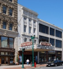 | F. F. Proctor Theatre and Arcade | 0.2 miles | 1979 |
| Fitzgerald Building | 0.2 miles | 2021 |
| National Archives record | The nomination case file for reference 100011892 in Record Group 79. |
| Schenectady County | All 87 listed properties in this county. |