BlockBefore

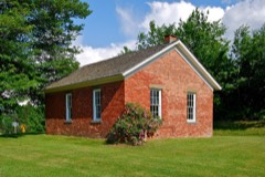
Coletti-Rowland-Agan Farmstead

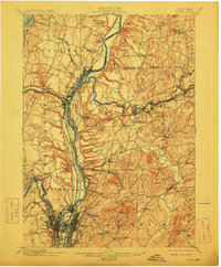
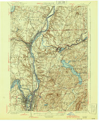
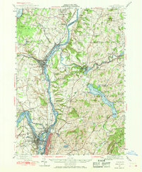
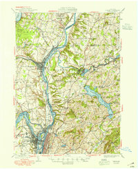
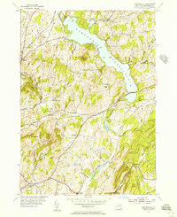
Listed on the National Register of Historic Places in 2013. 14 historic topographic surveys show this location, the earliest from 1893.

From the record

“Coletti-Rowland-Agan Farmstead is a historic farm and national historic district located at Pittstown, Rensselaer County, New York. The farm property consists of an East Farm and a West Farm.”

Wikipedia article Coletti-Rowland-Agan Farmstead, CC BY-SA 4.0.

One of 128 National Register listings published here for Rensselaer County · listed in 2013 · category: District.

Sources: the Wikipedia article · the National Register database, National Park Service

The listing

  • Listed as. Coletti--Rowland--Agan Farmstead - the National Register files a house under its owner's surname.
  • Address. 82 Cooksboro Rd., Troy, 12180
  • When was it listed? August 2013
  • Category. district
  • Town. Pittstown town
  • National Register reference number. 13000631 - assigned by the National Park Service when the property was listed.

Fires near this property

256 since 1993

Regional context, not property-specific evidence. The federal wildfire occurrence database lists 256 fires within 5 miles of Coletti-Rowland-Agan Farmstead between 1993 and 2020, burning about 232 acres in total. 13 started naturally. 27 were recorded as arson. Distance is straight-line from the map coordinates, so a fire counted here may appear on a neighbouring settlement's page as well.

Reported cause Fires
Missing data/not specified/undetermined134
Debris and open burning39
Arson/incendiarism27
Smoking17
Equipment and vehicle use14
Natural13
Power generation/transmission/distribution6
Misuse of fire by a minor4
Recreation and ceremony2

The most recent of them, most recent first, with the day each was reported and the service that recorded it.

DateCause SizeReported by Name on the report
9 September 2015Missing data/not specified/undeterminedunder an acreFire Department of New YorkNA
3 September 2008Naturalunder an acreFire Department of New Yorknot named
29 September 2012Missing data/not specified/undeterminedunder an acreFire Department of New Yorknot named
27 September 2017Smokingunder an acreFire Department of New YorkN/A
26 September 2000Missing data/not specified/undeterminedunder an acreFire Department of New Yorknot named
25 September 2002Missing data/not specified/undeterminedunder an acreFire Department of New Yorknot named
23 September 2007Missing data/not specified/undeterminedunder an acreFire Department of New Yorknot named
21 September 2009Misuse of fire by a minorunder an acreFire Department of New Yorknot named

Every fire recorded in Rensselaer County

Mines and quarries near this property

10 of 17 shown

Regional context, not property-specific evidence. The federal mineral resources record lists 17 workings within 5 miles of Coletti-Rowland-Agan Farmstead: 9 producers, 8 past producers. 9 still produce. What was taken out: Stone, Crushed/Broken, Sand and Gravel, Construction, Limestone, General. Distance is straight-line from the map coordinates, so a quarry counted here may appear on a neighbouring settlement's page as well.

Where SiteCommodity StatusRecorded
Melrose Limestone QuarryLimestone, GeneralProducerLimestone
Unnamed QuarryLimestone, GeneralProducerLimestone
Fanes PitSand and Gravel, ConstructionProducer
Pinewood Avenue PitSand and Gravel, ConstructionPast ProducerSedimentary
Pinewood Avenue PitSand and Gravel, ConstructionPast Producer
Route 66 PitSand and Gravel, ConstructionProducer
Valente Gravel Pit and MillSand and Gravel, ConstructionPast ProducerSedimentary
Campbell Mountain QuarryStone, Crushed/BrokenProducer

Every working recorded in Rensselaer County

Storms near this property

32 since 1994

Regional context, not property-specific evidence. The National Weather Service names Troy, the town this property stands in, in 32 storm reports between 1994 and 2021: 22 thunderstorm wind, 4 hail, 4 flash flood, 1 lightning. No death or injury is recorded in these reports. Each account below is quoted exactly as the forecast office filed it, from the NOAA Storm Events Database, and each date opens the federal record of that event.

WhenEvent Place namedHarm What the report says
January 2019FloodTroy$350,000A surge of ice and water from the prior day's heavy rain and snowmelt moved down the Hudson River and tore a total of ten vessels lose from their moorings above the Federal Dam in Troy during the predawn hours of the 25th. The vessels included tugboats, barges, a cruise ship, and a floating restaurant. Some of the vessels struck bridges, some ran aground, and at least one sunk. The loose vessels prompted the closing of several bridges between Troy and Albany over the Hudson during the morning rush hour, including the Patroon Island Bridge that carries Interstate 90. Amtrak trains crossing the river were forced to reduce their speed as a precaution. The vessels were secured by 11 am. Monetary damage amounts were estimated.
May 2016LightningTroy$50,000Lightning struck a home on Lindsey Drive in Brunswick. The lightning struck the chimney and traveled down through the walls to the basement, where it started a fire. The home was reported to have significant damage.
May 2010Thunderstorm WindTroy$50,000A large tree fell onto a house on 109th Street in Troy due to strong thunderstorm winds. Also, wires were reported down.
June 2000Thunderstorm WindTroy$35,000no account filed
May 2002Thunderstorm WindTroy$25,000no account filed
August 2002Thunderstorm WindTroy$25,000no account filed
August 2000Thunderstorm WindTroy$25,000no account filed
August 2002Thunderstorm WindTroy$20,000no account filed
July 2001Thunderstorm WindTroy$18,000no account filed
August 2003Thunderstorm WindTroy$5,000no account filed
July 1994Thunderstorm WindTroy$5,000no account filed
August 1994Thunderstorm WindTroy$5,000no account filed
July 1994Thunderstorm WindTroy$5,000no account filed
August 1995Thunderstorm WindTroy$4,000no account filed
August 2021Thunderstorm WindTroy-A large tree was downed across North Lake Avenue and Kestner Lane near Sycaway.
August 2021Thunderstorm WindTroy-Wires were downed across the road at North Lake Avenue and Valley View Drive near Sycaway.
June 2019Thunderstorm WindTroy-Tree branches were downed onto wires.
August 2019Flash FloodTroy-Several inches of water rushed down Sixth Street, Federal Street and Hoosick Street. There was also a few feet of standing water in places downtown. Roadways were closed due to damage and debris on Federal Street, Sage Avenue and Peoples Avenue.
July 2015Flash FloodTroy-Heavy rainfall from thunderstorms led to flash flooding in the city of Troy. A portion of Second Avenue (U.S. Route 4) was temporarily closed due to a foot and a half of flood waters across the roadway.
August 2015Thunderstorm WindTroy-Trees were reported down in the Lansingburgh section of Troy due to thunderstorm winds.
August 2015HailTroy-Penny size hail was reported during a thunderstorm in Troy.
July 2014Thunderstorm WindTroy-Trees and wires were reported down in the Lansinburgh section of Troy due to thunderstorm winds.
May 2011Thunderstorm WindTroy-Trees and wires were reported down at 102nd Street and 8th Avenue in Troy due to strong thunderstorm winds.
August 2011Flash FloodTroy-Route 7 across Rensselaer County was closed due to numerous reports of flooding.
July 2009Flash FloodTroy-Several roads were closed in North Troy due to flash flooding from very heavy rainfall with several vehicles stuck in the flood waters.
August 2007Thunderstorm WindTroy-Thunderstorm winds downed numerous trees and wires in several portions of Troy. Also, a roof was partially blown off of a building.
June 2006Thunderstorm WindTroy-Law enforcement personnel reported trees and wire were blown down in Troy.
September 2006HailTroy-Law enforcement personnel reported that penny-sized hail occurred in Troy.
July 2005Thunderstorm WindTroy-Trees down
June 2002HailTroy-no account filed
August 2000HailTroy-no account filed

Every storm recorded in Rensselaer County

Maps showing this location

14 surveys

United States Geological Survey topographic sheets whose coverage includes this point. Matched by taking the middle of the area the National Park Service maps for this listing, then testing that coordinate against the published boundary of every sheet.

Listed places nearby

6 within 8 miles

Other National Register properties close enough to walk or drive between, ordered by distance from this one. Both positions come from the same geocoding pass that matched these properties to their map sheets.

Photograph PropertyDistance Listed
Auclair-Button Farmstead0.8 miles2013
Halford-Hayner Farmstead1.5 miles2013
Cartin-Snyder-Overacker Farmstead1.6 miles2013
Tomhannock Methodist Episcopal Church4.0 miles2014
Sherman Farm4.0 miles2003
District No. 6 Schoolhouse4.1 miles2008

Sources for this property

National Archives recordThe nomination case file for reference 13000631 in Record Group 79.
Wikipedia articleCommunity-written account of this property, licensed CC BY-SA.
Rensselaer CountyAll 128 listed properties in this county.

Provenance

  • Listing record. National Park Service National Register of Historic Places, listed-properties dataset, current to 2026-05-22.
  • Map join. Address geocoded through the United States Census geocoder, then tested against the published boundary of every sheet in the USGS Historical Topographic Map Collection.
  • How this page is made. Listing fields come from federal records; map-sheet coverage is a labelled coordinate-to-boundary calculation, not a source-field claim.
  • Wildfire. Short, Karen C. 2022. Spatial wildfire occurrence data for the United States, 1992-2020 [FPA_FOD_20221014]. 6th Edition. Fort Collins, CO: Forest Service Research Data Archive. https://doi.org/10.2737/RDS-2013-0009.6 Collected with United States Government funding and usable without additional permissions or fees.
  • Mines and quarries. USGS Mineral Resources Data System (MRDS) https://mrdata.usgs.gov/mrds/ A work of the United States government, no copyright under 17 U.S.C. 105.
  • Storms. NOAA National Centers for Environmental Information, Storm Events Database https://www.ncei.noaa.gov/stormevents/ A work of the United States government, no copyright under 17 U.S.C. 105. Narratives are quoted verbatim from the National Weather Service report and are not edited or summarised.