BlockBefore
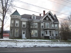
Photograph of Fort Ticonderoga
Photograph by Mwanner, CC BY-SA 3.0. Via Wikimedia Commons.

Fort Ticonderoga, North Demi-lune

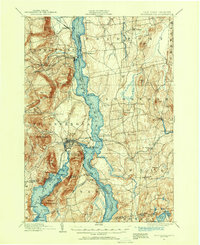
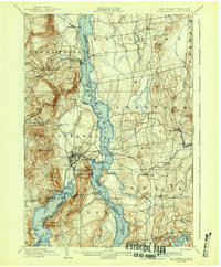
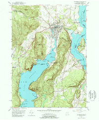
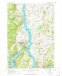
A National Historic Landmark. Built in 1754. Listed on the National Register of Historic Places in 1966. 11 historic topographic surveys show this location, the earliest from 1894.

From the record

“Fort Ticonderoga, formerly Fort Carillon, is a large 18th-century star fort built by the French at a narrows near the south end of Lake Champlain in northern New York. It was constructed between October 1755 and 1757 by French-Canadian military engineer Michel Chartier de Lotbinière, Marquis de Lotbinière during the North American phase of the Seven Years' War, known in the United States as the French and Indian War.”

Wikipedia article Fort Ticonderoga, CC BY-SA 4.0.

One of 114 National Register listings published here for Essex County · listed in 1966 · category: Structure · built in 1754, by Michel Chartier de Lotbinière, Marquis de Lotbinière · a National Historic Landmark.

Sources: the Wikipedia article · the case file at the National Archives · the National Register database, National Park Service

The listing

  • National Historic Landmark. The highest federal designation, held by about 2,600 places in the country against roughly 100,000 Register listings.
  • What is counted as historic. The nomination lists 3 buildingss, 3 sitess as contributing to the listing.
  • Still standing. The Park Service records this property as extant.
  • Address. 2.5 mi. S of Ticonderoga on NY 22, Ticonderoga, 12883
  • When was it listed? October 1966
  • Category. structure
  • Town. Ticonderoga town
  • When was it built? 1754
  • Architect. Michel Chartier de Lotbinière, Marquis de Lotbinière
  • National Register reference number. 66000519 - the number the National Park Service assigned this property when it was listed, and the key its nomination file is catalogued under at the National Archives.

Fires near this property

58 since 2000

Regional context, not property-specific evidence. The federal wildfire occurrence database lists 58 fires within 5 miles of Fort Ticonderoga, North Demi-lune between 2000 and 2018, burning about 28 acres in total. 7 started naturally. 9 were recorded as arson. Distance is straight-line from the map coordinates, so a fire counted here may appear on a neighbouring settlement's page as well.

Reported cause Fires
Missing data/not specified/undetermined30
Arson/incendiarism9
Natural7
Debris and open burning4
Smoking3
Equipment and vehicle use3
Recreation and ceremony2

The most recent of them, most recent first, with the day each was reported and the service that recorded it.

DateCause SizeReported by Name on the report
7 September 2007Smokingunder an acreFire Department of New Yorknot named
6 September 2016Missing data/not specified/undeterminedunder an acreFire Department of New YorkN/A
5 September 2016Missing data/not specified/undeterminedunder an acreFire Department of New YorkN/A
27 September 2007Naturalunder an acreFire Department of New Yorknot named
17 September 2016Equipment and vehicle useunder an acreFire Department of New YorkN/A
11 September 2009Missing data/not specified/undeterminedunder an acreFire Department of New Yorknot named
1 September 2001Missing data/not specified/undeterminedunder an acreFire Department of New Yorknot named
7 August 2006Natural1.0 acresFire Department of New Yorknot named

Every fire recorded in Essex County

Mines and quarries near this property

10 of 18 shown

Regional context, not property-specific evidence. The federal mineral resources record lists 18 workings within 5 miles of Fort Ticonderoga, North Demi-lune: 14 past producers, 4 producers. 4 still produce. What was taken out: Sand and Gravel, Construction, Graphite, Feldspar, Iron. Distance is straight-line from the map coordinates, so a quarry counted here may appear on a neighbouring settlement's page as well.

Where SiteCommodity StatusRecorded
Barrett Manufacturing Co. QuarryFeldspar, Garnet, Graphite, MicaPast Producer
Lead Hill DepositGraphite, Sulfur-PyritePast Producer1842, 1855
Mount Defiance MineIronPast Producer1888, 1905
UnnamedStone, DimensionPast Producer1825, 1845
Barrett DepositFeldsparPast Producer1917
Lead Hill MineGraphitePast Producer
Lead Hills MinesGraphitePast Producer1862, 1920
Donovan PitSand and Gravel, ConstructionPast ProducerSedimentary
La Vallee PitSand and Gravel, ConstructionPast ProducerSedimentary
La Vallee PitSand and Gravel, ConstructionProducer

Every working recorded in Essex County

Storms near this property

28 since 1993

Regional context, not property-specific evidence. The National Weather Service names Ticonderoga, the town this property stands in, in 28 storm reports between 1993 and 2023: 17 thunderstorm wind, 8 hail, 3 flash flood. No death or injury is recorded in these reports. Each account below is quoted exactly as the forecast office filed it, from the NOAA Storm Events Database, and each date opens the federal record of that event.

WhenEvent Place namedHarm What the report says
August 1998Thunderstorm WindTiconderoga$200,000no account filed
July 1995Thunderstorm WindTiconderoga$100,000no account filed
March 2021Thunderstorm WindTiconderoga$25,000Several reports of trees downed by thunderstorm winds and some utility lines downed between Schroon Lake, Crown Point and Ticonderoga off Routes 74 and 9N.
May 2018Thunderstorm WindTiconderoga$25,000Several trees and utility lines downed by thunderstorm winds.
June 1998Flash FloodTiconderoga$25,000no account filed
August 2015Thunderstorm WindTiconderoga$20,000Numerous reports of trees and wires down including Vineyard road, Burgoyne road, Park Ave and Routes 9N, 22.
June 2007Thunderstorm WindTiconderoga$20,000Numerous reports of trees, large limbs and power lines down in Ticonderoga, including trees down on several vehicles on Champlain Ave.
June 1996Thunderstorm WindTiconderoga$15,000no account filed
June 1996Flash FloodTiconderoga$15,000no account filed
June 2021Thunderstorm WindTiconderoga$10,000Several trees and power lines down along Route 9, just north of the village.
August 1995Thunderstorm WindTiconderoga$10,000no account filed
July 2023Thunderstorm WindTiconderoga$5,000Trees on wires.
May 2020Thunderstorm WindTiconderoga$5,000Several trees downed by thunderstorms winds in Ticonderoga.
June 2019Flash FloodTiconderoga$5,000St Claire St in Ticonderoga is flooded and impassable. Cellars are beginning to flood with emergency responders working to pump out water. In addition, several culverts between Schroon Lake and Ticonderoga have been washed out.
September 2012Thunderstorm WindTiconderoga$5,000Several large limbs and a few tree tops toppled.
June 2011Thunderstorm WindTiconderoga$5,000Several trees downed by thunderstorm winds.
July 2001Thunderstorm WindTiconderoga$5,000no account filed
August 1993Thunderstorm WindTiconderoga$5,000no account filed
July 1999Thunderstorm WindTiconderoga$1,000no account filed
June 2017HailTiconderoga-Quarter size hail reported.
August 2015HailTiconderoga-Several reports throughout Ticonderoga of quarter, half dollar and golf ball size hail reported accompanied by strong winds and torrential rains.
May 2012HailTiconderoga-Golf ball size hail reported by Ticonderoga Emergency manager.
June 2011HailTiconderoga-Quarter size hail reported.
July 1997HailTiconderoga-A cold front moved across northern New York during the late morning and afternoon hours of Monday, July 7, 1997. Showers and thunderstorms accompanied this front with locally heavy rain and some large hail.
June 2006HailTiconderoga-no account filed
July 2004Thunderstorm WindTiconderoga-no account filed
July 2004HailTiconderoga-no account filed
November 2004HailTiconderoga-no account filed

Every storm recorded in Essex County

Maps showing this location

11 surveys

United States Geological Survey topographic sheets whose coverage includes this point. Matched by taking the coordinate the National Park Service records for this property, then testing that coordinate against the published boundary of every sheet.

Listed places nearby

6 within 8 miles

Other National Register properties close enough to walk or drive between, ordered by distance from this one. Both positions come from the same geocoding pass that matched these properties to their map sheets.

Photograph PropertyDistance Listed
Ticonderoga Pulp and Paper Company Office1.7 miles1988
Ferris House1.8 miles1988
Central School1.8 miles1988
Frazier Bridge1.8 miles1998
H. G. Burleigh House1.8 miles1988
Ticonderoga National Bank1.8 miles1988

Sources for this property

National Archives recordThe nomination case file for reference 66000519 in Record Group 79.
Wikipedia articleCommunity-written account of this property, licensed CC BY-SA.
Essex CountyAll 114 listed properties in this county.

Provenance

  • Listing record. National Park Service National Register of Historic Places, listed-properties dataset, current to 2026-05-22.
  • Map join. Address geocoded through the United States Census geocoder, then tested against the published boundary of every sheet in the USGS Historical Topographic Map Collection.
  • How this page is made. Listing fields come from federal records; map-sheet coverage is a labelled coordinate-to-boundary calculation, not a source-field claim.
  • Wildfire. Short, Karen C. 2022. Spatial wildfire occurrence data for the United States, 1992-2020 [FPA_FOD_20221014]. 6th Edition. Fort Collins, CO: Forest Service Research Data Archive. https://doi.org/10.2737/RDS-2013-0009.6 Collected with United States Government funding and usable without additional permissions or fees.
  • Mines and quarries. USGS Mineral Resources Data System (MRDS) https://mrdata.usgs.gov/mrds/ A work of the United States government, no copyright under 17 U.S.C. 105.
  • Storms. NOAA National Centers for Environmental Information, Storm Events Database https://www.ncei.noaa.gov/stormevents/ A work of the United States government, no copyright under 17 U.S.C. 105. Narratives are quoted verbatim from the National Weather Service report and are not edited or summarised.