BlockBefore
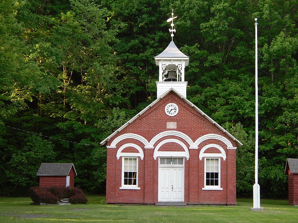
Photograph of District School No. 7
Photograph by Doug Kerr from Upstate New York, CC BY-SA 2.0. Via Wikimedia Commons.

District School No. 7

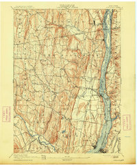
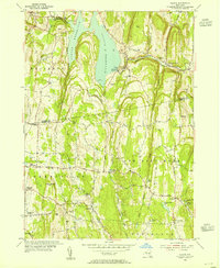
Listed on the National Register of Historic Places in 1996. 11 historic topographic surveys show this location, the earliest from 1893.

From the record

“District School No. 7, also known as "The Little Red Schoolhouse", is a historic one-room school building located at Coeymans Hollow in Albany County, New York. It was built in 1879 and is a single-story, rectangular brick building, three bays by three bays in the Italianate style.”

Wikipedia article District School No. 7, CC BY-SA 4.0.

One of 234 National Register listings published here for Albany County · listed in 1996 · category: Building.

Sources: the Wikipedia article · the case file at the National Archives · the National Register database, National Park Service

The listing

  • What is counted as historic. The nomination lists 2 buildingss as contributing to the listing.
  • Address. NY 143, approximately .25 mi. W of jct. with Co. Rt. 103, Coeymans Hollow, 12046
  • When was it listed? May 1996
  • Category. building
  • Town. Coeymans town
  • National Register reference number. 96000562 - the number the National Park Service assigned this property when it was listed, and the key its nomination file is catalogued under at the National Archives.

Fires near this property

138 since 1992

Regional context, not property-specific evidence. The federal wildfire occurrence database lists 138 fires within 5 miles of District School No. 7 between 1992 and 2020, burning about 141 acres in total. 12 started naturally. 21 were recorded as arson. Distance is straight-line from the map coordinates, so a fire counted here may appear on a neighbouring settlement's page as well.

Reported cause Fires
Missing data/not specified/undetermined63
Debris and open burning21
Arson/incendiarism21
Natural12
Railroad operations and maintenance8
Equipment and vehicle use4
Smoking3
Recreation and ceremony2
Power generation/transmission/distribution2
Misuse of fire by a minor2

The most recent of them, most recent first, with the day each was reported and the service that recorded it.

DateCause SizeReported by Name on the report
7 September 2007Power generation/transmission/distributionunder an acreFire Department of New Yorknot named
5 September 2012Arson/incendiarismunder an acreFire Department of New Yorknot named
27 September 2004Missing data/not specified/undeterminedunder an acreFire Department of New Yorknot named
23 September 2014Naturalunder an acreFire Department of New Yorknot named
23 September 2010Missing data/not specified/undeterminedunder an acreFire Department of New Yorknot named
21 September 2011Recreation and ceremonyunder an acreFire Department of New Yorknot named
21 September 2010Missing data/not specified/undeterminedunder an acreFire Department of New Yorknot named
20 September 2020Missing data/not specified/undeterminedunder an acreFire Department of New YorkNA

Every fire recorded in Albany County

Specimens collected near this property

12 of 4,869 shown

Regional context, not property-specific evidence. Museums hold 4,869 specimens collected within 10 miles of District School No. 7 between 1847 and 1975: 3,283 Fungi, 827 Animalia, 613 Plantae, 83 Protozoa, 44 Chromista, 19 Unrecorded. 12 distinct Species records are shown. Collected by A C. Frederick, A. A. Heller, A.F. Sherf and others. Each is a physical object with a catalogue number, and each entry opens the museum's record. This is what was collected and kept, not a survey of what lives here - nothing can be concluded from a species being absent.

Image SpeciesYear Collected by Where, as recorded
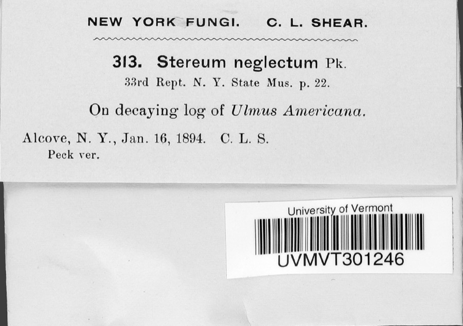
Specimen of Stereum neglectum PeckStereum neglectum Peck1894C. L. ShearAlcove
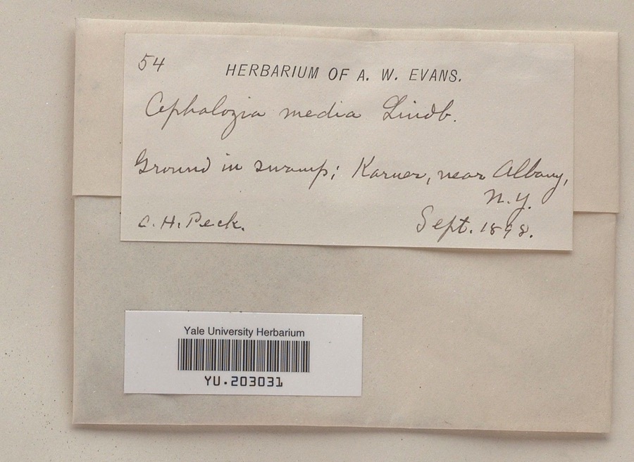
Specimen of Cephalozia media Lindb.Cephalozia media Lindb.1898Charles H. Pecknear Albany
A photograph of the species Phyllosticta innumerabilis, not of this specimenPhyllosticta innumerabilis Peck1847C.L. Shear
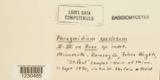
A photograph of the species Phragmidium speciosum, not of this specimenPhragmidium speciosum (Fr.) Bonord.1855SartwellE Novo-Eboraco [= New York]
A photograph of the species Diphyscium foliosum, not of this specimenDiphyscium foliosum (Hedw.) D.Mohr1862Coe F. AustinSand Lake.
A photograph of the species Leucobryum glaucum, not of this specimenLeucobryum glaucum (Hedw.) Ã…ngstr.1862Coe F. AustinSand Lake.
A photograph of the species Abietinella abietina, not of this specimenAbietinella abietina (Hedw.) M.Fleisch.1863C. F. AustinHelderberg Mt.
A photograph of the species Anomodon viticulosus, not of this specimenAnomodon viticulosus (Hedw.) Hook. & Taylor1863C. F. AustinHelderberg Mts.
A photograph of the species Barbilophozia barbata, not of this specimenBarbilophozia barbata (Schmidel ex Schreb.) Loeske1863C. F. AustinIn Mountain localities
A photograph of the species Barbula unguiculata, not of this specimenBarbula unguiculata Hedw.1863C. F. AustinHelderberg Mts.
A photograph of the species Brachythecium rutabulum, not of this specimenBrachythecium rutabulum (Hedw.) Schimp.1863C. H. PeckHelderberg Mountains
A photograph of the species Crossocalyx hellerianus, not of this specimenCrossocalyx hellerianus (Nees ex Lindenb.) Meyl.1863C. F. AustinHelderberg Mts.

All 4,869 specimens within 10 miles, at the Global Biodiversity Information Facility.

Mines and quarries near this property

10 of 14 shown

Regional context, not property-specific evidence. The federal mineral resources record lists 14 workings within 5 miles of District School No. 7: 9 producers, 5 past producers. 9 still produce. What was taken out: Stone, Crushed/Broken, Limestone, General, Clay, Sand and Gravel, Construction. Distance is straight-line from the map coordinates, so a quarry counted here may appear on a neighbouring settlement's page as well.

Where SiteCommodity StatusRecorded
Coeymans Clay PitClayProducer
Coeymans Clay PitClayPast Producer
Starr PitSand and Gravel, ConstructionProducer
Town of Bethlehem,Rupert Road PitSand and Gravel, ConstructionProducer
Aquetuck Limestone QuarryLimestone, GeneralProducerLimestone
New Baltimore Limestone QuarryLimestone, GeneralProducerLimestone
Ravena QuarryLimestone, GeneralPast ProducerSedimentary
South Bethlehem Limestone QuarryLimestone, GeneralProducerLimestone
Aquetuck Limestone QuarryStone, Crushed/BrokenPast Producer
East Nassau Sandstone QuarryStone, Crushed/BrokenProducerSedimentary

Every working recorded in Albany County

Storms near this property

13 since 1996

Regional context, not property-specific evidence. The National Weather Service names Coeymans Hollow, the town this property stands in, in 13 storm reports between 1996 and 2025: 8 thunderstorm wind, 4 hail, 1 flood. No death or injury is recorded in these reports. Each account below is quoted exactly as the forecast office filed it, from the NOAA Storm Events Database, and each date opens the federal record of that event.

WhenEvent Place namedHarm What the report says
August 2020Thunderstorm WindCoeymans Hollow$7,500,000A barn roof was torn off due to thunderstorm winds.
August 2000Thunderstorm WindCoeymans Hollow$45,000no account filed
June 1996HailCoeymans Hollow$5,000no account filed
August 2025Thunderstorm WindCoeymans Hollow-A local fire department reported several trees and wires down with wires on a car near Route 143 and Waterboard Road near Coeymans Hollow.
August 2025Thunderstorm WindCoeymans Hollow-A local fire department reported a tree and power lines down on Blodgett Hill Road in the Town of Coeymans.
July 2023Thunderstorm WindCoeymans Hollow-A tree and wires were downed on Biechman Road in the Town of Coeymans.
April 2022FloodCoeymans Hollow-Flooding was reported along Miller Road near Route 9W in Selkirk. Flooding was also reported along Marshall Road near Route 143 near Ravena.
July 2021Thunderstorm WindCoeymans Hollow-Several trees were downed in Coeymans Hollow. Route 143 was closed between Blodgett Hill Road and Gedney Hill Road due to downed trees and wires.
August 2020Thunderstorm WindCoeymans Hollow-Trees were downed at 1716 Route 143 in Coeymans, NY.
August 2019HailCoeymans Hollow-Quarter-sized hail lasted five to seven minutes.
August 2019HailCoeymans Hollow-Hail lasted 5 to 7 minutes.
March 2017Thunderstorm WindCoeymans Hollow-A tree was reported down in Coeymans Hollow due to thunderstorm winds.
June 2009HailCoeymans Hollow-Golf ball size hail was reported in Coeymans Hollow during a thunderstorm.

Every storm recorded in Albany County

Maps showing this location

11 surveys

United States Geological Survey topographic sheets whose coverage includes this point. Matched by taking the coordinate the National Park Service records for this property, then testing that coordinate against the published boundary of every sheet.

Listed places nearby

6 within 8 miles

Other National Register properties close enough to walk or drive between, ordered by distance from this one. Both positions come from the same geocoding pass that matched these properties to their map sheets.

Photograph PropertyDistance Listed
Israel Shear House0.1 miles1996
C. Van Der Zee House1.1 miles2002
Valley Paper Mill Chimney and Site1.2 miles2004
Alcove Historic District1.4 miles1980
Van derzee, Cornelius and Agnietje House2.3 miles2005
Fletcher Blaisdell Farm Complex5.1 miles2001

Sources for this property

National Archives recordThe nomination case file for reference 96000562 in Record Group 79.
Wikipedia articleCommunity-written account of this property, licensed CC BY-SA.
Albany CountyAll 234 listed properties in this county.

Provenance

  • Listing record. National Park Service National Register of Historic Places, listed-properties dataset, current to 2026-05-22.
  • Map join. Address geocoded through the United States Census geocoder, then tested against the published boundary of every sheet in the USGS Historical Topographic Map Collection.
  • How this page is made. Listing fields come from federal records; map-sheet coverage is a labelled coordinate-to-boundary calculation, not a source-field claim.
  • Wildfire. Short, Karen C. 2022. Spatial wildfire occurrence data for the United States, 1992-2020 [FPA_FOD_20221014]. 6th Edition. Fort Collins, CO: Forest Service Research Data Archive. https://doi.org/10.2737/RDS-2013-0009.6 Collected with United States Government funding and usable without additional permissions or fees.
  • Specimens. Global Biodiversity Information Facility (GBIF), https://www.gbif.org/. Only records licensed CC0 or CC BY are used. Records licensed CC BY-NC are excluded because this site carries advertising. Images are checked individually and any whose licence is non-commercial, no-derivatives or unreadable is refused.
  • Mines and quarries. USGS Mineral Resources Data System (MRDS) https://mrdata.usgs.gov/mrds/ A work of the United States government, no copyright under 17 U.S.C. 105.
  • Storms. NOAA National Centers for Environmental Information, Storm Events Database https://www.ncei.noaa.gov/stormevents/ A work of the United States government, no copyright under 17 U.S.C. 105. Narratives are quoted verbatim from the National Weather Service report and are not edited or summarised.