 Block
Vinita, Oklahoma
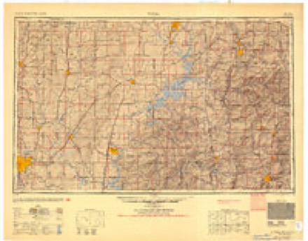
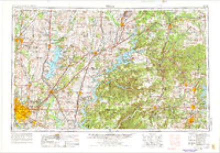
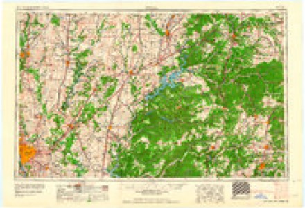
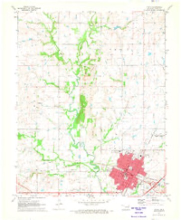
14 topographic sheets cover this place, the earliest surveyed in 1901 and the latest in 1985. It stands in the Vinita East census division. It lies in ZIP code area 74301. It stands on Pawpaw Creek. The Survey maps it on the Vinita quadrangle. 5,193 people lived here at the 2020 count. It stands 699 feet above sea level.
Research this city
On record in Vinita
Buildings and businesses the archive holds for this place. Each opens its own page, with the source record it came from.
On the National Register 9 records
 Attucks Schoollisted 2009
 Carselowey Houselisted 2011
 First Methodist-Episcopal Church, Southlisted 1999
 Hotel Vinitalisted 1995
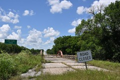 Little Cabin Creek Bridgelisted 2009
 McDougal Filling Stationlisted 2004
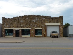 Randall Tire Companylisted 1995
- Craig County Courthouselisted 1984
- Spraker Service Stationlisted 1995
Population over time
2 figuresVinita fell from 5,743 to 5,193 between 2010 and 2020. These are the recorded population figures Wikidata holds for this place, reached through the Geographic Names Information System number this page is keyed on rather than by name, so they belong to this place and not to another of the same name. Most are census counts, but not all are: an early figure may be a founding or settlement estimate, and an estimate published within five years of a census is left out. The change column is computed, and is left blank where more than 20 years separate a figure from the one before it, because a gap that long is not a change between two counts.
| Year | People | Change |
|---|---|---|
| 2010 | 5,743 | |
| 2020 | 5,193 | -550 (-10%) |
Topographic sheets covering this place
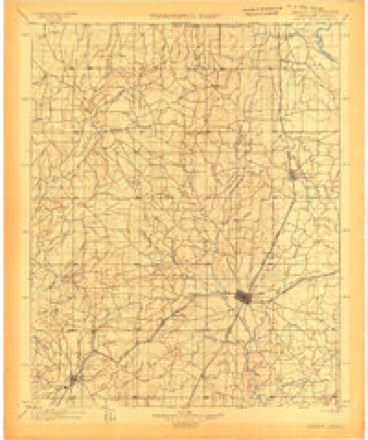
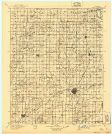
7 surveys from 14 printed sheetsMatched by testing this settlement's coordinate against the published boundary of every sheet in the United States Geological Survey's historical collection. Each opens the scanned sheet at the Survey.
- 1901 USGS Vinita quadrangle1:125000, 2 printings
- 1913 USGS Vinita quadrangle1:125000, 3 printings
- 1954 USGS Tulsa quadrangle1:250000, 2 printings
- 1958 USGS Tulsa quadrangle1:250000, 3 printings
- 1963 USGS Tulsa quadrangle1:250000
- 1971 USGS Vinita quadrangle1:24000
- 1985 USGS Bartlesville quadrangle1:100000, 2 printings
Fires near this place
6 since 2010Regional context, not property-specific evidence. The federal wildfire occurrence database lists 6 fires within 5 miles of Vinita between 2010 and 2020, burning about 106 acres in total. 1 started naturally. 4 were recorded as arson. Distance is straight-line from the map coordinates, so a fire counted here may appear on a neighbouring settlement's page as well.
| Reported cause | Fires |
|---|---|
| Arson/incendiarism | 4 |
| Debris and open burning | 1 |
| Natural | 1 |
The most recent of them, most recent first, with the day each was reported and the service that recorded it.
| Date | Cause | Size | Reported by | Name on the report |
|---|---|---|---|---|
| 14 June 2012 | Debris and open burning | 5.0 acres | Oklahoma Division of Forestry | 30244 |
| 1 April 2012 | Arson/incendiarism | 80 acres | Oklahoma Division of Forestry | 30217 |
| 26 March 2020 | Arson/incendiarism | 21 acres | Cherokee Nation Tribe | BUFFINGTON |
| 19 February 2010 | Natural | under an acre | Cherokee Nation Tribe | KEYSTONE |
| 9 October 2010 | Arson/incendiarism | under an acre | Cherokee Nation Tribe | BRUSHCOAT |
| 10 October 2010 | Arson/incendiarism | under an acre | Cherokee Nation Tribe | RED ASPHALT |
Settlements close enough to share some of these fires:
Mines and quarries near this place
7 within 5 milesRegional context, not property-specific evidence. The federal mineral resources record lists 7 workings within 5 miles of Vinita: 7 past producers. None of them still produces. What was taken out: Clay, Sand and Gravel, Construction, Stone, Crushed/Broken. Distance is straight-line from the map coordinates, so a quarry counted here may appear on a neighbouring settlement's page as well.
| Where | Site | Commodity | Status | Recorded |
|---|---|---|---|---|
| Unknown Gravel Pit | Sand and Gravel, Construction | Past Producer | ||
| Unknown Gravel Pit | Sand and Gravel, Construction | Past Producer | ||
| Unknown Limestone Pit | Stone, Crushed/Broken | Past Producer | ||
| Unknown Sandstone Pit | Stone, Crushed/Broken | Past Producer | ||
| Unknown Shale Pit | Clay | Past Producer | ||
| Unknown Shale Pit | Clay | Past Producer | ||
| Unknown Shale Pit | Clay | Past Producer |
Storms near this place
60 of 156 shownRegional context, not property-specific evidence. The National Weather Service names Vinita in 156 storm reports between 1994 and 2026: 71 hail, 66 thunderstorm wind, 13 flash flood, 3 lightning. The reports record 4 injuries. Each account below is quoted exactly as the forecast office filed it, from the NOAA Storm Events Database, and each date opens the federal record of that event.
| When | Event | Place named | Harm | What the report says |
|---|---|---|---|---|
| August 2002 | Thunderstorm Wind | Vinita | 4 hurt, $30,000 | A collapsing thunderstorms produced microburst winds estimated at 70 miles an hour. These winds blew down several trees and destroyed a trailer house. The four people inside the trailer house were injured and taken to the hospital for treatment. |
| May 1999 | Flash Flood | Vinita | $4,000,000 | An estimated 5 to 8 inches of rain in a short time caused Big Cabin Creek on the west side of Vinita and Bull Creek on the east side of Vinita to overflow their banks and enter 54 homes. Water was five feet deep in some homes. 30 homes were evacuated. The hardest-hit areas were located along North Second to North Fourth Streets, near Sequoyah and Tahlequah. According to the police chief, all of the homes around North Second Street were devastated. Later in the evening, water from Bull Creek drained into Big Cabin Creek, flooding out several homes in the Westwood area. Long-time residents say that the last time Bull Creek flooded any homes was in 1961, though they said the flooding this time was much more serious. Property damage was estimated at $4 million. Swift-moving floodwater from Bull Creek swept a pickup truck off of Eastern State Road.All four lanes of US Hwy 60 were closed by high water 1/2 mile west of Vinita. There were also reports of flooding around Welch. |
| June 2010 | Lightning | Vinita | $500,000 | Lightning ignited a large fire at the Paint and Home Decorative Center of the TH Rogers Lumber Company in Vinita, destroying the building and all of its contents. The structure was approximately 60x200 feet and contained laminate flooring, rolls of carpet, cans of paint, and decorative doors. |
| May 2000 | Flash Flood | Vinita | $150,000 | Heavy rains caused flooding on the eastern side of Vinita. Water up to four inches deep entered up to fifteen houses. Boats were used in the streets to rescue families. |
| May 2020 | Hail | Vinita | $75,000 | Hail larger than golf ball size damaged vehicles, homes, and businesses. |
| July 2003 | Thunderstorm Wind | Vinita | $63,000 | Thunderstorm winds estimated at 70 miles an hour blew down numerous trees and did some damage to a few structures. One home which was under construction collapsed and tin roofs were blown off two buildings at a lumber yard. Rain damaged contents of the buildings. |
| June 2003 | Thunderstorm Wind | Vinita | $58,000 | Thunderstorm winds estimated at 80 miles an hour caused considerable damage in Vinita. A mobile home was pushed off its foundation and several metal garages were damaged. Trees were also blown down. A few of the trees fell on homes causing roof and other structural damage. |
| December 1999 | Hail | Vinita | $50,000 | Qarter to half dollar size hail fell in Vinita. |
| April 1995 | Thunderstorm Wind | Vinita | $50,000 | no account filed |
| April 2026 | Hail | Vinita | $30,000 | Golf ball size hail damaged homes and vehicles. |
| August 2020 | Hail | Vinita | $25,000 | Golf ball size hail damaged vehicles and homes. |
| August 2020 | Hail | Vinita | $25,000 | Baseball size hail damaged vehicles and homes. |
| April 2009 | Tornado (EF0) | Vinita | $25,000 | A tornado tore the roof off of a mobile home, blew down a small billboard, damaged the roofs of several barns and outbuildings, and blew down power poles. Maximum winds based on the damage were estimated to be near 75 mph. |
| May 2017 | Hail | Vinita | $25,000 | no account filed |
| October 2017 | Thunderstorm Wind | Vinita | $20,000 | Strong thunderstorm wind destroyed outbuildings and uprooted trees. |
| May 2020 | Hail | Vinita | $15,000 | Ping pong ball size hail damaged vehicles and homes. |
| September 1999 | Thunderstorm Wind | Vinita | $15,000 | The roof was blown off of a business in Vinita, and many trees and power lines were blown down. |
| May 2015 | Hail | Vinita | $15,000 | no account filed |
| August 2006 | Lightning | Vinita | $10,000 | Lightning struck a house causing a fire. |
| April 2015 | Hail | Vinita | $10,000 | no account filed |
| May 2019 | Tornado (EF0) | Vinita | $5,000 | This tornado was reported by a trained storm spotter. The tornado snapped large tree limbs and blew down power poles. Based on this damage, maximum estimated wind in the tornado was 80 to 85 mph. |
| April 2001 | Thunderstorm Wind | Vinita | $5,000 | Thunderstorm winds blew the roof off a barn. |
| April 2001 | Thunderstorm Wind | Vinita | $5,000 | Thunderstorm winds overturned a semi on the Will Rogers turnpike. |
| August 2001 | Thunderstorm Wind | Vinita | $5,000 | Thunderstorm winds estimated at 70 miles an hour blew down trees and destroyed an outbuilding. |
| June 1998 | Thunderstorm Wind | Vinita | $5,000 | Trees and power lines were blown down. |
| April 1995 | Thunderstorm Wind | Vinita | $5,000 | no account filed |
| August 2001 | Lightning | Vinita | $3,000 | A house was struck by lightning in Vinita. Only minor damage was reported. |
| July 1999 | Thunderstorm Wind | Vinita | $3,000 | Tree limbs and power lines were blown down in Vinita. |
| November 2005 | Thunderstorm Wind | Vinita | $2,000 | A Sonic restaurant had wind damage to the awning. |
| November 1999 | Thunderstorm Wind | Vinita | $2,000 | Winds estimated near 60 miles an hour caused several electrical transformers to blow near Ketchum at the Craig/Mayes County line. |
| March 2017 | Thunderstorm Wind | Vinita | $1,000 | Strong thunderstorm wind blew down trees and overturned a shed. |
| May 2016 | Thunderstorm Wind | Vinita | $1,000 | Strong thunderstorm wind blew down large tree limbs and snapped a power pole. |
| June 2008 | Thunderstorm Wind | Vinita | $1,000 | Thunderstorm winds estimated at 70 miles an hour broke off one power pole and caused 3 others to lean over. The wind also blew down numerous large tree limbs. |
| June 2007 | Thunderstorm Wind | Vinita | $1,000 | Thunderstorm winds estimated at 60 miles an hour blew down power poles. |
| April 2006 | Thunderstorm Wind | Vinita | $1,000 | Thunderstorm winds estimated at 60 miles an hour damaged the roof of a drive through at a bank in Ketchum. |
| May 2005 | Thunderstorm Wind | Vinita | $1,000 | Thunderstorm winds estimated at 60 miles an hour blew down power lines. |
| August 2001 | Thunderstorm Wind | Vinita | $1,000 | Power lines in Vinita were blown down by thunderstorm winds. |
| November 1999 | Thunderstorm Wind | Vinita | $1,000 | The roof was blown off of a shed 3 miles northwest of Big Cabin. |
| September 1996 | Thunderstorm Wind | Vinita | $1,000 | no account filed |
| March 2001 | Thunderstorm Wind | Vinita | $100 | Thunderstorm winds blew down several large tree limbs at Big Cabin. |
| March 2000 | Thunderstorm Wind | Vinita | $100 | Thunderstorm winds blew down several large tree limbs in Big Cabin. |
| November 1999 | Thunderstorm Wind | Vinita | $100 | Winds estimated between 60 and 75 miles an hour blew tree limbs down in Vinita. |
| May 1999 | Thunderstorm Wind | Vinita | $100 | Tree limbs were blown down west of Vinita. |
| June 1997 | Thunderstorm Wind | Vinita | $100 | no account filed |
| August 2023 | Flash Flood | Vinita | - | Portions of several roads in and around Vinita were flooded. |
| May 2019 | Flash Flood | Vinita | - | Portions of Highway 60 east of Vinita were flooded and closed. |
| May 2019 | Flash Flood | Vinita | - | Portions of Highways 69 and 60 were flooded and closed. |
| April 2019 | Flash Flood | Vinita | - | Portions of Highway 2 were closed due to flooding. |
| July 2014 | Thunderstorm Wind | Vinita | - | Strong thunderstorm wind blew down several trees. |
| May 2011 | Flash Flood | Vinita | - | Flood water covered many county roads around Bluejacket and Pyramid Corners. |
| June 2011 | Thunderstorm Wind | Vinita | - | Large tree limbs were blown down by strong thunderstorm wind. |
| June 2011 | Thunderstorm Wind | Vinita | - | The Oklahoma Mesonet station located near Vinita measured 60 mph thunderstorm wind gusts. |
| April 2009 | Thunderstorm Wind | Vinita | - | Thunderstorm winds estimated at 60 miles an hour blew down large tree limbs. |
| April 2008 | Flash Flood | Vinita | - | Heavy rain caused street flooding in the Ketchum area. |
| April 2008 | Flash Flood | Vinita | - | Heavy rain caused secondary roads near Vinita to be flooded. |
| June 2008 | Flash Flood | Vinita | - | Heavy rain caused extensive flooding near Interstate 44. |
| June 2008 | Flash Flood | Vinita | - | Locally heavy rainfall flooded streets in and around Vinita. |
| June 2008 | Thunderstorm Wind | Vinita | - | The Oklahoma mesonet site near Vinita recorded a 58 mile an hour wind gust. |
| April 2008 | Flash Flood | Vinita | - | Heavy rain caused some low lying areas in the City of Vinita to be flooded. A few roads in the vicinity of Vinita were also flooded. |
| June 2008 | Thunderstorm Wind | Vinita | - | Strong thunderstorm wind gusts blew down large tree limbs in Ketchum. |
Newspapers printed here
23,312 digitised pages6 papers published in this town, digitised by the Library of Congress and free to read: 5,186 issues, 23,312 pages. Every page is searchable, so a name or a street can be looked for directly in what the town printed about itself at the time.
| Newspaper | Published |
|---|---|
| The Weekly Chieftain | 1905 to 1913 |
| The Vinita Weekly Chieftain | 1902 to 1905 |
| The Vinita Daily Chieftain | 1902 to 1913 |
| The Daily Indian Chieftain | 1891 to 189? |
| The Daily Chieftain | 1898 to 1902 |
| Indian Chieftain | 1882 to 1902 |
What the paper printed
24,168 wordsFront pages of the local paper, read from the Library of Congress scans: 22 issues spread across its run from 1882 to 1913, 24,168 words in total. Each is reproduced on its own page, exactly as the recogniser returned it.
These pages read less well than anything else here, and the number is worth stating: about three words in four come through cleanly, against nine in ten for the building records. An 1896 broadsheet sets eight-point type in seven columns on microfilm, which is the hardest thing in this archive to read by machine. We tested our own recognisers against the Library's and they were not better, so the Library's text is what appears, with the wholly unreadable columns removed. Read it as a guide to what the paper covered, and follow the link to the scan before quoting anything.
| Issue | Paper | Length |
|---|---|---|
| 1882-09-29 | Indian Chieftain | 136 words |
| 1882-11-03 | Indian Chieftain | 1,479 words |
| 1882-11-24 | Indian Chieftain | 1,004 words |
| 1902-12-18 | Indian Chieftain | 492 words |
| 1902-12-18 | The Vinita Daily Chieftain | 1,091 words |
| 1902-12-23 | The Vinita Daily Chieftain | 797 words |
| 1902-12-26 | The Vinita Daily Chieftain | 1,520 words |
| 1902-12-30 | The Vinita Daily Chieftain | 759 words |
| 1913-01-31 | The Vinita Daily Chieftain | 3,122 words |
| 1891-09-23 | The Daily Indian Chieftain | 775 words |
| 1891-09-25 | The Daily Indian Chieftain | 773 words |
| 1892-10-06 | The Daily Indian Chieftain | 683 words |
| 1908-03-26 | The Weekly Chieftain | 188 words |
| 1908-07-24 | The Weekly Chieftain | 1,428 words |
| 1908-09-18 | The Weekly Chieftain | 1,352 words |
| 1912-12-27 | The Weekly Chieftain | 3,729 words |
| 1902-12-25 | The Vinita Weekly Chieftain | 621 words |
| 1908-03-19 | The Vinita Weekly Chieftain | 76 words |
| 1898-10-20 | The Daily Chieftain | 477 words |
| 1898-11-09 | The Daily Chieftain | 1,851 words |
| 1898-11-28 | The Daily Chieftain | 1,403 words |
| 1898-12-17 | The Daily Chieftain | 412 words |
Nearest settlements
The eight closest, with where each one stands in the county. Distances are straight-line, computed from the Geographic Names Information System coordinates.
Elsewhere
Matched on this settlement's Geographic Names Information System number rather than its name, so it cannot be a different place of the same name in another state.
| Wikipedia article on Vinita | An encyclopaedic summary. Its text is share-alike, so it is linked here rather than copied. |
| Wikidata item Q1003693 | The structured record the population and elevation above come from. Public domain (CC0). |
Provenance
This settlement is recorded in the Geographic Names Information System as feature 1099271. The sheet list is computed by point-in-boundary test against the United States Geological Survey's historical topographic inventory. Both are works of the United States government and carry no copyright under 17 U.S.C. 105.
Wildfire. Short, Karen C. 2022. Spatial wildfire occurrence data for the United States, 1992-2020 [FPA_FOD_20221014]. 6th Edition. Fort Collins, CO: Forest Service Research Data Archive. https://doi.org/10.2737/RDS-2013-0009.6 Collected with United States Government funding and usable without additional permissions or fees.
Mines and quarries. USGS Mineral Resources Data System (MRDS) https://mrdata.usgs.gov/mrds/ A work of the United States government, no copyright under 17 U.S.C. 105.
Storms. NOAA National Centers for Environmental Information, Storm Events Database https://www.ncei.noaa.gov/stormevents/ A work of the United States government, no copyright under 17 U.S.C. 105. Narratives are quoted verbatim from the National Weather Service report and are not edited or summarised.