BlockBefore

Clatsop County, Oregon

77 topographic sheets cover 45 settlements here, and 56 properties are on the National Register of Historic Places.

Research this county

From the record

56 National Register listings published here, 2 of them National Historic Landmarks · the county-history sources name 1 person · people the book names include J. A. Buchanan (Astoria, 1922) (machine-read).

Sources: the county history on the Internet Archive · the National Register database, National Park Service

Oregon within the United States
Clatsop County within Oregon

What the record shows

  • 717 topographic sheet readings cover the county's settlements.
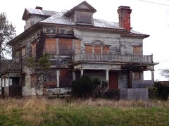
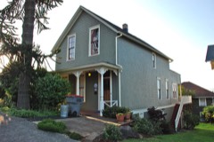
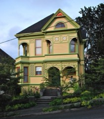
  • 56 properties here are on the National Register of Historic Places: 47 buildings, 5 districts, 2 structures and 2 sites.
  • 5 of the 56 listings were added during the 1970s.
  • The Geographic Names Information System records 45 populated places in this county; 45 are covered by at least one topographic sheet.

Places on the National Register

56

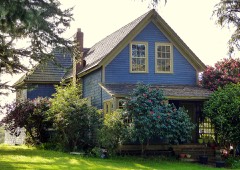
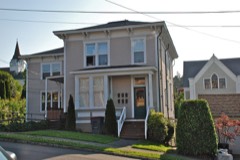
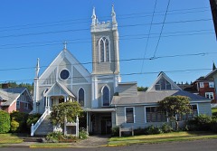
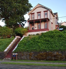
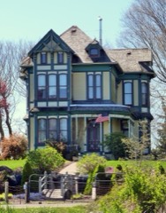
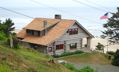
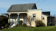
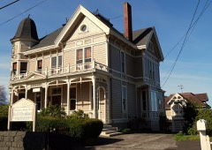
Every property in this county listed on the National Register of Historic Places, with the year it was listed and the federal nomination document.

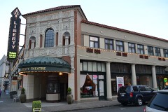
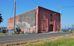
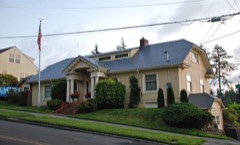
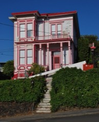
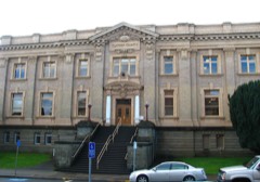
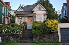
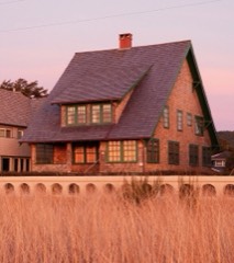
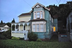
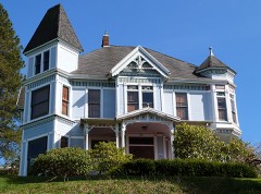
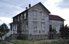
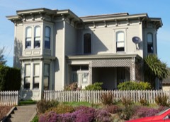
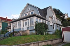
Photograph PropertyType ListedReference
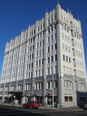
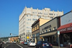
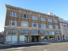
Astor Buildingbuilding198484002938
John Jacob Astor Hotelbuilding197979002046
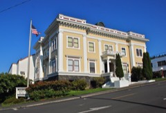
Astoria City Hallbuilding198484002940
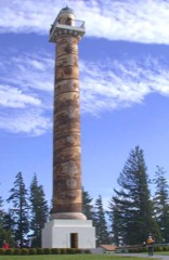
Astoria Columnstructure197474001681
Astoria Downtown Historic Districtdistrict199898000631
Astoria Elks Buildingbuilding199090000843
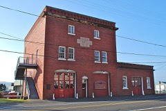
Astoria Fire House No. 2building198484002946
Astoria Marine Construction Company Historic Districtdistrict201413001058
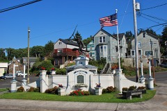
Astoria Victory Monumentbuilding198484000466
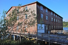
Astoria Wharf and Warehouse Companybuilding198484002949
Robert Rensselaer Bartlett Housebuilding198686001236
Cahill-Nordstrom Farmdistrict2023100008331
Peter L. Cherry Housebuilding198484002952
Clatsop County Courthousebuilding198484002954
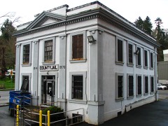
Clatsop County Jail (Old)building198383002145
Erickson-Larsen Ensemblebuilding199191000055
Albert W. Ferguson Housebuilding198484002955
Ferdinand Fisher Housebuilding198787000668
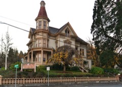
Capt. George Flavel House and Carriage Housebuilding198080003307
Captain George Conrad Flavel Housebuilding198686001222
George C. and Winona Flavel Housebuilding199191000054
Martin Foard Housebuilding198686001221
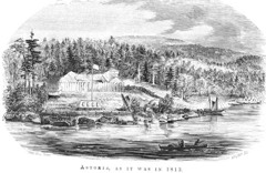
Fort Astoriasite196666000639
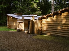
Fort Clatsop National Memorialbuilding196666000640
Fort Stevenssite197171000678
William and Nellie Fullam Housebuilding199191001570
Rev. William S. Gilbert Housebuilding199393000457
Goodwin-Wilkinson Farmhousebuilding199292000128
Grace Episcopal Church Rectory, Oldbuilding199090000375
Grace Episcopal Church and Rectorybuilding198484002957
Capt. J. H. D. Gray Housebuilding198484002958
John N. Griffin Housebuilding198484000119
Haller-Black Housebuilding199191001568
John Hobson Housebuilding197878002281
Gustavus Holmes Housebuilding198484000121
Peter and Maria Larson Housebuilding199090000374
Latourette, Charles, David, Housebuilding198484002962
Christian Leinenweber Housebuilding199999000604
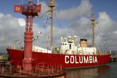
Lightship WAL-604, COLUMBIAstructure198989002463
Noonan-Norblad Housebuilding198888000303
Judge C. H. Page Housebuilding198585001177
Charles Preston Housebuilding199191001569
Sea Lyftbuilding200101000496
Shively-McClure Historic Districtdistrict200505000829
Norris Staples Housebuilding198484000126
Charles Stevens Housebuilding198585001178
Svenson Blacksmith Shopbuilding198686003015
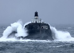
Tillamook Rock Lighthousebuilding198181000480
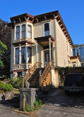
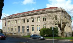
US Post Office and Custom Housebuilding198585000542
Union Fishermen's Cooperative Packing Company Alderbrook Stationbuilding199191000053
Uniontown-Alameda Historic Districtdistrict198888001311
Warren Investment Company Housing Groupbuilding198686001223
Daniel Knight Warren Housebuilding198888001521
Oswald West Coastal Retreatbuilding199292000066
Andrew Young Housebuilding198686001391
Benjamin Young House and Carriage Housebuilding197979002047

Wildfire, 1992 to 2020

486 fires

Every wildfire the federal occurrence database records inside this county: 486 of them, burning about 877 acres. 12 started naturally and 9 were recorded as arson. Each settlement page carries the fires within five miles of it.

Reported cause Fires
Debris and open burning188
Recreation and ceremony98
Missing data/not specified/undetermined50
Equipment and vehicle use43
Misuse of fire by a minor31
Smoking17
Fireworks17
Natural12
Arson/incendiarism9
Power generation/transmission/distribution8
Other causes8
Firearms and explosives use4
Railroad operations and maintenance1

The five largest, by the area the report gives. None of them was recorded as arson.

DateCause SizeReported by Name on the report
23 January 2014Debris and open burning254 acresOregon Department of Forestry Salem HeadquartersFALCON
11 November 2014Debris and open burning143 acresOregon Department of Forestry Salem HeadquartersHUG POINT
26 October 2007Debris and open burning60 acresAstoria DistrictCRUSHER
23 January 2014Debris and open burning46 acresOregon Department of Forestry Salem HeadquartersSHINGLE FIRE
27 November 2002Debris and open burning40 acresAstoria DistrictELK MTN
9 December 2017Debris and open burning37 acresOregon Department of Forestry Salem HeadquartersKNAPPA DUMP
11 November 2018Debris and open burning35 acresOregon Department of Forestry Salem HeadquartersSIMMONS FIRE
3 August 2015Recreation and ceremony27 acresOregon Department of Forestry Salem HeadquartersSOUTH JETTY

Every settlement page carries the fires within five miles of it - see the settlement index below.

Storms, 1957 to 2026

36 of 36 shown

The NOAA Storm Events Database holds 36 reports for this county, causing no deaths, 2 injuries and about $66,500 in recorded property damage. Each settlement page carries the reports that name it.

Kind of event Reports
Heavy Rain12
Flood7
Tornado5
Thunderstorm Wind4
Hail4
Funnel Cloud2
Waterspout1
Lightning1

The most serious of them, by death, then injury, then recorded damage. The accounts are quoted exactly as the forecast office filed them.

WhenEvent Place namedHarm What the report says
December 2004LightningAstoria1 hurtno account filed
September 1996Tornado (F0)Seaside1 hurtno account filed
October 1967Tornado (F1)not stated$25,000no account filed
October 1966Tornado (F0)not stated$25,000no account filed
November 2016Heavy RainBradwood$13,000A total of 3.52 inches of rain was recorded at the Astoria Airport weather station from 1 AM to 10 PM. A landslide was reported on Highway 30, blocking one lane and damaging a car. Another landslide was reported on US Highway 103 near milepost 7.
January 1998Tornado (F0)Seaside$3,000A weak tornado did minor damage to the Kinni-Kinnic Lodge and an adjacent home on Beach Street in Seaside.
February 1994Tornado (F0)Warrenton$500A small tornado touched down during a thunderstorm at Kamper's West Park near Warrenton at 0834 PST. The twister lifted about 20 wooden picnic tables up to 40 feet in the air and dumped them about 200 yards east of the area.
January 2026Funnel CloudCannon Beach-Member of the public reported a funnel cloudy near Haystack Rock in Cannon beach with a clear picture showing this feature.
December 2023FloodGearhart-Highway 101 closed in Seaside at 9 am due to flooding from heavy rainfall and tidal influences.
January 2022FloodOlney-Road failure during heavy rain closed Oregon highway 202 approximately 1 mile southeast of Olney.
January 2021FloodSeaside-Street flooding stranded vehicles along Circle Creek about 1 mile south of Seaside, OR.
March 2021HailWarrenton-Nickel sized hail fell in the Warrenton area. There were other reports of 0.25 to 0.7 inch hail in the Warrenton and Astoria at about the same time. There was one report of 0.5 inch hail covering the road up to 1 inch deep in Astoria.
September 2020Heavy RainCannon Beach-Total rainfall of 2.70 inches.
January 2018HailSeaside-Picture on Twitter from Seaside showed 2 inch hail. A trained spotter also reported 1 inch hail 1 mile north of Seaside.
October 2016Thunderstorm WindAstoria-Strong thunderstorms produced gusts up to 58 mph, recorded at the ASOS at the Astoria Airport.
October 2016Thunderstorm WindCannon Beach-Strong thunderstorm produced a gust to 59 mph at a weather station located in Cannon Beach.
October 2016HailFt Stevens-Warrenton Police Department posted a picture to Twitter of 1 to 1.5 inch hail from Hammond, Oregon.
September 2015Funnel Cloud(Ast)Astoria Arpt-A fisherman observed a water spout over the columbia river near buoy 10, and submitted a photo of it to the local station KATU.
January 2011FloodSeaside-With heavy rain and high tides hitting the North Coast Saturday night, Oregon Department of Transportation officials closed Highway 101 two miles south of Seaside from 08:20 PST. The Necanicum River and Beerman Creek overflowed their banks which caused about 15 inches of water on highway 101.
December 2010Thunderstorm WindFt Stevens-Strong, gusty winds were reported at Clatsop Spit with sustained winds of 35 kts and gusts to 56 kts.
January 2009FloodSeaside-Heavy rain caused the Necanicum River to overflow its banks and flood highway 101 near mile post 23. Approximately 10 inches of water was flowing across the highway.
January 2009FloodGearhart-Heavy rain caused small creeks to overflow their banks resulting in one foot of water covering highway 101 near Gearhart.
January 2009FloodJewell-Heavy rain caused several small stream and creek flooding. Damage included structures in the Plympton Creek and Fishhawk Falls area. A landslide near Hamlet also closed highway 202.
January 2009Heavy RainCannon Beach-Heavy rain caused small streams and creeks to overflow which resulted in several inches of water over highway 101 near the interchange of highways 101 and 26.
December 2007Heavy RainAstoria-Storm total precipitation was 3.94 inches, before the airport lost power.
December 2007Heavy RainJewell-Storm total precipitation was 7.30 inches.
November 2006Heavy RainJewell-Recorded a 5-day total of 15.7 inches.
January 2004Heavy RainCountywide-no account filed
December 2003Heavy RainCountywide-no account filed
January 2003Heavy RainCountywide-no account filed
March 2003Heavy RainCountywide-no account filed
August 2001Heavy RainCountywide-no account filed
April 1996HailCannon Beach-no account filed
September 1996WaterspoutSeaside-no account filed
June 1957Thunderstorm Windnot stated-no account filed

Mines and quarries

161 recorded

The Survey's mineral resources record lists 161 workings inside this county. 61 still produce and 100 are closed or unrecorded. Each settlement page carries the workings within five miles of it.

Commodity Workings
Stone64
Sand and Gravel, Construction59
Stone, Crushed/Broken17
Clay12
Titanium3
Zirconium, Iron2
Silica1
Peat1
Titanium, Metal, Iron1
Stone, Dimension1
Flagstone1
Gold1
Iron, Titanium1

The least common of them first, because a county's hundredth gravel pit says nothing its first ten did not.

Where SiteCommodity StatusRecorded
Clatsop Peat SoilsPeatPast Producer
Gant Creek QuarrySilicaPast Producer
Hammond-Mcgowan-Columbia PlacerTitanium, Metal, IronOccurrenceIlmenite, Magnetite
Sand Island PlacerGold, Iron, TitaniumOccurrence
Sunset Quarry & MillStone, DimensionUnknown
Unnamed PitFlagstoneProducer
Hammond Black Sand Locality No. 1Titanium, Zirconium, IronProspect
Hammond Black Sand Locality No. 2Titanium, Zirconium, IronProspect
Columbia River BarTitaniumUnknown
Edith Gallaher ClayClayPast Producer
Edith Gallaher ClayClayOccurrence
Endicott PitClayPast Producer
Estoos PitClayPast Producer
Estoos PitClayProducer
Olney ClayClayOccurrence
Onley Clay DepositClayProspect
P M West ClayClayPast Producer
P. M. West ClayClayPast Producer
Wauna Mill PitClayPast Producer
Wauna Shingle Mill PitClayProducer
Wauna Will PitClayProducer
Barth Falls 1Stone, Crushed/BrokenProducer
Barth Falls 2Stone, Crushed/BrokenProducer
East Humbug PitStone, Crushed/BrokenProducer
Elderberry PitStone, Crushed/BrokenProducer
Gant Creek QuarryStone, Crushed/BrokenProducer
Keasey Expandable ShaleStone, Crushed/BrokenOccurrence
McallisterStone, Crushed/BrokenPast Producer
Mulligan PitStone, Crushed/BrokenProducer
Nehalem QuarryStone, Crushed/BrokenProducer
Olney QuarryStone, Crushed/BrokenProducer
Square Creek PitStone, Crushed/BrokenProducer
Taylorville Quarry and PlantStone, Crushed/BrokenProducer
The KnollStone, Crushed/BrokenPast Producer
The KnollStone, Crushed/BrokenProducer
Unnamed PitStone, Crushed/BrokenProducer
Volmer CreekStone, Crushed/BrokenProducer
West Humbug PitStone, Crushed/BrokenProducer
AlliedSand and Gravel, ConstructionProducer
Astor House, Inc.Sand and Gravel, ConstructionPast Producer
Astor House,IncSand and Gravel, ConstructionPast Producer
Astoria LandfilleSand and Gravel, ConstructionPast Producer
Barbey Packing Corp.Sand and Gravel, ConstructionPast Producer
Barbey Packing Corp.Sand and Gravel, ConstructionOccurrence
Big Creek Pit 1Sand and Gravel, ConstructionPast Producer
Big Creek Pit 2Sand and Gravel, ConstructionPast Producer
Big Creek Pit 2Sand and Gravel, ConstructionProducer
City of AstoriaSand and Gravel, ConstructionPast Producer
City of AstoriaSand and Gravel, ConstructionOccurrence
Clapsop CountySand and Gravel, ConstructionPast Producer
Clapsop CountySand and Gravel, ConstructionProducer
Clatsop CountySand and Gravel, ConstructionPast Producer
Clatsop County OregonSand and Gravel, ConstructionProducer
Clifton PitSand and Gravel, ConstructionProducer
Crown Zellerbach 3Sand and Gravel, ConstructionPast Producer
Crown Zellerbach 3Sand and Gravel, ConstructionProducer
Crown Zellerbach Corp. 1Sand and Gravel, ConstructionPast Producer
Crown Zellerbach Corp. 1Sand and Gravel, ConstructionProducer
DimeoSand and Gravel, ConstructionPast Producer
Fish Hawk Falls QuarrySand and Gravel, ConstructionProducer
Gil GramsonSand and Gravel, ConstructionPast Producer
Gil Gransom PitSand and Gravel, ConstructionProducer
Gravel PitSand and Gravel, ConstructionPast Producer
Halvorson, Carl M. IncSand and Gravel, ConstructionPast Producer
Halvorson, Carl M. IncSand and Gravel, ConstructionProducer
HjortlandSand and Gravel, ConstructionProducer
Longview FiberSand and Gravel, ConstructionPast Producer
Longview Fiber PitSand and Gravel, ConstructionProducer
Mulligan # 1 PitSand and Gravel, ConstructionProducer
Oregon, StateSand and Gravel, ConstructionPast Producer
Oregon, StateSand and Gravel, ConstructionProducer
Peterson PitSand and Gravel, ConstructionPast Producer
Peterson PitSand and Gravel, ConstructionProducer
Port of AstoriaSand and Gravel, ConstructionPast Producer
Port of AstoriaSand and Gravel, ConstructionProducer
QuarrySand and Gravel, ConstructionPast Producer
Sand PitSand and Gravel, ConstructionPast Producer
Seacoast NurserySand and Gravel, ConstructionPast Producer
Seacoast Nursery PitSand and Gravel, ConstructionProducer
Smith PropertySand and Gravel, ConstructionPast Producer
Smith PropertySand and Gravel, ConstructionProducer
TaggSand and Gravel, ConstructionPast Producer
Tagg PitSand and Gravel, ConstructionProducer
Tongue PointSand and Gravel, ConstructionPast Producer
Tongue Point PitSand and Gravel, ConstructionProducer
Topsoil PitSand and Gravel, ConstructionPast Producer
Unnamed PitSand and Gravel, ConstructionProducer
AlliedStonePast Producer
Astoria LandfillStonePast Producer
Barth Falls 1StonePast Producer
Barth Falls 2StonePast Producer
Big Creek Pit 1StoneProducer
Clifton PitStonePast Producer
Cole Mountain QuarryStonePast Producer
Cole Mountain QuarryStoneProducer
Drake PitStonePast Producer
East HumbugStonePast Producer
ElderberryStonePast Producer
Fish Hawk Falls QuarryStonePast Producer
Graprock QuarryStonePast Producer
Graprock QuarryStoneProducer
Hamlet PitStonePast Producer
Hamlet QuarryStonePast Producer
Hamlet QuarryStoneProducer
HjortlandStonePast Producer
Humberg RockStonePast Producer
Humberg RockStoneProducer
Little North Fork PitStonePast Producer
Little North Fork PitStoneProducer
McallisterStonePast Producer
Mulligan #1StonePast Producer
Mulligan #2StonePast Producer
Mulligan #2 PitStoneProducer
Nehalen QuarryStonePast Producer
Northrup Creek QuarryStonePast Producer
Northrup Creek QuarryStoneProducer
Northup Creek Middle PitStoneProducer
Nygaard Loggin PitStoneProducer
Nygaard LoggingStonePast Producer
Olney QuarryStonePast Producer
Pit 11StonePast Producer
QuarryStonePast Producer
Rippet PitStonePast Producer
Rippet PitStoneProducer
Square CreekStonePast Producer
Taylorville QuarryStonePast Producer
Unnamed PitStoneProducer
Unnamend PitStoneProducer
Volmer CreekStonePast Producer
Wauna Will PitStoneProducer
West Humbug PitStonePast Producer

Town by town, in the county's histories

33,309 words

The part of each published history that is about one town: 4 chapters, each reproduced complete.

TownChapter FromLength
AstoriaHistoryA Story of the Gateway: Being, in Fact, a Truthful Exposition of Astoria and Clatsop County, Oregon; The Gateway of the Pacific to the Great Empire of the Columbia - Oregon, Washington, Idaho and Montana - Through Which the World Will Trade (1919)6,617 words
Astoria1922: Port of Astoria: Who's Who and What's What in Clatsop County, Or1922: Port of Astoria: Who's Who and What's What in Clatsop County, Oregon; Character Is Given to a Locality by the Men and Women Who Live In It (1922)21,127 words in 2 parts
Cannon BeachThe Land of Better Living: Being, in Fact, a Truthful Exposition of AsThe Land of Better Living: Being, in Fact, a Truthful Exposition of Astoria and Clatsop County, Oregon: The Gateway of the Great Columbia Empire of Oregon, Washington, Idaho, and Montana, Through Which the World Will Trade, to Which the Tourist, the Farmer, and the Manufacturer Will Come. (1925)420 words
WarrentonThe Land of Better Living: Being, in Fact, a Truthful Exposition of AsThe Land of Better Living: Being, in Fact, a Truthful Exposition of Astoria and Clatsop County, Oregon: The Gateway of the Great Columbia Empire of Oregon, Washington, Idaho, and Montana, Through Which the World Will Trade, to Which the Tourist, the Farmer, and the Manufacturer Will Come. (1925)5,145 words

The people it describes

1 named

Everyone The Land of Better Living: Being, in Fact, a Truthful Exposition of Astoria and Clatsop County, Oregon: The Gateway of the Great Columbia Empire of Oregon, Washington, Idaho, and Montana, Through Which the World Will Trade, to Which the Tourist, the Farmer, and the Manufacturer Will Come. stops to write about, with the section that describes them. Among them are the men who founded the place and governed the Territory. Each name opens the passage itself, in the words of 1925.

Every populated place in the county

45

Named settlements recorded in the Geographic Names Information System, each with the topographic sheets covering it. Villages, hamlets and abandoned places alike. Each is shown with the nearest named watercourse or landform and the survey quadrangle it falls on.

The vanished settlements of Clatsop County: the places named above that are no longer on the map.

Provenance

  • Topographic sheets. USGS Historical Topographic Map Collection, county index, measured from the bulk metadata.
  • Fire insurance maps. Library of Congress Sanborn collection, faceted to this county.
  • Photographs. Each place queried individually against the Library of Congress Prints and Photographs search.
  • Wildfire. Short, Karen C. 2022. Spatial wildfire occurrence data for the United States, 1992-2020 [FPA_FOD_20221014]. 6th Edition. Fort Collins, CO: Forest Service Research Data Archive. https://doi.org/10.2737/RDS-2013-0009.6 Collected with United States Government funding and usable without additional permissions or fees.
  • Mines and quarries. USGS Mineral Resources Data System (MRDS) https://mrdata.usgs.gov/mrds/ A work of the United States government, no copyright under 17 U.S.C. 105.
  • Storms. NOAA National Centers for Environmental Information, Storm Events Database https://www.ncei.noaa.gov/stormevents/ A work of the United States government, no copyright under 17 U.S.C. 105. Narratives are quoted verbatim from the National Weather Service report and are not edited or summarised.