Block
From the record
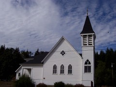
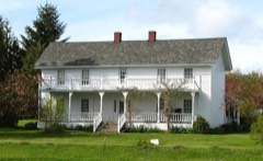
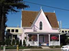
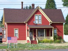
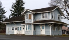
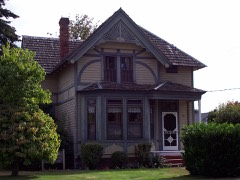
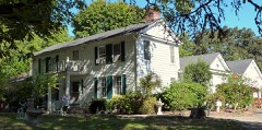
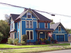
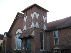
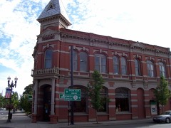
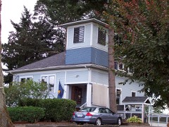
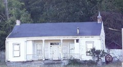
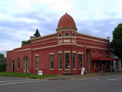
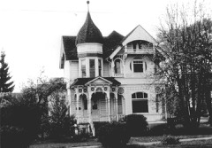
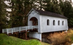
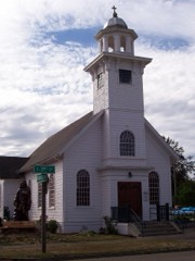
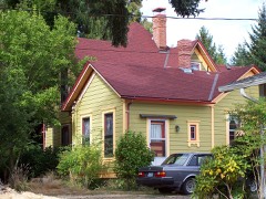
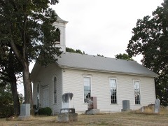
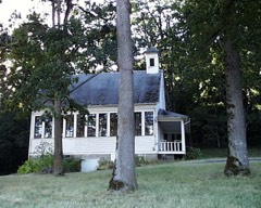
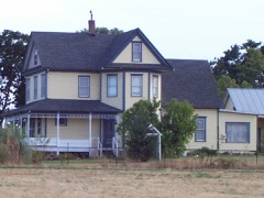
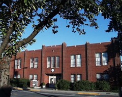
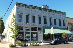
33 National Register listings published here.
Sources: the National Register database, National Park Service
94 topographic sheets cover 44 settlements here, and 33 properties are on the National Register of Historic Places.
33 National Register listings published here.
Sources: the National Register database, National Park Service
Every property in this county listed on the National Register of Historic Places, with the year it was listed and the federal nomination document.
Every wildfire the federal occurrence database records inside this county: 285 of them, burning about 1,102 acres. 27 started naturally and 13 were recorded as arson. Each settlement page carries the fires within five miles of it.
| Reported cause | Fires |
|---|---|
| Debris and open burning | 92 |
| Equipment and vehicle use | 62 |
| Recreation and ceremony | 29 |
| Natural | 27 |
| Smoking | 23 |
| Arson/incendiarism | 13 |
| Missing data/not specified/undetermined | 12 |
| Other causes | 11 |
| Misuse of fire by a minor | 9 |
| Fireworks | 6 |
| Firearms and explosives use | 1 |
The five largest, by the area the report gives. None of them was recorded as arson.
| Date | Cause | Size | Reported by | Name on the report |
|---|---|---|---|---|
| 4 June 2003 | Debris and open burning | 376 acres | Dallas Unit | SAVORSKI SLOPOVER |
| 9 August 1996 | Equipment and vehicle use | 55 acres | Baskett Slough National Wildlife Refuge | TRACTOR |
| 18 May 1997 | Debris and open burning | 55 acres | Dallas Unit | 106 UNIT |
| 27 October 2007 | Debris and open burning | 54 acres | Dallas Unit | IDAHO |
| 7 August 2010 | Equipment and vehicle use | 52 acres | Dallas Unit | SMITH ROAD |
| 18 June 2004 | Natural | 43 acres | Northwest Oregon District | FANNO RIDG |
| 29 April 1999 | Debris and open burning | 41 acres | Dallas Unit | 1480 RD |
| 9 July 2017 | Recreation and ceremony | 40 acres | Oregon Department of Forestry Salem Headquarters | RILEY CENTRAL FIRE |
Every settlement page carries the fires within five miles of it - see the settlement index below.
The NOAA Storm Events Database holds 54 reports for this county, causing no deaths, no injuries and about $4,400,000 in recorded property damage. Each settlement page carries the reports that name it.
| Kind of event | Reports |
|---|---|
| Flood | 27 |
| Heavy Rain | 16 |
| Funnel Cloud | 5 |
| Thunderstorm Wind | 3 |
| Tornado | 3 |
The most serious of them, by death, then injury, then recorded damage. The accounts are quoted exactly as the forecast office filed them.
| When | Event | Place named | Harm | What the report says |
|---|---|---|---|---|
| January 2012 | Flood | Buena Vista | $3,000,000 | Heavy rain caused the Luckiamute River at Suver to overflow its banks causing major flooding to surrounding areas. The Luckiamute River crested at 34.2 feet on January 19th at 7 pm PST, 7.2 feet above flood stage. |
| December 2007 | Flood | Suver | $1,000,000 | The Luckiamute River flooded near Suver, causing minor flooding. NOTE: Damage estimates are for the entire Polk county. |
| December 2015 | Flood | Suver | $225,000 | Heavy rain resulted in flooding of the Lukiamute River near Suver. |
| December 2015 | Flood | Suver | $95,000 | Heavy rain resulted in flooding of the Lukiamute River near Suver as well as several streams in the area. Water covered many of the roads including the closure of Highway 18. |
| December 2015 | Flood | Suver | $75,000 | The Luckiamute River flooded near Suver. |
| September 1997 | Tornado (F0) | Mc Coy | $5,000 | A weak tornado briefly touched down in rural Polk county. A house was slightly damaged by a falling tree. |
| February 2025 | Flood | Mitchell | - | The Luckiamute River near Suver reached minor flood (27ft) 2/24 415 PST. Peaked at 27.31 ft 2/24 at 10 AM. Fell below minor flood 2/26 415 PST. |
| January 2024 | Flood | Suver | - | Heavy rain caused minor flooding along the Luckiamute River near Suver. |
| December 2024 | Flood | Suver | - | The Luckimute at Suver reached Minor Flood level(27 ft) at 1800 PST on Dec 27. The river fell below flood level on Dec 28 at 2330. |
| December 2023 | Flood | Suver | - | Minor flooding occurred on the Luckiamute River near Suver as an atmospheric river brought heavy rains. |
| January 2022 | Flood | Mitchell | - | The gauge on the Luckiamute River near Suver rose above flood stage of 27 feet at 0900PST, crested at 27.2 feet at 1315PST, then dropped below flood stage at 2020PST. |
| January 2022 | Flood | Mitchell | - | The gauge on the Luckiamute River near Suver rose above flood stage of 27.0 feet at 1230PST, crested at 27.6 feet on the 7th at 1000PST, then dropped below flood stage on the 8th at 0900PST. |
| January 2021 | Flood | Falls City | - | The Luckiamute River near Suver (SUVO3) rose above flood stage at 0005PST, crested at 31.29 feet, then fell below flood stage at 2200PST on the 14th. Flood stage is 27.0 feet. Major flood stage is 32.0 feet. |
| January 2021 | Thunderstorm Wind | Black Rock | - | The Rockhouse RAWS sensor reported a wind of 40 mph gusting to 81 mph. |
| December 2021 | Flood | Buena Vista | - | Measured Rain of 2 to 4 inches. Minor flooding along the Luckiamute River near Suver. No damages reported. |
| December 2020 | Flood | Mitchell | - | The gage on the Luckiamute River near Suver (SUVO3) crested at an unknown value due to gage issues. Flood stage is 27.0 feet. No damage was reported. |
| September 2020 | Heavy Rain | Pinckney | - | Station EW7604 in Salem. |
| September 2020 | Heavy Rain | Mc Coy | - | Station 2711D 4 miles WSW of Wheatland. |
| September 2020 | Heavy Rain | Pinckney | - | Station FW8313 in Salem. |
| September 2020 | Heavy Rain | Pinckney | - | Pea sized hail and rain reported. |
| February 2017 | Flood | Parker | - | Heavy rain caused the Luckiamute River near Suver to flood. The river crested at 27.42 feet, which is 0.42 feet above flood stage. |
| April 2016 | Funnel Cloud | Monmouth | - | There were several reports and photos of a funnel cloud near Monmouth, Oregon. |
| June 2016 | Funnel Cloud | Rickreall | - | Video of a funnel cloud over Rickreall, Oregon was shared over Social Media. |
| November 2016 | Flood | Parker | - | Heavy rain resulted in flooding of the Luckiamute River near Suver. The Luckiamute River reached flood stage at 1225 PM on November 25th, and crested at 28.8 feet at 830 PM on November 25th. The river dropped below flood stage at 627 PM on November 26. |
| May 2015 | Funnel Cloud | Rickreall | - | A member of the public supplied a video and photo of a funnel cloud to a local news station. |
| December 2014 | Flood | Suver | - | The Luckiamute river near Suver reached flood stage of 27 feet around 820 AM PST on December 21st. The river crested at 30.46 feet at 3 PM, and dropped below flood stage later that evening. |
| March 2012 | Flood | Buena Vista | - | Heavy rain caused the Luckiamute River at Suver to overflow its banks causing flooding to surrounding areas. The Luckiamute River crested at 28.0 feet on March 31st at 7 am PST, 1.0 feet above flood stage. |
| November 2012 | Flood | Buena Vista | - | Heavy rain caused the Luckiamute River at Suver to overflow its banks causing flooding to surrounding areas. The Luckiamute River crested at 28.3 feet on January 20th at 3 pm PST, 1.3 feet above flood stage. |
| January 2011 | Flood | Suver | - | Heavy rain combined with snowmelt runoff to produce flooding on the Luckiamute River. The Luckiamute River at Suver crested at 28.7 feet on January 17th at 09:15 PST. |
| December 2010 | Flood | Suver | - | Heavy rain caused the Luckiamute River to rise above flood stage. |
| December 2010 | Thunderstorm Wind | Black Rock | - | Gusty winds were reported at the Rockhouse RAWS site with gusts to 57 kts. |
| January 2009 | Flood | Suver | - | Heavy rain caused the Luckiamute river to overflow its banks and flood property near highway 99. |
| January 2009 | Flood | Suver | - | Heavy rain caused the Luckiamuter river to rise above flood stage. |
| January 2007 | Heavy Rain | Dallas | - | A total accumulation of 1.91 inches was reported at Rockhouse RAWS. |
| December 2007 | Heavy Rain | Falls City | - | Storm total precipitation was 10.70 inches. |
| December 2007 | Heavy Rain | Black Rock | - | Storm total precipitation was 9.12 inches at the Rockhouse Mountain RAWS. |
| December 2006 | Flood | Suver | - | The Luckiamute River near Suver crested at 28.9 feet on the 15th; flood stage for this river is 27.0 feet. |
| November 2006 | Heavy Rain | Falls City | - | Recorded a 5-day total of 14.0 inches. |
| June 2003 | Tornado (F1) | Independence | - | According to a report from the public, a tornado touched down for approximately 5 minutes near Independence. No damage was reported. |
| September 1997 | Tornado (F0) | Rickreall | - | A weak tornado briefly touched down in rural Polk County. Some farms sustained minor crop damage. |
| January 2006 | Flood | Suver | - | no account filed |
| January 2006 | Flood | Suver | - | no account filed |
| December 2005 | Flood | Suver | - | no account filed |
| January 2004 | Heavy Rain | Countywide | - | no account filed |
| April 2004 | Funnel Cloud | Monmouth | - | no account filed |
| August 2004 | Heavy Rain | Countywide | - | no account filed |
| December 2003 | Heavy Rain | Countywide | - | no account filed |
| January 2003 | Heavy Rain | Countywide | - | no account filed |
| March 2003 | Heavy Rain | Countywide | - | no account filed |
| March 2003 | Heavy Rain | Countywide | - | no account filed |
| June 2003 | Funnel Cloud | Salem | - | no account filed |
| February 2002 | Heavy Rain | Countywide | - | no account filed |
| August 2001 | Heavy Rain | Countywide | - | no account filed |
| January 1996 | Thunderstorm Wind | Dallas | - | no account filed |
The Survey's mineral resources record lists 138 workings inside this county. 43 still produce and 95 are closed or unrecorded. Each settlement page carries the workings within five miles of it.
| Commodity | Workings |
|---|---|
| Stone | 44 |
| Sand and Gravel, Construction | 39 |
| Stone, Crushed/Broken | 35 |
| Limestone, General | 10 |
| Manganese | 3 |
| Aluminum | 3 |
| Uranium | 2 |
| Aluminum, Titanium, Metal, Iron | 1 |
| Tungsten | 1 |
| Titanium, Iron | 1 |
| Clay | 1 |
The least common of them first, because a county's hundredth gravel pit says nothing its first ten did not.
| Where | Site | Commodity | Status | Recorded |
|---|---|---|---|---|
| Bauxite Chapman and Eola Hills | Aluminum, Titanium, Metal, Iron | Occurrence | Bauxite, Gibbsite | |
| Chapman and Eola Hills Bauxite | Aluminum, Titanium, Iron | Occurrence | ||
| Collins Ranch | Aluminum, Clay | Occurrence | ||
| Rowell Creek | Tungsten | Occurrence | ||
| Johnson Uranium Occurrence | Uranium | Occurrence | Carnotite | |
| Johnson Uranium Occurrence | Uranium | Occurrence | ||
| Collins Ranch | Aluminum | Occurrence | Bauxite | |
| Dallas Manganese | Manganese | Occurrence | Hausmannite | |
| Dallas Prospect | Manganese | Occurrence | 1941 | |
| Kingwell & Mc Manners Prospect | Manganese | Occurrence | ||
| Boulder Creek Camp Deposit | Limestone, General | Occurrence | ||
| Buell Limestone | Limestone, General | Past Producer | ||
| Buell Limestone | Limestone, General | Occurrence | ||
| Lime Products Co | Limestone, General | Past Producer | ||
| Lime Products Co. Quarry | Limestone, General | Producer | ||
| Oregon Portland Cement Co | Limestone, General | Past Producer | ||
| Oregon Portland Cement Co. | Limestone, General | Past Producer | ||
| Rickreall Creek Deposit | Limestone, General | Occurrence | ||
| Rowell Creek Deposit | Limestone, General | Occurrence | ||
| Waymire Creek Deposit | Limestone, General | Occurrence | ||
| Bailey Pit | Stone, Crushed/Broken | Producer | ||
| Clay Hill Pit | Stone, Crushed/Broken | Past Producer | ||
| Ellendale Quaary | Stone, Crushed/Broken | Producer | ||
| Ellendale Quarry | Stone, Crushed/Broken | Producer | ||
| Ellendale Quarry | Stone, Crushed/Broken | Producer | ||
| Ellendale Quarry | Stone, Crushed/Broken | Past Producer | ||
| Finley Pit | Stone, Crushed/Broken | Producer | ||
| Freeman & Sons Quarry | Stone, Crushed/Broken | Producer | ||
| Gold Creek Pit and Plant | Stone, Crushed/Broken | Producer | ||
| Krauger Pit | Stone, Crushed/Broken | Producer | ||
| Martin Quarries | Stone, Crushed/Broken | Producer | ||
| Mill Creek Site | Stone, Crushed/Broken | Producer | ||
| Pit 100 | Stone, Crushed/Broken | Past Producer | ||
| Pit 641 | Stone, Crushed/Broken | Past Producer | ||
| Road Pit 100 | Stone, Crushed/Broken | Past Producer | ||
| Shenk Quarry | Stone, Crushed/Broken | Producer | ||
| South Pit | Stone, Crushed/Broken | Producer | ||
| Unnamed Pit | Stone, Crushed/Broken | Producer | ||
| Unnamed Pit | Stone, Crushed/Broken | Producer | ||
| Unnamed Pit | Stone, Crushed/Broken | Producer | ||
| Unnamed Pit | Stone, Crushed/Broken | Producer | ||
| Unnamed Pit | Stone, Crushed/Broken | Producer | ||
| Unnamed Pit | Stone, Crushed/Broken | Producer | ||
| Unnamed Pit | Stone, Crushed/Broken | Producer | ||
| Unnamed Pit | Stone, Crushed/Broken | Producer | ||
| Unnamed Pit | Stone, Crushed/Broken | Producer | ||
| Unnamed Quarry | Stone, Crushed/Broken | Past Producer | ||
| Unnamed Quarry | Stone, Crushed/Broken | Past Producer | ||
| Unnamed Quarry | Stone, Crushed/Broken | Past Producer | ||
| Unnamed Quarry | Stone, Crushed/Broken | Past Producer | ||
| Unnamed Quarry | Stone, Crushed/Broken | Past Producer | ||
| Unnamed Quarry | Stone, Crushed/Broken | Past Producer | ||
| Voigt Quarry | Stone, Crushed/Broken | Producer | ||
| Weisensee Farm/Luckiamute Pit | Stone, Crushed/Broken | Producer | ||
| Wigrich-Pomeroy Bar | Stone, Crushed/Broken | Producer | ||
| Buell Pit | Sand and Gravel, Construction | Past Producer | ||
| Buell Pit | Sand and Gravel, Construction | Producer | ||
| Fowler Pit | Sand and Gravel, Construction | Past Producer | ||
| Fowler Pit | Sand and Gravel, Construction | Producer | ||
| Gravel Pit | Sand and Gravel, Construction | Past Producer | ||
| Gravel Pit | Sand and Gravel, Construction | Past Producer | ||
| Gravel Pit | Sand and Gravel, Construction | Past Producer | ||
| Gravel Pit | Sand and Gravel, Construction | Past Producer | ||
| Hanna Ranch | Sand and Gravel, Construction | Past Producer | ||
| Hanna Ranch Pit | Sand and Gravel, Construction | Producer | ||
| Hayden Island | Sand and Gravel, Construction | Past Producer | ||
| Hayden Island | Sand and Gravel, Construction | Producer | ||
| Jones Pit | Sand and Gravel, Construction | Past Producer | ||
| Jones Pit | Sand and Gravel, Construction | Producer | ||
| K. D. Sand & Gravel Pit | Sand and Gravel, Construction | Past Producer | ||
| K. D. Sand & Gravel Pit | Sand and Gravel, Construction | Past Producer | ||
| Old River Bend Site | Sand and Gravel, Construction | Past Producer | ||
| Old River Bend Site | Sand and Gravel, Construction | Producer | ||
| Perry Mills Pit | Sand and Gravel, Construction | Past Producer | ||
| Perry Mills Pit | Sand and Gravel, Construction | Producer | ||
| Pomroy Bar | Sand and Gravel, Construction | Past Producer | ||
| Pomroy Bar | Sand and Gravel, Construction | Past Producer | ||
| Rentsch Pit | Sand and Gravel, Construction | Past Producer | ||
| Rentsch Pit | Sand and Gravel, Construction | Producer | ||
| Swope Bar | Sand and Gravel, Construction | Past Producer | ||
| Swope Bar | Sand and Gravel, Construction | Producer | ||
| Traglio Bar | Sand and Gravel, Construction | Past Producer | ||
| Traglio Bar | Sand and Gravel, Construction | Producer | ||
| Unnamed Pit | Sand and Gravel, Construction | Producer | ||
| Unnamed Pit | Sand and Gravel, Construction | Producer | ||
| Unnamed Pit | Sand and Gravel, Construction | Producer | ||
| Unnamed Pit | Sand and Gravel, Construction | Producer | ||
| Unnamed Quarry | Sand and Gravel, Construction | Past Producer | ||
| Valley Concrete and Gravel Plant | Sand and Gravel, Construction | Past Producer | ||
| Valley Concrete and Gravel Plant | Sand and Gravel, Construction | Producer | ||
| Wigrich-Pomeroy Bar | Sand and Gravel, Construction | Past Producer | ||
| Wigrich-Pomeroy Bar | Sand and Gravel, Construction | Producer | ||
| Windsor Island Pit and Plant | Sand and Gravel, Construction | Past Producer | ||
| Windsor Island Pit and Plant | Sand and Gravel, Construction | Past Producer | ||
| Bailey Pit | Stone | Past Producer | ||
| Bailey Pit | Stone | Past Producer | ||
| Bailey Pit | Stone | Producer | ||
| Basalt Quarry | Stone | Past Producer | ||
| Basalt Quarry | Stone | Past Producer | ||
| Boulder Pass Deposit | Stone | Past Producer | ||
| Clay Hill Pit | Stone | Past Producer | ||
| Ellendale Quarry | Stone | Past Producer | ||
| Ellendale Quarry | Stone | Past Producer | ||
| Ellendale Quarry | Stone | Past Producer | ||
| Ellendale Quarry | Stone | Past Producer | ||
| Finley Pit | Stone | Past Producer | ||
| Freeman & Sons Quarry | Stone | Past Producer | ||
| Gold Creek Pit and Plant | Stone | Past Producer | ||
| Krauger Pit | Stone | Past Producer | ||
| Martin Quarries | Stone | Past Producer | ||
| Noble Mountain Tree Farm Quarry | Stone | Past Producer | ||
| Noble Mountain Tree Farm Quarry | Stone | Producer | ||
| Pit 100 | Stone | Past Producer | ||
| Pit 641 | Stone | Past Producer | ||
| Quarry | Stone | Past Producer | ||
| Quarry | Stone | Past Producer | ||
| Quarry | Stone | Past Producer | ||
| Quarry | Stone | Past Producer | ||
| Quarry | Stone | Past Producer | ||
| Quarry | Stone | Past Producer | ||
| Quarry | Stone | Past Producer | ||
| Quarry | Stone | Past Producer | ||
| Quarry | Stone | Past Producer | ||
| Quarry | Stone | Past Producer | ||
| Quarry | Stone | Past Producer | ||
| Quarry | Stone | Past Producer | ||
| Quarry | Stone | Past Producer | ||
| Rickreall Creek Deposit | Stone | Past Producer | ||
| Road Pit 100 | Stone | Past Producer | ||
| Shenk Quarry | Stone | Past Producer | ||
| Shenk Quarry | Stone | Past Producer | ||
| Shenk Quarry | Stone | Past Producer | ||
| South | Stone | Past Producer | ||
| Tuff Quarry | Stone | Past Producer | ||
| Voigt Quarry | Stone | Past Producer | ||
| Waymire Creek | Stone | Past Producer | ||
| Weisensee Farm/Luckiamute Quarry | Stone | Past Producer | ||
| Wigrich-Pomeroy Bar | Stone | Past Producer |
Named settlements recorded in the Geographic Names Information System, each with the topographic sheets covering it. Villages, hamlets and abandoned places alike. Each is shown with the nearest named watercourse or landform and the survey quadrangle it falls on.
Falls City census division · 97361 · On Airlie Creek · Airlie North quadrangle
15 sheets, 1922 to 1980
Salem census division · 97304 · Near Athey Canyon · Amity quadrangle
21 sheets, 1924 to 1980
Falls City census division · 97344 · On Sams Creek · Falls City quadrangle
12 sheets, 1942 to 1980
Dallas census division · 97338 · Near Cadle Hill · Dallas quadrangle
13 sheets, 1942 to 1980
No longer a settlement
Falls City census division · 97338 · On Teal Creek · Falls City quadrangle
12 sheets, 1942 to 1980
Salem census division · 97304 · Near Wallace Hill · Salem West quadrangle
20 sheets, 1915 to 1980
Willamina census division · 97378 · On Meadow Creek · Sheridan quadrangle
17 sheets, 1942 to 1980
Monmouth-Independence census division · 97351 · Near Wells Island · Monmouth quadrangle
16 sheets, 1914 to 1980
Falls City census division · 97338 · On Waymire Creek · Falls City quadrangle
12 sheets, 1942 to 1980
No longer a settlement
Salem census division · 97304 · Near Chapman Hill · Salem West quadrangle
20 sheets, 1915 to 1980
Monmouth-Independence census division · 97361 · Rickreall quadrangle
16 sheets, 1915 to 1980
No longer a settlement
Dallas census division · 97338 · On Ellendale Creek · Dallas quadrangle
13 sheets, 1942 to 1980
Salem census division · 97304 · On Hayden Slough · Salem West quadrangle
20 sheets, 1915 to 1980
Falls City census division · 97344 · On Everz Creek · Falls City quadrangle
12 sheets, 1942 to 1980
Dallas census division · 97338 · On Teal Creek · Airlie North quadrangle
15 sheets, 1922 to 1980
No longer a settlement
Dallas census division · 97338 · Near Cadle Hill · Dallas quadrangle
13 sheets, 1942 to 1980
Willamina census division · 97396 · Near Fort Hill · Grand Ronde quadrangle
15 sheets, 1942 to 1980
Willamina census division · 97347 · On Cow Creek · Grand Ronde quadrangle
15 sheets, 1942 to 1980
Monmouth-Independence census division · 97351 · Near American Bottom · Monmouth quadrangle
16 sheets, 1914 to 1980
Monmouth-Independence census division · 97351 · On South Fork Ash Creek · Monmouth quadrangle
16 sheets, 1914 to 1980
Salem census division · 97304 · On Chatnicka Creek · Salem West quadrangle
20 sheets, 1915 to 1980
No longer a settlement
Falls City census division · 97361 · On Dry Creek · Airlie North quadrangle
15 sheets, 1922 to 1980
Salem census division · 97304 · On Walker Creek · Mission Bottom quadrangle
22 sheets, 1924 to 1980
Monmouth-Independence census division · 97351 · Near Wells Island · Monmouth quadrangle
16 sheets, 1914 to 1980
Monmouth-Independence census division · 97361 · Near Cupids Knoll · Monmouth quadrangle
16 sheets, 1914 to 1980
Monmouth-Independence census division · 97351 · Near Davidson Hill · Monmouth quadrangle
16 sheets, 1914 to 1980
Falls City census division · 97361 · On McTimmonds Creek · Falls City quadrangle
12 sheets, 1942 to 1980
Dallas census division · 97101 · On West Branch Ash Swale · Ballston quadrangle
17 sheets, 1942 to 1980
Monmouth-Independence census division · 97361 · On Little Luckiamute River · Airlie North quadrangle
15 sheets, 1922 to 1980
No longer a settlement
Dallas census division · 97371 · Near Cadle Hill · Rickreall quadrangle
16 sheets, 1915 to 1980
Salem census division · 97304 · Near Wallace Hill · Salem West quadrangle
20 sheets, 1915 to 1980
Monmouth-Independence census division · 97351 · On Hartman Slough · Monmouth quadrangle
16 sheets, 1914 to 1980
Monmouth-Independence census division · 97361 · On Berry Creek · Lewisburg quadrangle
18 sheets, 1913 to 1980
Dallas census division · 97101 · Ballston quadrangle
17 sheets, 1942 to 1980
No longer a settlement
Willamina census division · 97396 · On Rowell Creek · Grand Ronde quadrangle
15 sheets, 1942 to 1980
Falls City census division · On Fanno Creek · Valsetz quadrangle
11 sheets, 1942 to 1980
No longer a settlement
Salem census division · 97304 · Near Chapman Hill · Salem West quadrangle
20 sheets, 1915 to 1980
The vanished settlements of Polk County: the places named above that are no longer on the map.