Block
From the record
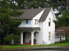
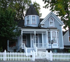
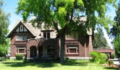
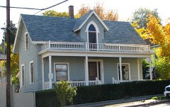
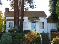
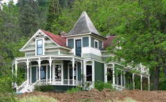
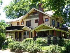
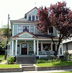
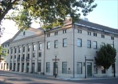
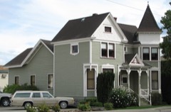
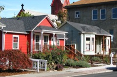
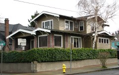
31 National Register listings published here.
Sources: the National Register database, National Park Service
100 topographic sheets cover 32 settlements here, and 31 properties are on the National Register of Historic Places.
31 National Register listings published here.
Sources: the National Register database, National Park Service
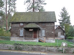
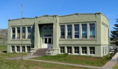
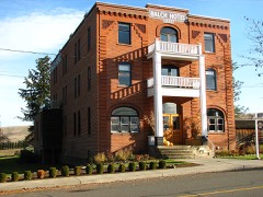
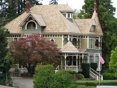
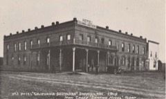
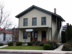
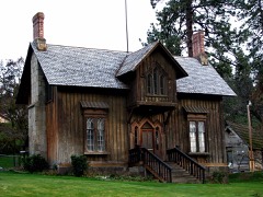
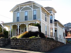
Every property in this county listed on the National Register of Historic Places, with the year it was listed and the federal nomination document.
Every wildfire the federal occurrence database records inside this county: 1,906 of them, burning about 1,016,358 acres. 573 started naturally and 134 were recorded as arson. Each settlement page carries the fires within five miles of it.
| Reported cause | Fires |
|---|---|
| Natural | 573 |
| Recreation and ceremony | 347 |
| Debris and open burning | 206 |
| Equipment and vehicle use | 168 |
| Missing data/not specified/undetermined | 135 |
| Arson/incendiarism | 134 |
| Smoking | 132 |
| Fireworks | 67 |
| Railroad operations and maintenance | 48 |
| Power generation/transmission/distribution | 42 |
| Misuse of fire by a minor | 28 |
| Other causes | 25 |
| Firearms and explosives use | 1 |
The five largest, by the area the report gives. None of them was recorded as arson.
| Date | Cause | Size | Reported by | Name on the report |
|---|---|---|---|---|
| 10 August 1996 | Equipment and vehicle use | 118,230 acres | Warm Springs Agency | SIMNASHO |
| 21 June 2018 | Natural | 100,226 acres | Prineville District | BOXCAR |
| 17 July 2018 | Missing data/not specified/undetermined | 78,425 acres | Prineville District | SUBSTATION |
| 8 August 2017 | Equipment and vehicle use | 68,135 acres | Oregon Department of Forestry Salem Headquarters | NENA SPRINGS |
| 12 August 2015 | Equipment and vehicle use | 66,613 acres | Warm Springs Agency | COUNTY LINE 2 |
| 24 August 2011 | Natural | 51,384 acres | Prineville District | 0655 RAZOR BACK EAST |
| 13 July 2014 | Natural | 50,900 acres | Warm Springs Agency | SHANIKO BUTTE |
| 14 July 2014 | Natural | 35,724 acres | Prineville District | 0358 BLACK ROCK |
Every settlement page carries the fires within five miles of it - see the settlement index below.
The NOAA Storm Events Database holds 41 reports for this county, causing no deaths, no injuries and about $27,000 in recorded property damage. Each settlement page carries the reports that name it.
| Kind of event | Reports |
|---|---|
| Thunderstorm Wind | 17 |
| Hail | 14 |
| Wildfire | 5 |
| Flood | 2 |
| Tornado | 1 |
| Heavy Rain | 1 |
| Flash Flood | 1 |
The most serious of them, by death, then injury, then recorded damage. The accounts are quoted exactly as the forecast office filed them.
| When | Event | Place named | Harm | What the report says |
|---|---|---|---|---|
| July 2002 | Wildfire | The Dalles | $10,000 | The Sheldon Ridge Fire, sparked by lightning, consumed 12,681 acres and eight structures, all of which were out buildings. Around 250 homes were threatened by the flames. Oregon National Guard Troops assisted in battling the flames. |
| August 2019 | Thunderstorm Wind | Tygh Vly | $5,000 | Large Aspen blown down west of Tygh Valley at the intersection of US Highways 197 and 216. |
| August 2019 | Thunderstorm Wind | Wamic | $5,000 | Large oak tree blown down in Wamic. |
| May 2001 | Thunderstorm Wind | Axford | $5,000 | no account filed |
| June 2009 | Thunderstorm Wind | Maupin | $2,000 | Shingles were blown off roofs, patio furniture blown around, and pieces of plywood blown away. |
| May 2023 | Thunderstorm Wind | Axford | - | The Mesonet station MDXO recorded at gust of 59 mph at 1745L from an outflow boundary. |
| May 2023 | Thunderstorm Wind | Clarno | - | The mesonet station NPFO3 measured a gust of 59 mph at 1848L from an outflow boundary. |
| August 2020 | Thunderstorm Wind | Kah-Nee-Ta | - | Roof torn off carport in the Wolf Creek subdivision north of Warm Springs. |
| May 2020 | Thunderstorm Wind | Shaniko | - | Strong winds estimated at 100-115 mph downed portions of two high tension power towers. |
| May 2020 | Flash Flood | Pine Grove | - | Flash flooding and debris flow reported. 300 yard debris flow on BIA Route 6. 8 inches of water over roads near Warm Springs. |
| May 2020 | Thunderstorm Wind | Shaniko | - | Completely destroyed riverside camps along Deschutes River with debris everywhere. |
| June 2019 | Hail | Antelope | - | Hail up to nickel size and .62 inches of rainfall in 15 minutes was reported. |
| August 2019 | Thunderstorm Wind | Friend | - | Occurred on US Highway 97 northbound at mile post 21. |
| August 2019 | Flood | The Dalles | - | Several areas of flooding reported due to heavy rainfall and small hail. |
| June 2017 | Hail | Kah-Nee-Ta | - | Trained spotter relayed a report from the public of golf ball size hail in southern Wasco county. |
| May 2010 | Thunderstorm Wind | Clarno | - | North Pole Ridge RAWS site measured 59 mph gust with thunderstorm. |
| August 2010 | Hail | Pine Grove | - | Hail up to quarter size nearly covered the ground. |
| August 2010 | Thunderstorm Wind | Pine Grove | - | Branches up to 4 inches in diameter downed by thunderstorm winds. |
| June 2008 | Thunderstorm Wind | Maupin | - | Tree branches downed from winds estimated over 50 mph. |
| August 2008 | Hail | Antelope | - | Large hail was accompanied by heavy rainfall. |
| January 2006 | Flood | Moody | - | Deschutes River at Moody fell below flood stage at 0700. |
| July 2002 | Wildfire | Maupin | - | The White River Fire, sparked by lightning, consumed 28,500 acres and four structures. The fire temporarily closed Highway 216. |
| June 1998 | Heavy Rain | The Dalles | - | A thunderstorm that moved through The Dalles dumped up to 0.67 inches of rain in 20 minutes, knocked out power, and caused some flooding problems. The wind blew trees and tree limbs onto power lines causing power outages to much of the east side of town. Heavy rain caused minor street flooding, flooding of basements and businesses, and caused manhole covers to come loose. Rock slides were reported along hillsides. Pea sized hail was also reported. |
| June 2020 | Hail | Simnasho | - | no account filed |
| July 2014 | Hail | Foley Butte | - | no account filed |
| July 2014 | Hail | Bear Spgs | - | no account filed |
| July 2014 | Hail | Fivemile Butte | - | no account filed |
| August 2014 | Hail | Bear Spgs | - | no account filed |
| August 2013 | Hail | Dant | - | no account filed |
| April 2012 | Hail | Clarno | - | no account filed |
| May 2006 | Hail | Maupin | - | no account filed |
| August 2004 | Thunderstorm Wind | Wamic | - | no account filed |
| July 2002 | Hail | Wamic | - | no account filed |
| May 2001 | Wildfire | Maupin | - | no account filed |
| October 1999 | Wildfire | Maupin | - | no account filed |
| July 1998 | Wildfire | Simnasho | - | no account filed |
| July 1990 | Thunderstorm Wind | not stated | - | no account filed |
| July 1987 | Hail | not stated | - | no account filed |
| July 1983 | Thunderstorm Wind | not stated | - | no account filed |
| May 1970 | Tornado (F0) | not stated | - | no account filed |
| May 1958 | Thunderstorm Wind | not stated | - | no account filed |
The Survey's mineral resources record lists 217 workings inside this county. 88 still produce and 129 are closed or unrecorded. Each settlement page carries the workings within five miles of it.
| Commodity | Workings |
|---|---|
| Stone | 82 |
| Stone, Crushed/Broken | 81 |
| Sand and Gravel, Construction | 35 |
| Perlite | 6 |
| Stone, Dimension | 5 |
| Geothermal | 3 |
| Manganese | 2 |
| Pumice | 1 |
| Clay | 1 |
| Aluminum, Contained or Metal | 1 |
The least common of them first, because a county's hundredth gravel pit says nothing its first ten did not.
| Where | Site | Commodity | Status | Recorded |
|---|---|---|---|---|
| (Facility) the Dalles Aluminum Smelter | Aluminum, Contained or Metal | Plant | ||
| Douthit Pit | Clay | Producer | ||
| Mcnamee Pit | Pumice | Producer | ||
| Axford Ranch | Manganese | Occurrence | ||
| Axford Ranch | Manganese | Occurrence | ||
| J. Sandoz Well | Geothermal | Producer | ||
| Kah-Nee-Ta Warm Springs | Geothermal | Occurrence | ||
| M. Martin Well | Geothermal | Producer | ||
| Indian Candy Stone Quarry | Stone, Dimension | Past Producer | ||
| Indian Candy Stone Quarry | Stone, Dimension | Past Producer | ||
| Pine Grove | Stone, Dimension | Past Producer | ||
| Pine Grove | Stone, Dimension | Producer | ||
| Rainbow Quarry | Stone, Dimension | Past Producer | ||
| Axford Hunt | Perlite | Occurrence | ||
| Axford-Hunt Perlite Deposit | Perlite | Occurrence | ||
| Lady Francis | Perlite | Past Producer | ||
| Lady Francis Mine | Perlite | Past Producer | ||
| Simnasho | Perlite | Occurrence | ||
| Simnasho Perlite Deposit | Perlite | Occurrence | ||
| Antelope Rock Product | Sand and Gravel, Construction | Past Producer | ||
| Douthit Pit | Sand and Gravel, Construction | Past Producer | ||
| Fulton Property | Sand and Gravel, Construction | Past Producer | ||
| Fulton Property | Sand and Gravel, Construction | Producer | ||
| Gravel Pit | Sand and Gravel, Construction | Past Producer | ||
| Gravel Pit | Sand and Gravel, Construction | Past Producer | ||
| Gravel Pit | Sand and Gravel, Construction | Past Producer | ||
| Gravel Pit | Sand and Gravel, Construction | Past Producer | ||
| Gravel Pit | Sand and Gravel, Construction | Past Producer | ||
| Gravel Pit | Sand and Gravel, Construction | Past Producer | ||
| Gravel Pit | Sand and Gravel, Construction | Past Producer | ||
| Gravel Pit | Sand and Gravel, Construction | Past Producer | ||
| Justesen Pit | Sand and Gravel, Construction | Past Producer | ||
| Justesen Pit | Sand and Gravel, Construction | Past Producer | ||
| May | Sand and Gravel, Construction | Past Producer | ||
| May Pit | Sand and Gravel, Construction | Producer | ||
| Mosier Pit | Sand and Gravel, Construction | Past Producer | ||
| Mosier Pit | Sand and Gravel, Construction | Producer | ||
| Sand Pit | Sand and Gravel, Construction | Past Producer | ||
| Sand Pit | Sand and Gravel, Construction | Past Producer | ||
| Sand Pit | Sand and Gravel, Construction | Producer | ||
| Skyles Property | Sand and Gravel, Construction | Past Producer | ||
| Skyles Property | Sand and Gravel, Construction | Producer | ||
| Slaughter Pit | Sand and Gravel, Construction | Past Producer | ||
| Slaughter Pit | Sand and Gravel, Construction | Producer | ||
| Tygh Valley Dredge and Mill | Sand and Gravel, Construction | Past Producer | ||
| Tygh Valley Dredge and Mill | Sand and Gravel, Construction | Past Producer | ||
| Unnamed Pit | Sand and Gravel, Construction | Producer | ||
| Unnamed Pit | Sand and Gravel, Construction | Producer | ||
| Unnamed Pit | Sand and Gravel, Construction | Producer | ||
| Unnamed Pit | Sand and Gravel, Construction | Producer | ||
| Unnamed Pit | Sand and Gravel, Construction | Producer | ||
| Unnamed Pit | Sand and Gravel, Construction | Producer | ||
| Unnamed Pit | Sand and Gravel, Construction | Producer | ||
| Unnamed Pit & Mill | Sand and Gravel, Construction | Past Producer | ||
| Alkali Trap Rock | Stone, Crushed/Broken | Producer | ||
| Antelope Rock Products Pit | Stone, Crushed/Broken | Producer | ||
| Barnett Pit | Stone, Crushed/Broken | Producer | ||
| Boule Pit | Stone, Crushed/Broken | Producer | ||
| Brown Pit | Stone, Crushed/Broken | Producer | ||
| Byzantine Gulch Pit | Stone, Crushed/Broken | Producer | ||
| Cove Gravel Pit | Stone, Crushed/Broken | Producer | ||
| Cow Canyon Pit | Stone, Crushed/Broken | Producer | ||
| Crawford Pit | Stone, Crushed/Broken | Past Producer | ||
| Davis & Neil Property | Stone, Crushed/Broken | Producer | ||
| Dickinson Pit | Stone, Crushed/Broken | Producer | ||
| Dulling Pit | Stone, Crushed/Broken | Producer | ||
| Eddins | Stone, Crushed/Broken | Producer | ||
| Flannagan Pit | Stone, Crushed/Broken | Producer | ||
| Foley Lakes Pit | Stone, Crushed/Broken | Producer | ||
| Green Lakes Quarry | Stone, Crushed/Broken | Producer | ||
| Harvey Pit | Stone, Crushed/Broken | Producer | ||
| Harvey Quarry | Stone, Crushed/Broken | Producer | ||
| Helyer Pit | Stone, Crushed/Broken | Producer | ||
| Hillgen Pit | Stone, Crushed/Broken | Producer | ||
| Jakey Quarry | Stone, Crushed/Broken | Past Producer | ||
| Justesen Pit | Stone, Crushed/Broken | Producer | ||
| Keo Quarry | Stone, Crushed/Broken | Past Producer | ||
| Magill Pit | Stone, Crushed/Broken | Producer | ||
| Marsh Pit | Stone, Crushed/Broken | Producer | ||
| Martin Pit | Stone, Crushed/Broken | Producer | ||
| Maupin Pit | Stone, Crushed/Broken | Producer | ||
| Mcnamee | Stone, Crushed/Broken | Past Producer | ||
| Metzentine Quarry | Stone, Crushed/Broken | Producer | ||
| Mosier Pit | Stone, Crushed/Broken | Producer | ||
| Mosier Pit and Plant | Stone, Crushed/Broken | Past Producer | ||
| Mp 61.8 Shaniko | Stone, Crushed/Broken | Producer | ||
| Mp 62.2 Criterion Summit | Stone, Crushed/Broken | Producer | ||
| Oades It | Stone, Crushed/Broken | Producer | ||
| Oades Pit | Stone, Crushed/Broken | Producer | ||
| Obrist Pit | Stone, Crushed/Broken | Producer | ||
| Perkins Pit | Stone, Crushed/Broken | Producer | ||
| Pine Grove | Stone, Crushed/Broken | Producer | ||
| Schmidt Pit | Stone, Crushed/Broken | Producer | ||
| Seven Mile Hill Quarry | Stone, Crushed/Broken | Past Producer | ||
| Shady Brook Pit | Stone, Crushed/Broken | Past Producer | ||
| Shaniko Rock Products Pit | Stone, Crushed/Broken | Producer | ||
| Shaniko Rock Products Pit | Stone, Crushed/Broken | Producer | ||
| Snodgass Pit | Stone, Crushed/Broken | Producer | ||
| Sorenson Quarry | Stone, Crushed/Broken | Past Producer | ||
| Sun Rock Quarry | Stone, Crushed/Broken | Producer | ||
| Tygh Ridge Quarry | Stone, Crushed/Broken | Producer | ||
| Tygh Valley Quarry | Stone, Crushed/Broken | Past Producer | ||
| Tygh Valley Rock Products Pit | Stone, Crushed/Broken | Producer | ||
| Underhill Pit | Stone, Crushed/Broken | Producer | ||
| Underhill Pit | Stone, Crushed/Broken | Producer | ||
| Unjnamed Pit | Stone, Crushed/Broken | Producer | ||
| Unnamed Pit | Stone, Crushed/Broken | Producer | ||
| Unnamed Pit | Stone, Crushed/Broken | Producer | ||
| Unnamed Pit | Stone, Crushed/Broken | Producer | ||
| Unnamed Pit | Stone, Crushed/Broken | Producer | ||
| Unnamed Pit | Stone, Crushed/Broken | Producer | ||
| Unnamed Pit | Stone, Crushed/Broken | Producer | ||
| Unnamed Pit | Stone, Crushed/Broken | Producer | ||
| Unnamed Pit | Stone, Crushed/Broken | Producer | ||
| Unnamed Pit | Stone, Crushed/Broken | Producer | ||
| Unnamed Pit | Stone, Crushed/Broken | Producer | ||
| Unnamed Pit | Stone, Crushed/Broken | Producer | ||
| Unnamed Pit | Stone, Crushed/Broken | Producer | ||
| Unnamed Pit | Stone, Crushed/Broken | Producer | ||
| Unnamed Pit | Stone, Crushed/Broken | Producer | ||
| Unnamed Pit | Stone, Crushed/Broken | Producer | ||
| Unnamed Pit | Stone, Crushed/Broken | Producer | ||
| Unnamed Pit | Stone, Crushed/Broken | Producer | ||
| Unnamed Pit | Stone, Crushed/Broken | Producer | ||
| Unnamed Pit | Stone, Crushed/Broken | Producer | ||
| Unnamed Pit | Stone, Crushed/Broken | Producer | ||
| Unnamed Pit | Stone, Crushed/Broken | Producer | ||
| Unnamed Quarry | Stone, Crushed/Broken | Past Producer | ||
| Unnamed Quarry | Stone, Crushed/Broken | Past Producer | ||
| Unnamed Quarry | Stone, Crushed/Broken | Past Producer | ||
| Van Orman Pit | Stone, Crushed/Broken | Producer | ||
| Ward Pit | Stone, Crushed/Broken | Producer | ||
| Warm Spring Quarry | Stone, Crushed/Broken | Producer | ||
| White River Pit | Stone, Crushed/Broken | Producer | ||
| Williams Pit | Stone, Crushed/Broken | Producer | ||
| Alkali Traprock | Stone | Past Producer | ||
| Barnett | Stone | Past Producer | ||
| Basalt Quarry | Stone | Past Producer | ||
| Basalt Quarry | Stone | Past Producer | ||
| Basalt Quarry | Stone | Past Producer | ||
| Basalt Quarry | Stone | Past Producer | ||
| Basalt Quarry | Stone | Past Producer | ||
| Boule | Stone | Past Producer | ||
| Brown | Stone | Past Producer | ||
| Byzantine Gulch | Stone | Past Producer | ||
| Cove | Stone | Past Producer | ||
| Cow Canyon | Stone | Past Producer | ||
| Crawford | Stone | Past Producer | ||
| Davis & Neil Property | Stone | Past Producer | ||
| Dickinson | Stone | Past Producer | ||
| Dulling | Stone | Past Producer | ||
| Eddins | Stone | Past Producer | ||
| Flannagan | Stone | Past Producer | ||
| Foley Lakes | Stone | Past Producer | ||
| Green Lakes Quarry | Stone | Past Producer | ||
| Harvey | Stone | Past Producer | ||
| Harvey Quarry | Stone | Past Producer | ||
| Helyer | Stone | Past Producer | ||
| Hillgen | Stone | Past Producer | ||
| Jakey Quarry | Stone | Past Producer | ||
| Justesen | Stone | Past Producer | ||
| Kah Nee Ta Stone Quarry | Stone | Past Producer | ||
| Kah Nee Ta Stone Quarry | Stone | Past Producer | ||
| Keo Quarry | Stone | Past Producer | ||
| Magill | Stone | Past Producer | ||
| Marsh | Stone | Past Producer | ||
| Martin | Stone | Past Producer | ||
| Maupin | Stone | Past Producer | ||
| Metzentine Quarry | Stone | Past Producer | ||
| Mosier | Stone | Past Producer | ||
| Mosier Quarry and Plant | Stone | Past Producer | ||
| Mp 61.8 Shaniko | Stone | Past Producer | ||
| Mp 62.2 Criterion Summit | Stone | Past Producer | ||
| Oades | Stone | Past Producer | ||
| Oades | Stone | Past Producer | ||
| Obrist | Stone | Past Producer | ||
| Perkins | Stone | Past Producer | ||
| Pine Grove | Stone | Past Producer | ||
| Quarry | Stone | Past Producer | ||
| Quarry | Stone | Past Producer | ||
| Quarry | Stone | Past Producer | ||
| Quarry | Stone | Past Producer | ||
| Quarry | Stone | Past Producer | ||
| Quarry | Stone | Past Producer | ||
| Quarry | Stone | Past Producer | ||
| Quarry | Stone | Past Producer | ||
| Quarry | Stone | Past Producer | ||
| Quarry | Stone | Past Producer | ||
| Quarry | Stone | Past Producer | ||
| Quarry | Stone | Past Producer | ||
| Quarry | Stone | Past Producer | ||
| Quarry | Stone | Past Producer | ||
| Quarry | Stone | Past Producer | ||
| Quarry | Stone | Past Producer | ||
| Quarry | Stone | Past Producer | ||
| Quarry | Stone | Past Producer | ||
| Quarry | Stone | Past Producer | ||
| Quarry | Stone | Past Producer | ||
| Rainbow Quarry | Stone | Past Producer | ||
| Schmidt | Stone | Past Producer | ||
| Seven Mile Hill Quarry | Stone | Past Producer | ||
| Shady Brook Quarry | Stone | Past Producer | ||
| Shaniko Rock Product | Stone | Past Producer | ||
| Shaniko Rock Product | Stone | Past Producer | ||
| Snodgass | Stone | Past Producer | ||
| Sorenson Quarry | Stone | Past Producer | ||
| Sun Rock Quarry | Stone | Past Producer | ||
| Tygh Ridge Quarry | Stone | Past Producer | ||
| Tygh Valley Quarrypit | Stone | Past Producer | ||
| Tygh Valley Rock Product | Stone | Past Producer | ||
| Underhill | Stone | Past Producer | ||
| Underhill | Stone | Past Producer | ||
| Van Orman | Stone | Past Producer | ||
| Ward | Stone | Past Producer | ||
| Warm Spring Quarry | Stone | Past Producer | ||
| White River | Stone | Past Producer | ||
| Williams | Stone | Past Producer |
Named settlements recorded in the Geographic Names Information System, each with the topographic sheets covering it. Villages, hamlets and abandoned places alike. Each is shown with the nearest named watercourse or landform and the survey quadrangle it falls on.
Antelope census division · 97001 · On Grub Hollow Creek · Antelope quadrangle
8 sheets, 1955 to 1987
The Dalles census division · 97058 · On Badger Creek · The Dalles North quadrangle
17 sheets, 1934 to 1994
The Dalles census division · 97058 · On Brown Creek · The Dalles South quadrangle
17 sheets, 1934 to 1994
Antelope census division · 97001 · Near Corral Canyon · Clarno quadrangle
11 sheets, 1926 to 1988
Dufur census division · 97037 · Criterion quadrangle
8 sheets, 1953 to 1981
No longer a settlement
Dufur census division · 97037 · On Bakeoven Creek · Maupin quadrangle
14 sheets, 1930 to 1996
The Dalles census division · 97058 · Near Pine Hollow · Dufur West quadrangle
13 sheets, 1930 to 1983
Dufur census division · 97058 · Petersburg quadrangle
15 sheets, 1934 to 1994
No longer a settlement
Dufur census division · 97058 · Near Company Hollow · Petersburg quadrangle
15 sheets, 1934 to 1994
Dufur census division · 97021 · Friend quadrangle
14 sheets, 1930 to 1996
No longer a settlement
Dufur census division · 97037 · On Bakeoven Creek · Maupin quadrangle
14 sheets, 1930 to 1996
The Dalles census division · 97040 · On Mosier Creek · White Salmon quadrangle
15 sheets, 1934 to 1994
The Dalles census division · 97058 · Near Sevenmile Hill · Lyle quadrangle
16 sheets, 1934 to 1994
Dufur census division · 97058 · On Eightmile Creek · Petersburg quadrangle
15 sheets, 1934 to 1994
Dufur census division · 97037 · Near Kelly Gulch · Wapinitia quadrangle
13 sheets, 1930 to 1996
The Dalles census division · 97058 · Near Sevenmile Hill · Lyle quadrangle
16 sheets, 1934 to 1994
Antelope census division · 97057 · Near West Little Pine Hollow · Shaniko quadrangle
8 sheets, 1953 to 1981
Dufur census division · 97063 · On Wildcat Creek · Rock Creek Reservoir quadrangle
13 sheets, 1930 to 1996
The Dalles census division · 97058 · Near Dry Hollow · The Dalles South quadrangle
17 sheets, 1934 to 1994
Dufur census division · 97063 · Near Butler Canyon · Tygh Valley quadrangle
14 sheets, 1930 to 1996
The vanished settlements of Wasco County: the places named above that are no longer on the map.