 Block
From the record
One of 51 National Register listings published here for Deschutes County · listed in 2000 · category: Building · built in 1923.
Sources: the case file at the National Archives · the National Register database, National Park Service
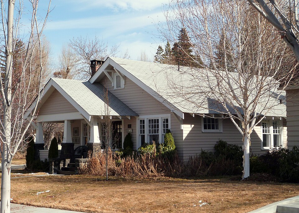
Built in 1923. Listed on the National Register of Historic Places in 2000.
One of 51 National Register listings published here for Deschutes County · listed in 2000 · category: Building · built in 1923.
Sources: the case file at the National Archives · the National Register database, National Park Service
Regional context, not property-specific evidence. The federal wildfire occurrence database lists 311 fires within 5 miles of Benjamin Hamilton House between 1992 and 2020, burning about 123 acres in total. 36 started naturally. 8 were recorded as arson. Distance is straight-line from the map coordinates, so a fire counted here may appear on a neighbouring settlement's page as well.
| Reported cause | Fires |
|---|---|
| Recreation and ceremony | 142 |
| Natural | 36 |
| Missing data/not specified/undetermined | 27 |
| Smoking | 26 |
| Misuse of fire by a minor | 21 |
| Debris and open burning | 19 |
| Fireworks | 10 |
| Equipment and vehicle use | 9 |
| Arson/incendiarism | 8 |
| Other causes | 7 |
| Power generation/transmission/distribution | 6 |
The most recent of them, most recent first, with the day each was reported and the service that recorded it.
| Date | Cause | Size | Reported by | Name on the report |
|---|---|---|---|---|
| 9 September 2002 | Smoking | under an acre | Sisters Unit | SKYLINERS |
| 8 September 1998 | Natural | under an acre | Deschutes National Forest | 1316 |
| 7 September 2011 | Smoking | under an acre | Sisters Unit | GURU |
| 6 September 2010 | Recreation and ceremony | under an acre | Deschutes National Forest | 0684 |
| 5 September 2019 | Natural | under an acre | Oregon Department of Forestry Salem Headquarters | KNOTT FIRE 0886 |
| 5 September 2016 | Misuse of fire by a minor | under an acre | Oregon Department of Forestry Salem Headquarters | BROKEN TOP #0569 |
| 5 September 2001 | Recreation and ceremony | under an acre | Sisters Unit | OVERTURF BUTTE |
| 5 September 1995 | Recreation and ceremony | 3.0 acres | Deschutes National Forest | CENTURY |
Regional context, not property-specific evidence. The federal mineral resources record lists 80 workings within 5 miles of Benjamin Hamilton House: 49 past producers, 28 producers, 3 unknowns. 28 still produce. What was taken out: Sand and Gravel, Construction, Pumice, Stone, Stone, Crushed/Broken. Distance is straight-line from the map coordinates, so a quarry counted here may appear on a neighbouring settlement's page as well.
| Where | Site | Commodity | Status | Recorded |
|---|---|---|---|---|
| Gravel-Pumice Pit | Sand and Gravel, Construction, Pumice | Past Producer | ||
| Bull Springs | Stone, Crushed/Broken | Past Producer | ||
| Jones Cinder | Stone, Crushed/Broken | Past Producer | ||
| Site #1 | Stone, Crushed/Broken | Producer | ||
| Site #2 | Stone, Crushed/Broken | Producer | ||
| Site #3 | Stone, Crushed/Broken | Producer | ||
| Deschutes Ready Mix | Stone | Past Producer | ||
| Deschutes Ready Mix Pit | Stone | Producer | ||
| Shalex Cinder Pit | Stone | Past Producer | ||
| Site #1 | Stone | Past Producer |
Regional context, not property-specific evidence. The National Weather Service names Bend, the town this property stands in, in 90 storm reports between 1997 and 2025: 62 hail, 10 lightning, 6 thunderstorm wind, 5 heavy rain. The reports record 1 injury. Each account below is quoted exactly as the forecast office filed it, from the NOAA Storm Events Database, and each date opens the federal record of that event.
| When | Event | Place named | Harm | What the report says |
|---|---|---|---|---|
| August 2004 | Lightning | Bend | 1 hurt, $1,000 | no account filed |
| June 2006 | Hail | Bend | $7,000,000 | no account filed |
| July 1998 | Hail | Bend | $2,000,000 | A spotter reported hail up to 1 3/4 inch in Redmond along with heavy rain. 1/2 inch hail was reported in Bend. A local newspaper reported 2 inch hail in Terrebonne with damage to roofs, patio furniture, trees, windows, cars, satellite dishes, solar panels, corn and hay fields. The hail piled up more than four inches deep in places. Damage claims are estimated to be near two million dollars. |
| June 1997 | Lightning | Bend | $1,500,000 | Lightning blew up a large transformer and a small natural gas pipeline east of Bend. About 14,000 customers were without power for an hour. Twentyfive customers were without gas untill a section of the pipe was replaced. |
| August 2012 | Lightning | Bend | $75,000 | Lightning started a fire at the Presbyterian Church on 9th Street. |
| July 2010 | Lightning | Bend | $50,000 | Lightning strikes hit two homes. One of the strikes put a hole in the roof. The other started an attic fire which had to be extinguished by the Bend firefighters. |
| August 2019 | Lightning | Bend | $12,000 | Lightning caused damage to an unoccupied vehicle in Bend. The lightning entered through the windshield. |
| May 2000 | Lightning | Bend | $2,000 | Lightning struck a transformer near Tumalo on Twin Bridges Road. This briefly knocked out power to around 24 homes nearby in Bend. Lightning also sparked several small fires nearby. |
| July 1999 | Lightning | Bend | $1,000 | Thunderstorms developed around Bend during the afternoon. Lightning struck a home in western Bend, damaging a wall and some electrical circuits. Frequent lightning also started several dozen small fires around the area. |
| August 2025 | Hail | Bend | - | Multiple weather spotters and members of the public posting on Facebook reported severe hail of 1 to 1.5 inches falling around southern and eastern Bend, Oregon. |
| August 2025 | Thunderstorm Wind | Bend | - | ODOT sensors recorded thunderstorm gusts up to 63 mph associated with a severe cell that tracked north northwest over Bend, Oregon. This storm also produced severe hail around the Bend area. |
| July 2022 | Hail | Bend | - | Hail stones between 1 inch to 1.75 inches in diameter were produced by a slow moving thunderstorm that passed over the Bend, OR area. |
| June 2021 | Hail | Bend | - | A severe thunderstorm developed and sat over the Bend, OR area for about 30 minutes, producing half an inch to 1.25 inch sized hailstones during the duration of the storm. |
| August 2021 | Hail | Bend | - | A report relayed by a local television station in Deschutes county of hail slightly larger than one inch southeast of Bend, OR. |
| May 2017 | Hail | Bend | - | Measure 2 inch hail occurred in northwest Bend in Deschutes county. |
| April 2017 | Tornado (EF0) | Bend | - | Brief apparent tornado lifting tumble weeds on Jewell school grounds. Lasted about a minute and moved off into an empty field before dissipating. No damage reported. Also 1/2 inch of hail accumulation with stones around 1/4 to 3/8 inches in diameter. Track estimated. |
| August 2012 | Hail | Bend | - | Brief large hail occurred during heavy rainfall of 1.26 inches over a 2 hour period. |
| August 2011 | Hail | Bend | - | Hail was accompanied by heavy rainfall which produced street flooding. |
| July 2010 | Heavy Rain | Bend | - | One half to one inch of rain fell in 15-25 minutes. An underpass was flooded which closed 3rd street. |
| July 2010 | Hail | Bend | - | Hail up to penny size and heavy rainfall for 15 minutes. |
| June 2009 | Heavy Rain | Bend | - | Slow moving thunderstorms produced heavy rainfall and hail 1/4 inch to 3/4 inch in diameter which caused widespread street flooding. U.S. Highway 97 had traffic stopped. Hail covered the ground to a depth of 4 inches at the base of Pilot Butte. Rainfall reports ranged between 1 and 2 inches. |
| June 2009 | Hail | Bend | - | Penny hail accompanied by heavy rainfall and street flooding. |
| June 2009 | Heavy Rain | Bend | - | Estimated one inch of rain in 20 minutes. Local street flooding. Hail up to 1/2 inch diameter. |
| August 2007 | Thunderstorm Wind | Bend | - | Tree fell on house during thunderstorm winds. |
| May 2006 | Hail | Bend | - | Hail covered ground to 1 inch. |
| June 2006 | Funnel Cloud | Bend | - | Funnel cloud observed moving over Highway 97. |
| July 2006 | Lightning | Bend | - | Lightning hit a main electrical transmission line at the Pilot Butte substation and knocked out power to 31,500 people until power was restored at 6:08 PM PST. |
| July 2006 | Thunderstorm Wind | Bend | - | Tree limbs down near St. Charles Medical Center east side of Bend. |
| June 2006 | Flash Flood | Bend | - | Major flooding at underpasses in Bend. City crews pumped out several feet of water from underpasses at Greenwood and Franklin Avenues and Third Street. Vehicles were stalled and had to be towed out of flooded underpasses. |
| August 2003 | Heavy Rain | Bend | - | Heavy rains resulted in flooding in some of the underpasses in Bend. |
| April 2003 | Funnel Cloud | Bend | - | A short lived cold core funnel cloud occurred 5-6 miles south of Bend. |
| July 2002 | Thunderstorm Wind | Bend | - | Thunderstorms which moved through Deschutes County brought small hail and wind gusts to 40 knots. The winds knocked down tree branches and caused local power outages. |
| August 2002 | Flash Flood | Bend | - | Heavy rain caused underpasses to flood to a depth of four feet. |
| March 2000 | Lightning | Bend | - | During a snowstorm, lightning struck a 230,000 volt transmission line just east of Bend. Power was briefly lost to around 25,000 customers in and around Bend. |
| August 1999 | Hail | Bend | - | Winds gusts of 40 to 50 mph and street flooding accompanied dime-sized hail. |
| May 1998 | Thunderstorm Wind | Bend | - | Thunderstorm wind gust of 60 mph was reported eight miles north of Bend. Heavy rain and 1/4 inch hail was also reported. |
| August 1998 | Hail | Bend | - | A spotter in Bend reported 3/4 inch hail. |
| July 1997 | Hail | Bend | - | Hail from 0.75 to 1.75 inches fell in Bend. |
| July 1997 | Heavy Rain | Bend | - | Heavy rain from a thunderstorm filled underpasses in Bend up to the windows of stuck cars. Lightning strikes knocked out power to at least 1,000 customers from Bend to Terrebonne. Some phone service was also down for a while. |
| May 2020 | Hail | Bend | - | no account filed |
| July 2014 | Hail | Bend | - | no account filed |
| July 2014 | Hail | Bend | - | no account filed |
| July 2014 | Hail | Bend | - | no account filed |
| August 2014 | Hail | Bend | - | no account filed |
| July 2014 | Hail | Bend | - | no account filed |
| August 2014 | Hail | Bend | - | no account filed |
| August 2014 | Hail | Bend | - | no account filed |
| August 2014 | Hail | Bend | - | no account filed |
| August 2014 | Hail | Bend | - | no account filed |
| September 2013 | Hail | Bend | - | no account filed |
| August 2011 | Hail | Bend | - | no account filed |
| July 2010 | Hail | Bend | - | no account filed |
| May 2009 | Hail | Bend | - | no account filed |
| May 2009 | Hail | Bend | - | no account filed |
| May 2009 | Hail | Bend | - | no account filed |
| August 2008 | Hail | Bend | - | no account filed |
| July 2006 | Hail | Bend | - | no account filed |
| June 2006 | Hail | Bend | - | no account filed |
| June 2006 | Hail | Bend | - | no account filed |
| June 2006 | Hail | Bend | - | no account filed |
No historic map-sheet match is published for this property yet. That does not mean no map exists. This record needs a coordinate-quality review before it can be joined to a sheet boundary. Browse the county's mapped places while that work is pending.
Other National Register properties close enough to walk or drive between, ordered by distance from this one. Both positions come from the same geocoding pass that matched these properties to their map sheets.
| Photograph | Property | Distance | Listed |
|---|---|---|---|
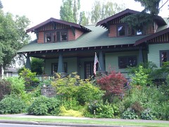 | Drake Park Neighborhood Historic District | under 500 feet | 2005 |
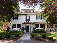 | Robert D. Moore House | under 500 feet | 1999 |
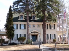 | Thomas McCann House | under 500 feet | 1980 |
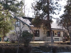 | Putnam, George Palmer and Dorothy Binney House | 0.1 miles | 1998 |
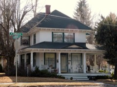 | Evan Andreas Sather House | 0.1 miles | 1997 |
 | Congress Apartments | 0.2 miles | 2000 |
| National Archives record | The nomination case file for reference 00000228 in Record Group 79. |
| Deschutes County | All 51 listed properties in this county. |