 Block
From the record
One of 650 National Register listings published here for Multnomah County · listed in 2019 · category: Building.
Sources: the National Register database, National Park Service
Listed on the National Register of Historic Places in 2019.
One of 650 National Register listings published here for Multnomah County · listed in 2019 · category: Building.
Sources: the National Register database, National Park Service
Regional context, not property-specific evidence. The federal mineral resources record lists 35 workings within 5 miles of Kiernan House: 25 past producers, 7 producers, 1 occurrence, 1 prospect. 7 still produce. What was taken out: Sand and Gravel, Construction, Stone, Stone, Crushed/Broken, Iron. Distance is straight-line from the map coordinates, so a quarry counted here may appear on a neighbouring settlement's page as well.
| Where | Site | Commodity | Status | Recorded |
|---|---|---|---|---|
| Oswego Iron Mine | Iron | Past Producer | 1867, 1894 | |
| Oswego Iron Mine | Iron | Past Producer | ||
| Portland Tunnel | Mercury | Occurrence | ||
| Portland Tunnel | Mercury | Prospect | ||
| Sylvan Brick Co | Clay | Past Producer | ||
| Sylvan Brick Company | Clay | Past Producer | ||
| City of Portland | Stone | Past Producer | ||
| City of Portland | Stone, Crushed/Broken | Past Producer | ||
| Grimms Fuel Co | Stone | Past Producer | ||
| Grimms Fuel Co. Pit | Stone, Crushed/Broken | Past Producer |
Regional context, not property-specific evidence. The National Weather Service names Portland, the town this property stands in, in 16 storm reports between 1999 and 2018: 6 heavy rain, 5 thunderstorm wind, 2 hail, 1 lightning. No death or injury is recorded in these reports. Each account below is quoted exactly as the forecast office filed it, from the NOAA Storm Events Database, and each date opens the federal record of that event.
| When | Event | Place named | Harm | What the report says |
|---|---|---|---|---|
| December 2015 | Heavy Rain | West Portland | $621,000 | Heavy rain resulted in urban flooding across the Portland metro area. All Amtrack and freight trains were shut down between Portland and Vancouver due to flooding. A mobile home park in Gresham flooded. There were a couple of land slides on Highway 30 where debris covered the highway. One of these slides was near German Town Road. The other slide was near the St John's Bridge, hit a car (with no injuries) as it happened, and covered all lanes of Highway 30. |
| October 2016 | Heavy Rain | Portland | $30,000 | Heavy rain caused culverts and low-lying urban areas to flood, including 4th and Morrison. Also flooding was reported at the Portland State University Bookstore. |
| May 2014 | Thunderstorm Wind | Portland | $11,000 | Winds from a thunderstorm resulted in a large Oak Tree falling on two parked cars in downtown Portland. |
| March 2015 | Heavy Rain | Portland | $6,000 | A mudslide crossed Northwest Marlborough Street into a residential garage after 3 to 6 inches of rain fell across Northwest Oregon. |
| September 2007 | Hail | Portland | $5,000 | Estimated half-inch hail fell near 162nd and Main. |
| July 2007 | Thunderstorm Wind | Portland | $5,000 | Reports received of strong wind resulting trees blown down in downtown Portland. |
| June 2009 | Thunderstorm Wind | Portland | $1,200 | The top of a 70-foot tree, estimated between 20 and 20 inches in diameter, was snapped off in downtown Portland at the intersection of SW Salmon Street and Park Avenue. A passer-by was nearly hit as it fell to the ground. Time of the event is estimated based nearby reports from the storm. |
| September 2018 | Heavy Rain | Portland | - | Standing water reported near NE 28th Ave between Glisan and Burnside. Trimet MAX lines were temporarily closed due to standing water between Lloyd Center and Hollywood. Rain guage at the Portland Airport reported 0.82 of an inch of rain. |
| July 2011 | Thunderstorm Wind | Portland | - | A thunderstorm moving through Multnomah County produced lightning that hit a tree which fell on power lines causing a power outage to about 1600 customers. |
| November 2009 | Heavy Rain | Portland | - | An observer reported receiving 0.98 inches in two and a half hours. |
| November 2009 | Flood | Portland | - | Major street flooding was reported at the intersection of 39th Avenue and Belmont Street, east of downtown Portland. |
| January 2007 | Heavy Rain | Portland | - | A total accumulation of 1.61 inches was reported at the WFO Portland. |
| August 1999 | Hail | Portland | - | A reporter from the Hillsboro Argus newspaper reported 3/4 inch hail near 33rd Ave and Columbia Boulevard in Portland. This is unusually large hail for the Portland area away from mountains or foothills. |
| May 2003 | Funnel Cloud | Portland | - | no account filed |
| May 2001 | Thunderstorm Wind | Portland | - | no account filed |
| August 1999 | Lightning | Portland | - | no account filed |
No historic map-sheet match is published for this property yet. That does not mean no map exists. This record needs a coordinate-quality review before it can be joined to a sheet boundary. Browse the county's mapped places while that work is pending.
Other National Register properties close enough to walk or drive between, ordered by distance from this one. Both positions come from the same geocoding pass that matched these properties to their map sheets.
| Photograph | Property | Distance | Listed |
|---|---|---|---|
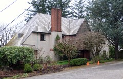 | W. Leland James House | 0.2 miles | 2016 |
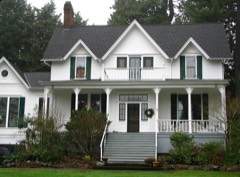 | Henry E. Dosch House | 0.8 miles | 1978 |
 | Terwilliger Parkway | 0.8 miles | 2021 |
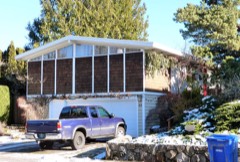 | Dr. Homer H. Harris House | 1.0 miles | 2017 |
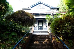 | Jewish Shelter Home | 1.1 miles | 1984 |
 | Cardwell-Parrish House | 1.2 miles | 1991 |
| National Archives record | The nomination case file for reference 100003460 in Record Group 79. |
| Multnomah County | All 650 listed properties in this county. |