 Block
From the record
One of 650 National Register listings published here for Multnomah County · listed in 2015 · category: Building · built in 1952, Northwest Regional style, by John Storrs.
Sources: the National Register database, National Park Service
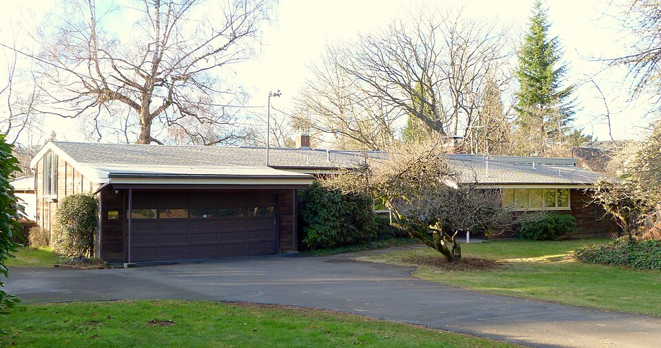
Built in 1952 (Northwest Regional style). Listed on the National Register of Historic Places in 2015.
One of 650 National Register listings published here for Multnomah County · listed in 2015 · category: Building · built in 1952, Northwest Regional style, by John Storrs.
Sources: the National Register database, National Park Service
Regional context, not property-specific evidence. The federal wildfire occurrence database lists 16 fires within 5 miles of David and Marianne Ott House between 1992 and 2020, burning about 4 acres in total. None started naturally. 3 were recorded as arson. Distance is straight-line from the map coordinates, so a fire counted here may appear on a neighbouring settlement's page as well.
| Reported cause | Fires |
|---|---|
| Recreation and ceremony | 6 |
| Debris and open burning | 4 |
| Arson/incendiarism | 3 |
| Equipment and vehicle use | 1 |
| Smoking | 1 |
| Fireworks | 1 |
The most recent of them, most recent first, with the day each was reported and the service that recorded it.
| Date | Cause | Size | Reported by | Name on the report |
|---|---|---|---|---|
| 22 September 1994 | Smoking | 1.0 acres | Molalla Unit | TUCKER RD |
| 2 September 2013 | Debris and open burning | under an acre | Columbia River Gorge National Scenic Area | SANDY 2 |
| 10 September 2002 | Arson/incendiarism | under an acre | Columbia River Gorge National Scenic Area | SANDY JUNCTION |
| 21 August 2018 | Recreation and ceremony | under an acre | Columbia River Gorge National Scenic Area | SANDY-ODF MOLALLA ASSIST |
| 20 August 2019 | Recreation and ceremony | under an acre | Columbia River Gorge National Scenic Area | SANDY RIVER |
| 16 August 2015 | Equipment and vehicle use | under an acre | Oregon Department of Forestry Salem Headquarters | ASHLEY'S FIRE |
| 16 August 2013 | Arson/incendiarism | under an acre | Columbia River Gorge National Scenic Area | SANDY |
| 16 August 1992 | Debris and open burning | under an acre | Molalla Unit | NURSERY #1 |
Regional context, not property-specific evidence. The federal mineral resources record lists 36 workings within 5 miles of David and Marianne Ott House: 23 past producers, 13 producers. 13 still produce. What was taken out: Sand and Gravel, Construction, Stone, Clay, Stone, Crushed/Broken. Distance is straight-line from the map coordinates, so a quarry counted here may appear on a neighbouring settlement's page as well.
| Where | Site | Commodity | Status | Recorded |
|---|---|---|---|---|
| Camp Collins Ymca | Geothermal | Producer | ||
| Columbia Brick Works | Clay | Past Producer | ||
| Columbia Brick Works | Clay | Producer | ||
| Damascus Pit & Plant | Stone, Crushed/Broken, Sand and Gravel, Construction | Past Producer | ||
| Lakeside Stables | Stone, Crushed/Broken | Producer | ||
| Midvale Quarry | Stone, Crushed/Broken | Producer | ||
| Oregon State Hwy Div 2 | Clay, Sand and Gravel, Construction | Past Producer | ||
| Lakeside Stables | Stone | Past Producer | ||
| Midvale Quarry | Stone | Past Producer | ||
| Quarry | Stone | Past Producer |
Regional context, not property-specific evidence. The National Weather Service names Gresham, the town this property stands in, in 9 storm reports between 1996 and 2020: 4 heavy rain, 2 lightning, 1 funnel cloud, 1 flash flood. The reports record 1 injury. Each account below is quoted exactly as the forecast office filed it, from the NOAA Storm Events Database, and each date opens the federal record of that event.
| When | Event | Place named | Harm | What the report says |
|---|---|---|---|---|
| August 1999 | Lightning | Gresham | 1 hurt | Lightning struck Richard Parker, 14, of Gresham as he was bicycling near NE 230th Court in Wood Village at 1230 PDT. The lightning struck him in the head and exited through his groin. His companion at the time called 911 from a neighbors house and paramedics arrived in about two minutes. Parkers's heart had stopped, and he suffered a concussion and second degree burns on his face, chest, groin, and upper legs. Parker apparently did not receive the full force of the bolt directly, which spared his life. He was still on his bicycle with his hands on the handlebars when the paramedics arrived. He was revived in the ambulance enroute to the hospital and he is expected to recover. |
| December 2015 | Flood | Gresham | $1,087,000 | Heavy rain resulted in Johnson Creek to exceed major flood stage. Water from the river flooded homes, vehicles, and businesses. Several roads were closed due to the high water. |
| October 2015 | Heavy Rain | Gresham | $150,000 | Heavy rain combined with clogged drains from leaves resulted in urban flooding. The Portland Fire and Rescue received 32 calls in regards to street flooding, and assisted travelers in 5 cars from their stalled or trapped cars to dry land. Four roads were closed in the area for high water, and several Max lines were cancelled due to flooding under bridges. Thirteen Max trains were damaged by water and will be out of service for up to 2 weeks. One roof collapsed from the weight of rain water after the roof drains had been clogged, and several homes or businesses had flooded basements. A tree had fallen onto and damaged a parked car. |
| June 2005 | Lightning | Gresham | $50,000 | no account filed |
| September 2020 | Heavy Rain | Gresham | - | Heavy rainfall reported over 48 hours. |
| January 2007 | Heavy Rain | Gresham | - | A total accumulation of 1.93 inches was reported. |
| December 2007 | Heavy Rain | Gresham | - | Storm total precipitation was 3.70 inches. |
| August 2004 | Flash Flood | Gresham | - | A debris flow was reported by the public at Kerslake Road and Stark Street along the Sandy River. |
| October 1996 | Funnel Cloud | North Gresham | - | no account filed |
No historic map-sheet match is published for this property yet. That does not mean no map exists. This record needs a coordinate-quality review before it can be joined to a sheet boundary. Browse the county's mapped places while that work is pending.
Other National Register properties close enough to walk or drive between, ordered by distance from this one. Both positions come from the same geocoding pass that matched these properties to their map sheets.
| Photograph | Property | Distance | Listed |
|---|---|---|---|
 | Emanuel and Christina Anderson House | 0.6 miles | 2005 |
 | William Gedamke House | 1.2 miles | 1989 |
 | Charles and Fae Olson House | 1.5 miles | 2007 |
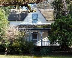 | Charles Hunter Hamlin House | 1.5 miles | 2016 |
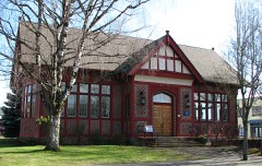 | Gresham Carnegie Library | 1.8 miles | 2000 |
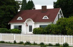 | Dr. Herbert H. Hughes House | 2.2 miles | 2001 |
| National Archives record | The nomination case file for reference 15000167 in Record Group 79. |
| Multnomah County | All 650 listed properties in this county. |