 Block
From the record
One of 69 National Register listings published here for Josephine County · listed in 1982 · category: Building.
Sources: the case file at the National Archives · the National Register database, National Park Service
Listed on the National Register of Historic Places in 1982.
One of 69 National Register listings published here for Josephine County · listed in 1982 · category: Building.
Sources: the case file at the National Archives · the National Register database, National Park Service
Regional context, not property-specific evidence. The federal wildfire occurrence database lists 492 fires within 5 miles of Kienlen-Harbeck Building between 1992 and 2020, burning about 368 acres in total. 47 started naturally. 17 were recorded as arson. Distance is straight-line from the map coordinates, so a fire counted here may appear on a neighbouring settlement's page as well.
| Reported cause | Fires |
|---|---|
| Equipment and vehicle use | 120 |
| Debris and open burning | 71 |
| Smoking | 57 |
| Missing data/not specified/undetermined | 50 |
| Natural | 47 |
| Recreation and ceremony | 33 |
| Fireworks | 30 |
| Other causes | 27 |
| Misuse of fire by a minor | 25 |
| Arson/incendiarism | 17 |
| Power generation/transmission/distribution | 10 |
| Railroad operations and maintenance | 4 |
| Firearms and explosives use | 1 |
The most recent of them, most recent first, with the day each was reported and the service that recorded it.
| Date | Cause | Size | Reported by | Name on the report |
|---|---|---|---|---|
| 9 September 2015 | Debris and open burning | under an acre | Medford District | GRANITE HILL 3 |
| 9 September 2011 | Equipment and vehicle use | under an acre | Grants Pass Unit | VERTICAL DRIVE |
| 9 September 2008 | Equipment and vehicle use | under an acre | Grants Pass Unit | I-5 MP 55 OVERPASS #2 |
| 9 September 2001 | Misuse of fire by a minor | under an acre | Grants Pass Unit | HIGHLAND AVE |
| 8 September 2016 | Missing data/not specified/undetermined | under an acre | Oregon Department of Forestry Salem Headquarters | REDWOOD HWY 4444 |
| 8 September 2011 | Smoking | 2.5 acres | Grants Pass Unit | HILLCREST |
| 8 September 2002 | Debris and open burning | under an acre | Grants Pass Unit | 2119 WILLIAMS HWY |
| 8 September 2002 | Fireworks | under an acre | Grants Pass Unit | FOOTHILL BLVD |
Regional context, not property-specific evidence. The federal mineral resources record lists 46 workings within 5 miles of Kienlen-Harbeck Building: 26 past producers, 9 producers, 5 occurrences, 5 prospects. 9 still produce. What was taken out: Gold, Stone, Stone, Crushed/Broken, Silver. Distance is straight-line from the map coordinates, so a quarry counted here may appear on a neighbouring settlement's page as well.
| Where | Site | Commodity | Status | Recorded |
|---|---|---|---|---|
| Jewett Mine | Gold, Tellurium, Bismuth, Silver, Copper, Arsenic | Producer | Altaite, Gold, Pyrite, Pyrrhotite, Sylvanite, Tetradymite | |
| Jewett Mine | Gold, Arsenic, Silver, Copper | Past Producer | ||
| Red Jacket Mine | Gold, Silver, Copper, Lead | Past Producer | Bornite, Chalcopyrite, Chrysocolla, Galena, Gold, Malachite, Pyrite, Pyrrhotite | |
| Red Jacket Mine | Gold, Silver, Lead, Copper | Past Producer | ||
| Cal-Ore Power Co. | Nickel | Occurrence | ||
| Cal-Ore Power Co. | Nickel | Unknown | ||
| Derick Berylium | Beryllium | Prospect | ||
| Dry Diggins | Gold, Silver | Producer | ||
| Gold Chief | Gold, Copper | Producer | Chalcopyrite, Pyrite | |
| Gold Chief Mine | Gold, Copper | Past Producer |
Regional context, not property-specific evidence. The National Weather Service names Grants Pass, the town this property stands in, in 9 storm reports between 1997 and 2012: 4 hail, 2 lightning, 2 heavy rain, 1 flood. No death or injury is recorded in these reports. Each account below is quoted exactly as the forecast office filed it, from the NOAA Storm Events Database, and each date opens the federal record of that event.
| When | Event | Place named | Harm | What the report says |
|---|---|---|---|---|
| November 2012 | Flood | Grants Pass | $4,000,000 | Spotters reported up to five inches of rain along with localized flooding with this storm. Local roads near OBrien were flooded in four different places. |
| July 2007 | Lightning | Grants Pass | $60,000 | The steeple of the Newman United Methodist Church was struck twice this day, damaging the steeple, windows, organ, and some other stuff. Damage amounted to $60,000. |
| June 2012 | Hail | Grants Pass | - | A thunderstorm in south Grants Pass dropped hail a little bigger than quarter sized...about 1 inch in diameter. Associated winds were 20 to 25 mph. |
| April 2005 | Heavy Rain | Grants Pass | - | A spotter 4 NNW of Grants Pass recorded 3.60 inches of rain in one hour ending at 1630 PDT. |
| April 2005 | Heavy Rain | Grants Pass | - | A spotter 2 N of Grants Pass recorded 2.00 inches of rain in one hour ending at 1630 PDT. |
| September 1997 | Hail | Grants Pass | - | 1-1/4 inch hail. |
| September 1997 | Hail | Grants Pass | - | 3/4-1 inch hail covered the ground. |
| September 1997 | Hail | Grants Pass | - | 3/4 inch hail. Storm knocked out power to about 75 residences. |
| April 1998 | Lightning | Grants Pass | - | no account filed |
No historic map-sheet match is published for this property yet. That does not mean no map exists. This record needs a coordinate-quality review before it can be joined to a sheet boundary. Browse the county's mapped places while that work is pending.
Other National Register properties close enough to walk or drive between, ordered by distance from this one. Both positions come from the same geocoding pass that matched these properties to their map sheets.
| Photograph | Property | Distance | Listed |
|---|---|---|---|
| Grants Pass G Street Historic District | under 500 feet | 1993 | |
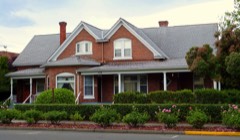 | Herbert and Katherine Smith House | 0.1 miles | 1983 |
| Rogue Theatre | 0.1 miles | 2005 | |
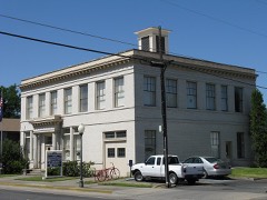 | Grant Pass City Hall and Fire Station | 0.1 miles | 1984 |
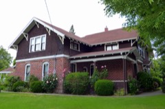 | Claus and Hannchen Schmidt House | 0.2 miles | 2004 |
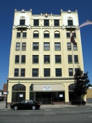 | Redwoods Hotel | 0.2 miles | 1979 |
| National Archives record | The nomination case file for reference 82003729 in Record Group 79. |
| Josephine County | All 69 listed properties in this county. |