 Block
From the record
One of 47 National Register listings published here for Douglas County · listed in 1990 · category: District.
Sources: the case file at the National Archives · the National Register database, National Park Service
Listed on the National Register of Historic Places in 1990.
One of 47 National Register listings published here for Douglas County · listed in 1990 · category: District.
Sources: the case file at the National Archives · the National Register database, National Park Service
Regional context, not property-specific evidence. The federal wildfire occurrence database lists 96 fires within 5 miles of Laurelwood Historic District between 1992 and 2020, burning about 688 acres in total. 5 started naturally. 12 were recorded as arson. Distance is straight-line from the map coordinates, so a fire counted here may appear on a neighbouring settlement's page as well.
| Reported cause | Fires |
|---|---|
| Equipment and vehicle use | 17 |
| Missing data/not specified/undetermined | 15 |
| Debris and open burning | 14 |
| Arson/incendiarism | 12 |
| Power generation/transmission/distribution | 8 |
| Smoking | 7 |
| Misuse of fire by a minor | 7 |
| Other causes | 6 |
| Natural | 5 |
| Recreation and ceremony | 4 |
| Fireworks | 1 |
The most recent of them, most recent first, with the day each was reported and the service that recorded it.
| Date | Cause | Size | Reported by | Name on the report |
|---|---|---|---|---|
| 9 September 2020 | Recreation and ceremony | 2.9 acres | Oregon Department of Forestry Salem Headquarters | SUMMIT DRIVE |
| 9 September 2009 | Missing data/not specified/undetermined | under an acre | Roseburg District | ORCHARD LANE |
| 9 September 2000 | Debris and open burning | 1.5 acres | Douglas Forest Protective Association | GEM DRIVE |
| 6 September 2012 | Equipment and vehicle use | under an acre | Oregon Department of Forestry Salem Headquarters | TOPAZ DRIVE |
| 5 September 2019 | Natural | under an acre | Oregon Department of Forestry Salem Headquarters | DAWSON RD |
| 3 September 2011 | Other causes | under an acre | Central Unit | BREEZY LN. |
| 3 September 2001 | Smoking | 3.9 acres | Douglas Forest Protective Association | NAVAJO DRIVE |
| 29 September 2000 | Other causes | 1.0 acres | Douglas Forest Protective Association | KESTER RIDGE |
Regional context, not property-specific evidence. The federal mineral resources record lists 74 workings within 5 miles of Laurelwood Historic District: 41 past producers, 33 producers. 33 still produce. What was taken out: Sand and Gravel, Construction, Stone, Stone, Crushed/Broken. Distance is straight-line from the map coordinates, so a quarry counted here may appear on a neighbouring settlement's page as well.
| Where | Site | Commodity | Status | Recorded |
|---|---|---|---|---|
| Boggs Site | Stone, Crushed/Broken | Producer | ||
| Christensen Pit | Stone, Crushed/Broken | Producer | ||
| Compton Quarry & Plant | Stone, Crushed/Broken | Producer | ||
| Cunningham Quarry | Stone, Crushed/Broken | Producer | ||
| Cunningham Quarry | Stone, Crushed/Broken | Producer | ||
| Dan Parker Pit | Stone, Crushed/Broken | Producer | ||
| Green Quarry | Stone, Crushed/Broken | Producer | ||
| Keller Pit | Stone, Crushed/Broken | Producer | ||
| Kester Road Upper Quarry | Stone, Crushed/Broken | Producer | ||
| Looking Glass Quarry | Stone, Crushed/Broken | Past Producer |
Regional context, not property-specific evidence. The National Weather Service names Roseburg, the town this property stands in, in 4 storm reports between 2009 and 2025: 3 flood, 1 thunderstorm wind. No death or injury is recorded in these reports. Each account below is quoted exactly as the forecast office filed it, from the NOAA Storm Events Database, and each date opens the federal record of that event.
| When | Event | Place named | Harm | What the report says |
|---|---|---|---|---|
| June 2009 | Thunderstorm Wind | Roseburg | $10,000 | The Roseburg newspaper reported that gusty winds caused damage throughout the area and two trees fell onto the Stewart Park bandshell in Roseburg. Power outages were also reported. |
| March 2025 | Flood | Roseburg | - | Deer Creek at Roseburg rose above minor flood stage of 10.0 ft. at 16/605 PST, peaked in minor flood stage at 16/1445 PST at 15.91 ft. It then fell below flood stage at 16/2250 PST. At 12.0 feet, Widespread flooding of structures and farmland is occurring. |
| February 2019 | Flood | Roseburg | - | Deer Creek at Roseburg rose above flood stage (10.0 feet) at 24/1730 PST, crested at 11.78 feet at 24/2030 PST, then fell below flood stage at 25/0430 PST. |
| February 2011 | Flood | Roseburg | - | Deer Creek exceeded the flood stage of 10.0 feet at 15/1500 PST, crested at 10.02 feet at 15/1530 PST, the fell below flood stage by 15/1600 PST. |
No historic map-sheet match is published for this property yet. That does not mean no map exists. This record needs a coordinate-quality review before it can be joined to a sheet boundary. Browse the county's mapped places while that work is pending.
Other National Register properties close enough to walk or drive between, ordered by distance from this one. Both positions come from the same geocoding pass that matched these properties to their map sheets.
| Photograph | Property | Distance | Listed |
|---|---|---|---|
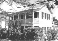 | Creed Floed House | 0.3 miles | 1974 |
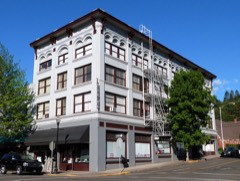 | Roseburg Downtown Historic District | 0.5 miles | 2003 |
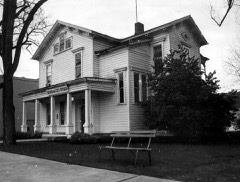 | Judge William R. Willis House | 0.5 miles | 1975 |
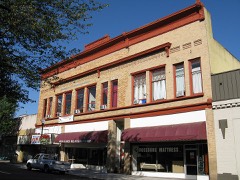 | Kohlhagen Building | 0.6 miles | 1997 |
 | U.S. Post Office | 0.6 miles | 1979 |
 | Oregon Roseburg National Guard Armory | 0.6 miles | 1993 |
| National Archives record | The nomination case file for reference 90001521 in Record Group 79. |
| Douglas County | All 47 listed properties in this county. |