 Block
Block
Celina, Ohio
14 topographic sheets cover this place, the earliest surveyed in 1914 and the latest in 1986. It stands in Jefferson Township. It lies in ZIP code area 45822. The Survey maps it on the Celina quadrangle. 10,935 people lived here at the 2020 count. It stands 876 feet above sea level.
Research this city
This curated hub for Mercer County, Ohio brings together the page's documented record links, visible map or image evidence where published, and routes to related local records.
What is documented here?
Use the page's provenance and linked records to distinguish the source material from the site's navigation and summaries.
How should I cite it?
Open the original record, preserve its repository and identifier, then use the citation tool for this page as a path back to the source.
Where should I go next?
Follow the county or state hub for related places and records, then use the guide for a source-aware research sequence.
Population over time
2 figuresCelina grew from 10,400 to 10,935 between 2010 and 2020. These are the recorded population figures Wikidata holds for this place, reached through the Geographic Names Information System number this page is keyed on rather than by name, so they belong to this place and not to another of the same name. Most are census counts, but not all are: an early figure may be a founding or settlement estimate. The change column is computed, and is left blank where more than 20 years separate a figure from the one before it, because a gap that long is not a change between two counts.
| Year | People | Change |
|---|---|---|
| 2010 | 10,400 | |
| 2020 | 10,935 | +535 (+5%) |
Then and now
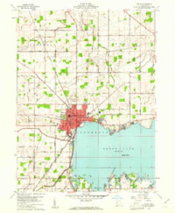
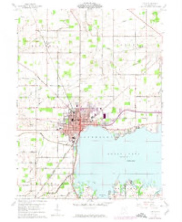
1914 to 1986The same ground, surveyed 72 years apart. Drag the handle to wipe between them. Both sheets are United States Geological Survey originals; neither has been altered.

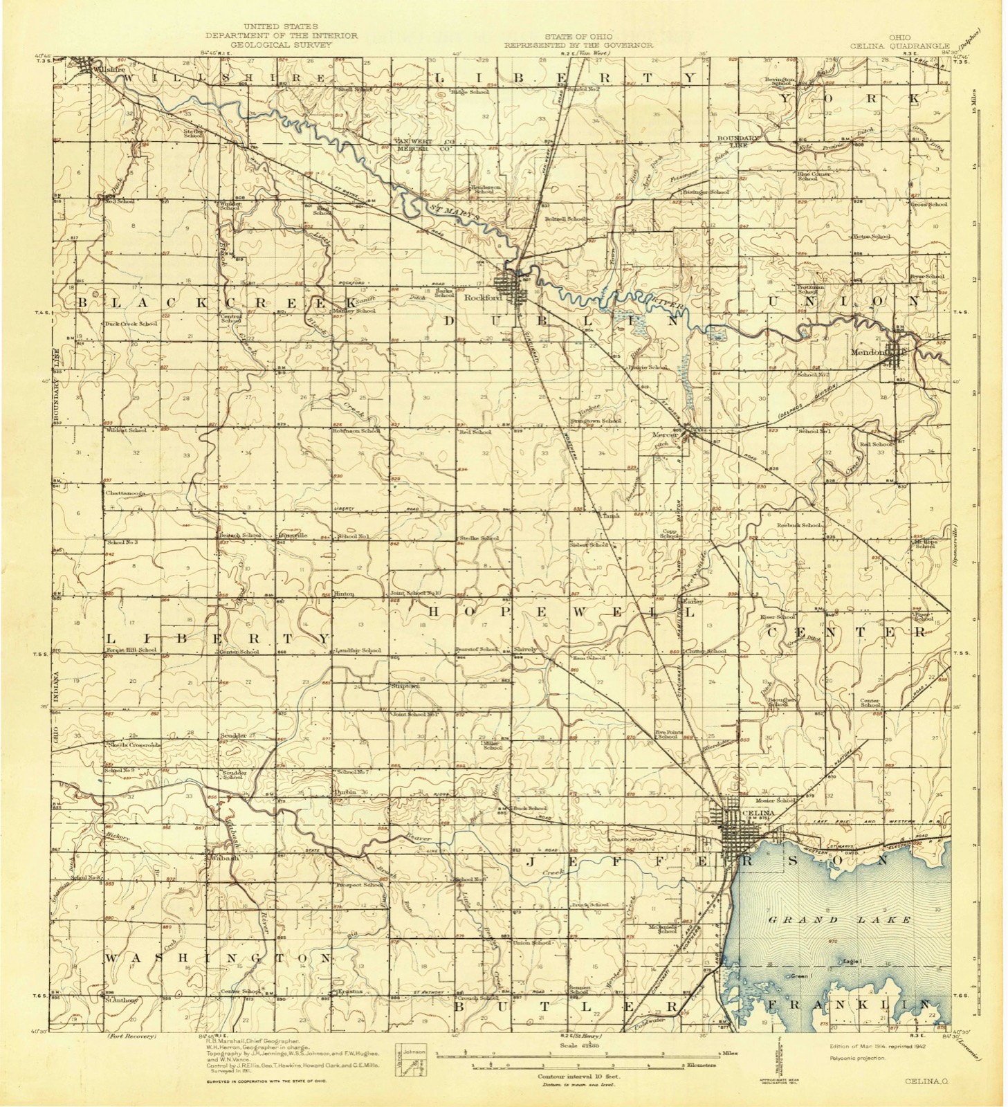
Topographic sheets covering this place
14 sheetsMatched by testing this settlement's coordinate against the published boundary of every sheet in the United States Geological Survey's historical collection. Each opens the scanned sheet at the Survey.
- 1914 USGS Celina quadrangle1:62500
- 1944 USGS Celina quadrangle1:62500
- 1953 USGS Muncie quadrangle1:250000
- 1953 USGS Muncie quadrangle1:250000
- 1953 USGS Muncie quadrangle1:250000
- 1953 USGS Muncie quadrangle1:250000
- 1953 USGS Muncie quadrangle1:250000
- 1956 USGS Muncie quadrangle1:250000
- 1960 USGS Celina quadrangle1:24000
- 1960 USGS Celina quadrangle1:24000
- 1960 USGS Celina quadrangle1:24000
- 1986 USGS Lima quadrangle1:100000
- 1986 USGS Lima quadrangle1:100000
- 1986 USGS Lima quadrangle1:100000









Specimens collected nearby
12 of 289 shownMuseums hold 289 specimens collected within 10 miles of Celina between 1840 and 1975: 282 Animalia, 5 Plantae, 1 Unrecorded, 1 Bacteria. 12 distinct Species records are shown. Collected by . R. Slonakerj, Adler, K. K., Brown, H P and others. Each is a physical object with a catalogue number, and each entry opens the museum's record. This is what was collected and kept, not a survey of what lives here - nothing can be concluded from a species being absent.
| Image | Species | Year | Collected by | Where, as recorded |
|---|---|---|---|---|
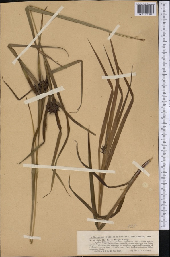 | Carex grayi J.Carey | 1903 | Wetzstein A. | |
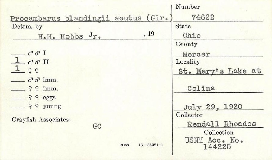 | Procambarus blandingii (Harlan, 1830) | 1920 | R. Rhoades | St. Marys Lake at Celina |
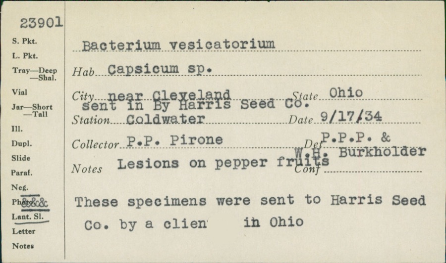 | unnamed | 1934 | P. P. Pirone | Coldwater |
 | Silene virginica L. | 1840 | J. Wolle, D. Blum | |
 | Umbra limi (Kirtland, 1840) | 1886 | Meek and Harris | Montezuma |
 | Ardea alba egretta Gmelin, 1789 | 1888 | J. R. Slonaker | Celina |
 | Calidris canutus (Linnaeus, 1758) | 1888 | J. R. Slonaker | Celina |
 | Ceryle alcyon alcyon Cramp & Simmons, 1977-1994 | 1888 | J. R. Slonaker | Celina |
 | Charadrius vociferus Linnaeus, 1758 | 1888 | J. R. Slonaker | Celina |
 | Cistothorus palustris dissaeptus Bangs, 1902 | 1888 | J. R. Slonaker | Celina |
 | Gallinago gallinago delicata (Ord, 1825) | 1888 | J. R. Slonaker | Celina |
 | Porzana carolina (Linnaeus, 1758) | 1888 | J.R.S. | Celina |
All 289 specimens within 10 miles, at the Global Biodiversity Information Facility.
Mines and quarries nearby
2 within 5 milesThe federal mineral resources record lists 2 workings within 5 miles of Celina: 1 past producer, 1 producer. 1 still produces. What was taken out: Limestone, General, Stone, Crushed/Broken. Distance is straight-line from the map coordinates, so a quarry counted here may appear on a neighbouring settlement's page as well.
| Where | Site | Commodity | Status | Recorded |
|---|---|---|---|---|
| John W. Karch Quarry | Limestone, General | Past Producer | Sedimentary | |
| John W. Karch Quarry | Stone, Crushed/Broken | Producer |
Storms nearby
60 of 85 shownThe National Weather Service names Celina in 85 storm reports between 1994 and 2026: 40 thunderstorm wind, 20 hail, 14 flood, 7 flash flood. The reports record 13 injuries. Each account below is quoted exactly as the forecast office filed it, from the NOAA Storm Events Database, and each date opens the federal record of that event.
| When | Event | Place named | Harm | What the report says |
|---|---|---|---|---|
| November 2017 | Tornado (EF2) | Celina | 8 hurt, $5,000,000 | Law enforcement initially observed a funnel cloud near the intersection of Main Street and Schunk Road in Celina. Just to the northeast of this report is where it appears the tornado first touched down, where multiple tree limbs were knocked down between Main Street and W Bank Road.||It is believed that the tornado then skirted Grand Lake St. Marys, producing minor tree and structural damage near the corner of Lake Shore Drive and Elmgrove Avenue. The tornado then likely moved back over a small portion of Grand Lake St. Marys before knocking down a fence and a few small trees at the back parking lot of a Wendy's restaurant on E Market Street. A one story home on Vine Street also had shingles removed from about 10 percent of its roof. ||Further east on E Market Street, the tornado intensified as it impacted Lakeshore Auto Sales. This business had its roof completely destroyed. Along Lake Street, several large branches were knocked down on one property, with significant debris splatter on the east-facing side of a home along with some removal of siding.||Further east on E Market Street, another business had a significant portion of its roof removed, and windows at the front of the business were broken. On the 1100 block of E Livingston Street, tree damage was common and several of the homes also exhibited minor roof damage. One of the homes also had one large hardwood tree knocked down onto its second floor, producing significant roof damage. ||To the northeast, an outbuilding associated with a business on Grand Lake Road was completely destroyed. On the other side of Grand Lake Road, significant debris wrapped around a fence on Montgomery Field. Trees were also uprooted on adjacent May Street.||The most significant damage was then observed beginning at Crown Equipment Corporation. A significant portion of the roof was removed, and exterior walls on the southwest side of the building also collapsed. Damage was also noted on the east-facing side of the building. ||Businesses along Havermann Road were also affected, most notably C-Town Wings, where the front windows were blown out, and the Dollar General store which sustained considerable structural damage, including roof collapse and exterior wall failure. Observed damage from the Crown Equipment Corporation to the Dollar General store was consistent with EF2 tornadic winds.||Several businesses within a strip mall along Havermann Road also sustained some damage, particularly a sports store where the front doors were blown in and a portion of the roof collapsed into the store. ||Damage to the northeast of the strip mall became more sparse, however some trees were downed near the intersection of Howick Road and Riley Road. The end of the tornado appears to have occurred near the 8000 block of Riley Road. |
| June 2002 | Thunderstorm Wind | Celina | 1 hurt, $50,000 | High winds knocked down over 100 trees in the city, including twenty which were two feet in diameter or larger. There were several reports of trees falling on cars and homes producing minor damage. A woman sustained fractured ribs when a large branch struck her car during the storm. The storm also produced dime sized hail throughout town. |
| June 2012 | Thunderstorm Wind | Celina | 1 hurt, $30,000 | Several large limbs and power poles were down within the city due to thunderstorm winds. Roof of one structure was damaged. One tree fell on a camper at the fairgrounds, injuring one person. |
| June 2012 | Thunderstorm Wind | Celina | 1 hurt, $10,000 | Damage occurred to a stage due to thunderstorm winds at a festival in downtown Celina. One stage crew member was injured. |
| July 1994 | Thunderstorm Wind | Celina | 1 hurt, $5,000 | Trees and limbs were downed, some on power lines. A police officer responding to a call to check on downed power lines had to be treated after stepping out of the car into some standing water which had been electrified by the downed line. |
| June 2000 | Lightning | Celina | 1 hurt | A girl was struck by lightning on a golf course and was hospitalized in critical condition. Time is estimated. |
| March 2024 | Tornado (EF1) | Celina | $500,000 | The tornado initially began in the city of Celina, a couple of blocks east of North Main Street, along East Anthony Street. A few houses received light damage to roofs and a few trees were knocked down. Additional light tree debris was noted along East Anthony Street toward College Avenue. The tornado continued eastward, causing tree and minor roofing damage to houses on Devonshire and Cumberland Drive. One house on Devonshire Drive had more significant roof damage. The tornado moved east from there, causing damage to the Menards store and Eastview Park, before crossing State Route 29. Sporadic tree damage was found between State Route 703 and State Route 29 as the tornado continued east. A few homes on Long Pine Drive and surrounding courts were damaged.||As the tornado neared Riley Road, it took on a more northeast motion, damaging several buildings south of State Route 29 before crossing from south to north. Damaged outbuildings, homes, and snapped/uprooted trees were then observed along Four Turkey Road north of State Route 29. After the tornado crossed State Route 29, the width of observed damage grew quite significantly, suggesting the circulation of the tornado grew. The observed damage, mostly consisting of damaged out-buildings, a few houses, and numerous trees, indicated an intensification of the tornado as well, with a swath of EF-1 damage stretching from Four Turkey Road to the Mercer/Auglaize County line. The tornado entered Auglaize County at 1808EST and continued east across the western part of the county before ending between Bay Road and Kettlersville Road at 1824EST. |
| July 2003 | Flash Flood | Celina | $500,000 | Major flooding continued across the county, with travel virtually at a standstill as many of the county roads were underwater. The worst flooding continued from Celina where Grand Lake Saint Marys was out of its banks, north to Rockford and Mendon with the Saint Marys River in record flood. Homes and businesses were flooded in Rockford, Celina, Mendon, and Montezuma. |
| July 2003 | Flash Flood | Celina | $500,000 | The spillway to Grand Lake Saint Marys overflowed onto US Route 127 and surrounding homes and businesses. An athletic club and medical office were under several feet of water. Beaver Creek remained well out of its banks, causing additional flooding of homes further downstream. |
| April 2011 | Tornado (EF2) | Celina | $340,000 | At the beginning of the path near Lake Street in Celina, substantial roof and chimney damage was observed and very large trees were uprooted and snapped. Further to the northeast along Havemann Road, damage occurred to a home improvement warehouse, where as much as twenty percent of the roof structure was uplifted and the HVAC units were moved. In addition, lumber impaled roofing material and damage occurred to indoor inventory. Also at this location, wooden fence walls were down and snapped at the base of their four by four fence posts. Nearby, numerous power poles were snapped and metal light posts were down. On the northwest corner of Havemann and Route 29, a large brick free standing grocery building suffered major damage, including nearly all of the roof being lifted off and one of the brick walls collapsing. Further to the northeast along the path, substantial damage occurred to a home along Staeger Road. The entire attached garage was destroyed with nearly a third of the roofing on the home gone. The siding on the second story of the home had been impaled by a two by four section of lumber. A small sport utility vehicle parked in the rear of the home was toppled and a twenty-five foot mobile home was moved nearly thirty yards. A forty by fifty foot steel framed outbuilding was completely demolished. A pontoon boat which was within this outbuilding was also moved at least fifteen yards. Additional damage further to the northeast in Mercer County occurred along Riley Road between Oldtown and Howick Roads. One wooden and one steel barn were destroyed. An additional steel frame building suffered door damage and damage to part of the roof and a wall. Estimated maximum wind speeds based on damage is 115 miles per hour. |
| February 2011 | Flash Flood | Celina | $250,000 | Multiple homes were flooded with water coming into the windows. Evacuations were also necessary across the flooded area. |
| April 2019 | Flood | Celina | $100,000 | Ohio Route 127 North was completely shut down due to high water. |
| July 2013 | Thunderstorm Wind | Celina | $100,000 | Multiple trees were downed in the county due to thunderstorm winds. A mini mart suffered a partial building collapse in Celina. A tree was downed on top of a car in Celina. |
| April 1994 | Thunderstorm Wind | Celina | $50,000 | Barn blown down, trees downed. |
| July 2003 | Flash Flood | Celina | $20,000 | Several roads were submerged in one foot of standing water. Homes on the south side of town sustained major basement flooding as Beaver Creek came out of its banks. |
| July 2020 | Thunderstorm Wind | Celina | $10,000 | A tree was uprooted and fell onto two homes. |
| December 2006 | Flood | Celina | $10,000 | Heavy rain and strong southerly winds helped to push Grand Lake Saint Marys out of its banks along its northern shore from Celina east to the Mercer-Auglaize county line. |
| July 2003 | Flash Flood | Celina | $10,000 | Several homes in town sustained basement flooding. Numerous roads had high water. |
| July 1998 | Thunderstorm Wind | Celina | $10,000 | Numerous trees downed. |
| November 1998 | Thunderstorm Wind | Celina | $10,000 | Roof blown off a car port and trees down. |
| February 2009 | Thunderstorm Wind | Celina | $8,000 | Several trees and power lines were knocked down. A trailer was blown into a road. |
| June 2005 | Thunderstorm Wind | Celina | $8,000 | A wall was knocked down at a Bob Evans restaurant under construction. The construction site is located at the intersection of State Route 29 and Havemann Road. |
| May 2006 | Hail | Celina | $6,000 | no account filed |
| April 2025 | Thunderstorm Wind | Celina | $5,000 | Numerous trees were downed. |
| July 2024 | Thunderstorm Wind | Celina | $5,000 | A tree fell on a home west of Celina. |
| August 2019 | Thunderstorm Wind | Celina | $5,000 | Several limbs were knocked down on the north side of Celina. Also, some field tile was removed from an unknown type of structure. |
| April 2012 | Thunderstorm Wind | Celina | $5,000 | Five electric poles were reported down on State Route 197. Two trees were also reported down in the area. This damage occurred due to thunderstorm winds. |
| March 2009 | Thunderstorm Wind | Celina | $5,000 | A road sign was blown over. A shed sustained minor damage. |
| August 2007 | Thunderstorm Wind | Celina | $5,000 | Several trees and large limbs were downed over the eastern part of the county. |
| August 2007 | Thunderstorm Wind | Celina | $5,000 | Several trees, large limbs and transformers were downed near the county fairgrounds. |
| March 2007 | Flood | Celina | $5,000 | A few roads were flooded across the county. |
| July 1997 | Thunderstorm Wind | Celina | $5,000 | Trees and power poles downed. |
| November 1994 | Thunderstorm Wind | Celina | $5,000 | Minor structural damage occurred to a house. |
| June 1995 | Thunderstorm Wind | Celina | $4,000 | Several large trees downed. |
| June 1995 | Thunderstorm Wind | Celina | $4,000 | Several large trees and limbs were downed. |
| July 2013 | Thunderstorm Wind | Celina | $3,000 | Five trees were reported down due to thunderstorm winds. |
| August 2007 | Thunderstorm Wind | Celina | $3,000 | Large tree limbs were downed. |
| March 2007 | Flood | Celina | $3,000 | Several roads were flooded and closed across the county. |
| June 2005 | Thunderstorm Wind | Celina | $3,000 | Winds were estimated near 60 mph with large limbs downed. |
| June 2004 | Thunderstorm Wind | Celina | $3,000 | Trees were downed. |
| July 2003 | Thunderstorm Wind | Celina | $3,000 | Trees and powerlines were downed. |
| July 2003 | Thunderstorm Wind | Celina | $3,000 | Trees and large limbs were downed. |
| July 2003 | Thunderstorm Wind | Celina | $3,000 | Trees and powerlines were downed across town. |
| August 2003 | Thunderstorm Wind | Celina | $3,000 | Large limbs were downed. |
| July 2002 | Thunderstorm Wind | Celina | $3,000 | Large limbs and power lines were blown down. |
| August 2011 | Thunderstorm Wind | Celina | $2,000 | Trees were reported down due to damaging thunderstorm winds. |
| October 2010 | Thunderstorm Wind | Celina | $2,000 | Numerous trees were reported down due to damaging thunderstorm winds. |
| June 2000 | Thunderstorm Wind | Celina | $2,000 | Trees were downed on the south side of Celina. |
| July 2023 | Thunderstorm Wind | Celina | $1,000 | A tree was downed along Fountain Avenue. |
| July 2020 | Thunderstorm Wind | Celina | $1,000 | A tree was downed in the 700 block of Murlin Avenue. |
| June 2007 | Hail | Celina | $1,000 | no account filed |
| April 2026 | Thunderstorm Wind | Celina | $500 | Several large tree branches were downed. |
| July 2020 | Thunderstorm Wind | Celina | $500 | A one and a half foot diameter tree limb fell onto a house. |
| June 2015 | Thunderstorm Wind | Celina | $500 | Several large limbs knocked down at the high school and on Zillah Street.|. |
| May 1995 | Thunderstorm Wind | Celina | $3 | Trees were downed. |
| April 2026 | Flood | Celina | - | High water was reported in several yards in Celina. |
| March 2023 | Flood | Celina | - | High water was reported at the intersection of Hellwarth and Mud Pike Roads. |
| June 2022 | Flood | Celina | - | Street flooding was reported at the intersection of Wayne Street and North Mill Street. |
| July 2020 | Flood | Celina | - | High water was reported on a few streets in Celina. |
| May 2019 | Flood | Celina | - | High water was reported on many roads in the Celina area. |
Newspapers printed here
0 digitised pages1 paper published in this town, digitised by the Library of Congress and free to read: 0 issues, 0 pages. Every page is searchable, so a name or a street can be looked for directly in what the town printed about itself at the time.
| Newspaper | Published |
|---|---|
| The Celina Democrat | 1895 to 1921 |
Nearest settlements
The eight closest, with where each one stands in the county. Distances are straight-line, computed from the Geographic Names Information System coordinates.
| Map | Place | Distance | Sheets |
|---|---|---|---|
| Summit Court | 0.8 miles | 14 | |
| Abbeywood Estates | 0.9 miles | 14 | |
| Mariners Point | 1.1 miles | 14 | |
| Sleepy Hollow Acres | 1.3 miles | 14 | |
| Harbor Point | 1.7 miles | 14 | |
| Highland Park | 2.1 miles | 14 | |
| Lakeland Beach | 2.5 miles | 14 | |
| Montezuma Acres | 3.3 miles | 14 |
Elsewhere
Matched on this settlement's Geographic Names Information System number rather than its name, so it cannot be a different place of the same name in another state.
| Wikipedia article on Celina | An encyclopaedic summary. Its text is share-alike, so it is linked here rather than copied. |
| Wikidata item Q387861 | The structured record the population and elevation above come from. Public domain (CC0). |
Provenance
This settlement is recorded in the Geographic Names Information System as feature 1048589. The sheet list is computed by point-in-boundary test against the United States Geological Survey's historical topographic inventory. Both are works of the United States government and carry no copyright under 17 U.S.C. 105.
Specimens. Global Biodiversity Information Facility (GBIF), https://www.gbif.org/. Only records licensed CC0 or CC BY are used. Records licensed CC BY-NC are excluded because this site carries advertising. Images are checked individually and any whose licence is non-commercial, no-derivatives or unreadable is refused.
Mines and quarries. USGS Mineral Resources Data System (MRDS) https://mrdata.usgs.gov/mrds/ A work of the United States government, no copyright under 17 U.S.C. 105.
Storms. NOAA National Centers for Environmental Information, Storm Events Database https://www.ncei.noaa.gov/stormevents/ A work of the United States government, no copyright under 17 U.S.C. 105. Narratives are quoted verbatim from the National Weather Service report and are not edited or summarised.