BlockBefore
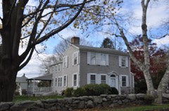
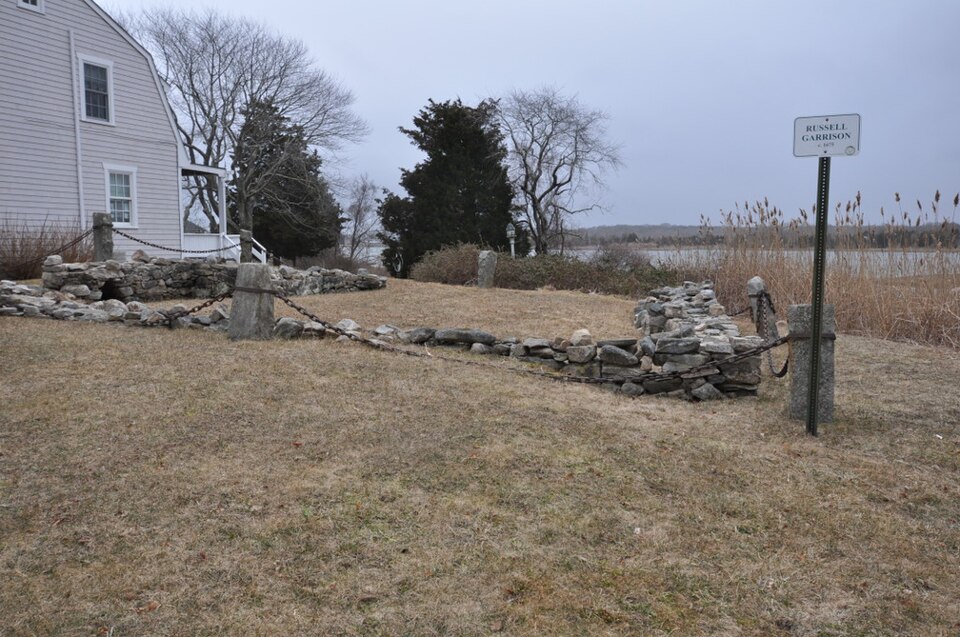
Photograph of Russell Garrison
Photograph by Magicpiano, CC BY-SA 4.0. Via Wikimedia Commons.

Russell Garrison

Built in 1675. Listed on the National Register of Historic Places in 2018. A historic map-sheet match is not published yet. The record needs a coordinate-quality review before it can be joined to a sheet boundary.

From the record

“The Russell Garrison was a fortified area of Dartmouth, Massachusetts in the 17th century. Now a small town-owned public park located on Fort Street in its Apponagansett neighborhood, the garrison site includes the reconstructed foundational remnants of the homestead of early settler John Russell, progenitor of the locally prominent Russell family.”

Wikipedia article Russell Garrison, CC BY-SA 4.0.

one of 272 National Register listings in Bristol County · listed in 2018 · category: Site · built in 1675 · one of 8 National Historic Landmarks in Bristol County.

Sources: the Wikipedia article · the National Register database, National Park Service
The listing

  • What is counted as historic. The nomination lists 3 objectss, 1 site as contributing to the listing.
  • Address. Fort Street, Dartmouth, 02748
  • When was it listed? 2018-08-10
  • Category. site
  • Township. Dartmouth town
  • When was it built? 1675
  • National Register reference number. 100002215 - assigned by the National Park Service when the property was listed.
The ground it stands on

32,712 words

The chapter on Dartmouth Town in History of Bristol County, Massachusetts, with Biographical Sketches of Many of Its Pioneers and Prominent Men, published 1883 names Dartmouth. This is what it says, exactly as the scans read.

Dartmouth is located in the southern part of the county, and is bounded as follows: on the north by Fall River and Freetown, on the east by New Bedford and Buzzard's Bay, on the south by Buzzard's Bay, and on the west by Westport.

Passage source: History of Bristol County, Massachusetts, with Biographical Sketches of Many of Its Pioneers and Prominent Men, published 1883.

In the summer of 1602, Bartholomew Gosnold, while fortifying his settlement upon the little islet within the island of Cuttyhunk, had crossed the bay - described by Gabriel Archer, the chronicler of the expedition, as a "stately sound" - and had trod upon the shores of Dartmouth. The Indians from the mainland had visited him and his band of adventurers in their island home, and Gosnold had returned their visits. He landed somewhere in the vicinity of the Round Hills, called by him Hap's Hill, and followed the coast westward to Gooseberry Neck. The locality is described as possessing " stately groves, flowery meadows, and running brooks," and the adventurers were delighted with the climate, the beauty of the country, and the fertility of the soil.

Passage source: History of Bristol County, Massachusetts, with Biographical Sketches of Many of Its Pioneers and Prominent Men, published 1883.

Machine-read from a century-old scan, so expect the errors a machine makes: misspelled names, dropped words, stray characters.

Read the whole chapter on Dartmouth Town - 32,712 words on its settlement, mills, schools and churches.

Fires near this property

26 since 2015

Regional context, not property-specific evidence. The federal wildfire occurrence database lists 26 fires within 5 miles of Russell Garrison between 2015 and 2020, burning about 13 acres in total. None started naturally. 2 were recorded as arson. Distance is straight-line from the map coordinates, so a fire counted here may appear on a neighbouring settlement's page as well.

Reported cause Fires
Missing data/not specified/undetermined14
Debris and open burning6
Arson/incendiarism2
Fireworks2
Misuse of fire by a minor1
Recreation and ceremony1

The most recent of them, most recent first, with the day each was reported and the service that recorded it.

DateCause SizeReported by Name on the report
22 September 2016Missing data/not specified/undeterminedunder an acreMassachusetts Bureau of Forest Fire Controlnot named
15 September 2020Missing data/not specified/undeterminedunder an acreMassachusetts Bureau of Forest Fire Controlnot named
9 August 2016Missing data/not specified/undeterminedunder an acreMassachusetts Bureau of Forest Fire Controlnot named
23 August 2018Debris and open burningunder an acreMassachusetts Bureau of Forest Fire Controlnot named
23 August 2017Missing data/not specified/undeterminedunder an acreMassachusetts Bureau of Forest Fire Controlnot named
22 August 2020Fireworksunder an acreMassachusetts Bureau of Forest Fire Controlnot named
11 August 2020Missing data/not specified/undeterminedunder an acreMassachusetts Bureau of Forest Fire Controlnot named
4 July 2018Fireworksunder an acreMassachusetts Bureau of Forest Fire Controlnot named

Every fire recorded in Bristol County

Specimens collected near this property

12 of 2,156 shown

Regional context, not property-specific evidence. Museums hold 2,156 specimens collected within 10 miles of Russell Garrison between 1824 and 1975: 899 Animalia, 605 Plantae, 538 Fungi, 86 Chromista, 23 Bacteria, 5 Unrecorded. 12 distinct Species records are shown. Collected by A. B. Gridley, A. Clark, A. F. Faull and others. Each is a physical object with a catalogue number, and each entry opens the museum's record. This is what was collected and kept, not a survey of what lives here - nothing can be concluded from a species being absent.

Image SpeciesYear Collected by Where, as recorded
A photograph of the species Gamochaeta purpurea, not of this specimenGamochaeta purpurea (L.) Cabrera1824T. A. Greene
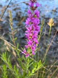
A photograph of the species Lythrum salicaria, not of this specimenLythrum salicaria L.1831T. A. Greene
A photograph of the species Mentha aquatica, not of this specimenMentha aquatica L.1831Collector unknownNew Bedford. [Inferred county from precise loc.]
A photograph of the species Trypethelium virens, not of this specimenTrypethelium virens Tuck.1848ex herb. OakesNew Bedford.
A photograph of the species Endocarpon pusillum, not of this specimenEndocarpon pusillum Hedw.1858H. WilleyFort Phoenix. Fairhaven.
A photograph of the species Menegazzia terebrata, not of this specimenMenegazzia terebrata (Hoffm.) A.Massal.1860H. WilleyNew Bedford
A photograph of the species Pandion haliaetus, not of this specimenPandion haliaetus (Linnaeus, 1758)1860Alan PooleWestport, Westport River, Allens Pond Wildlife Sanctuary
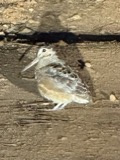
A photograph of the species Scolopax minor, not of this specimenScolopax minor J.F.Gmelin, 17891860Alan PooleWestport
A photograph of the species Abrothallus parmeliarum, not of this specimenAbrothallus parmeliarum (Sommerf.) Nyl., 18691862Willey H.Weymouth, New Bedford
A photograph of the species Agyrium rufum, not of this specimenAgyrium rufum (Pers.) Fr.1862Willey HenryNew Bedford
A photograph of the species Anaptychia palmatula, not of this specimenAnaptychia palmatula (Michx.) Vain., 18991862H. WilleyNew Bedford.
A photograph of the species Anisomeridium polypori, not of this specimenAnisomeridium polypori (Ellis & Everh.) M.E.Barr1862H. WilleyNew Bedford

All 2,156 specimens within 10 miles, at the Global Biodiversity Information Facility.

Mines and quarries near this property

5 within 5 miles

Regional context, not property-specific evidence. The federal mineral resources record lists 5 workings within 5 miles of Russell Garrison: 4 past producers, 1 producer. 1 still produces. What was taken out: Sand and Gravel, Construction, Stone. Distance is straight-line from the map coordinates, so a quarry counted here may appear on a neighbouring settlement's page as well.

Where SiteCommodity StatusRecorded
Clearwater Stone IncStonePast Producer
Clearwater Pit and PlantSand and Gravel, ConstructionPast Producer
Dartmouth Town PitSand and Gravel, ConstructionPast Producer
Medeiros Washed Sand & Stone PitSand and Gravel, ConstructionProducer
Pine Hill Sand and GravelSand and Gravel, ConstructionPast ProducerSedimentary

Every working recorded in Bristol County

Map coverage status

No historic map-sheet match is published for this property yet. That does not mean no map exists. This record needs a coordinate-quality review before it can be joined to a sheet boundary. Browse the county's mapped places while that work is pending.

Listed places nearby

6 within 8 miles

Other National Register properties close enough to walk or drive between, ordered by distance from this one. Both positions come from the same geocoding pass that matched these properties to their map sheets.

Photograph PropertyDistance Listed
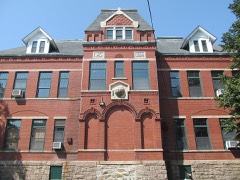
Hill School1.1 miles1980
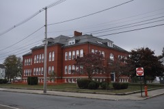
Thompson Street School2.3 miles1990
Donaghy, Thomas, School2.6 miles1989
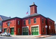
Fire Station No. 42.6 miles1975
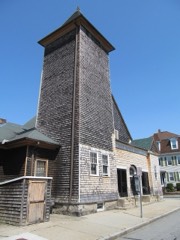
Union Baptist Church2.8 miles2008
Griffin Street Cemetery2.9 miles2014

Sources for this property

National Archives recordThe nomination case file for reference 100002215 in Record Group 79.
Wikipedia articleCommunity-written account of this property, licensed CC BY-SA.
Bristol CountyAll 272 listed properties in this county.

Provenance

  • Listing record. National Park Service National Register of Historic Places, listed-properties dataset, current to 2026-05-22.
  • Map join. Address geocoded through the United States Census geocoder, then tested against the published boundary of every sheet in the USGS Historical Topographic Map Collection.
  • How this page is made. Listing fields come from federal records; map-sheet coverage is a labelled coordinate-to-boundary calculation, not a source-field claim.
  • Wildfire. Short, Karen C. 2022. Spatial wildfire occurrence data for the United States, 1992-2020 [FPA_FOD_20221014]. 6th Edition. Fort Collins, CO: Forest Service Research Data Archive. https://doi.org/10.2737/RDS-2013-0009.6 Collected with United States Government funding and usable without additional permissions or fees.
  • Specimens. Global Biodiversity Information Facility (GBIF), https://www.gbif.org/. Only records licensed CC0 or CC BY are used. Records licensed CC BY-NC are excluded because this site carries advertising. Images are checked individually and any whose licence is non-commercial, no-derivatives or unreadable is refused.
  • Mines and quarries. USGS Mineral Resources Data System (MRDS) https://mrdata.usgs.gov/mrds/ A work of the United States government, no copyright under 17 U.S.C. 105.