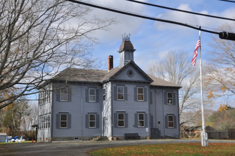
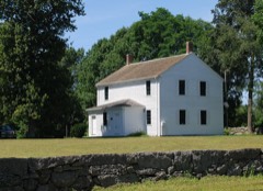
Listed on the National Register of Historic Places in
2012. A historic map-sheet match is not published yet. The record needs a coordinate-quality review before it can be joined to a sheet boundary.
From the record
“SIGNIFICANCE The present-day town of Acushnet was part of the colonial purchase that created the town of Dartmouth in 1652. This large land area also included the present-day towns of Westport and Fairhaven and the city of New Bedford.”
Narrative Statement of Significance, National Register nomination for Long Plain School. Machine-read text.
one of 272 National Register listings in Bristol County · listed in 2012 · category: Building · one of 8 National Historic Landmarks in Bristol County.
National Register reference number.12000413- the number the National Park Service assigned this property when it was listed, and the key its nomination file is catalogued under at the National Archives.
From 1664 to 1787 nearly all of Acushnet that now is was a part of old Dartmouth; from 1787 to 1812 it was a part of New Bedford ; and from 1812 to 1860 it was included in Fairhaven. The subject of dividing the town of Fairhaven was agitated a long while before the act occurred. The people in the north part of the town felt that as that section was sparsely populated they did not get their share of the appropriation, especially for schools. Then after the old Presbyterian meeting-house was torn down, the question came where to build a new one. The people in the village of Fairhaven wanted it nearer them, and finally succeeded in having it built on an acre-lot just north of Woodside Cemetery, on the Fairhaven road. This building was subsequently burned by an incendiary fire. The meetings were then held down in Fairhaven village; this was the straw that broke the camel's back, and the " northenders" renewed their purpose for a division. Among the zealous advocates of the division and one of the leaders of the movement was Rev. Israel Washburn, who owned the farm on which he resided, situated next north of the present Laura Keene farm in Acushnet. Mr. Washburn was a man of firmness, of i a strong, positive nature, with a good intellect and : readiness of speech, and was well calculated to be chosen as leader in such a movement. He was born in this town in 1796, in the last house on the north side of the road leading eastward from White's factory. He was for many years in the Methodist ministry, before and after his residence in Acushnet at the time of the division, a part of which time he was in the grocery business at Parting Ways, as I. Washburn & Son (William H. Washburn). His name heads a petition made to the General Court of the winter of 1858-59, praying for a division of the town. The petition was before the legislative committee, but no other action was taken than to refer the subject to the next General Court. The petitioners at once set about procuring all that was necessary to aid them to success at the following session.
Acushnet being in the district with other towns, it is entitled to a representation to the General Court but occasionally. It has sent four since its incorporation. The first representative was William H. Washburn, Esq. Mr. Washburn was a son of Rev. Israel Washburn, and for many years a resident of the town, being engaged in the grocery and wheelwright business. Always interested in the welfare of the town, he was especially so during the war, when he had charge of enlisting, drafting, and filling quotas, and served two years in the Legislature to the great satisfaction of his constituents. The next was Walter Spooner, Esq., who has faithfully served the town in many capacities. He was in the House two years. Mr. Spooner, who is the son of Dr. Rounsevel Spooner, is from " honorable" stock, his great-grandfather being Hon. Walter Spooner, and his grandfather was Hon. Alden Spooner, who was an uncle of the Hon. Nathaniel Spooner, all of .this town.
Regional context, not property-specific
evidence. The
federal wildfire occurrence database
lists 38 fires within 5 miles of Long Plain School between
2015 and 2020, burning about 26 acres in total. None started naturally. None was recorded as arson.
Distance is straight-line from the map coordinates, so a fire counted
here may appear on a neighbouring settlement's page as well.
Reported cause
Fires
Missing data/not specified/undetermined
18
Debris and open burning
11
Misuse of fire by a minor
5
Recreation and ceremony
3
Power generation/transmission/distribution
1
The most recent of
them, most recent first, with the day each was reported and the service
that recorded it.
Regional context, not property-specific
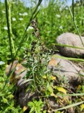
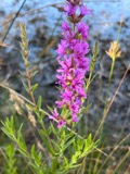
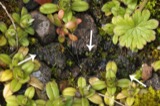
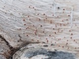
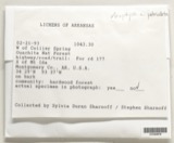
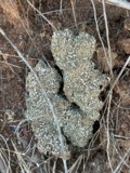
evidence. Museums hold 1,288 specimens
collected within 10 miles of Long Plain School between 1824 and
1975: 580 Fungi, 376 Animalia, 274 Plantae, 34 Chromista, 20 Bacteria, 4 Unrecorded. 12 distinct Species records are shown.
Collected by A. B. Gridley, A. Clark, A. M. Vail and others. Each is a
physical object with a catalogue
number, and each entry opens the museum's record. This is what was
collected and kept, not a survey of what lives here - nothing can be
concluded from a species being absent.
Regional context, not property-specific
evidence. The federal mineral resources record lists
2 workings within 5 miles of Long Plain School: 1 unknown, 1 producer.
1 still produces. What was taken out: Stone, Crushed/Broken. Distance is straight-line from the
map coordinates, so a quarry counted here may appear on a neighbouring
settlement's page as well.
Regional context, not property-specific
evidence. The National Weather Service names
Acushnet, the town this property stands in, in 20 storm reports between 1997 and 2025: 6 hail, 6 thunderstorm wind, 5 flood, 2 flash flood.
No death or injury is recorded in these reports. Each account below is quoted exactly as the forecast office
filed it, from the NOAA Storm Events Database, and each date
opens the federal record of that event.
Belleville Avenue between Tarkiln Hill Road and Nash Road was flooded and nearly impassable. The basement of the Urban Grille on Purchase Street was flooded with 10 inches of water.
Street flooding caused the closure of Belleville Road at Covell Street. Also, there was street flooding on Nash Road, with 6 to 12 inches of water on the roadway.
Two and a half feet of water flooded Main Street near Belleville Avenue in New Bedford. The intersections of Church and Princeton Streets and Ashley Boulevard and Wood Street were flooded with a foot and a half of water. Purchase Street was flooded with a foot and a half of water. Phillips Road near Pine Hill Drive was flooded with a foot of water. A condo complex on Heritage Drive was flooded with a foot of water. Belleville Road was closed due to two and a half feet of water over the road.
No historic map-sheet match is published
for this property yet. That does not mean no map exists. This record needs
a coordinate-quality review before it can be joined to a sheet boundary.
Browse the county's mapped places while that work is
pending.
From the nomination file
7,563 words on record
When this property was proposed for the
National Register, someone wrote the case for it: what the building is,
and why it matters. That document is a federal record in the public domain.
It is quoted below word for word, never summarised. The text was read off the scanned case file by machine, so the
occasional stray character is the recogniser's and the 1970s
typewriter's.
Statement of significance
Applicable National Register Criteria Aark "x" in one or more boxes for the criteria qualifying the prope r National Register listing A B Property is associated with events that have made ignificant contribution to the broad patterns of ol history. Property is associated with the lives of persons significant in our past.
Property embodies the distinctive characteristics of a type, period, or method of construction or represents the work of a master, or possesses high artistic values, or represents a significant and distinguishable entity whose components lact ndividual distinction Property has yielded, or is likely to yield, informatior important in prehistory or history (Expires 5/31/2012) Bristol County, MA County and State Areas of Significance (Enter categories from instructions.) EDUCATION COMMUNITY PLANNING ARCHITECTURE Period of Significance 1875-1962 Significant Dates 1875 - construction 1921 - addition 1924 - addition Significant Person (Complete only if Criterion B is marked above.) (Matk. % a Cohe dokas thar apply. ) Property is: A Owned by a religious institution or used for religious purposes.
B removed from its original location. C a birthplace or grave. D a cemetery. E a reconstructed building, object, or structure F G a commemorative property. less than 50 years old or achieving significance within the past 50 years. Cultural Affiliation Architect/Builder Caleb Hammond, architect of original 1875 building S.B. Simmons, builder of 1875 building Brown and Poole, architects of 1921 Sanitation Building and 1924 addition 6 United States Department of the Interior lational Park Service / National Register of Historic Places Registration Forr NPS Form 10-900 MB No.
Quoted from the National Register nomination
for reference 12000413, 32 pages, held by the National Archives in Record
Group 79. See the
catalogue record.
Listed places nearby
6 within 8 miles
Other National Register properties close
enough to walk or drive between, ordered by distance from this one. Both
positions come from the same geocoding pass that matched these properties
to their map sheets.
Listing record. National Park Service National Register of Historic Places, listed-properties dataset, current to 2026-05-22.
Map join. Address geocoded through the United States Census geocoder, then tested against the published boundary of every sheet in the USGS Historical Topographic Map Collection.
How this page is made. Listing fields come from federal records; map-sheet coverage is a labelled coordinate-to-boundary calculation, not a source-field claim.
Wildfire. Short, Karen C. 2022. Spatial wildfire occurrence data for the United States, 1992-2020 [FPA_FOD_20221014]. 6th Edition. Fort Collins, CO: Forest Service Research Data Archive. https://doi.org/10.2737/RDS-2013-0009.6 Collected with United States Government funding and usable without additional permissions or fees.
Specimens. Global Biodiversity Information Facility (GBIF), https://www.gbif.org/. Only records licensed CC0 or CC BY are used. Records licensed CC BY-NC are excluded because this site carries advertising. Images are checked individually and any whose licence is non-commercial, no-derivatives or unreadable is refused.
Mines and quarries. USGS Mineral Resources Data System (MRDS) https://mrdata.usgs.gov/mrds/ A work of the United States government, no copyright under 17 U.S.C. 105.
Storms. NOAA National Centers for Environmental Information, Storm Events Database https://www.ncei.noaa.gov/stormevents/ A work of the United States government, no copyright under 17 U.S.C. 105. Narratives are quoted verbatim from the National Weather Service report and are not edited or summarised.
 Block
Block