Block
From the record
One of 345 National Register listings published here for Suffolk County · listed in 2013 · category: Building.
Sources: the National Register database, National Park Service

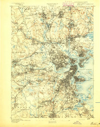
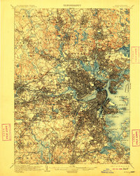
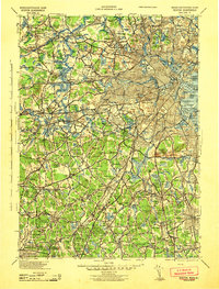
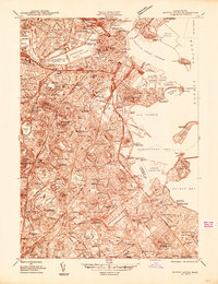
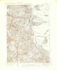
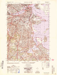
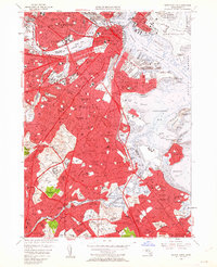
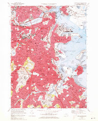
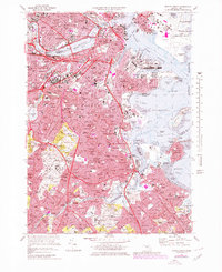
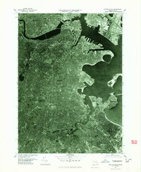
Listed on the National Register of Historic Places in 2013. 17 historic topographic surveys show this location, the earliest from 1893.
One of 345 National Register listings published here for Suffolk County · listed in 2013 · category: Building.
Sources: the National Register database, National Park Service
An account from the chapter on Boston city. The inset identifies its exact source book and publication year.
IN giving some notices of manners and social life during this period, I shall speak first of usages which were characteristic of the close of the last century: most of them continued without essential modification until our city charter swept away the old landmarks, and Boston felt the im¬ pulses which mark a new epoch in her history.
The chapter on Boston City in The Memorial History of Boston, Including Suffolk County, Massachusetts, 1630-1880, published 1880 names Boston. This is what it says, exactly as the scans read.
Illustrations: State House and the Monument (in 1811), 64; the Monument from the corner of Temple and Derne streets, 65 ; the Monument and the Thurston House, 65; Beacon Street and the Common (in 1804-1811), heliotype, 65; Boston from Breed's Hill (in 1791), 66; the Faneuil-Phillips House,
Passage source: The Memorial History of Boston, Including Suffolk County, Massachusetts, 1630-1880, published 1880.
IN giving some notices of manners and social life during this period, I shall speak first of usages which were characteristic of the close of the last century: most of them continued without essential modification until our city charter swept away the old landmarks, and Boston felt the im¬ pulses which mark a new epoch in her history. It is difficult to deal justly with ways of living which are not widely different from those that surround us. We miss the salient contrasts which lend themselves to picturesque de¬ scription, and are tempted to look for exceptional occurrences to brighten a narrative, rather than for facts which are truly symptomatic of taste and thought. Were it possible to go back four-score years, or even a century, and mingle with those then conducting the town, we should not feel among strangers. In many respects their ways were counterparts of our own. In certain directions, indeed, we might note a narrowness of range and a contraction of outlook, while envying the vigor of speech and de¬ cisiveness of action which seemed the outcome of the limitations. When Massachusetts took her place in the sisterhood of States, the gigantic up¬ heaval of the French Revolution had not taken place. The prophets whom her capital was to raise up to demand the redemption of human society, each with his panacea for its sad ailments, had put in no appearance. The tyranny of England had been broken by an heroic effort, and any further redemption which society might need would be provided by those who VOL. iv. - i.
Passage source: The Memorial History of Boston, Including Suffolk County, Massachusetts, 1630-1880, published 1880.
Machine-read from a century-old scan, so expect the errors a machine makes: misspelled names, dropped words, stray characters.
Read the whole chapter on Boston City - 637,699 words on its settlement, mills, schools and churches.
Regional context, not property-specific evidence. The federal wildfire occurrence database lists 133 fires within 5 miles of Walton and Roslin Halls between 2015 and 2020, burning about 84 acres in total. None started naturally. 2 were recorded as arson. Distance is straight-line from the map coordinates, so a fire counted here may appear on a neighbouring settlement's page as well.
| Reported cause | Fires |
|---|---|
| Recreation and ceremony | 85 |
| Smoking | 27 |
| Missing data/not specified/undetermined | 16 |
| Equipment and vehicle use | 2 |
| Arson/incendiarism | 2 |
| Debris and open burning | 1 |
The most recent of them, most recent first, with the day each was reported and the service that recorded it.
| Date | Cause | Size | Reported by | Name on the report |
|---|---|---|---|---|
| 5 September 2016 | Smoking | under an acre | Massachusetts Bureau of Forest Fire Control | QUINCY |
| 23 September 2020 | Missing data/not specified/undetermined | under an acre | Massachusetts Bureau of Forest Fire Control | not named |
| 23 September 2019 | Missing data/not specified/undetermined | under an acre | Massachusetts Bureau of Forest Fire Control | not named |
| 2 September 2018 | Equipment and vehicle use | under an acre | Massachusetts Bureau of Forest Fire Control | BROOKLINE |
| 2 September 2017 | Recreation and ceremony | under an acre | Massachusetts Bureau of Forest Fire Control | QUINCY |
| 14 September 2016 | Smoking | under an acre | Massachusetts Bureau of Forest Fire Control | QUINCY |
| 11 September 2016 | Smoking | under an acre | Massachusetts Bureau of Forest Fire Control | QUINCY |
| 10 September 2016 | Smoking | under an acre | Massachusetts Bureau of Forest Fire Control | QUINCY |
Regional context, not property-specific evidence. Museums hold 14,891 specimens collected within 10 miles of Walton and Roslin Halls between 1810 and 1975: 6,320 Plantae, 4,161 Fungi, 3,432 Animalia, 568 Chromista, 196 Protozoa, 135 Bacteria, 79 Unrecorded. 12 distinct Species records are shown. Collected by (MARSDEN, H W), ?, A B Seymour and others. Each is a physical object with a catalogue number, and each entry opens the museum's record. This is what was collected and kept, not a survey of what lives here - nothing can be concluded from a species being absent.
| Image | Species | Year | Collected by | Where, as recorded |
|---|---|---|---|---|
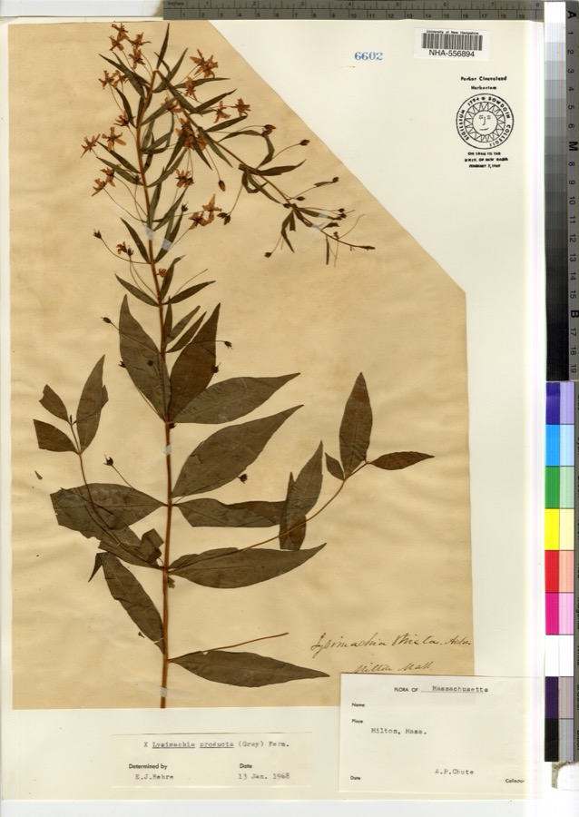 | Lysimachia × producta (A.Gray) Fernald | 1900 | A. P. Chute | |
 | Thalictrum L. | 1810 | Boott, J.W. | Near Boston. |
 | Anemone L. | 1815 | Boott, J. | Andover Turnpike, 7 miles from Boston. |
 | Betula L. | 1815 | Boott, J.W. | Near Fresh Pond, Cambridge, 4 miles from Boston. |
 | Chenopodium album L. | 1815 | not recorded | Gathered at Bunker (properly Breed's) Hill. |
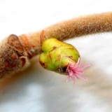 | Corylus L. | 1815 | not recorded | Cambridge Port, 2 miles from Boston. |
| Ericaceae | 1815 | Boott | Boston, U.S.A. | |
| Acanthis flammea flammea (Linnaeus, 1758) | 1900 | ZAPPEY, W R | ROSLINDALE | |
| Acer carpinifolium Siebold & Zucc. | 1900 | A. K. Harrison | Harvard Botanic Garden, Cambridge. | |
| Acer palmatum var. dissectum (Thunb.) Miq. | 1900 | A. K. Harrison | Harvard Botanic Garden, Cambridge. | |
| Agaricus flavescens (Gillet) Sacc. | 1900 | G. E. Morris | ||
| Agarum turneri Postels & Ruprecht | 1900 | J. Murdoch | Revere |
All 14,891 specimens within 10 miles, at the Global Biodiversity Information Facility.
Regional context, not property-specific evidence. The federal mineral resources record lists 6 workings within 5 miles of Walton and Roslin Halls: 3 plants, 1 unknown, 1 past producer, 1 producer. 4 still produce. What was taken out: Stone, Crushed/Broken, Granite, Iron, Lead. Distance is straight-line from the map coordinates, so a quarry counted here may appear on a neighbouring settlement's page as well.
| Where | Site | Commodity | Status | Recorded |
|---|---|---|---|---|
| General Metals & Smelting--Boston | Lead | Plant | ||
| Old Colony Crushed Stone | Granite | Past Producer | Granite | |
| Us Steel Supply Div--Boston | Iron | Plant | ||
| Whittemore Prdts Inc--Boston | Perlite | Plant | ||
| Old Colony Quarry | Stone, Crushed/Broken | Producer | ||
| West Roxbury Crushed Stone Operatio | Stone, Crushed/Broken | Unknown |
Regional context, not property-specific evidence. The National Weather Service names Boston, the town this property stands in, in 64 storm reports between 1994 and 2024: 37 thunderstorm wind, 9 flash flood, 7 lightning, 7 flood. The reports record 1 death and 9 injuries. Each account below is quoted exactly as the forecast office filed it, from the NOAA Storm Events Database, and each date opens the federal record of that event.
| When | Event | Place named | Harm | What the report says |
|---|---|---|---|---|
| August 2010 | Lightning | South Boston | 1 killed | A 50 year old man was struck by lightning while walking in an area known as the Sugar Bowl in South Boston. Lightning struck him in the head, passing through his back and exiting his feet. He collapsed in cardiac arrest and was revived and hospitalized for several days before dying from his injuries. |
| July 2012 | Lightning | Boston | 2 hurt | A 29 year old male and a 29 year old female were knocked unconscious when lightning struck them at Thomas Park, where the pair were watching the July 4th fireworks. They regained consciousness prior to the arrival of EMTs, but unable to feel their legs and were transported to Brigham and Women's Hospital. |
| August 2008 | Lightning | Boston | 2 hurt | Two people were hospitalized after lightning struck their boat. One of them, a woman, was believed to be directly struck by lightning. |
| June 1997 | Lightning | Boston | 2 hurt | Boston Harbor... |
| September 2023 | Lightning | Boston | 1 hurt | In Boston, a woman was struck by lightning at Malibu Beach in the Dorchester section of Boston and was listed in critical condition. |
| July 2004 | Lightning | South Boston | 1 hurt | no account filed |
| September 1995 | Thunderstorm Wind | Boston | 1 hurt | no account filed |
| August 2001 | Lightning | Boston | $1,500,000 | no account filed |
| June 1998 | Flash Flood | Boston | $570,000 | Muddy River |
| July 2010 | Flash Flood | Boston | $500,000 | In Boston, two cars were stuck in flood waters on Corey Road. Storrow Drive was closed due to flooding at the Mass Avenue and Longmeadow Bridges. Several other roadways in the city experienced significant flooding. |
| June 2010 | Thunderstorm Wind | Boston | $100,000 | Numerous trees and wires and several utility poles were downed throughout Boston, including in Boston Common. Several trees were downed onto cars throughout town, though no injuries resulted. One tree was downed onto a building on Corey Road. The Automated Surface Observing System at Logan International Airport in Boston, MA (KBOS) recorded sustained wind speeds of 47 mph and wind gusts up to 68 mph. |
| July 2016 | Thunderstorm Wind | Boston | $50,000 | Multiple trees and wires were downed throughout Boston, including on Barstow Street, Forrester Street, Washington Street, Houston Road, and Keith Street. Trees were downed onto cars on Forrester and Washington Streets. A portion of a chimney was blown over onto Keith Street. |
| July 1994 | Thunderstorm Wind | Boston | $50,000 | The National Weather Service at Logan International Airport recorded a wind gust to 60 mph as a severe thunderstorm moved across the city of Boston. Scaffolding was blown down at government center and some large trees were blown down in Revere and Winthrop. One damaged a house in Winthrop and a tree limb and electrical wires fell onto an auto. The occupants of the auto were not injured. |
| June 2012 | Thunderstorm Wind | Boston | $30,000 | Trees and wires on Call Street were downed by thunderstorm winds. |
| July 2005 | Flash Flood | Boston | $30,000 | no account filed |
| September 2017 | Thunderstorm Wind | Boston | $25,000 | At 546 PM EST, an amateur radio operator reported two trees down on Belden Street in the Upham's Corner section of Boston. Also, two trees were down on Hamlet Street including one down on three cars. A tree was down on Willis Street. A tree was down on wires on Taft Street. |
| September 2017 | Flood | Boston | $25,000 | At 607 PM EST Columbia Road near Ceylon Street and Hamilton Street In Boston was flooded and impassable. Four cars were trapped in flood waters. |
| June 2019 | Flood | East Boston | $20,000 | At 3:26 PM EST, heavy rain caused the intersection of Lewis and Marginal Streets in East Boston to be flooded and impassable. At 3:36 PM EST a car was trapped in floodwaters at Clark and Stockton Streets in Chelsea. At 3:38 PM EST several cars were trapped in floodwaters on the McClellan Highway, Condor Street and Putnam Street in East Boston. |
| July 2018 | Flash Flood | East Boston | $20,000 | At 5:09 PM EST, the access road for Logan Airport at Terminal B Lower Level was flooded. Several cars were stalled in the flood waters. |
| July 2016 | Thunderstorm Wind | Boston | $20,000 | A utility pole at the intersection of Washington and New Washington Streets in Boston was downed by thunderstorm winds. |
| June 2011 | Thunderstorm Wind | Boston | $20,000 | Numerous trees were downed by thunderstorm winds. |
| July 2005 | Flash Flood | Boston | $20,000 | no account filed |
| May 2018 | Flood | Boston | $15,000 | At 5:05 PM EST several cars on Child Street and Boynton Street were trapped in flood waters as high as the car doors. At 5:10 PM EST a car was trapped in flooding on Columbia Road at Bodwell Street, and Ceylon Street was impassable at Quincy Street due to flooding. |
| June 2016 | Thunderstorm Wind | Boston | $15,000 | Several trees were downed throughout Boston, including one on Parkdale Avenue in Brighton. |
| June 2010 | Thunderstorm Wind | Boston | $15,000 | A tree and a utility pole on North Harvard Street were downed by thunderstorm winds. |
| May 2022 | Thunderstorm Wind | South Boston | $10,000 | In South Boston, a large tree was down on top of 3 parked cars on Columbia Road. No injuries were reported. Report relayed by amateur radio. |
| July 2016 | Thunderstorm Wind | Boston | $10,000 | Power lines on Weld and Beech Streets were downed by thunderstorm winds. |
| July 2016 | Thunderstorm Wind | Boston | $10,000 | A tree on Warner Street was downed onto a house by thunderstorm winds. |
| August 2011 | Thunderstorm Wind | Boston | $10,000 | Trees on Park and Dartmouth Streets were downed by thunderstorm winds, blocking those streets. |
| October 2006 | Flood | Boston | $8,000 | Significant urban flooding was reported throughout the city of Boston. |
| July 2002 | Thunderstorm Wind | Boston | $8,000 | no account filed |
| June 2008 | Thunderstorm Wind | Boston | $6,000 | A tree was downed by thunderstorm winds onto a car at the intersection of Bakersfield and Stoughton Streets. Another tree was downed onto a car on Columbia Road. |
| February 2016 | Thunderstorm Wind | South Boston | $5,000 | Wires on West Fifth Street in South Boston were downed by thunderstorm winds. |
| July 2016 | Thunderstorm Wind | Boston | $5,000 | A tree on Lagrange Street was downed by thunderstorm winds blocking the road. |
| September 2012 | Thunderstorm Wind | Boston | $5,000 | Wires on Charles Street were downed by thunderstorm winds. |
| August 2011 | Thunderstorm Wind | Boston | $5,000 | Large branches and wires on Pond, Hereford, and Tremont Streets. |
| August 2008 | Thunderstorm Wind | East Boston | $5,000 | Trees and power lines on Quarter Street Place were downed by thunderstorm winds. |
| August 2008 | Thunderstorm Wind | Boston | $5,000 | Trees and wires in Dorchester, Mattapan, Roxbury, and Boston were downed by thunderstorm winds. |
| June 2008 | Thunderstorm Wind | Boston | $5,000 | Wires on Columbia Road and trees on Saywood Street were downed by thunderstorm winds. |
| June 2006 | Thunderstorm Wind | South Boston | $5,000 | no account filed |
| August 2004 | Thunderstorm Wind | Boston | $5,000 | no account filed |
| May 2020 | Thunderstorm Wind | East Boston | $3,000 | In East Boston (street unspecified), a light pole was knocked down by thunderstorm winds. |
| July 2019 | Flood | Boston | $2,000 | Portions of Columbia Road were closed due to flooding. |
| July 2018 | Thunderstorm Wind | Boston | $1,000 | At 1:15 PM EST, a thunderstorm over Boston brought a tree down on Dorchester Avenue. |
| August 2017 | Thunderstorm Wind | East Boston | $1,000 | At 140 PM EST, a tree was uprooted on Harborside Drive in East Boston. |
| July 2019 | Thunderstorm Wind | Boston | $500 | A tree was downed on Adams Street. |
| June 2010 | Thunderstorm Wind | South Boston | $500 | Large limbs were downed by thunderstorm winds. |
| July 2019 | Thunderstorm Wind | Boston | $300 | In Boston, power lines were down from wind on Willis Street. |
| June 2024 | Flash Flood | Boston | - | In Boston, an underpass was flooded at Columbia Rd and Ceylon St. |
| July 2023 | Flash Flood | Boston | - | In Boston, on Columbia Rd at Hamilton St a car was stuck in flooding and the driver needed to be rescued. |
| June 2021 | Thunderstorm Wind | South Boston | - | At 616 PM EDT, a mesonet site at Pleasure Bay recorded a gust to 58 mph. |
| June 2017 | Hail | South Boston | - | At 435 PM EST, dime size hail fell in South Boston. |
| August 2017 | Flood | East Boston | - | At 158 PM EST, the Ted Williams Tunnel near Logan Airport flooded, with two feet of water trapping a car in the flood waters. |
| February 2016 | Thunderstorm Wind | Boston | - | An amateur radio operator recorded a 69 mph wind gust on their home weather station in Boston. No damage was reported. |
| February 2016 | Thunderstorm Wind | Boston | - | An amateur radio operator recorded a wind gust of 63 mph on their home weather station in Boston. No damage was reported. |
| June 2013 | Flood | Boston | - | Three to four inches of rain fell across the Boston metro area. Sargent Street in Boston was flooded. |
| August 2011 | Hail | Boston | - | Quarter size hail fell in the Back Bay section of Boston. |
| July 2007 | Thunderstorm Wind | Boston | - | Tree down on car. |
| July 2007 | Thunderstorm Wind | Boston | - | Multiple trees down. |
| July 2004 | Hail | Boston | - | no account filed |
8 papers published in this town, digitised by the Library of Congress and free to read. Every page is searchable, so a name or a street can be looked for directly in what the town printed about itself at the time.
| Newspaper | Published |
|---|---|
| The Boston Courant | 1890 to 19?? |
| The Boston Advance | 1896 to 1907 |
| The New-England Chronicle | 1776 |
| The Massachusetts Spy | 1770 to 1772 |
| The Massachusetts Spy, Or, Thomas's Boston Journal | 1772 to 1775 |
| The Boston Gazette, Or, Country Journal | 1755 to 1793 |
| The Liberator | 1831 to 1865 |
| The Guardian | 1901 to 1960 |
United States Geological Survey topographic sheets whose coverage includes this point. Matched by taking the coordinate the National Park Service records for this property, then testing that coordinate against the published boundary of every sheet.
Other National Register properties close enough to walk or drive between, ordered by distance from this one. Both positions come from the same geocoding pass that matched these properties to their map sheets.
| Photograph | Property | Distance | Listed |
|---|---|---|---|
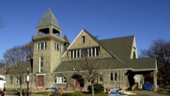 | Dorchester Temple Baptist Church | under 500 feet | 1998 |
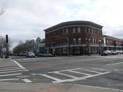 | Codman Square District | 0.1 miles | 1983 |
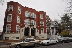 | Sherman Apartments Historic District | 0.3 miles | 2012 |
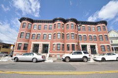 | Samuel Edelman Apartments | 0.3 miles | 2019 |
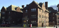 | Peabody, The | 0.4 miles | 2001 |
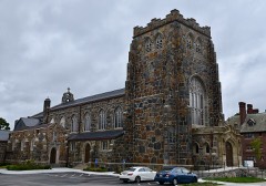 | All Saints' Church | 0.4 miles | 1980 |
| National Archives record | The nomination case file for reference 13000930 in Record Group 79. |
| Suffolk County | All 345 listed properties in this county. |