Listed on the National Register of Historic Places in
1973. A historic map-sheet match is not published yet. The record needs a coordinate-quality review before it can be joined to a sheet boundary.
From the record
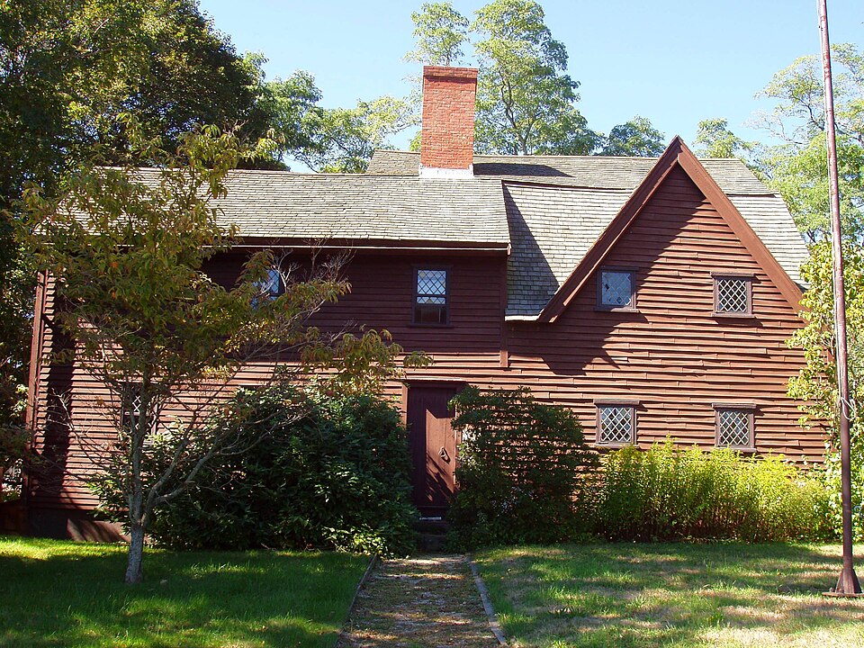
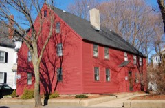
“The John Balch House, located at 448 Cabot Street, Beverly, Massachusetts, is one of the oldest wood-frame houses in the United States. It is now operated as one of the historic house museums of Historic Beverly, and open seasonally.”
Wikipedia article John Balch House, CC BY-SA 4.0.
one of 350 National Register listings in Essex County · listed in 1973 · category: Building · one of 2 National Historic Landmarks in Essex County.
National Register reference number.73000275- the number the National Park Service assigned this property when it was listed, and the key its nomination file is catalogued under at the National Archives.
Fires near this property
57 since 2006
Regional context, not property-specific
evidence. The
federal wildfire occurrence database
lists 57 fires within 5 miles of Balch, John, House between
2006 and 2020, burning about 135 acres in total. 1 started naturally. 1 was recorded as arson.
Distance is straight-line from the map coordinates, so a fire counted
here may appear on a neighbouring settlement's page as well.
Reported cause
Fires
Recreation and ceremony
15
Debris and open burning
12
Smoking
10
Equipment and vehicle use
7
Missing data/not specified/undetermined
4
Misuse of fire by a minor
3
Power generation/transmission/distribution
2
Natural
1
Railroad operations and maintenance
1
Arson/incendiarism
1
Fireworks
1
The most recent of
them, most recent first, with the day each was reported and the service
that recorded it.
Regional context, not property-specific
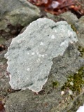
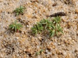
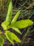
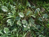
evidence. Museums hold 7,598 specimens
collected within 10 miles of Balch, John, House between 1800 and
1975: 2,809 Plantae, 2,206 Animalia, 1,313 Fungi, 645 Chromista, 439 Unrecorded, 121 Bacteria, 65 Protozoa. 12 distinct Species records are shown.
Collected by A H HIGGINSON, A Perlmutter, A. A. Eaton and others. Each is a
physical object with a catalogue
number, and each entry opens the museum's record. This is what was
collected and kept, not a survey of what lives here - nothing can be
concluded from a species being absent.
Regional context, not property-specific
evidence. The federal mineral resources record lists
5 workings within 5 miles of Balch, John, House: 4 plants, 1 past producer.
4 still produce. What was taken out: Zirconium, Thorium, Tungsten, Mercury. Distance is straight-line from the
map coordinates, so a quarry counted here may appear on a neighbouring
settlement's page as well.
Regional context, not property-specific
evidence. The National Weather Service names
Beverly, the town this property stands in, in 15 storm reports between 1993 and 2020: 7 thunderstorm wind, 3 hail, 2 flood, 1 heavy rain.
No death or injury is recorded in these reports. Each account below is quoted exactly as the forecast office
filed it, from the NOAA Storm Events Database, and each date
opens the federal record of that event.
Local police reported numerous trees blown down. At the Beverly Airport, a wind gust to an estimated 70 to 75 mph occurred during a severe thunderstorm, flipping over several light aircraft and damaging a total of 14 aircraft. Five were damaged beyond repair.
The Federal Street railroad underpass and portions of Park Street flooded, resulting in several cars getting stuck in the floodwaters. At least eight inches of water flooded the Cummings Center, flooding all first floor businesses (about 200). The Department of Public Works garage flooded, damaging police cars and other city vehicles. Approximately 100 houses were affected by flooding.
Several trees downed. Lightning struck several homes. Damage by fire occurred to one house on Gregg Street after lightning hit a telephone cable entering the house.
No historic map-sheet match is published
for this property yet. That does not mean no map exists. This record needs
a coordinate-quality review before it can be joined to a sheet boundary.
Browse the county's mapped places while that work is
pending.
From the nomination file
3,653 words on record
When this property was proposed for the
National Register, someone wrote the case for it: what the building is,
and why it matters. That document is a federal record in the public domain.
It is quoted below word for word, never summarised. The text was read off the scanned case file by machine, so the
occasional stray character is the recogniser's and the 1970s
typewriter's.
Description of the property
The original Balch House was built in 1636, according to local records, on a rise in ground eight to ten feet above the adjacent highway and about seventy feet back from the road. In its life it has been added to and altered a number of times and stands today, a structure of composite shape in brown weathered clapboard, wood shingle roof, single central brick chimney and windows of various types, from diamond pane casement to multiple pane double hung. The house has been extensively repaired and restored (most notably about 1961 when an effort was made to re-create the appearance of the original 1636 portion) but the framing and other truly original elements remain and are clearly visible. The east elevation consists of two parts in the same plane.
On the right is the 1961 restoration of the one and one-half story original house, with two diamond- paned casement windows about two feet square set high in the ground floor wall and two more similar windows set directly above them toward the bottom of a steeply pitched gable, the roof of which overhangs the wall by approximately a foot and has plain barge boards with simple moulding meeting the shingles. The ridge of this old portion runs north and south slightly higher than the gable ridge and the valley between gable and main roof runs down to within a foot or so of the house corner, returning along the front with a short run of level eave.
The left half of the east elevation consists of a two story element of three bays with three double hung diamond paned windows on the second floor close to the overhanging eave and irregularly spaced.
robe eo framie bouse in dhe dnite stitean sererlgas now beltevea to be the NATIONAL oldest wooden frame house in the United States, the original (northeast) section probably having been built in February of 1636 (new style calendar), about one year before the Fairbanks House in Dedham. The house has been enlarged several times and was the target of "preservation" efforts in 1925 and 1961. Built by John Balch, it is the only home still standing of those built by the original "Old Planters" of Salem (later Beverly). It has a record of continuous ownership by descendants of the family first receiving the grant, until 1932 when the house was acquired by the Beverly Historical Society.
Its architectural significance lies in the fact that the original structure was built in a style very forward looking for the period. Because of the additions made to the house after its construction, the progression of architectural methods in the years following 1636 are clearly demonstrated, particularly in the attic framing. John Balch, born in England in 1579, came to America with Captain Gorges in 1623, settling at Cape Ann (Gloucester) in 1624 as part of the Dorchester Company. Finding the soil of Cape Ann too rocky to cultivate, he and others of the Dorchester Company moved to Naumkeag (Salem) with Governor Roger Conant in 1626.
About nine years later, (November 25, 1635, old style; January 25, 1636, new style), the first grant in the Salem Book of Grants records that John Balch was to be allotted a farm of 200 acres on the Bass River, along with equal grants to William Trask, John Woodbery, Roger Conant and Peter Palfrey. When Beverly separated from Salem in 1668, this 1,000 acre grant came within the boundary of the new town.
Quoted from the National Register nomination
for reference 73000275, 21 pages, held by the National Archives in Record
Group 79. See the
catalogue record.
Listed places nearby
6 within 8 miles
Other National Register properties close
enough to walk or drive between, ordered by distance from this one. Both
positions come from the same geocoding pass that matched these properties
to their map sheets.
Listing record. National Park Service National Register of Historic Places, listed-properties dataset, current to 2026-05-22.
Map join. Address geocoded through the United States Census geocoder, then tested against the published boundary of every sheet in the USGS Historical Topographic Map Collection.
How this page is made. Listing fields come from federal records; map-sheet coverage is a labelled coordinate-to-boundary calculation, not a source-field claim.
Wildfire. Short, Karen C. 2022. Spatial wildfire occurrence data for the United States, 1992-2020 [FPA_FOD_20221014]. 6th Edition. Fort Collins, CO: Forest Service Research Data Archive. https://doi.org/10.2737/RDS-2013-0009.6 Collected with United States Government funding and usable without additional permissions or fees.
Specimens. Global Biodiversity Information Facility (GBIF), https://www.gbif.org/. Only records licensed CC0 or CC BY are used. Records licensed CC BY-NC are excluded because this site carries advertising. Images are checked individually and any whose licence is non-commercial, no-derivatives or unreadable is refused.
Mines and quarries. USGS Mineral Resources Data System (MRDS) https://mrdata.usgs.gov/mrds/ A work of the United States government, no copyright under 17 U.S.C. 105.
Storms. NOAA National Centers for Environmental Information, Storm Events Database https://www.ncei.noaa.gov/stormevents/ A work of the United States government, no copyright under 17 U.S.C. 105. Narratives are quoted verbatim from the National Weather Service report and are not edited or summarised.
 Block
Block