Listed on the National Register of Historic Places in
1973. A historic map-sheet match is not published yet. The record needs a coordinate-quality review before it can be joined to a sheet boundary.
From the record
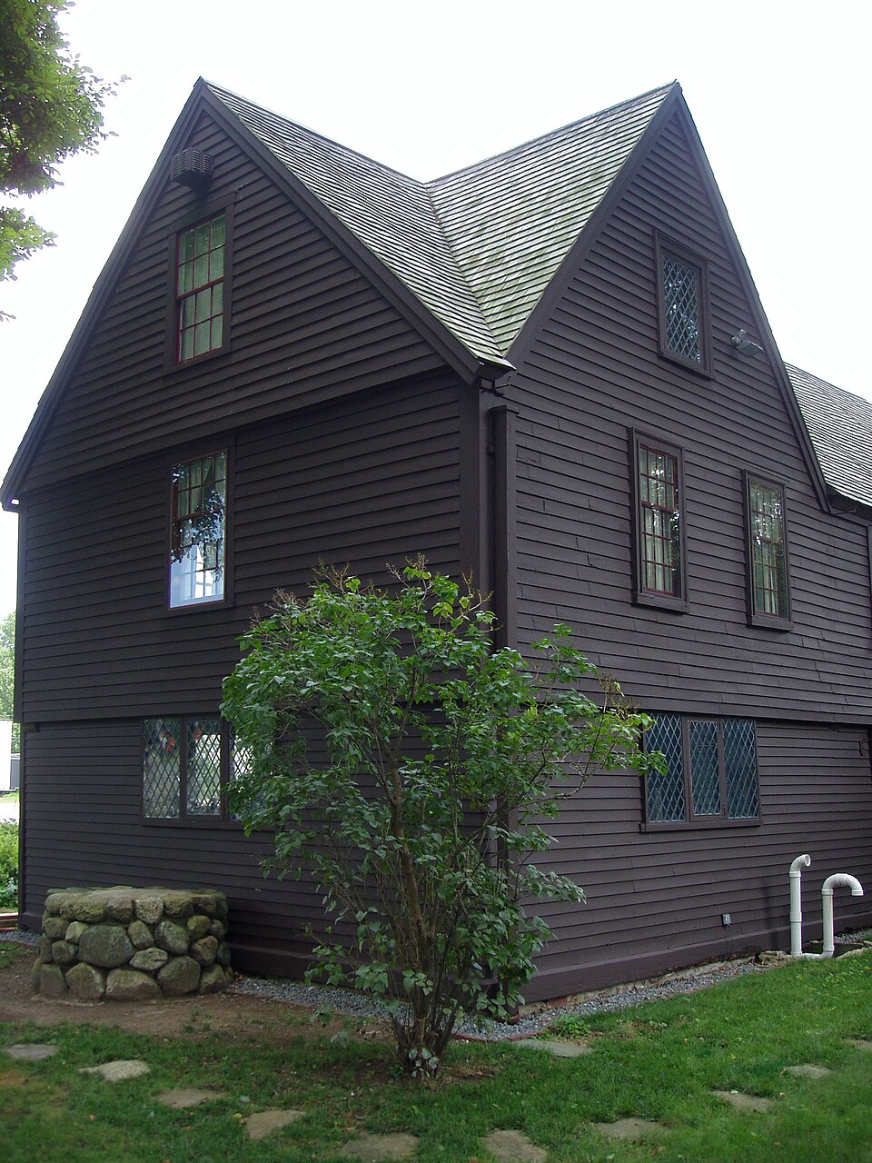
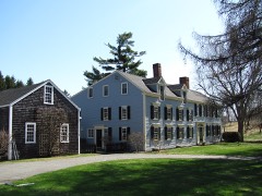
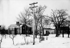
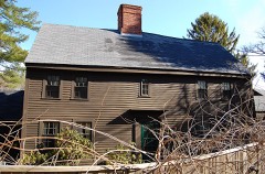
“The Claflin-Richards House, also known as the Claflin-Gerrish-Richards House, is a historic First Period house located at 132 Main Street, Wenham, Massachusetts. It is now part of the nonprofit Wenham Museum and may be toured by appointment.”
Wikipedia article Claflin-Richards House, CC BY-SA 4.0.
one of 350 National Register listings in Essex County · listed in 1973 · category: Building · one of 2 National Historic Landmarks in Essex County.
National Register reference number.73000853- the number the National Park Service assigned this property when it was listed, and the key its nomination file is catalogued under at the National Archives.
Fires near this property
56 since 2015
Regional context, not property-specific
evidence. The
federal wildfire occurrence database
lists 56 fires within 5 miles of Claflin-Richards House between
2015 and 2020, burning about 92 acres in total. 1 started naturally. 1 was recorded as arson.
Distance is straight-line from the map coordinates, so a fire counted
here may appear on a neighbouring settlement's page as well.
Reported cause
Fires
Debris and open burning
18
Recreation and ceremony
13
Missing data/not specified/undetermined
6
Equipment and vehicle use
6
Smoking
5
Misuse of fire by a minor
3
Power generation/transmission/distribution
1
Arson/incendiarism
1
Fireworks
1
Natural
1
Railroad operations and maintenance
1
The most recent of
them, most recent first, with the day each was reported and the service
that recorded it.
Regional context, not property-specific
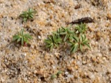
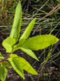
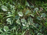
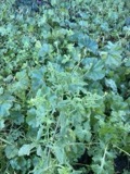
evidence. Museums hold 5,803 specimens
collected within 10 miles of Claflin-Richards House between 1800 and
1975: 2,146 Plantae, 1,592 Animalia, 1,255 Fungi, 398 Unrecorded, 270 Chromista, 77 Bacteria, 65 Protozoa. 12 distinct Species records are shown.
Collected by A H HIGGINSON, A Perlmutter, A. A. Eaton and others. Each is a
physical object with a catalogue
number, and each entry opens the museum's record. This is what was
collected and kept, not a survey of what lives here - nothing can be
concluded from a species being absent.
Regional context, not property-specific
evidence. The federal mineral resources record lists
5 workings within 5 miles of Claflin-Richards House: 4 plants, 1 past producer.
4 still produce. What was taken out: Zirconium, Thorium, Tungsten, Mercury. Distance is straight-line from the
map coordinates, so a quarry counted here may appear on a neighbouring
settlement's page as well.
Regional context, not property-specific
evidence. The National Weather Service names
Wenham, the town this property stands in, in 4 storm reports between 2005 and 2022: 4 thunderstorm wind.
No death or injury is recorded in these reports. Each account below is quoted exactly as the forecast office
filed it, from the NOAA Storm Events Database, and each date
opens the federal record of that event.
No historic map-sheet match is published
for this property yet. That does not mean no map exists. This record needs
a coordinate-quality review before it can be joined to a sheet boundary.
Browse the county's mapped places while that work is
pending.
From the nomination file
3,235 words on record
When this property was proposed for the
National Register, someone wrote the case for it: what the building is,
and why it matters. That document is a federal record in the public domain.
It is quoted below word for word, never summarised. The text was read off the scanned case file by machine, so the
occasional stray character is the recogniser's and the 1970s
typewriter's.
Description of the property
The Claflin-Richards House is situated in the center of Wenham on approxi- mately one-halt acre of land and is surrounded by lawns and planting enclosed by a white picket fence. Set with the northwest gable end to the street and the front entrance facade facing southwest, it stands well back from the main road (Rte. 1A). The house property is flanked on the southwest by an extensively landscaped private home and on the northeast by the Wenham Twon Hall (1853). The property faces the remnant of the old Town Green beyond which are three fine clapboard structures: the Wenham Tea House (1913), the Hobbs House (17th century, added to in 18th century) and the First Congregational Church (1842). This town center is the focal point of Wenham's recently established Historic District.
The 2 1/2 story Claflin-Richards House is a four-room, center chimney dwelling with a late (1925) salt-box addition on the rear half of the northeast side. the house when built in 1661 consisted of two rooms and attic with the large chimney on the rear, southeast facade. It was enlarged to the present four rooms in 1673 by the town for the use of the new minister, Reverend Joseph Gerrish. Its exterior is now brown stained clapboard but in 1661 it may have been covered by the 1" thick pine planks ranging from 14" to 25" in width which were fitted vertically into grooves in the ground sills and second story girts. These planks were discovered during the 1925 restoration and have been removed. At the second story the same vertical planking remains today under the present clapboards.
The high and steep shingled pitch roof, extending from northwest to southeast, is interrupted on the front half of its southwest slope by a typical 17th century gable.
The Claflin-Richards House is the oldest house on Main Street, Wenham, and is perhaps the oldest in the town. For over 250 years this house has escaped fire and decay and has survived improvements. It has been continuously occupied from at least as early as 1661, with a long ownership by ministers, schoolmasters, doctors, and men of importance in civil and military matters. In 1642 Samuel Smith and John Fiske gave to the Town of Wenham, out of their grants, 10 acres each on either side of the Meeting House to be divided into two-acre lots for the encouragement of tradespeople to come to the town. In 1661 Robert MacClaflin was granted two acres of this land at the same time he was accepted as a'townsman.
It is not known whether he built the house or whether it was already standing on his land. MacClaflin and his family lived in the house for approximately ten years. In 1672 the town of Wenham exchanged with MacClaflin his house and land for property elsewhere in Wenham. Robert MacClaflin, a Scot, was captured at the Battle of Dunbar in 1650 and sold into indenture to the master of the Iron Undertaking at Saugus before coming to Wenham. MacClaflin served under Sir Edmund Andros and his eldest son, Robert, died fighting under Sir William Phips in 1690. He was a surveyor for the town and owned a bark mill, tan vat and brick yard before his death c. 1690. The "Mac" was dropped from the name shortly after 1700 by his children.
Among his eminent descendants was Lee Claflin, a member of the Massachusetts Senate in 1868 and founder of the first coeducational college for black students, Claflin University, Orangeburg, South Carolina.
Quoted from the National Register nomination
for reference 73000853, 13 pages, held by the National Archives in Record
Group 79. See the
catalogue record.
Listed places nearby
6 within 8 miles
Other National Register properties close
enough to walk or drive between, ordered by distance from this one. Both
positions come from the same geocoding pass that matched these properties
to their map sheets.
Listing record. National Park Service National Register of Historic Places, listed-properties dataset, current to 2026-05-22.
Map join. Address geocoded through the United States Census geocoder, then tested against the published boundary of every sheet in the USGS Historical Topographic Map Collection.
How this page is made. Listing fields come from federal records; map-sheet coverage is a labelled coordinate-to-boundary calculation, not a source-field claim.
Wildfire. Short, Karen C. 2022. Spatial wildfire occurrence data for the United States, 1992-2020 [FPA_FOD_20221014]. 6th Edition. Fort Collins, CO: Forest Service Research Data Archive. https://doi.org/10.2737/RDS-2013-0009.6 Collected with United States Government funding and usable without additional permissions or fees.
Specimens. Global Biodiversity Information Facility (GBIF), https://www.gbif.org/. Only records licensed CC0 or CC BY are used. Records licensed CC BY-NC are excluded because this site carries advertising. Images are checked individually and any whose licence is non-commercial, no-derivatives or unreadable is refused.
Mines and quarries. USGS Mineral Resources Data System (MRDS) https://mrdata.usgs.gov/mrds/ A work of the United States government, no copyright under 17 U.S.C. 105.
Storms. NOAA National Centers for Environmental Information, Storm Events Database https://www.ncei.noaa.gov/stormevents/ A work of the United States government, no copyright under 17 U.S.C. 105. Narratives are quoted verbatim from the National Weather Service report and are not edited or summarised.
 Block
Block