BlockBefore
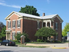
Photograph of Auglaize County Courthouse
Photograph by Unknown, Public domain. Via Wikimedia Commons.

Auglaize County Courthouse

Listed on the National Register of Historic Places in 1973. A historic map-sheet match is not published yet. The record needs a coordinate-quality review before it can be joined to a sheet boundary.

From the record

“The Auglaize County Courthouse is located between West Mechanic, Willipie, West Pearl and Perry Streets in downtown Wapakoneta, Ohio, United States. Completed in 1894, it is listed on the National Register of Historic Places.”

Wikipedia article Auglaize County Courthouse, CC BY-SA 4.0.

one of 24 National Register listings in Auglaize County · listed in 1973 · category: Building.

Sources: the Wikipedia article · the case file at the National Archives · the National Register database, National Park Service

The listing

  • What is counted as historic. The nomination lists 1 building as contributing to the listing.
  • Address. Courthouse Sq., Wapakoneta, 45895
  • When was it listed? 1973-05-07
  • Category. building
  • Township. Duchouquet township
  • Architectural style. Italianate architecture
  • National Register reference number. 73001387 - the number the National Park Service assigned this property when it was listed, and the key its nomination file is catalogued under at the National Archives.

Specimens collected near this property

12 of 1,061 shown

Regional context, not property-specific evidence. Museums hold 1,061 specimens collected within 10 miles of Auglaize County Courthouse between 1882 and 1975: 1,037 Animalia, 19 Plantae, 5 Fungi. 12 distinct Species records are shown. Collected by A. Wetzstein, Adler, K. K., Albert Wetzstein and others. Each is a physical object with a catalogue number, and each entry opens the museum's record. This is what was collected and kept, not a survey of what lives here - nothing can be concluded from a species being absent.

Image SpeciesYear Collected by Where, as recorded
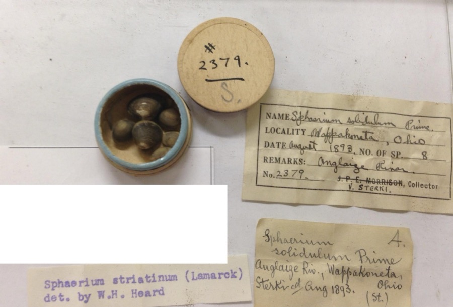
Specimen of Sphaerium striatinum (Lamarck, 1818)Sphaerium striatinum (Lamarck, 1818)1893not recordedAuglaize River, Wapakoneta [Wappakoneta]
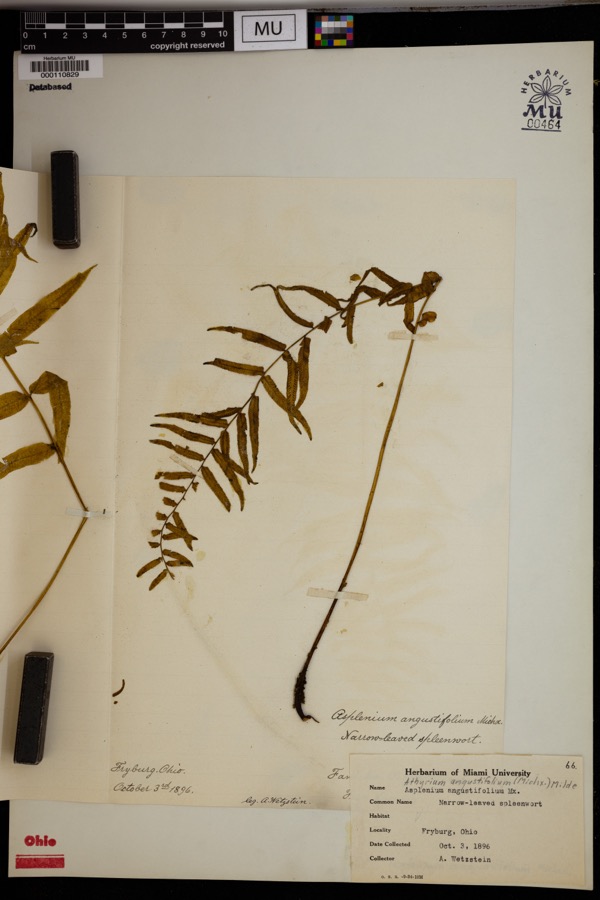
Specimen of Athyrium pycnocarpon (Spreng.) Tidestr.Athyrium pycnocarpon (Spreng.) Tidestr.1896Wetzstein, A.Fryburg.
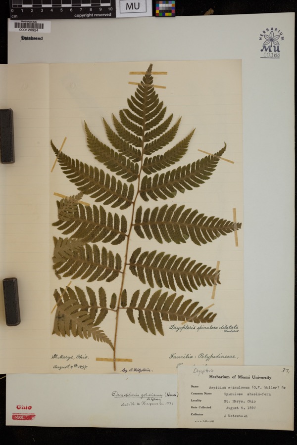
Specimen of Dryopteris goldiana (Hook. ex Goldie) A.GrayDryopteris goldiana (Hook. ex Goldie) A.Gray1897Wetzstein, A.St. Marys
A photograph of the species Recurvirostra americana, not of this specimenRecurvirostra americana J.F.Gmelin, 17891882Uller, C. (Clem)St. Marys Res, Auglaize, Ohio, USA
A photograph of the species Stachys aspera, not of this specimenStachys aspera Michx.1889Wilhelm SchiblerOhio: St. Marys, borders of Canal.
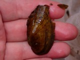
A photograph of the species Alasmidonta viridis, not of this specimenAlasmidonta viridis (Rafinesque, 1820)1893Sterki, VictorWapakoneta
A photograph of the species Amblema plicata, not of this specimenAmblema plicata (Say, 1817)1893Sterki, VictorWapakoneta
A photograph of the species Ameiurus nebulosus, not of this specimenAmeiurus nebulosus (Lesueur, 1819)1893P. KirschAnglaize Rver, Wapakaneta, Ohio
A photograph of the species Anodontoides ferussacianus, not of this specimenAnodontoides ferussacianus (I.Lea, 1834)1893Sterki, VictorWapakoneta
A photograph of the species Cambarunio iris, not of this specimenCambarunio iris (I.Lea, 1829)1893Sterki, VictorWapakoneta
A photograph of the species Campostoma anomalum, not of this specimenCampostoma anomalum (Rafinesque, 1820)1893P. KirschOhio, Auglaize River, Wapakoneta
A photograph of the species Catostomus commersonii, not of this specimenCatostomus commersonii (Lacepède, 1803)1893P. KirschOhio, Auglaize River, Wapakoneta

All 1,061 specimens within 10 miles, at the Global Biodiversity Information Facility.

Mines and quarries near this property

3 within 5 miles

Regional context, not property-specific evidence. The federal mineral resources record lists 3 workings within 5 miles of Auglaize County Courthouse: 2 plants, 1 past producer. 2 still produce. What was taken out: Sand and Gravel, Construction, Stone, Crushed/Broken. Distance is straight-line from the map coordinates, so a quarry counted here may appear on a neighbouring settlement's page as well.

Where SiteCommodity StatusRecorded
Buckland Plant & QuarryStone, Crushed/BrokenPlant
Quality Pit & MillSand and Gravel, ConstructionPlant
Quality Sand and Gravel PitSand and Gravel, ConstructionPast ProducerSedimentary

Every working recorded in Auglaize County

Storms near this property

60 of 67 shown

Regional context, not property-specific evidence. The National Weather Service names Wapakoneta, the town this property stands in, in 67 storm reports between 1995 and 2026: 34 thunderstorm wind, 15 hail, 8 flood, 6 flash flood. The reports record 9 injuries. Each account below is quoted exactly as the forecast office filed it, from the NOAA Storm Events Database, and each date opens the federal record of that event.

WhenEvent Place namedHarm What the report says
March 2023Tornado (EF1)Wapakoneta7 hurt, $3,000,000The first sign of visible damage associated with this tornado occurred on Owl Creek Road. At one residence, two large trees were knocked down while a barn was destroyed at another residence. The tornado strengthened as it moved to the northeast, removing a significant portion of a warehouse building roof and snapping several power poles. Just northeast of here, a large commercial greenhouse was completely leveled. The tornado then crossed the intersection of U.S. 33 and Interstate 75, causing significant roof damage and partial exterior wall collapse to an industrial building. At this point, the tornado was at its strongest with estimated winds of up to 110 mph.||On the east side of Interstate 75 and just north of U.S. 33, a truck stop experienced significant damage and a few semi-trailers were blown over. Just northeast of here, a private campground suffered significant damage. At the campsite, numerous trailers were flipped over and a large meeting hall had its roof removed. Several trees were also knocked down. Seven people were injured when the trailers were flipped at the campground.||As the tornado continued northeast, several farmhouses were damaged and outbuildings were damaged or destroyed between Wapakoneta and Uniopolis, particularly along Middle Pike. Considerable debris was noted in nearby fields. A historic brick school building was also destroyed on Brown Road. Numerous trees were also snapped and uprooted along the path. Sporadic damage to trees and outbuildings continued to the northeast before the tornado apparently lifted near the Auglaize/Allen County line.||This tornado started at 2354 EST, March 31st, 2023 and ended at 0007 EST, April 1st, 2023. The injuries occurred just before midnight EST so were included in the March 2023 Storm Data for Ohio, Southwest.
June 2012Thunderstorm WindWapakoneta1 hurt, $10,000Glass windows were blown in at an automobile dealership due to thunderstorm winds. One person was injured by the glass.
June 2012Thunderstorm WindWapakoneta1 hurt, $1,000A woman was struck by a falling tree limb near the Auglaize County Public Library due to thunderstorm winds.
February 2011Flash FloodWapakoneta$250,000Multiple homes were flooded with water rescues necessary.
August 2010Thunderstorm WindWapakoneta$120,000Damaging thunderstorm winds resulted in several barns being damaged or destroyed, several silos with major damage or destruction, trees down, and an old brick school being destroyed.
February 2011FloodWapakoneta$100,000Flooding is a continuation from earlier flash flooding in the area. Several roads were impassible and hundreds of evacuations occurred due to the precipitation. Flooding began around 0645 EST on February 28th and continued until around 0900 EST on March 2nd. Damage estimates during March were around one-hundred thousand dollars.
March 2011FloodWapakoneta$100,000Flooding is a continuation from earlier flash flooding in the area. Several roads were impassible and hundreds of evacuations occurred due to the precipitation. Flooding began around 0645 EST on February 28th and continued until around 0900 EST on March 2nd. Damage estimates during February were around one-hundred thousand dollars.
April 1996LightningWapakoneta$50,000no account filed
October 2010Tornado (EF0)Wapakoneta$30,000Damage from this brief tornado touchdown included a garage door that was blown in and a barn that collapsed. Based on this damage, wind speeds were estimated to be 75 miles per hour.
May 2008Thunderstorm WindWapakoneta$30,000Several mobile homes were damaged in a trailer park. Awnings were ripped off and basketball poles and other ground fixtures were damaged. A few 2x4 wooden planks were driven into a trailer, causing one injury. Power poles and trees were also downed in the area.
July 2011Thunderstorm WindWapakoneta$25,000A pole barn was destroyed due to damaging thunderstorm winds.
June 2013Thunderstorm WindWapakoneta$23,000A semi trailer was overturned at Walmart west of Interstate 75 in Wapakoneta due to thunderstorm winds. Trees were also reported down in the city of Wapakoneta.
June 2013Thunderstorm WindWapakoneta$20,000A semi trailer was blown over west of Wapakoneta on Route 33.
April 2011Thunderstorm WindWapakoneta$20,000Several vehicles were blown off of the interstate due to damaging thunderstorm winds.
June 2012Thunderstorm WindWapakoneta$10,000A tractor trailer rolled over on Route 33 due to thunderstorm winds.
May 2011Thunderstorm WindWapakoneta$10,000Trees were reported down along with snapped power poles due to damaging thunderstorm winds.
March 2007FloodWapakoneta$10,000Several roads were flooded and closed. Over forty locations across the county dealt with high water.
March 2007FloodWapakoneta$10,000A few roads were flooded in the north side of Wapakoneta due to rising water from the Auglaize River. Sandbagging of buildings took place in this part of the city as well.
June 2006Tornado (F0)Wapakoneta$10,000A weak tornado touched down near the intersection of US Route 33 and Interstate 75. Several homes sustained roof damage from the tornado.
June 1997Thunderstorm WindWapakoneta$10,000Numerous trees and power lines downed.
June 1995Thunderstorm WindWapakoneta$9,000Winds measured at 58 mph downed a few large trees, one fell on an automobile.
May 1995Thunderstorm WindWapakoneta$8,000Several trees downed, and windows were reported blown out of a house.
October 2010Thunderstorm WindWapakoneta$6,000Power poles were snapped due to damaging thunderstorm winds.
June 2013Thunderstorm WindWapakoneta$5,000There were numerous reports of trees downed due to thunderstorm winds.
June 2012Thunderstorm WindWapakoneta$5,000Eleven trees were reported down at the fairgrounds due to damaging thunderstorm winds.
August 2007Flash FloodWapakoneta$5,000Several roads were flooded in and around Wapakoneta, Uniopolis and St. Johns.
July 1999Thunderstorm WindWapakoneta$5,000Trees downed.
May 2015Thunderstorm WindWapakoneta$4,000A tree fell onto the sun room of a home.
July 2013Thunderstorm WindWapakoneta$3,000Trees were downed due to thunderstorm winds.
April 2007Thunderstorm WindWapakoneta$3,000Power poles and power lines were knocked down.
March 2007FloodWapakoneta$3,000A few roads were flooded and closed across the county.
May 2006Thunderstorm WindWapakoneta$3,000Rafters were torn off of a home under construction.
June 2006Thunderstorm WindWapakoneta$3,000Trees and power poles were knocked down.
May 2004Thunderstorm WindWapakoneta$3,000Trees were downed.
May 2003Thunderstorm WindWapakoneta$3,000Trees were knocked down across the town.
August 2003Thunderstorm WindWapakoneta$3,000Trees and powerlines were downed.
November 1998Thunderstorm WindWapakoneta$3,000Trees down.
May 1995Thunderstorm WindWapakoneta$3,000Two large trees were uprooted.
May 1996Flash FloodWapakoneta$3,000no account filed
October 2010Thunderstorm WindWapakoneta$2,000Trees were reported down due to damaging thunderstorm winds.
December 2007Thunderstorm WindWapakoneta$2,000One tree was downed near the intersection of Kelly and Buckland River Roads. A power pole was knocked down just southeast of Wapakoneta.
June 2004Thunderstorm WindWapakoneta$2,000Tree limbs were knocked down.
November 2002Thunderstorm WindWapakoneta$2,000Two trees were knocked down.
June 2020Thunderstorm WindWapakoneta$1,000Numerous four to six inch diameter branches were knocked down.
June 2008HailWapakoneta$1,000no account filed
July 2020Thunderstorm WindWapakoneta$100A few large branches were downed.
June 2019FloodWapakoneta-Numerous roads were closed across Auglaize County due to flooding.
July 2017Flash FloodWapakoneta-Some water rescues were needed in Wapakoneta due to rising water.
July 2017Flash FloodWapakoneta-High water was reported at the intersection of State Route 501 and Infirmary Road.
June 2015FloodWapakoneta-Barbara Lane was closed due to flooding.
June 2015FloodWapakoneta-Ohio State Route 67 was closed due to flooding between Blackhoof Creek Road and Golden Bridge Road.
June 2003Flash FloodWapakoneta-Several roads across the central portion of the county were underwater. Ditches overflowed in Wapakoneta, flooding lawns.
March 2026HailWapakoneta-no account filed
April 2025HailWapakoneta-no account filed
April 2020HailWapakoneta-no account filed
April 2013HailWapakoneta-no account filed
June 2012Thunderstorm WindWapakoneta-no account filed
March 2012HailWapakoneta-no account filed

Every storm recorded in Auglaize County

Map coverage status

No historic map-sheet match is published for this property yet. That does not mean no map exists. This record needs a coordinate-quality review before it can be joined to a sheet boundary. Browse the county's mapped places while that work is pending.

From the nomination file

1,621 words on record

When this property was proposed for the National Register, someone wrote the case for it: what the building is, and why it matters. That document is a federal record in the public domain. It is quoted below word for word, never summarised. The text was read off the scanned case file by machine, so the occasional stray character is the recogniser's and the 1970s typewriter's.

Description of the property

1894. The architeets were Kremer and Hart, and the contractor The second floor is constructed of smooth stone, and the corners balustrade. Above the second floor windows, an ornamented frieze encircles the building, decorated with foliated scroll. The century. CONDITION cornice. REGISTER NATIONAL and rectangular windows are employed throughout this level. and is eleven bays by seven bays. story building is built on a rock-faced stone foundation. The upper part of the entablature is composed of denticular Ruins Justice, but the statue was removed sometime during the twentieth on the north and south sides.

for each geographical direction, and the tower is topped with The first floor stone is rusticated, and the windows on this The Auglaize County Courthouse was built of cut stone 1893- section in the center of that side.This section is columned, the north and south sides, the porch is capped with a stone The stone of the foundation is laid in regular ashlar bonds, The roof is constructed of green ceramic tiles and is hipped. is supported by two columns.Above the columns isa clock face an excellent state of repair.A tower is located in the center and a keystone is set in the wall just above each window.On on the east side is accented through the use ofa protruding was E.M.Campfield of Findlay, Ohio.

The two and one-half (Check One) K Good [* Original Site of the roof, and is octagonal in shape.

Read the complete 1,621-word case file.

Statement of significance

for itself, and for the storage of court records. The old Bonds were sold, and the county commissioners started to were let, and the low bidder for the general contract was E. M. Campfield. Campfield bid $102,536.80, but other items Construction was started in July, 1893, and the building was completed and occupied in December, 1894. After the Commerce SIGNIFICANCE Conservation Engineering losophy Architecture 251973 Literature Aboriginal Music REGISTER Communications Prehistoric Education Agriculture courthouse was considered cramped and somewhat unsafe. Industry The county commissioners applied to the state legislature Pre-Columbian from architects fees to furnishings was $259,481.21.

Invention Landscape Sculpture The entire cost of the building including all items ranging finally pushed the cost of the building to $184,526. plan the new courthouse.A new site was selected and Military Social/Human- court was moved to its new quarters, the old courthouse was in Ohio. for permission to issue bonds for construction of a new and is one of the finest nineteenth century courthouses purchased by the county ata cost of$12,862.50.Bids AREAS OF SIGNIFICANCE (Check One or More as Appropriate) APR NATIONAL Art The second courthouse in Auglaize County served county razed. The building has remained courthouse ever since, itarian grand jury recommended the construction of better facilities allowing the county to proceed.

building.On February 2,1893 an act passed in the legislature government from 1851 to the early 1890s.In 1892 the county American Buildings Survey, National Park Service, Washington, D. C. Indiana: Historical Publishing Company, 1923. 2 vol.

The whole case file for this property - 1,621 words, 11 pages, reproduced complete.

Quoted from the National Register nomination for reference 73001387, 11 pages, held by the National Archives in Record Group 79. See the catalogue record.

Listed places nearby

6 within 8 miles

Other National Register properties close enough to walk or drive between, ordered by distance from this one. Both positions come from the same geocoding pass that matched these properties to their map sheets.

Photograph PropertyDistance Listed
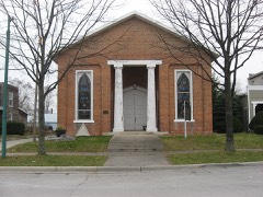
St. Joseph Catholic Church and Schoolunder 500 feet1979
Nichols, John H., House0.1 miles1988
First Presbyterian Church of Wapakoneta0.2 miles1985
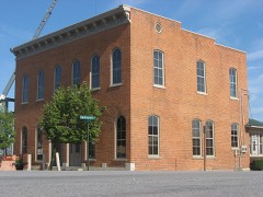
Wintzer, Charles, Building0.2 miles2010
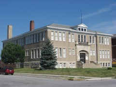
Blume High School0.2 miles1996

Sources for this property

National Archives recordThe nomination case file for reference 73001387 in Record Group 79.
Wikipedia articleCommunity-written account of this property, licensed CC BY-SA.
Auglaize CountyAll 24 listed properties in this county.

Provenance

  • Listing record. National Park Service National Register of Historic Places, listed-properties dataset, current to 2026-05-22.
  • Map join. Address geocoded through the United States Census geocoder, then tested against the published boundary of every sheet in the USGS Historical Topographic Map Collection.
  • How this page is made. Listing fields come from federal records; map-sheet coverage is a labelled coordinate-to-boundary calculation, not a source-field claim.
  • Specimens. Global Biodiversity Information Facility (GBIF), https://www.gbif.org/. Only records licensed CC0 or CC BY are used. Records licensed CC BY-NC are excluded because this site carries advertising. Images are checked individually and any whose licence is non-commercial, no-derivatives or unreadable is refused.
  • Mines and quarries. USGS Mineral Resources Data System (MRDS) https://mrdata.usgs.gov/mrds/ A work of the United States government, no copyright under 17 U.S.C. 105.
  • Storms. NOAA National Centers for Environmental Information, Storm Events Database https://www.ncei.noaa.gov/stormevents/ A work of the United States government, no copyright under 17 U.S.C. 105. Narratives are quoted verbatim from the National Weather Service report and are not edited or summarised.