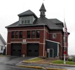
Listed on the National Register of Historic Places in
1974. A historic map-sheet match is not published yet. The record needs a coordinate-quality review before it can be joined to a sheet boundary.
From the record
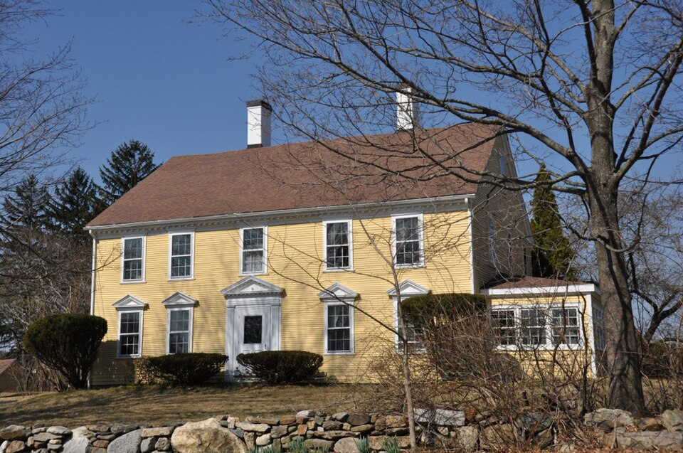
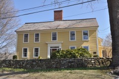
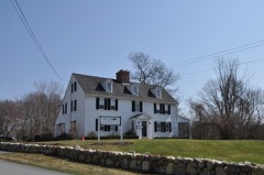
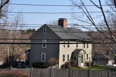
“The Samuel Osgood House is a historic house in North Andover, Massachusetts, USA. Built about 1740, it is said to be the birthplace of Samuel Osgood, a member of the Continental Congress and the first United States Postmaster General.”
Wikipedia article Samuel Osgood House (North Andover, Massachusetts), CC BY-SA 4.0.
one of 350 National Register listings in Essex County · listed in 1974 · category: Building · one of 2 National Historic Landmarks in Essex County.
National Register reference number.74000380- the number the National Park Service assigned this property when it was listed, and the key its nomination file is catalogued under at the National Archives.
Fires near this property
89 since 2015
Regional context, not property-specific
evidence. The
federal wildfire occurrence database
lists 89 fires within 5 miles of Osgood, Samuel, House between
2015 and 2020, burning about 28 acres in total. 1 started naturally. 5 were recorded as arson.
Distance is straight-line from the map coordinates, so a fire counted
here may appear on a neighbouring settlement's page as well.
Reported cause
Fires
Smoking
22
Debris and open burning
17
Missing data/not specified/undetermined
15
Recreation and ceremony
9
Misuse of fire by a minor
6
Power generation/transmission/distribution
5
Arson/incendiarism
5
Equipment and vehicle use
5
Railroad operations and maintenance
4
Natural
1
The most recent of
them, most recent first, with the day each was reported and the service
that recorded it.
Regional context, not property-specific
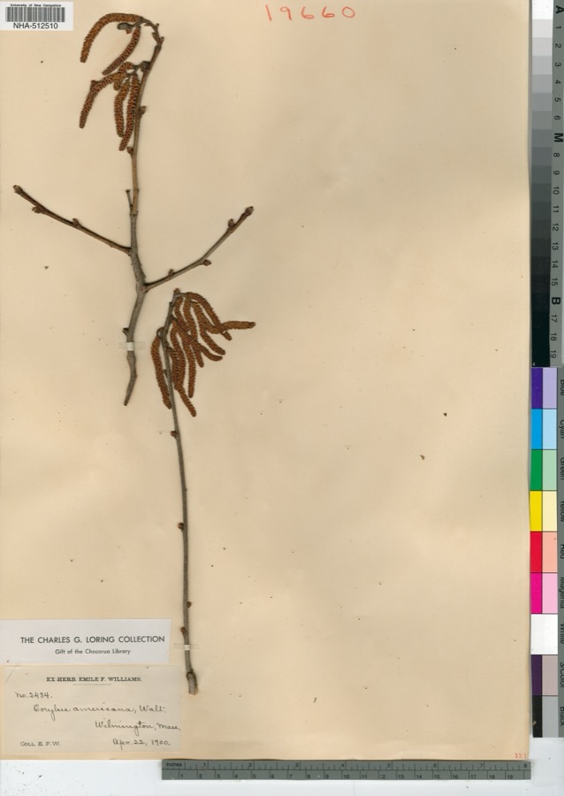
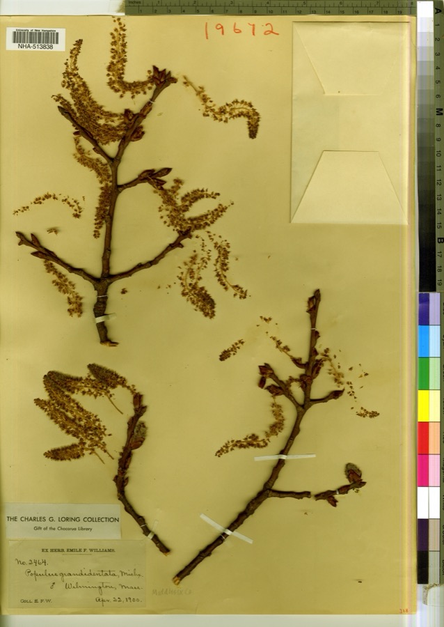
evidence. Museums hold 1,578 specimens
collected within 10 miles of Osgood, Samuel, House between 1816 and
1975: 808 Plantae, 598 Animalia, 154 Fungi, 5 Protozoa, 5 Bacteria, 4 Unrecorded, 4 Chromista. 12 distinct Species records are shown.
Collected by A Brown, A S Gaunt, A. C. Mathieson and others. Each is a
physical object with a catalogue
number, and each entry opens the museum's record. This is what was
collected and kept, not a survey of what lives here - nothing can be
concluded from a species being absent.
Regional context, not property-specific
evidence. The federal mineral resources record lists
4 workings within 5 miles of Osgood, Samuel, House: 3 past producers, 1 plant.
1 still produces. What was taken out: Sand and Gravel, Construction, Perlite. Distance is straight-line from the
map coordinates, so a quarry counted here may appear on a neighbouring
settlement's page as well.
Regional context, not property-specific
evidence. The National Weather Service names
North Andover, the town this property stands in, in 8 storm reports between 2000 and 2023: 5 thunderstorm wind, 1 heavy rain, 1 flood, 1 flash flood.
No death or injury is recorded in these reports. Each account below is quoted exactly as the forecast office
filed it, from the NOAA Storm Events Database, and each date
opens the federal record of that event.
No historic map-sheet match is published
for this property yet. That does not mean no map exists. This record needs
a coordinate-quality review before it can be joined to a sheet boundary.
Browse the county's mapped places while that work is
pending.
From the nomination file
1,892 words on record
When this property was proposed for the
National Register, someone wrote the case for it: what the building is,
and why it matters. That document is a federal record in the public domain.
It is quoted below word for word, never summarised. The text was read off the scanned case file by machine, so the
occasional stray character is the recogniser's and the 1970s
typewriter's.
Description of the property
The Samuel Osgood House was built in the mid-18th c. in the classical style. The building date of 1740 is well substantiated by the stylistic details of construction. Set on a 5-acre lot in a rural-residential area of North Andover, it faces soutffon Osgood Street and is set back on a circular side arive with a fence and stone wall on the street edge. There are 3 outbuildings: a 2-car garage, a 5-stall carriage shed with one end converted into a chicken coop, and a large 2-room shed with gable ends. All were built later than the house. The barn foundations remain, and there is a photograph, taken c. 1900, in Stevens Memorial Library, of the original structure. The house has 3 chimneys with 8 rooms and a center hall in the main part of the house.
There are 7 fireplaces, all set in field-panelled walls, and much addi- tional original panelling including hinged interior shutters in one room. The center hall has much of its original panelling, and 2 of the fireplace walls are of particular interest with their flanking stop-fluted pilasters. The upper u southeast room also has a dentilled cornice. M The exterior covering is wood clapboard, painted yellow with white trim. The southeast facade has a center entry with a dentilled pediment which is not - original, but which probably approximates the original treatment. There are a probabty aprorimatos 2 pedimented windows on either side of the door on the first floor. On the second floor , there are 5 windows spaced directly over the lower windows and the door.
The entire facade is topped by a dentiled cornice and edged with plain cornerboards. The gable ends have both been modified.
The house is notable as a fine example of mid-18th c. architecture. center hall retains most of its original panelling, and 2 of the field-panelled fireplace walls are of particular interest, with one of them featuring dentil moulding. The house has primary historical significance as the birthplace and boyhood home of Samuel Osgood (1747-1813). Col.Osguood was an aid to Gen. Artemus ward during the American Revolution and was elected to the Continental Congress in 1781. He served as one of the first three commissioners of the Treasury and was appointed by George Washington as the first Postmaster General under the new Constitution. - He spent the latter part of his life in New York where he was Speaker of the New York Assembly in 1800.
and became the first President of the National City Bank of New York. His friend Thomas Jefferson appointed him Supervisor of Internal Revenue for the aistrict of N.Y.. Osgood was later Naval Officer oof the Port of New York. 1803-1813, and was.also one of, the found- ers of the American Academy of Fine Arts. During the Revalution, the house served as a temporary refuge for books from Harvara's library, which were sent to Andover for safe keeping. In 1953 a historical marker outlining Osgood's career was placed outside the house. -3 ens pc essaad RECEIVED NOV 11 1974 NATIONAL! REGISTER ToTE -6
Quoted from the National Register nomination
for reference 74000380, 9 pages, held by the National Archives in Record
Group 79. See the
catalogue record.
Listed places nearby
6 within 8 miles
Other National Register properties close
enough to walk or drive between, ordered by distance from this one. Both
positions come from the same geocoding pass that matched these properties
to their map sheets.
Listing record. National Park Service National Register of Historic Places, listed-properties dataset, current to 2026-05-22.
Map join. Address geocoded through the United States Census geocoder, then tested against the published boundary of every sheet in the USGS Historical Topographic Map Collection.
How this page is made. Listing fields come from federal records; map-sheet coverage is a labelled coordinate-to-boundary calculation, not a source-field claim.
Wildfire. Short, Karen C. 2022. Spatial wildfire occurrence data for the United States, 1992-2020 [FPA_FOD_20221014]. 6th Edition. Fort Collins, CO: Forest Service Research Data Archive. https://doi.org/10.2737/RDS-2013-0009.6 Collected with United States Government funding and usable without additional permissions or fees.
Specimens. Global Biodiversity Information Facility (GBIF), https://www.gbif.org/. Only records licensed CC0 or CC BY are used. Records licensed CC BY-NC are excluded because this site carries advertising. Images are checked individually and any whose licence is non-commercial, no-derivatives or unreadable is refused.
Mines and quarries. USGS Mineral Resources Data System (MRDS) https://mrdata.usgs.gov/mrds/ A work of the United States government, no copyright under 17 U.S.C. 105.
Storms. NOAA National Centers for Environmental Information, Storm Events Database https://www.ncei.noaa.gov/stormevents/ A work of the United States government, no copyright under 17 U.S.C. 105. Narratives are quoted verbatim from the National Weather Service report and are not edited or summarised.
 Block
Block