Listed on the National Register of Historic Places in
1974. A historic map-sheet match is not published yet. The record needs a coordinate-quality review before it can be joined to a sheet boundary.
From the record
one of 4 National Register listings in Pike County · listed in 1974 · category: Building.
National Register reference number.74001597- the number the National Park Service assigned this property when it was listed, and the key its nomination file is catalogued under at the National Archives.
Fires near this property
76 since 2006
Regional context, not property-specific
evidence. The
federal wildfire occurrence database
lists 76 fires within 5 miles of Eager Inn between
2006 and 2020, burning about 240 acres in total. 1 started naturally. 2 were recorded as arson.
Distance is straight-line from the map coordinates, so a fire counted
here may appear on a neighbouring settlement's page as well.
Reported cause
Fires
Debris and open burning
49
Missing data/not specified/undetermined
20
Arson/incendiarism
2
Equipment and vehicle use
1
Misuse of fire by a minor
1
Natural
1
Recreation and ceremony
1
Smoking
1
The most recent of
them, most recent first, with the day each was reported and the service
that recorded it.
Regional context, not property-specific
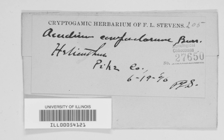
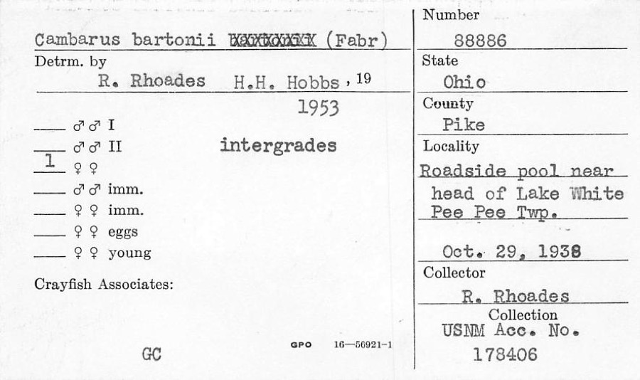
evidence. Museums hold 895 specimens
collected within 10 miles of Eager Inn between 1896 and
1975: 820 Animalia, 37 Plantae, 33 Fungi, 3 Protozoa, 2 Unrecorded. 12 distinct Species records are shown.
Collected by A VERWYST, A. Braun, A. Cronquist and others. Each is a
physical object with a catalogue
number, and each entry opens the museum's record. This is what was
collected and kept, not a survey of what lives here - nothing can be
concluded from a species being absent.
Regional context, not property-specific
evidence. The federal mineral resources record lists
1 working within 5 miles of Eager Inn: 1 past producer.
None of them still produces. What was taken out: Limestone, General. Distance is straight-line from the
map coordinates, so a quarry counted here may appear on a neighbouring
settlement's page as well.
Regional context, not property-specific
evidence. The National Weather Service names
Morgantown, the town this property stands in, in 9 storm reports between 2012 and 2025: 7 thunderstorm wind, 1 hail, 1 flood.
No death or injury is recorded in these reports. Each account below is quoted exactly as the forecast office
filed it, from the NOAA Storm Events Database, and each date
opens the federal record of that event.
No historic map-sheet match is published
for this property yet. That does not mean no map exists. This record needs
a coordinate-quality review before it can be joined to a sheet boundary.
Browse the county's mapped places while that work is
pending.
From the nomination file
1,625 words on record
When this property was proposed for the
National Register, someone wrote the case for it: what the building is,
and why it matters. That document is a federal record in the public domain.
It is quoted below word for word, never summarised. The text was read off the scanned case file by machine, so the
occasional stray character is the recogniser's and the 1970s
typewriter's.
Description of the property
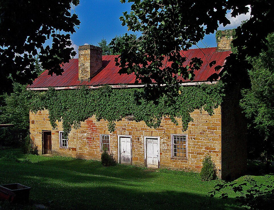
The original portion of the Eager Inn was a two-story, rectangular portion consisted of four rooms, two to each floor. There are four The outer bays have a single, double-hung window on each framed and have flat, stone arches above. A two-story, two room addition on the left side was constructed, probably, in 1858, which is the date appearing in the gable end. was built by Peter Higgins, a local stone mason who also built the sandstone, gable-roofed, with an inside-end chimney. Openings in framed, but do not have stone arches. of the area were not until 1798. It is likely that the inn was JUL 1 7 1974 CONDITION Trace.
NATIONAL REGISTER Excellent Moved structure built of smooth random ashlar Waverly sandstone.The inn Fair it is not likely that it is quite that early.The earliest surveys on each floor to the right of the door.These openings are wood constructed between 1805 and 1834 when the area was being settled stone jail in Piketon in 1853.The addition is also of Waverly was gable-roofed with inside end chimneys,also of stone.This Though it is locally believed that the Eager Inn was built in 1797, by Virginians and was part of the widely used westward path of Zane's the front facade are a plain door to the left and one small window (Check One) bay are identical,6/6.The 1ower window in the right bay.is larger, floor.The two in the left bay and the upper window in the right bays in this portion; the two inside bays each have a doorway.
RECEIVED 8/12. This was likely the tap room.Windows and doors are wood
Statement of significance
between Zanesville, Ohio and Maysville, Kentucky: Zane's Trace. along the route. months later it was sold to Isaac Penisten, an early (1798) Kirkpatrick in 1834 and he, in turn, sold it to Steven Graves in 1835. In April 1836 it was sold to John Eager, and the Eager Penisten, who was related by marriage to an earlier owner, Conservation Architecture Communications Commerce Engineering Transportation Science losophy Prehistoric Aboriginal itarian Literature Music Theater Education Social/Human- Agriculture Sculpture Industry Political Invention Trace was completed.Penisten sold the property to Andrew but the structure seems to predate his ownership of the property. 18th Century property remained in the family through 1917. The actual date of construction for the Eager Inn is not known.
The Eager Inn was located on the shortest and most used route an early inhabitant of the westward frontier and founder of Urban Planning inns that were used by these early travelers. It was built on Virginia Military Survey tract number 3255 which It is known that John Eager ran a tavern and inn until his the inn, since he owned the property during the years that Zane's at an average of every four miles since travel was slow and Isaac Penisten.It remained in the family until 1917. Religion/Phi.
Eventually all the shares went to George Eager in 1856.Upon to Simon Morgan in 1799 and then to John Beasley in 1805.Eight Georgets death in 1902 it was willed to his sister, E1len wagons often broke down.In 1830 there were over 75 taverns The property was left to Johnts sons Lewis, George and Robert. PERIOD (Check One or More as Appropriate) AREAS OF SIGNIFICANCE (Check One or More as Appropriate) Wheeling, West Virginia.
Quoted from the National Register nomination
for reference 74001597, 10 pages, held by the National Archives in Record
Group 79. See the
catalogue record.
Listing record. National Park Service National Register of Historic Places, listed-properties dataset, current to 2026-05-22.
Map join. Address geocoded through the United States Census geocoder, then tested against the published boundary of every sheet in the USGS Historical Topographic Map Collection.
How this page is made. Listing fields come from federal records; map-sheet coverage is a labelled coordinate-to-boundary calculation, not a source-field claim.
Wildfire. Short, Karen C. 2022. Spatial wildfire occurrence data for the United States, 1992-2020 [FPA_FOD_20221014]. 6th Edition. Fort Collins, CO: Forest Service Research Data Archive. https://doi.org/10.2737/RDS-2013-0009.6 Collected with United States Government funding and usable without additional permissions or fees.
Specimens. Global Biodiversity Information Facility (GBIF), https://www.gbif.org/. Only records licensed CC0 or CC BY are used. Records licensed CC BY-NC are excluded because this site carries advertising. Images are checked individually and any whose licence is non-commercial, no-derivatives or unreadable is refused.
Mines and quarries. USGS Mineral Resources Data System (MRDS) https://mrdata.usgs.gov/mrds/ A work of the United States government, no copyright under 17 U.S.C. 105.
Storms. NOAA National Centers for Environmental Information, Storm Events Database https://www.ncei.noaa.gov/stormevents/ A work of the United States government, no copyright under 17 U.S.C. 105. Narratives are quoted verbatim from the National Weather Service report and are not edited or summarised.
 Block
Block