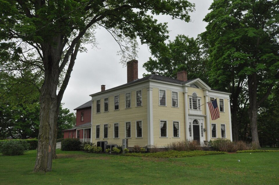
Built in 1805 in the Federal architecture. Listed on the National Register of Historic Places in
1975. A historic map-sheet match is not published yet. The record needs a coordinate-quality review before it can be joined to a sheet boundary.
From the record
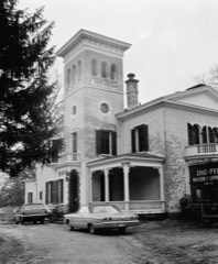
“Charles Leonard House is a historic house at 663 Main Street in Agawam, Massachusetts. Built in 1805, it is described as Agawam's finest Federalist building, and is attributed to architect Asher Benjamin.”
Wikipedia article Capt. Charles Leonard House, CC BY-SA 4.0.
one of 123 National Register listings in Hampden County · listed in 1975 · category: Building · built in 1805, Federal architecture, by Asher Benjamin.
National Register reference number.75000273- the number the National Park Service assigned this property when it was listed, and the key its nomination file is catalogued under at the National Archives.
Fires near this property
370 since 2015
Regional context, not property-specific
evidence. The
federal wildfire occurrence database
lists 370 fires within 5 miles of Leonard, Capt. Charles, House between
2015 and 2020, burning about 122 acres in total. 16 started naturally. 3 were recorded as arson.
Distance is straight-line from the map coordinates, so a fire counted
here may appear on a neighbouring settlement's page as well.
Reported cause
Fires
Missing data/not specified/undetermined
193
Equipment and vehicle use
96
Recreation and ceremony
24
Debris and open burning
22
Natural
16
Smoking
14
Arson/incendiarism
3
Misuse of fire by a minor
2
The most recent of
them, most recent first, with the day each was reported and the service
that recorded it.
Regional context, not property-specific
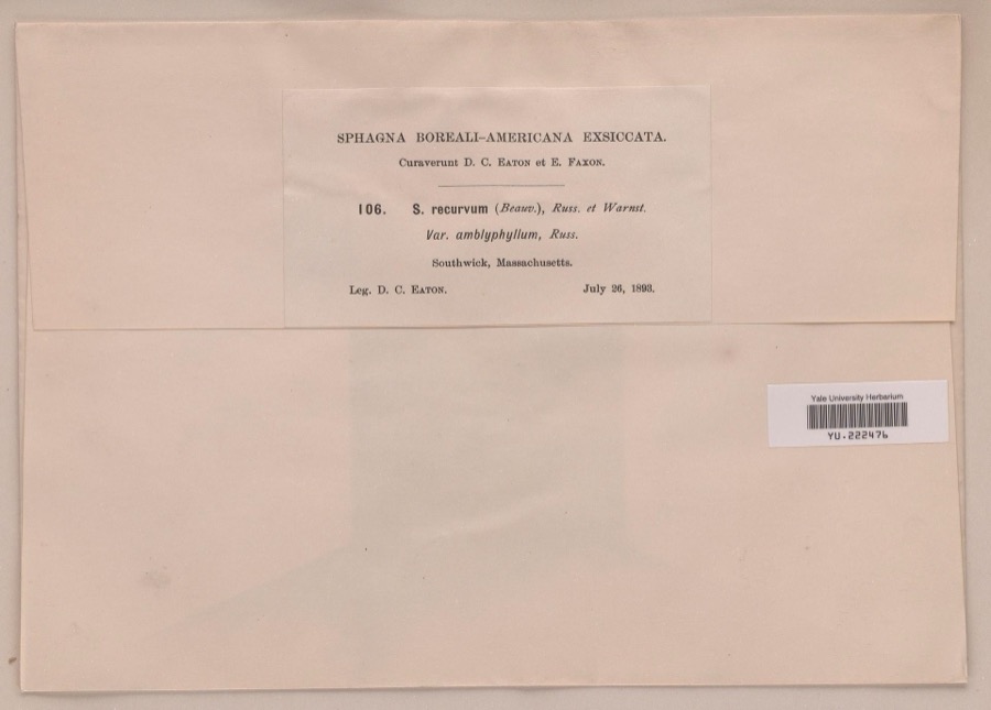
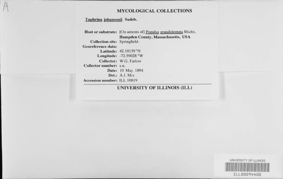
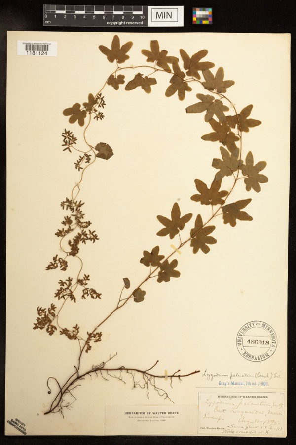
evidence. Museums hold 1,331 specimens
collected within 10 miles of Leonard, Capt. Charles, House between 1844 and
1975: 538 Animalia, 423 Plantae, 333 Fungi, 26 Chromista, 11 Unrecorded. 12 distinct Species records are shown.
Collected by A. B. Seymour, A. B. Seymour; S., A. K. Harrison, F. G. Floyd and others. Each is a
physical object with a catalogue
number, and each entry opens the museum's record. This is what was
collected and kept, not a survey of what lives here - nothing can be
concluded from a species being absent.
Regional context, not property-specific
evidence. The federal mineral resources record lists
25 workings within 5 miles of Leonard, Capt. Charles, House: 12 past producers, 10 producers, 2 occurrences, 1 unknown.
10 still produce. What was taken out: Stone, Crushed/Broken, Sand and Gravel, Construction, Brick Clay, Clay. Distance is straight-line from the
map coordinates, so a quarry counted here may appear on a neighbouring
settlement's page as well.
Regional context, not property-specific
evidence. The National Weather Service names
Agawam, the town this property stands in, in 59 storm reports between 1993 and 2024: 31 thunderstorm wind, 14 hail, 7 flood, 4 lightning.
No death or injury is recorded in these reports. Each account below is quoted exactly as the forecast office
filed it, from the NOAA Storm Events Database, and each date
opens the federal record of that event.
A storm survey team from the National Weather Service in Taunton, MA confirmed that a microburst occurred in the town of Agawam. There were two areas of straight line wind damage. One was in the area of Harvey Johnson Blvd where several trees were downed, a few onto houses. The more significant area of damage was the area around Meadow Street where 40 to 50 trees were uprooted and 6 to 12 vehicles were crushed by the fallen trees. Wires were downed in both areas. There were no reports of significant structural damage or injuries or fatalities.
Trees on Rowley and Suffield Streets and Barn Road were downed by thunderstorm winds. Wires were also downed at the intersection of Barn Road and Rowley Street.
Trees in Agawam were downed by thunderstorm winds. In East Longmeadow, there were several reports of trees down. This includes trees and large branches downed in the vicinity of 5th and Edmond Streets. Another tree fell on East Longmeadow High School on Maple Street (no damage to the school reported). Trees, poles, and wires also were downed on Berchland and Rodgers Roads. Another tree was downed onto a house on Maple Avenue. There was minor damage to the house. Also, several telephone poles were downed in East Longmeadow.
The intersection of Sylvan and Park Streets was flooded and impassable. The Route 5 tunnel was flooded and traffic was rerouted to the rotary above the tunnel. The Union Street underpass was flooded and impassable with damage to the road.
North Westfield Street in Agawam was flooded and impassable. Suffield Street near Mill Street was flooded and closed. Flooding also reported at Mill and Poplar Streets.
At 947 PM EST, amateur radio operators reported cars stuck in flood waters on Mill Street and Poplar Street in Agawam. At 952 PM EST, Henry Street and Suffield Street were reported flooded and impassable. At 1002 PM EST, North Westfield Street was impassable with flood waters three feet deep; multiple cars were stuck in the water. At 1037 PM EST, the intersection of Kensington and Mill Streets was flooded and impassable.
Large tree limbs were knocked down in Robinson State Park as reported by a Park Ranger and in Agawam as reported by a Skywarn spotter. One large tree limb was also reported downed on Amostown Road in W. Springfield.
No historic map-sheet match is published
for this property yet. That does not mean no map exists. This record needs
a coordinate-quality review before it can be joined to a sheet boundary.
Browse the county's mapped places while that work is
pending.
From the nomination file
2,230 words on record
When this property was proposed for the
National Register, someone wrote the case for it: what the building is,
and why it matters. That document is a federal record in the public domain.
It is quoted below word for word, never summarised. The text was read off the scanned case file by machine, so the
occasional stray character is the recogniser's and the 1970s
typewriter's.
Description of the property
The Captain Charles Leonard House, built in 1805, faces west on Main Street in a residential area of Agawam. It is a hip roofed clapboard structure, two rooms wide and two deep, with a central hall. The cornice is lined with a moulding resembling acanthus leaves, below which is a plain frieze. The facade center, the focal point of the building, is elaborately treated. A deep roof pediment with returns, which contains a fan window, projects from the facade plane and is supported by Tuscan columns. The door surround fits between the columns and is also elaborately treated. The door with fanlight is flanked on each side by a Doric pilaster, twelve-pane side light, and another Doric pilaster. An octagonal medallion is situated above each side light.
The pilasters support a wide frieze with tryglyph moulding and a lintel with mutules. the door surround and lights the second floor stair landing. The pilaster, oum ant uagtea the t i A tall and elegant Palladian window is centered atop frieze, and lintel treatment are identical in type to that of the door surround below. The facade corners are highlighted with Doric cornerboards 7 having a simple comb-like frieze. A two-story ridge roof ell, raised from one story in 1938, projects east from the rear of the main house and has two porches. A long one story hip roof ell, c..1960, with a north-south axis, is attached to this ell and has an off-center door on its east side.
The most notable room in the house is the tap room which runs the width on eore partoae sian an the bodtiore an neanl a i on The walls are vertical kitchen side." 8
Statement of significance
/ARCHITECT 1805 Asher Benjamin STATEMENT OF SIGNIFICANCE Believed to have been designed by Asher Benjamin, the Captain Charles Leonard House is significant as the most elaborate pre-1850 architectural work in Agawam, a rural and unpretentious town in southwestern Massachusetts. The house sits on a wide thoroughfare lined with trees on either side. Main Street, like Agawam entire, has a mixture of unelaborate community and residential properties, predominantly from the Colonial, Greek Revival, and present periods. The house was built for Captain Charles Leonard, who was known as "the farmer who went to Harvard." A member of the local militia and a leading citizen, Captain Leonard operated the house as an inn until his death in He and his wife are buried in a nearby cemetery.
1814 LEBOVICH 2-15 The house is presently the town's community house and museum house, the location of many civic functions and a source of local pride and concern. I9
Quoted from the National Register nomination
for reference 75000273, 14 pages, held by the National Archives in Record
Group 79. See the
catalogue record.
Listed places nearby
6 within 8 miles
Other National Register properties close
enough to walk or drive between, ordered by distance from this one. Both
positions come from the same geocoding pass that matched these properties
to their map sheets.
Listing record. National Park Service National Register of Historic Places, listed-properties dataset, current to 2026-05-22.
Map join. Address geocoded through the United States Census geocoder, then tested against the published boundary of every sheet in the USGS Historical Topographic Map Collection.
How this page is made. Listing fields come from federal records; map-sheet coverage is a labelled coordinate-to-boundary calculation, not a source-field claim.
Wildfire. Short, Karen C. 2022. Spatial wildfire occurrence data for the United States, 1992-2020 [FPA_FOD_20221014]. 6th Edition. Fort Collins, CO: Forest Service Research Data Archive. https://doi.org/10.2737/RDS-2013-0009.6 Collected with United States Government funding and usable without additional permissions or fees.
Specimens. Global Biodiversity Information Facility (GBIF), https://www.gbif.org/. Only records licensed CC0 or CC BY are used. Records licensed CC BY-NC are excluded because this site carries advertising. Images are checked individually and any whose licence is non-commercial, no-derivatives or unreadable is refused.
Mines and quarries. USGS Mineral Resources Data System (MRDS) https://mrdata.usgs.gov/mrds/ A work of the United States government, no copyright under 17 U.S.C. 105.
Storms. NOAA National Centers for Environmental Information, Storm Events Database https://www.ncei.noaa.gov/stormevents/ A work of the United States government, no copyright under 17 U.S.C. 105. Narratives are quoted verbatim from the National Weather Service report and are not edited or summarised.
 Block
Block