Listed on the National Register of Historic Places in
1975. A historic map-sheet match is not published yet. The record needs a coordinate-quality review before it can be joined to a sheet boundary.
From the record
one of 338 National Register listings in Cuyahoga County · listed in 1975 · category: Building · one of 3 National Historic Landmarks in Cuyahoga County.
National Register reference number.75001355- the number the National Park Service assigned this property when it was listed, and the key its nomination file is catalogued under at the National Archives.
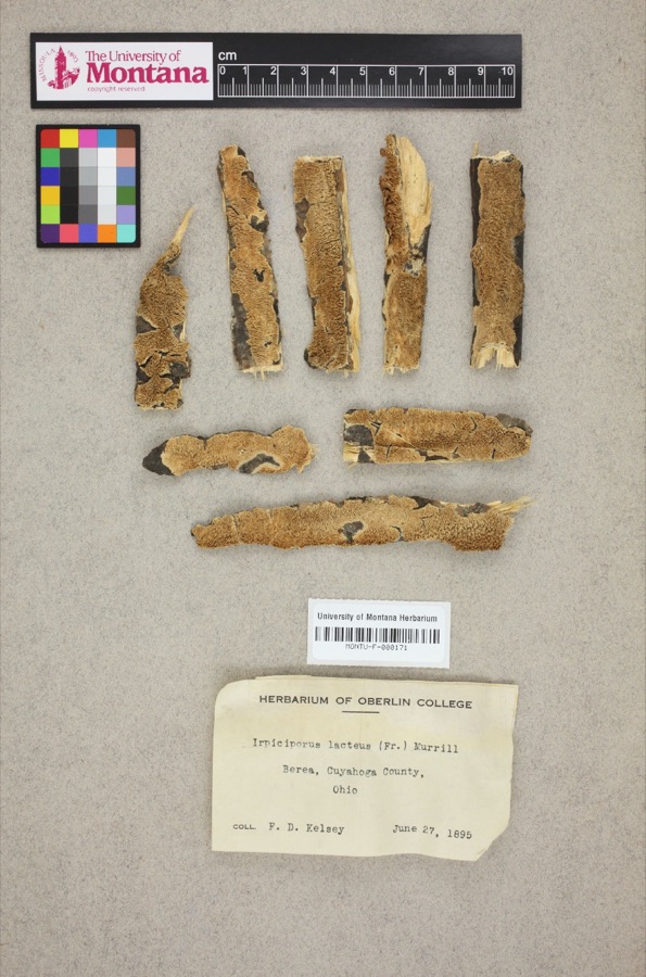
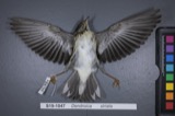
Specimens collected near this property
12 of 1,231 shown
Regional context, not property-specific
evidence. Museums hold 1,231 specimens
collected within 10 miles of Berea District 7 School between 1849 and
1975: 1,132 Animalia, 62 Plantae, 30 Fungi, 6 Protozoa, 1 Unrecorded. 12 distinct Species records are shown.
Collected by A. D. Huryn, A. D. Selby, A. G. Newhall and others. Each is a
physical object with a catalogue
number, and each entry opens the museum's record. This is what was
collected and kept, not a survey of what lives here - nothing can be
concluded from a species being absent.
Regional context, not property-specific
evidence. The National Weather Service names
Berea, the town this property stands in, in 15 storm reports between 1996 and 2024: 8 thunderstorm wind, 4 hail, 3 flash flood.
No death or injury is recorded in these reports. Each account below is quoted exactly as the forecast office
filed it, from the NOAA Storm Events Database, and each date
opens the federal record of that event.
Heavy rain and thunderstorms moved across Cuyahoga County during the morning hours of the 7th. The first reports of flash flooding occurred in Berea and then quickly expanded into Brookpark. Several roads, including State Route 237 through Berea, were closed. As the heavy rain continued, major streets across Cleveland became flooded. In downtown Cleveland, flash flooding occurred along streets just north of Superior Avenue, especially near the intersection with Martin Luther King Jr. Drive. In this area, seventeen people had to be rescused from their vehicles, and a total of thirty five rescues were performed on other streets throughout downtown Cleveland. Approximately thirty eight residences and two businesses sustained major flood damage. Rainfall reports across Cuyahoga County from this event ranged from 1.74 inches in North Royalton to 3.74 inches in Westlake. The majority of the rain fell in a four hour time period between 7 am and 11 am.
No historic map-sheet match is published
for this property yet. That does not mean no map exists. This record needs
a coordinate-quality review before it can be joined to a sheet boundary.
Browse the county's mapped places while that work is
pending.
From the nomination file
1,618 words on record
When this property was proposed for the
National Register, someone wrote the case for it: what the building is,
and why it matters. That document is a federal record in the public domain.
It is quoted below word for word, never summarised. The text was read off the scanned case file by machine, so the
occasional stray character is the recogniser's and the 1970s
typewriter's.
Description of the property
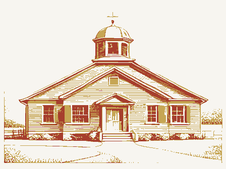
The main facade of the Berea District Elementary School (Berea Fine Arts Club) faces south on Bagley Road. Built in 1913, the structure height, rectangular in plan and has a hipped roof of slate tiles. There are double, arched windows to either side of the entrance change in the exterior is a wing across the back of the building on in 1935 the large sliding door which separated the two rooms was re- moved. A stage was added across the east side and a cloakroom was and floors remain. NOV 2 2 1974 CONDITION REGISTER Excellent Deteriorated RECEIVED installed to either side of the entrance.The wooden walls, ceilings NATIONAL' - Moved The brick school is one-story in houses the main entrance.
" This bay is gable roofed with a semi- open belltower above the entrance which has an intersecting gable the north side. This wing was added in the early 1950's and contains a kitchen and two restrooms. When the Fine Arts Club took over the building bay (these have been bricked in). The east and west facades each Few changes have been made to the interior. The original building was Original Site retains its original appearance. a two room school. PERIOD (Check One or More as Appropriate) - Pre-Columbian| - Prehistoric STATEMENT OF
Statement of significance
schoolhouse, common in the early part of the twentieth century. The two-room school was, at the time it was built, an early improvement remains in good condition, with very little major alteration, and is Art classes, ballet, Little Theater of Berea and church groups Brookpark and Middleburg Heights) the third largest school district in NOV 22 1974 for. SIGNIFICANCE Conservation losophy Commerce Military Engineering Music Aboriginal Science Communications REGISTER Architecture Theater itarian Agriculture RECEIVED Landscape NATIONAL Industry Education Political Sculpture Religion/Phi. Cuyahoga County. Transpogtation Urban Planning Literature Social/Human- needs of the community of Berea and remains well-used and well-cared used almost daily.
18th Century on the one-room schoolhouse of the nineteenth century.The building Berea District 7 School is a good example of the two-room district Invention The Berea District 7 School has served as the Berea Fine Arts Club Other (Specify) SPECIFICDATE(S) (It Applicable and Known) there monthly. The schoolhouse has adapted itself well to meet the 1913 AREAs OF SIGNIFICANCE (Check One or More as Appropriate) Township), Berea News, 1970. Berea News articles .
Quoted from the National Register nomination
for reference 75001355, 11 pages, held by the National Archives in Record
Group 79. See the
catalogue record.
Listed places nearby
6 within 8 miles
Other National Register properties close
enough to walk or drive between, ordered by distance from this one. Both
positions come from the same geocoding pass that matched these properties
to their map sheets.
Listing record. National Park Service National Register of Historic Places, listed-properties dataset, current to 2026-05-22.
Map join. Address geocoded through the United States Census geocoder, then tested against the published boundary of every sheet in the USGS Historical Topographic Map Collection.
How this page is made. Listing fields come from federal records; map-sheet coverage is a labelled coordinate-to-boundary calculation, not a source-field claim.
Specimens. Global Biodiversity Information Facility (GBIF), https://www.gbif.org/. Only records licensed CC0 or CC BY are used. Records licensed CC BY-NC are excluded because this site carries advertising. Images are checked individually and any whose licence is non-commercial, no-derivatives or unreadable is refused.
Storms. NOAA National Centers for Environmental Information, Storm Events Database https://www.ncei.noaa.gov/stormevents/ A work of the United States government, no copyright under 17 U.S.C. 105. Narratives are quoted verbatim from the National Weather Service report and are not edited or summarised.
 Block
Block