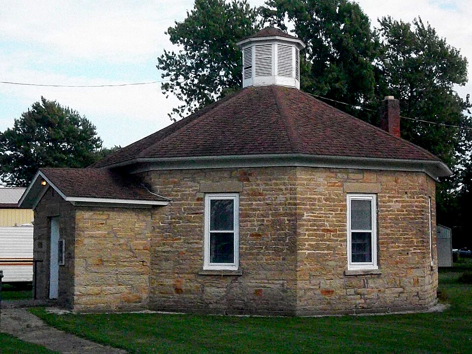
Listed on the National Register of Historic Places in
1975. A historic map-sheet match is not published yet. The record needs a coordinate-quality review before it can be joined to a sheet boundary.
From the record
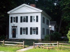
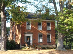
“The Fish home is of some historic interest. It is situated in Florence Township near the western line thereof, and on the old State Road which for a century has been a thoroughfare - in the earliest days carrying a procession of settlers' moving wagons, many of which were drawn by oxen; later the regular stage coach shuttling travelers to and fro, and now an automobile route between Cleveland and Toledo.”
A Standard History of Erie County, Ohio (1916). Machine-read text.
one of 175 National Register listings in Erie County · listed in 1975 · category: Building · one of 2 National Historic Landmarks in Erie County.
National Register reference number.75001378- the number the National Park Service assigned this property when it was listed, and the key its nomination file is catalogued under at the National Archives.
The ground it stands on
6,497 words
The chapter on Florence Township in A Standard History of Erie County, Ohio, published 1916 names Florence. This is what it says, exactly as the scans read.
Vermillion River, which has its rise in a little lake of the same name in Ashland County, passes through this township on its way to the lake. There is but one other water-course in the township: Chapelle Creek, that rises in Townsend, and entering Florence from Wakeman, a mile and a quarter east of the west town line, empties into Lake Erie.
The first settlement was made by Ezra Sprague and family, in May, 1809. They came to the mouth of the Huron River by water, and then went to Florence through an unbroken wilderness. Mr. Sprague was the first justice of the peace in the township, and afterwards held the _ position of associate judge of the Common Pleas Court. He died in 1856, survived by only two of his seven children.
Regional context, not property-specific
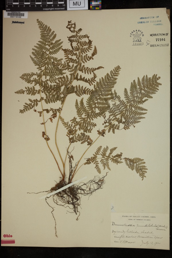
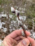
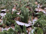
evidence. Museums hold 1,211 specimens
collected within 10 miles of Florence Corners School between 1874 and
1975: 750 Plantae, 367 Animalia, 93 Fungi, 1 Protozoa. 12 distinct Species records are shown.
Collected by ?, A. Dowdy, A. M. Evans and others. Each is a
physical object with a catalogue
number, and each entry opens the museum's record. This is what was
collected and kept, not a survey of what lives here - nothing can be
concluded from a species being absent.
Regional context, not property-specific
evidence. The federal mineral resources record lists
3 workings within 5 miles of Florence Corners School: 2 producers, 1 past producer.
2 still produce. What was taken out: Stone, Crushed/Broken, Flagstone. Distance is straight-line from the
map coordinates, so a quarry counted here may appear on a neighbouring
settlement's page as well.
Regional context, not property-specific
evidence. The National Weather Service names
Florence, the town this property stands in, in 3 storm reports between 2006 and 2013: 1 hail, 1 flash flood, 1 thunderstorm wind.
No death or injury is recorded in these reports. Each account below is quoted exactly as the forecast office
filed it, from the NOAA Storm Events Database, and each date
opens the federal record of that event.
Training thunderstorms with torrential showers brought as much as 2 to 3 inches of rain over the Berlin Heights region. This heavy rainfall fell during rush hour and all within 2 hours. This resulted in several flooded roads with water as high as bumpers, and several road birms were washed away.
No historic map-sheet match is published
for this property yet. That does not mean no map exists. This record needs
a coordinate-quality review before it can be joined to a sheet boundary.
Browse the county's mapped places while that work is
pending.
From the nomination file
2,718 words on record
When this property was proposed for the
National Register, someone wrote the case for it: what the building is,
and why it matters. That document is a federal record in the public domain.
It is quoted below word for word, never summarised. The text was read off the scanned case file by machine, so the
occasional stray character is the recogniser's and the 1970s
typewriter's.
Statement of significance
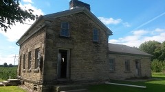
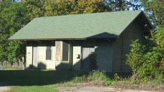
shape for a one - room schoolhouse, and because of its construction estimate, but it was certainly built before the Civil War. In 1879 Florence Corners boasted two churches, one schoolhouse, two shop. material. factories. Conservation Commerce Engineering Communications REGISTER losophy SIGNIFICANCE Aboriginal Transportation Music unknown NATIONAL Architecture Theater Agriculture RECEIVED itarian Pre-Columbian Invention Education general stores, one harness shop, two blacksmiths and one shoe Industry Political The first school in the township was built at Sprague's Corners. The story of Florence was not unusual.
Florence Township The exact date of this building is unknown.Campen suggests that Religion/Phi few manufactures other than grist mills, saw mills and cheese This building is primarily significant because of its octagonal no stores at Florence Corners until 1829-1830.The township had was first settled in l809,but there were few permanent settlers Urban Planning until after 1815. The township was organized in 1817. There were it may have been built around 1850,which may be an early Landscape Other (Specify) PERIOD (Check One or More as Appropriate) - Military DEC3I Art 1971), 203. Henry Timman, President, Firelands Historical Society. LATITUDE AND LONGITUDE COORDINATES DEFINING A RECTANGLE LOCATING THE PROPERTY OF LESS THAN TEN ACRES DEC 31 1974
Quoted from the National Register nomination
for reference 75001378, 16 pages, held by the National Archives in Record
Group 79. See the
catalogue record.
Listed places nearby
6 within 8 miles
Other National Register properties close
enough to walk or drive between, ordered by distance from this one. Both
positions come from the same geocoding pass that matched these properties
to their map sheets.
Listing record. National Park Service National Register of Historic Places, listed-properties dataset, current to 2026-05-22.
Map join. Address geocoded through the United States Census geocoder, then tested against the published boundary of every sheet in the USGS Historical Topographic Map Collection.
How this page is made. Listing fields come from federal records; map-sheet coverage is a labelled coordinate-to-boundary calculation, not a source-field claim.
Specimens. Global Biodiversity Information Facility (GBIF), https://www.gbif.org/. Only records licensed CC0 or CC BY are used. Records licensed CC BY-NC are excluded because this site carries advertising. Images are checked individually and any whose licence is non-commercial, no-derivatives or unreadable is refused.
Mines and quarries. USGS Mineral Resources Data System (MRDS) https://mrdata.usgs.gov/mrds/ A work of the United States government, no copyright under 17 U.S.C. 105.
Storms. NOAA National Centers for Environmental Information, Storm Events Database https://www.ncei.noaa.gov/stormevents/ A work of the United States government, no copyright under 17 U.S.C. 105. Narratives are quoted verbatim from the National Weather Service report and are not edited or summarised.
 Block
Block