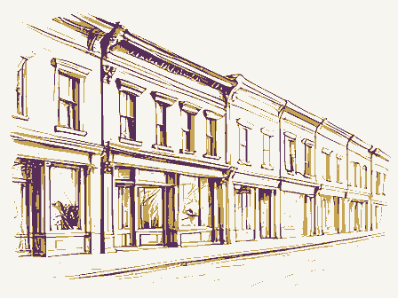
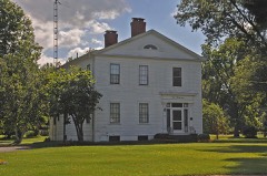
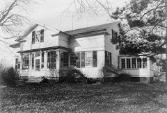
Listed on the National Register of Historic Places in
1975. A historic map-sheet match is not published yet. The record needs a coordinate-quality review before it can be joined to a sheet boundary.
From the record
one of 175 National Register listings in Erie County · listed in 1975 · category: District · one of 2 National Historic Landmarks in Erie County.
National Register reference number.75001381- the number the National Park Service assigned this property when it was listed, and the key its nomination file is catalogued under at the National Archives.
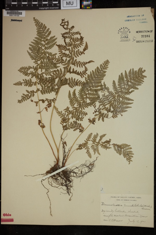
Specimens collected near this property
12 of 1,368 shown
Regional context, not property-specific
evidence. Museums hold 1,368 specimens
collected within 10 miles of Milan Historic District between 1874 and
1975: 760 Plantae, 548 Animalia, 60 Fungi. 12 distinct Species records are shown.
Collected by ?, A. Dowdy, Albert Commons and others. Each is a
physical object with a catalogue
number, and each entry opens the museum's record. This is what was
collected and kept, not a survey of what lives here - nothing can be
concluded from a species being absent.
Regional context, not property-specific
evidence. The federal mineral resources record lists
5 workings within 5 miles of Milan Historic District: 5 producers.
All of them still produce. What was taken out: Sand and Gravel, Construction. Distance is straight-line from the
map coordinates, so a quarry counted here may appear on a neighbouring
settlement's page as well.
Regional context, not property-specific
evidence. The National Weather Service names
Milan, the town this property stands in, in 34 storm reports between 1995 and 2025: 17 thunderstorm wind, 10 hail, 3 flood, 2 flash flood.
No death or injury is recorded in these reports. Each account below is quoted exactly as the forecast office
filed it, from the NOAA Storm Events Database, and each date
opens the federal record of that event.
Strong thunderstorm winds estimated to 70 miles per hour produced widespread damage in Milan. An estimated one thousand or more trees were downed in the area and the roofs of the town hall and police station were badly damaged.
A tornado touched down north of Monroeville in Huron County and traveled east along State Route 113 into southern Erie County. The tornado dissipated near the corner of Higbee and Livengood Roads after destroying a farm house. The destroyed house was ripped from its foundation, moved 40 feet and knocked over. A second house and a small barn were also slightly damaged. The tornado traveled approximately one mile in Erie County and had a damage path about 100 yards wide. Debris from the homes was thrown well outside the damage path which was clearly visible through corn fields. Ears of corn were shucked, apparently by the tornado and some ears had many kernels removed. Several dozen trees were downed along the damage path.
The towns of Milan, Oxford, and Groton townships were the most impacated by the heavy rains of July 10th. Doppler radar estimates between 3 and 4 inches of rain fell within an hour and a half with strong storms that moved through Erie County. Flooding was so widespread that local and county officials were advising the public to stay off the roads. The major thru ways of Ohio 113, Ohio 99, and U.S. 250 were closed. Drivers trying to circumvent the area were left with few options, as most of the surrounding roads had varying degrees of flooding. Portions of Patten Tract, Mason, Strecker, Ransom, Thomas and Kelley roads were overrun with pools of inches-deep water. A few homes were inundated in the first floor by flood waters, but the majority of the home flood damage was the result of basement flooding.
Thunderstorm winds tore the roof off of a barn located three miles northwest of Milan on Thomas Road in Oxford Township. Several nearby outbuildings were also damaged.
The small community called Franklin Flats located along the Huron River in western Milan is frequently inundated during times of flood. During Superstorm Sandy the Huron River reached major flood stage at 21 feet during the night of the 30th. At this stage the river inundated Franklin Flats community with about 2 feet of water. Being flood prone, the homes are elevated and citizens in the area moved valuable property out of the flood zone prior to the inundation. The property damage was minimal as a result.
At 910 AM EST, Erie Emergency Management reported an ice jam along the Huron River at Franklin Flats in Milan. The water backed up to Route 250. Ice was 8 inches thick.
Heavy rain that fell across the area during the morning hours of the 20th quickly filled streams and rivers across the area. At 9 am on the 20th, the Huron River at Milan was 7.74 feet. As the morning progressed, the river rose between two and three feet per hour until it rose above the flood stage of 18 feet during the afternoon. The river continued to rise through the evening hours, and crested at 22.7 feet at around 10:45 pm. Through the overnight hours into the 21st, the river gradually fell, but did not drop below flood stage until the late morning hours of the 21st.
No historic map-sheet match is published
for this property yet. That does not mean no map exists. This record needs
a coordinate-quality review before it can be joined to a sheet boundary.
Browse the county's mapped places while that work is
pending.
From the nomination file
3,506 words on record
When this property was proposed for the
National Register, someone wrote the case for it: what the building is,
and why it matters. That document is a federal record in the public domain.
It is quoted below word for word, never summarised. The text was read off the scanned case file by machine, so the
occasional stray character is the recogniser's and the 1970s
typewriter's.
Description of the property
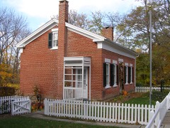
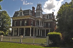
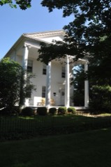
second-story ones round-arched. The second-story wall is articulated The Italianate commercial block is a remarkably intact two-story modified, and the interior modernized for a modern bank. Neverthe- building looks like a diminutive, even a child's, version of the Town Hall. The interior has been extensively altered. ival, High Victorian Italianate and Neo-Colonial Revival styles, wings, its end facing the street with the entrance being the left one CONDITION round-arched windows with cast-iron cornices. The most unusual (continued) suggest a semi-circular pediment. Society.The main one is a brick Greek Revival house with flanking porch and an Italianate house with a Neo-Colonial veranda. building have wooden cornices with modillion brackets.
There are pletely altered, the window arrangement on the north elevation was the interior remains unchanged. This group is the focal point of the district.Behind the Town brick building with sandstone foundation, steps, sills, keystones and To the east along Front Street is a residential area which Civil War monument. Forming a monumental backdrop for the square the architectural elements are those of the Town Hall, so that the and such mixtures as a Greek Revival house with an Italianate less, the building harmonizes fairly well with the others.
with the life of Thomas A. Edison, Milan's most famous citizen. whose property had been destroyed by fire under the British, and the a Great Lakes captain and ship-builder, the shipyard being located wood for the Sunday school, and it was used for worship while the Sayles house, built in 1845 and restored in 1969, located at the corner 1826-1890 Communications Commerce losophy Architecture SIGNIFICANCE Engineering Science Transportation Military Aboriginal Industry Music Prehistoric Religion/Phi Literature Theater Landscape Education itarian Political carriage shed.The Society has also recently acquired the Robert Sculpture of Edison Drive and Front Street.
Edison Drive was originally called Western Reserve Firelands, plus a representative section of nineteenth same fire, the first Presbyterian Church building of 1837 was destroy This is a district which preserves relatively intact the late Conservation Seminary Street, and was recently re-named after the inventor. The Milan Historical Society occupies the home of Dr.Lehman one of the most prosperous citizens of Milan, a banker, merchant, Agriculture ship-builder and ship owner. ed. That building was the site of the christening of Thomas Edison.
new Victorian Gothic church was built in 1889-1890.Lockwood.was and used for stores and newspaper publishing, housing a bank for the Invention village was laid out in 18l4, but the oldest building surviving on the and was one of the founders of the Erie County Medical Society. ed by a series of disastrous fires in the nineteenth century.A town hall built in 1876 burned ina great fire in 1888,and the present Town square is the bank building of 1826.
Quoted from the National Register nomination
for reference 75001381, 26 pages, held by the National Archives in Record
Group 79. See the
catalogue record.
Listed places nearby
6 within 8 miles
Other National Register properties close
enough to walk or drive between, ordered by distance from this one. Both
positions come from the same geocoding pass that matched these properties
to their map sheets.
Listing record. National Park Service National Register of Historic Places, listed-properties dataset, current to 2026-05-22.
Map join. Address geocoded through the United States Census geocoder, then tested against the published boundary of every sheet in the USGS Historical Topographic Map Collection.
How this page is made. Listing fields come from federal records; map-sheet coverage is a labelled coordinate-to-boundary calculation, not a source-field claim.
Specimens. Global Biodiversity Information Facility (GBIF), https://www.gbif.org/. Only records licensed CC0 or CC BY are used. Records licensed CC BY-NC are excluded because this site carries advertising. Images are checked individually and any whose licence is non-commercial, no-derivatives or unreadable is refused.
Mines and quarries. USGS Mineral Resources Data System (MRDS) https://mrdata.usgs.gov/mrds/ A work of the United States government, no copyright under 17 U.S.C. 105.
Storms. NOAA National Centers for Environmental Information, Storm Events Database https://www.ncei.noaa.gov/stormevents/ A work of the United States government, no copyright under 17 U.S.C. 105. Narratives are quoted verbatim from the National Weather Service report and are not edited or summarised.
 Block
Block