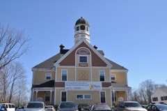
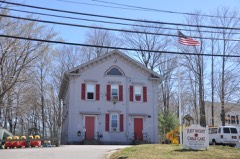
Built in 1821 in the Federal architecture. Listed on the National Register of Historic Places in
1976. A historic map-sheet match is not published yet. The record needs a coordinate-quality review before it can be joined to a sheet boundary.
From the record
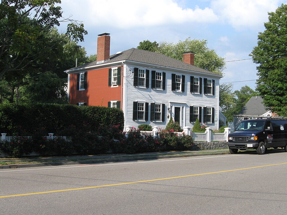
“The Caleb Lothrop House is a historic house in Cohasset, Massachusetts. The two-story hip-roof wood-frame house was built in 1821, and is the only brick-ended houses in the town.”
Wikipedia article Caleb Lothrop House, CC BY-SA 4.0.
one of 249 National Register listings in Norfolk County · listed in 1976 · category: Building · built in 1821, Federal architecture · one of 2 National Historic Landmarks in Norfolk County.
National Register reference number.76000269- the number the National Park Service assigned this property when it was listed, and the key its nomination file is catalogued under at the National Archives.
Measuring also by the standard of money contributed, the religious efforts of the town were much increased ; for while the salary of the old parish was not diminished but rather increased, that of the new one upon the plain soon grew to be six hundred dollars a year in addition. This, moreover, leaves out of the count the financial sup- port of the Methodist Church at Jerusalem which came partly from Cohasset. The population and wealth of the town was not increasing half as rapidly as its religious efforts during the twenty-five years following the divorce.
Rev. Hugh P. Smith,* of Roxbury, who then had the oversight of these Roman Catholic newcomers in Weymouth, Hingham, Cohasset, and Scituate, soon saw the necessity of a building for public worship, and with characteristic energy he set about it. From the time of its completion in 1876, St. Anthony's Church has called an increasing number of worshipers, until now there are as high as five hundred at some services. During the summer months especially, when the visitors from city homes bring more than a hundred domestic servants to our town,
Regional context, not property-specific
evidence. The
federal wildfire occurrence database
lists 104 fires within 5 miles of Lothrop, Caleb, House between
2015 and 2020, burning about 34 acres in total. 3 started naturally. 2 were recorded as arson.
Distance is straight-line from the map coordinates, so a fire counted
here may appear on a neighbouring settlement's page as well.
Reported cause
Fires
Debris and open burning
65
Missing data/not specified/undetermined
15
Misuse of fire by a minor
9
Smoking
5
Recreation and ceremony
5
Natural
3
Arson/incendiarism
2
The most recent of
them, most recent first, with the day each was reported and the service
that recorded it.
Regional context, not property-specific
evidence. Museums hold 2,832 specimens
collected within 10 miles of Lothrop, Caleb, House between 1836 and
1975: 1,890 Plantae, 349 Chromista, 273 Animalia, 244 Fungi, 57 Unrecorded, 13 Protozoa, 6 Bacteria. 12 distinct Species records are shown.
Collected by A Loveridge, A. B. Seymour, A. C. Mathieson and others. Each is a
physical object with a catalogue
number, and each entry opens the museum's record. This is what was
collected and kept, not a survey of what lives here - nothing can be
concluded from a species being absent.
Regional context, not property-specific
evidence. The federal mineral resources record lists
1 working within 5 miles of Lothrop, Caleb, House: 1 past producer.
None of them still produces. What was taken out: Stone, Crushed/Broken. Distance is straight-line from the
map coordinates, so a quarry counted here may appear on a neighbouring
settlement's page as well.
Regional context, not property-specific
evidence. The National Weather Service names
Cohasset, the town this property stands in, in 5 storm reports between 1998 and 2020: 3 thunderstorm wind, 1 flash flood, 1 hail.
No death or injury is recorded in these reports. Each account below is quoted exactly as the forecast office
filed it, from the NOAA Storm Events Database, and each date
opens the federal record of that event.
No historic map-sheet match is published
for this property yet. That does not mean no map exists. This record needs
a coordinate-quality review before it can be joined to a sheet boundary.
Browse the county's mapped places while that work is
pending.
From the nomination file
2,283 words on record
When this property was proposed for the
National Register, someone wrote the case for it: what the building is,
and why it matters. That document is a federal record in the public domain.
It is quoted below word for word, never summarised. The text was read off the scanned case file by machine, so the
occasional stray character is the recogniser's and the 1970s
typewriter's.
Description of the property
The Caleb Lothrop House, built about 1823, is located in a residential section of Cohasset. It is located on about half an acre of land, protected by trees in the side and back yards and large evergreen bushes in the front. The two story house has a hip roof and brick ends with a clapboard facade and a shingled rear elevation. Portions of the roof are still slated, but many parts have been covered with composition shingles. The house rests on a granite foundation and has a full basement. A two story clapboard ell, built c. 1900, has been added to the northeast rear of the house. Iwo tall inside end chimneys, both in need of repair, serve the four main fireplaces. The house is symmetrical, with a five bay facade; the brick ends are two bays deep.
A11 of the windows in the main part of the house have 6/6 sash and louvered shutters; those on the ell have 2/2 sash... The centered front door, covered by a non-original flat hood, is flanked by half sidelights and slender pilasters. The door itself, also probably not original, has six finely moldedd panels; a large granite slab serves as a step up to the door. The plan of the interior of the house has been slightly altered over the years, but a surprising amount of original paneling and molding are extant. The mantels in the two first floor front rooms are original, and finely molded; the mantels on the second floor are simplified versions of those below.
The upstairs ceilings appear to have been slight- ly raised, which incongruously reveals the building's structural members in a manner more appropriate to early Georgian architecture than to Federal.
/ARCHITECT The Caleb Iothrop House is not only significant architecturally but also has strong associations through the Iothrop family with the development of Cohasset. The house was built c. 1823 by Caleb Iothrop, who was the grandson of Revolutionary War hero Thomas Lothrop. Caleb was a ship owner and ship chandler, and served the town as a member of the Board of Selectmen and as town treasurer. The Iothrop family for many years owned a wharf at the cove end of Cohasset Harbor, and were involved in the town's principal industry, mackerel fishing. Members of the Lothrop family lived in the house until 1966, and while none of them achieved outstanding significance the family was always an important part of the community life. In 1966 the house was sold to St.
Anthony's Church to be used as hous- ing for nuns; when that plan did not materialize the house was rented out for a number of years. The building has been vacant for three years but plans are now underway to restore the house and turn it into a community historic resource center. The Iothrop House is' significant architecturally to the town of Cohasset because it is one of two brick end Federal period houses left in the community. Brick was not com- monly used for fesidential purposes in Massachusetts until the latter half of the nineteenth century, so brick walls on an earlier house usually denoted affluence and importance. The house, which has been very little altered through the years, is a good example of the architectural style once so popular in Massachusetts' seaports.
Quoted from the National Register nomination
for reference 76000269, 11 pages, held by the National Archives in Record
Group 79. See the
catalogue record.
Listed places nearby
6 within 8 miles
Other National Register properties close
enough to walk or drive between, ordered by distance from this one. Both
positions come from the same geocoding pass that matched these properties
to their map sheets.
Listing record. National Park Service National Register of Historic Places, listed-properties dataset, current to 2026-05-22.
Map join. Address geocoded through the United States Census geocoder, then tested against the published boundary of every sheet in the USGS Historical Topographic Map Collection.
How this page is made. Listing fields come from federal records; map-sheet coverage is a labelled coordinate-to-boundary calculation, not a source-field claim.
Wildfire. Short, Karen C. 2022. Spatial wildfire occurrence data for the United States, 1992-2020 [FPA_FOD_20221014]. 6th Edition. Fort Collins, CO: Forest Service Research Data Archive. https://doi.org/10.2737/RDS-2013-0009.6 Collected with United States Government funding and usable without additional permissions or fees.
Specimens. Global Biodiversity Information Facility (GBIF), https://www.gbif.org/. Only records licensed CC0 or CC BY are used. Records licensed CC BY-NC are excluded because this site carries advertising. Images are checked individually and any whose licence is non-commercial, no-derivatives or unreadable is refused.
Mines and quarries. USGS Mineral Resources Data System (MRDS) https://mrdata.usgs.gov/mrds/ A work of the United States government, no copyright under 17 U.S.C. 105.
Storms. NOAA National Centers for Environmental Information, Storm Events Database https://www.ncei.noaa.gov/stormevents/ A work of the United States government, no copyright under 17 U.S.C. 105. Narratives are quoted verbatim from the National Weather Service report and are not edited or summarised.
 Block
Block