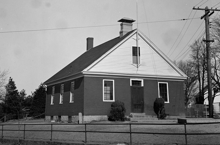
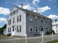
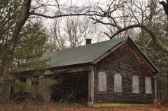
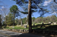
Photograph by Frank O. Branzetti for, Public domain. Via
Wikimedia Commons.
Red Brick School
Listed on the National Register of Historic Places in
1976. A historic map-sheet match is not published yet. The record needs a coordinate-quality review before it can be joined to a sheet boundary.
From the record
“The Red Brick School is a historic school in Franklin, Massachusetts. It was one of the oldest active one-room schools in the United States.”
Wikipedia article Red Brick School (Massachusetts), CC BY-SA 4.0.
one of 249 National Register listings in Norfolk County · listed in 1976 · category: Building · one of 2 National Historic Landmarks in Norfolk County.
National Register reference number.76000276- the number the National Park Service assigned this property when it was listed, and the key its nomination file is catalogued under at the National Archives.
Fires near this property
130 since 2007
Regional context, not property-specific
evidence. The
federal wildfire occurrence database
lists 130 fires within 5 miles of Red Brick School between
2007 and 2020, burning about 84 acres in total. None started naturally. 1 was recorded as arson.
Distance is straight-line from the map coordinates, so a fire counted
here may appear on a neighbouring settlement's page as well.
Reported cause
Fires
Missing data/not specified/undetermined
48
Recreation and ceremony
43
Debris and open burning
16
Smoking
14
Equipment and vehicle use
7
Arson/incendiarism
1
Power generation/transmission/distribution
1
The most recent of
them, most recent first, with the day each was reported and the service
that recorded it.
Regional context, not property-specific
evidence. Museums hold 1,390 specimens
collected within 10 miles of Red Brick School between 1843 and
1973: 1,050 Animalia, 214 Plantae, 119 Fungi, 6 Unrecorded, 1 Bacteria. 12 distinct Species records are shown.
Collected by A Herz, A. B. Seymour, A. M. Rogers; D. P. Rogers and others. Each is a
physical object with a catalogue
number, and each entry opens the museum's record. This is what was
collected and kept, not a survey of what lives here - nothing can be
concluded from a species being absent.
Regional context, not property-specific
evidence. The federal mineral resources record lists
19 workings within 5 miles of Red Brick School: 11 past producers, 6 producers, 2 unknowns.
6 still produce. What was taken out: Sand and Gravel, Construction, Stone, Crushed/Broken, Silver, Gold, Gold. Distance is straight-line from the
map coordinates, so a quarry counted here may appear on a neighbouring
settlement's page as well.
Regional context, not property-specific
evidence. The National Weather Service names
Franklin, the town this property stands in, in 22 storm reports between 1994 and 2023: 7 thunderstorm wind, 5 hail, 4 flood, 2 flash flood.
No death or injury is recorded in these reports. Each account below is quoted exactly as the forecast office
filed it, from the NOAA Storm Events Database, and each date
opens the federal record of that event.
Minor street flooding occurred in the area near Upper Union Street. The right lane of King Street to the Interstate 495 south exit ramp was also flooded.
No historic map-sheet match is published
for this property yet. That does not mean no map exists. This record needs
a coordinate-quality review before it can be joined to a sheet boundary.
Browse the county's mapped places while that work is
pending.
From the nomination file
3,611 words on record
When this property was proposed for the
National Register, someone wrote the case for it: what the building is,
and why it matters. That document is a federal record in the public domain.
It is quoted below word for word, never summarised. The text was read off the scanned case file by machine, so the
occasional stray character is the recogniser's and the 1970s
typewriter's.
Description of the property
The Red Brick School is situated on a small lot close to the street, just as it was originally built in 1833. When first constructed it had no playground area or shade trees; as was customary at the time it sat right next to the roadway with no thought for the traffic or noise. The 1 story painted red brick building is three bays wide and three long, with a door in each gable end. The main door on the south facade has a three light transom, the north elevation was made into a door recently to meet code requirements for means of egress. All of the other windows are 6/6 with plain sash and have brick lintels which are slightly skew-backed. The school was built on a cut granite foundation, part of which has now been patched with concrete.
The original granite steps are intact, along with the old mudscraper. There have been a few alterations to the building, including putting toilet facilities in the basement, then moving them out adjacent to the school during the Depression, and putting a coal fired furnace in the basement to replace a woodburning stove. In 1959 the building was declared unsafe by the state Comm- issioner of Education, but the town immediately appropriated enough money to under- take the necessary structural repairs, mostly in the basement and attic. At this time the coal fired furnace was converted to oil. The exterior now shows a few concessions to the twentieth century. Iwo metal heating and ventilating ducts adorn the roof, and a chainlink and pipe fence surrounds the property.
/ARCHITECT The Red Brick School in Franklin has been virtually unaltered since it was built in 1833, and has been in continuous use as a school since that time. It is con- sidered by many residents of the town to be the most significant building in the community, and one which symbolizes Franklin's remarkable commitment to public education. At a meeting of the residents of the Meetinghouse School District (also known as the Centre School District and District No. 1) on February 11, 1833, it was decided by a vote of 22 to 8 to build a new school house. On February 18, 1833 the Building Committee chaired by Col.
Cleaveland reported on a plan for the new school "to be built of good bricks, 36 feet by 30 feet and 9½ feet clear above the floor, with a square roof, eleven windows and a window with the same sized glass above the outer door." The building essentially exists now as it was described by the building committee. The bricks for the building were reputedly used as ballast in sailing, ships, and brought to Franklin by ox cart when the building was put up. The School was financially supported by the town year after year and a good many of Franklin's school children were educated here. It was used at various times for a variety of grades, from lst through 12th.
Finally however, the building was deemed unsafe and closed by the Massachusetts Commissioner of Education on May 27, 1959, 2½ weeks before school recessed for the summer. This was the only period in its history that the building was not open during the school year.
Quoted from the National Register nomination
for reference 76000276, 13 pages, held by the National Archives in Record
Group 79. See the
catalogue record.
Listed places nearby
6 within 8 miles
Other National Register properties close
enough to walk or drive between, ordered by distance from this one. Both
positions come from the same geocoding pass that matched these properties
to their map sheets.
Listing record. National Park Service National Register of Historic Places, listed-properties dataset, current to 2026-05-22.
Map join. Address geocoded through the United States Census geocoder, then tested against the published boundary of every sheet in the USGS Historical Topographic Map Collection.
How this page is made. Listing fields come from federal records; map-sheet coverage is a labelled coordinate-to-boundary calculation, not a source-field claim.
Wildfire. Short, Karen C. 2022. Spatial wildfire occurrence data for the United States, 1992-2020 [FPA_FOD_20221014]. 6th Edition. Fort Collins, CO: Forest Service Research Data Archive. https://doi.org/10.2737/RDS-2013-0009.6 Collected with United States Government funding and usable without additional permissions or fees.
Specimens. Global Biodiversity Information Facility (GBIF), https://www.gbif.org/. Only records licensed CC0 or CC BY are used. Records licensed CC BY-NC are excluded because this site carries advertising. Images are checked individually and any whose licence is non-commercial, no-derivatives or unreadable is refused.
Mines and quarries. USGS Mineral Resources Data System (MRDS) https://mrdata.usgs.gov/mrds/ A work of the United States government, no copyright under 17 U.S.C. 105.
Storms. NOAA National Centers for Environmental Information, Storm Events Database https://www.ncei.noaa.gov/stormevents/ A work of the United States government, no copyright under 17 U.S.C. 105. Narratives are quoted verbatim from the National Weather Service report and are not edited or summarised.
 Block
Block