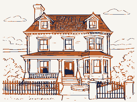
Listed on the National Register of Historic Places in
1976. A historic map-sheet match is not published yet. The record needs a coordinate-quality review before it can be joined to a sheet boundary.
From the record
one of 338 National Register listings in Cuyahoga County · listed in 1976 · category: Building · one of 3 National Historic Landmarks in Cuyahoga County.
National Register reference number.76001389- the number the National Park Service assigned this property when it was listed, and the key its nomination file is catalogued under at the National Archives.
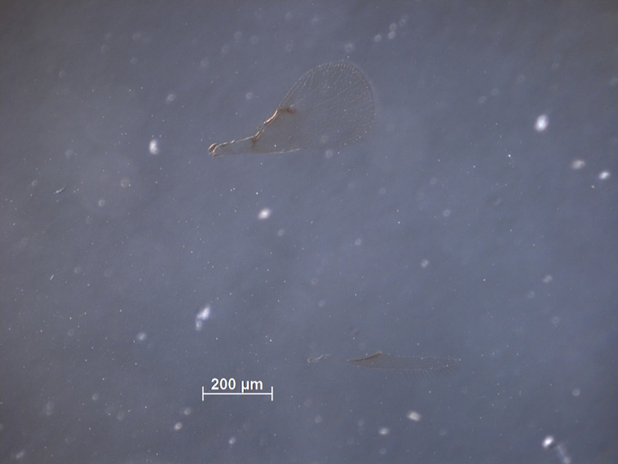
Specimens collected near this property
12 of 4,377 shown
Regional context, not property-specific
evidence. Museums hold 4,377 specimens
collected within 10 miles of Brown, John Hartness, House between 1850 and
1975: 3,937 Animalia, 220 Fungi, 140 Plantae, 73 Protozoa, 5 Unrecorded, 1 Chromista, 1 incertae sedis. 12 distinct Species records are shown.
Collected by A. D. Huryn, A. D. Selby, A. Hall and others. Each is a
physical object with a catalogue
number, and each entry opens the museum's record. This is what was
collected and kept, not a survey of what lives here - nothing can be
concluded from a species being absent.
Regional context, not property-specific
evidence. The federal mineral resources record lists
2 workings within 5 miles of Brown, John Hartness, House: 1 producer, 1 unknown.
1 still produces. What was taken out: Calcium, Zirconium, Zinc, Tungsten, Molybdenum. Distance is straight-line from the
map coordinates, so a quarry counted here may appear on a neighbouring
settlement's page as well.
Regional context, not property-specific
evidence. The National Weather Service names
Cleveland Heights, the town this property stands in, in 1 storm report between 1996 and 1996: 1 thunderstorm wind.
No death or injury is recorded in these reports. Each account below is quoted exactly as the forecast office
filed it, from the NOAA Storm Events Database, and each date
opens the federal record of that event.
No historic map-sheet match is published
for this property yet. That does not mean no map exists. This record needs
a coordinate-quality review before it can be joined to a sheet boundary.
Browse the county's mapped places while that work is
pending.
From the nomination file
1,906 words on record
When this property was proposed for the
National Register, someone wrote the case for it: what the building is,
and why it matters. That document is a federal record in the public domain.
It is quoted below word for word, never summarised. The text was read off the scanned case file by machine, so the
occasional stray character is the recogniser's and the 1970s
typewriter's.
Description of the property
ular form. The exterior is broken-course, rock-faced sandstone with transoms are finished in the same manner, as is the remainder of the its Tudor element, as most of them are in the form of the flattened arch, with some having hoodmolds over them. A second-story bay window of copper, decorated with shields, is on the north side of the house. The interior is well-lit by large windows of the flattened arch shape, but especially by the tall, round-arch windows of the second on the north side of the house.
The entry hall, next to the reception hall, is half a floor lower than the remainder of the living rooms on the first floor, but its connecting staircase forms part of the general the ground floor rooms are commodious, basically rectangular rooms of large, bascially unadorned rooms, as is the third floor with its tea-tray ceilings. Two second-story sundecks serve the bedrooms of the house. CONDITION UNEXPOSED RUINS FAIR CHECK ONE a whimsical Gothic nature, possibly reflecting the historical distortions XUNALTERED building, including the ground floor buttresses near the conservatory.
The windows and doorways of the house are what give the structure GOOD of the Gothick era fifty years before.The second floor is comprised and third floors which serve the three-and-a-half story open stairwell with small alcoves and bay windows which add interest and dimension beaded mortar still retains its rose hue. Almost all the mullions and to the rooms.The woodwork is particularly fine and is noted for its hood serves as a porte-cochere on the north side.Gothic detailing is found on many of the doorways in the form of geometric tracery.
Inis residence, one of the original four on Overlook Road, was the home of John Hartness Brown, who is credited witn the conception of the development of the area now referred to as University Circle Little is known of John Hartness Brown's early career, but he was first planned by Brown who, when difficulties arose, turned the completion, although with some alterations. Euclid Heights, now known Alfred Hoyt Granger, architect of the residence, designed 1896 1700-1799 EDUCATION PERIOD COMMERCE ECONOMICS ARCHEOLOGY-HISTORIC ART INVENTION ENGINEERING AGRICULTURE SIGNIFICANCE SCULPTURE PHILOSOPHY 1500-1599 MILITARY TRANSPORTATION XARCHITECTURE ARCHEOLOGY-PREHISTORIC INDUSTRY LITERATURE _EXPLORATION/SETTLEMENT _POLITICS/GOVERNMENT _PREHISTORIC 1900.
as Cleveland Heights, was originally conceived by Brown and a group _CONSERVATION -1400-1499 -COMMUNICATIONS a large sandstone dwelling embellished with Tudoresque and Gothic recognized as the home of many of Cleveland's cultural institutions, the design of railway terminals. where he setup a successful architectural practice which excelled in _SCIENCE at the entrance to the Cleveland Heights development -1600-1699 _THEATER is listed as early as 189l in the Cleveland City Directory as a dealer ment on the east side of the city. _RELIGION -MUSIC Revival detailing, plus its location at the intersection of two roads in real estate and real estate securities. University Circle, now and Cleveland Heights.Also significant is the architecture of the house, - LAW
Quoted from the National Register nomination
for reference 76001389, 17 pages, held by the National Archives in Record
Group 79. See the
catalogue record.
Listed places nearby
6 within 8 miles
Other National Register properties close
enough to walk or drive between, ordered by distance from this one. Both
positions come from the same geocoding pass that matched these properties
to their map sheets.
Listing record. National Park Service National Register of Historic Places, listed-properties dataset, current to 2026-05-22.
Map join. Address geocoded through the United States Census geocoder, then tested against the published boundary of every sheet in the USGS Historical Topographic Map Collection.
How this page is made. Listing fields come from federal records; map-sheet coverage is a labelled coordinate-to-boundary calculation, not a source-field claim.
Specimens. Global Biodiversity Information Facility (GBIF), https://www.gbif.org/. Only records licensed CC0 or CC BY are used. Records licensed CC BY-NC are excluded because this site carries advertising. Images are checked individually and any whose licence is non-commercial, no-derivatives or unreadable is refused.
Mines and quarries. USGS Mineral Resources Data System (MRDS) https://mrdata.usgs.gov/mrds/ A work of the United States government, no copyright under 17 U.S.C. 105.
Storms. NOAA National Centers for Environmental Information, Storm Events Database https://www.ncei.noaa.gov/stormevents/ A work of the United States government, no copyright under 17 U.S.C. 105. Narratives are quoted verbatim from the National Weather Service report and are not edited or summarised.
 Block
Block